Washington’s ‘Washaway Beach’ Experiment Is Reshaping Ideas About Coastal Erosion
In 2016, a concerned local dropped $400 worth of rock on a vanishing beach to see what would happen. Now engineers are watching, too.
This piece was originally published in High Country News and appears here as part of our Climate Desk collaboration.
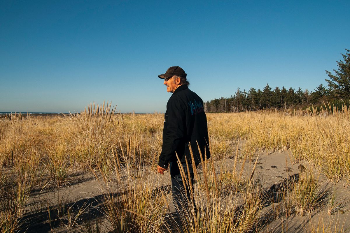
David Cottrell stood on what used to be a 14-foot-high cliff at the crumbled end of Blue Pacific Drive. Just a few years ago, this was the fastest-eroding shoreline on the U.S. Pacific Coast; locals here in North Cove, Washington, dubbed it “Washaway Beach.” But as Cottrell walked toward the water on a sunny November morning, he stepped not off a cliff but onto soft, dry sand. Thigh-high dune grasses sprawled in all directions. The low tide lapped at a flock of sandpipers a few hundred feet away.
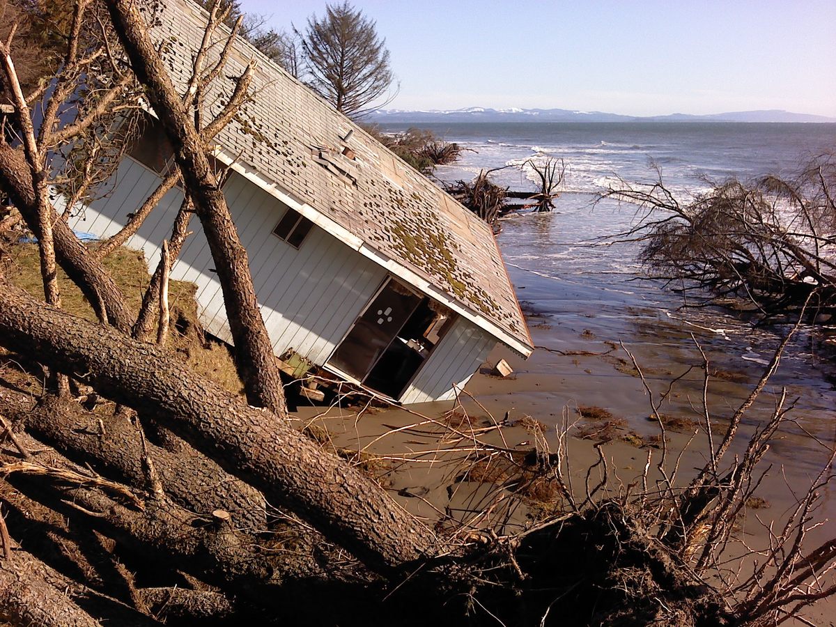
Cottrell, a cranberry farmer and local drainage commissioner, held up a laminated map, pointing to our location. During his childhood, this was part of a dense beachside neighborhood, but the tides have swept most of it away — a complex phenomenon related to dams and jetties that have changed the flow of sediments. “Where we’re standing right now, we were losing 50 to 100 feet a year,” he said. All told, North Cove has lost more than 4 square miles of land, plus a lighthouse, a cannery, and 160 other structures.
By 2015, many residents had given up on saving their town. Facing predictions of continued erosion, agencies had begun talk of moving Highway 105 away from the coast—a loss that could doom this isolated rural community. An essential transportation artery, 105 serves as the dike that protects 800 acres of historic bogs where Cottrell and other farmers grow more than half the state’s cranberries. Cottrell felt he had to try something. “We had absolutely nothing to lose,” he said.
So in 2016, Cottrell dropped $400 worth of rocks from the end of this road: “one load, right off the end, just to see what would happen.” He sought to mimic the cobble beaches and basalt slides that are common in the Pacific Northwest. That experiment has since grown into a more than 2-kilometer-long berm of rocks and stumps that shift with the waves and collect sand, rebuilding the beach.
As a result, much of this coastline has held, putting North Cove at the forefront of a global shift in how communities protect their coastlines as sea levels rise. Engineers—who have long depended on rigid sea walls—are now closely watching this softer approach. North Cove’s solution, which resembles the techniques many Indigenous communities use to cultivate shellfish, looks less like the conventional structures engineers know, and more like the dunes and berms that centuries of storms and tides build on their own.
Cottrell stood in the salty breeze, wearing his signature black Carhartt jacket. On the back, hand-painted letters read “Washaway No More.” Most days, he walks the beach, troubleshooting the remaining hotspots with landowners and explaining the still-evolving project to visitors. “The people that get this best are surfers and Buddhists,” Cottrell had told me earlier. “In a situation that’s in constant flux, what you want to do is position yourself to go with it.”
North Cove was built on land near the Columbia River outlet that has always been at the mercy of intense waves, El Niño-driven storms, tidal currents, flowing sediment, and tangles of driftwood. Over millennia, these forces built a long sandy spit at the mouth of Willapa Bay. Storms swept sand away each winter, then currents replenished it each summer—until they didn’t, Cottrell said, for reasons scientists are only beginning to understand. Maps show that the trend had started by the early 1900s; researchers believe a series of jetties and the 1930s damming of the Columbia, both of which changed sediment flow in the region, contributed to it. Over decades, the spit was whittled down to a nub. The rising tides and intensifying storms of climate change only hastened its undoing.
That collision of forces made Washaway Beach a terrible candidate for any protective efforts, Washington Department of Ecology coastal engineer George Kaminsky told me. But since Cottrell couldn’t make anything worse, he decided to try something unorthodox, setting the stage for an experiment whose results global experts, including Kaminsky, are now researching.
After Cottrell dropped that first load of rock, nature took over: When waves hit the pile, the water spread out instead of smashing against the steep, eroded bank. Stones migrated and settled. Sand collected in between.
This galvanized the community, and in 2016, a group led by Charlene Nelson, chairwoman of the nearby Shoalwater Bay Tribe, expanded the project. Using a $600,000 state grant, they made a scrappy version of what engineers call a dynamic revetment: a long cobble berm along the top of the beach. Using the cheapest unsorted rock they could find, they dumped piles along more than a mile of bank, letting the waves sort them into place. Then, lower down, near the highest average waterline, they spread the same jagged cobbles into a 3-foot-tall speed bump. Together, these structures build back the beach: As waves trip over the speed bump and slosh through the berm, they slow and drop sand. The first year both were in place, the beach near this road-end grew by about 50 feet. The next year, it kept growing.
As climate change progresses, coastal communities nearly everywhere are searching for solutions. Hard barriers like seawalls and riprap won’t cut it in many places; they do block water, but often cause further erosion. They’re also so expensive that few can afford them.
U.S. climate models show sea-level rise locked in at around a foot on average nationwide by 2050. In Washington alone, that is forecast to cause billions in damage. By 2100, the state expects catastrophic land loss, including 44 percent of tidal flats and 65 percent of estuarine beaches at key sites along the coast — places that myriad coastal species, including humans, rely on for food and protection. Coastal resilience experts believe building beaches back could be enough to prevent some of this.
Kaminsky’s research on the berm has already influenced projects nearby and in California, Europe, and Guam. Together, these experiments promise to transform the tools that agencies and communities can apply elsewhere. To create any protective structure, engineers need design standards. The data to establish them didn’t exist until communities like North Cove started experimenting.
“If you’ve not been out here, it’s hard to wrap your brain around what’s really going on,” Lauren Bauernschmidt, a state Department of Fish and Wildlife biologist, said, standing on loose cobble. After working with Cottrell for five years, she was due to issue him a new maintenance permit, and needed her boss’s signoff. She and Cottrell were also trying to drum up more funding and buy-in from the many agencies involved, so they had assembled a cadre of colleagues to bring them up to speed.
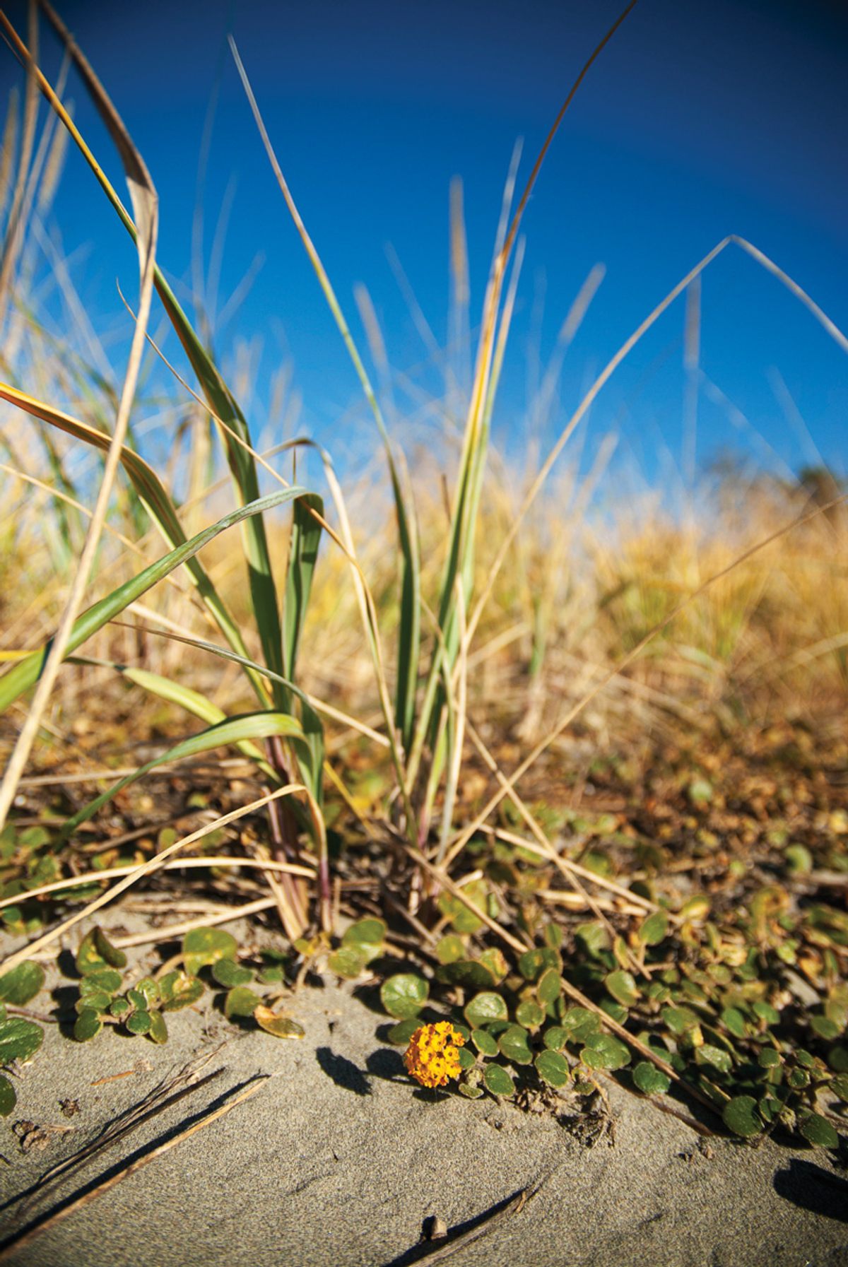
On this breezy, blue-sky morning near the road-end, the once-threatening waterline was hundreds of feet out. The speed bump, Cottrell told the group, was buried under three feet of sand. Clam beds long absent have returned, along with grasses and shorebird habitat. And even when winter storms pull sand away—the way of things, here—the cobble remains to restart the beach-building process. Now that this section of shore seems stable, Cottrell said, “My hope is that this is hands-off forever.” But down the beach, trouble spots remain.
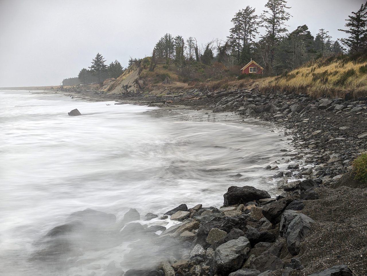
Further south, the beach narrowed until it reached a prominent finger of land—a single home atop it—that has so far defied the tides. Surrounded by a seawall of giant boulders, it has become a landmark at the center of this project. Even that day’s gentle waves deflected off the wall toward the banks beside it. Stronger ones have carved deeply into the adjacent shoreline, threatening to turn the point into an island: A reminder of the pitfalls of bulwark structures in a naturally ephemeral environment.
The worst erosion was on the southern side. There, a vertical cliff-edge flanked a narrow curve of beach. Over the previous year, seven spruce trees on that neighboring property had lost their footing, toppling into the surf. An eighth leaned ominously. This vulnerable strip of land, owned by Ed Borden, has become a linchpin for North Cove. “From here to the highway is about 400 feet,” Cottrell said. “That could go in one or two nights in a big storm.” With it would go the roadway, homes and cranberry bogs behind it.
Cottrell hopes to drop more cobble around the wall to re-establish a beach, which would slow the waves or even prevent them from reaching the seawall.
At the edge of his land, Borden stacked hay bales with a mini excavator, hoping they, too, might slow the ocean’s inland creep. Throughout the year, Borden and Cottrell had dumped thousands of tons of cobble along this bank, but the wash off the seawall was too strong. Despite—maybe because of—its impact here, that wall remained a seductive solution. Borden eyed the fortress, which stood deceptively steady. He wasn’t sure yet about the small cobbles; he had yet to see whether they worked as planned.
“I need a bigger excavator, bigger rock,” he started to explain.
“Or we could get you your sand beach back,” Cottrell countered, glancing to the surf. “Nothing dissipates wave energy like a good beach.”












Follow us on Twitter to get the latest on the world's hidden wonders.
Like us on Facebook to get the latest on the world's hidden wonders.
Follow us on Twitter Like us on Facebook