50 States of Wonder
Sink Into 7 of Louisiana's Swampiest Secrets
Louisiana has long had a complex relationship with the wet world. Chitimacha, Choctaw, and Atakapa peoples built communities among the knobby knees of bald cypress trees; French fur traders and pirates eventually made their own marks. Later still, modern engineers attempted to corral waters with levees and dams, or to reclaim land where there had been none. Across the 50,000-odd square miles that make up the state, troves of special places are becoming concealed by rising water. Here are seven places water has revealed or covered up.
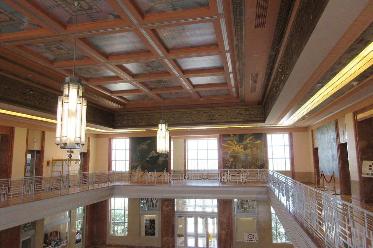
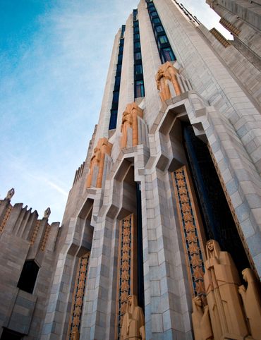
1. Lakefront Airport
The transport hub now known as Lakefront Airport was built on a human-made peninsula that required the Orleans Levee Board to position a 10,000-foot retaining wall in Lake Pontchartrain and deposit an astounding six million cubic yards of hydraulic fill to elevate the strip above the water’s surface.
The facility opened to the public in 1934 as Shushan Airport, named for a New Orleans government official who later was convicted of mail fraud. The terminal got a new name but remains a feat of Art Deco design, including luxurious gilded accents, stone floors, and custom artworks. (Read more.)
6001 Stars and Stripes Blvd, New Orleans, LA 70126


2. Lake Peigneur
Lake Peigneur was once a small, freshwater lake, less than 11 feet deep and popular for fishing. That all changed on November 20, 1980, when one of the largest human-powered maelstroms in history flushed the lake, barges, big-rig trucks, houses, 65 acres of surrounding land, and a Texaco oil rig into an enormous vortex.
A drilling crew accidentally punctured the roof of a salt mine beneath the lake, which swiftly swallowed the entire offshore rig, and the shallow, freshwater body burbled and swirled as it merged with saltier adjacent water. Now, very little visual evidence peeks up above the surface. (Read more.)
5505 Rip Van Winkle Rd, New Iberia, LA 70560
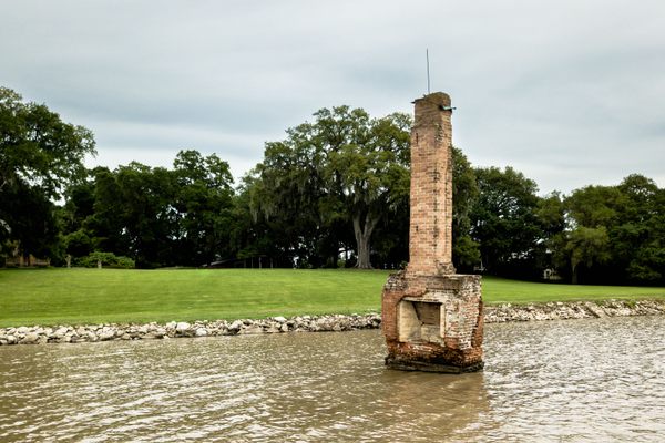
3. Fort Proctor
Southeastern Louisiana is stippled with the remains of 19th-century fortresses, the so-called "Third System" of defense. The troupe includes Fort Pike, Fort Macomb, Fort Livingston, and Fort St. Philip. All are increasingly surrounded by the Gulf of Mexico, but perhaps none as remarkably as the solitary Fort Proctor, which is only accessible by water.
Fort Proctor was constructed in the 19th century to protect the strategically crucial waterways near New Orleans. A hurricane damaged the structure shortly after it was completed. Then, before the facility could be repaired and put back into use, the Civil War erupted, diverting attention from the site. By the time anyone had the time and energy to devote to it, the place was obsolete and simply left to fall to pieces. (Read more.)
St Bernard, LA 70085

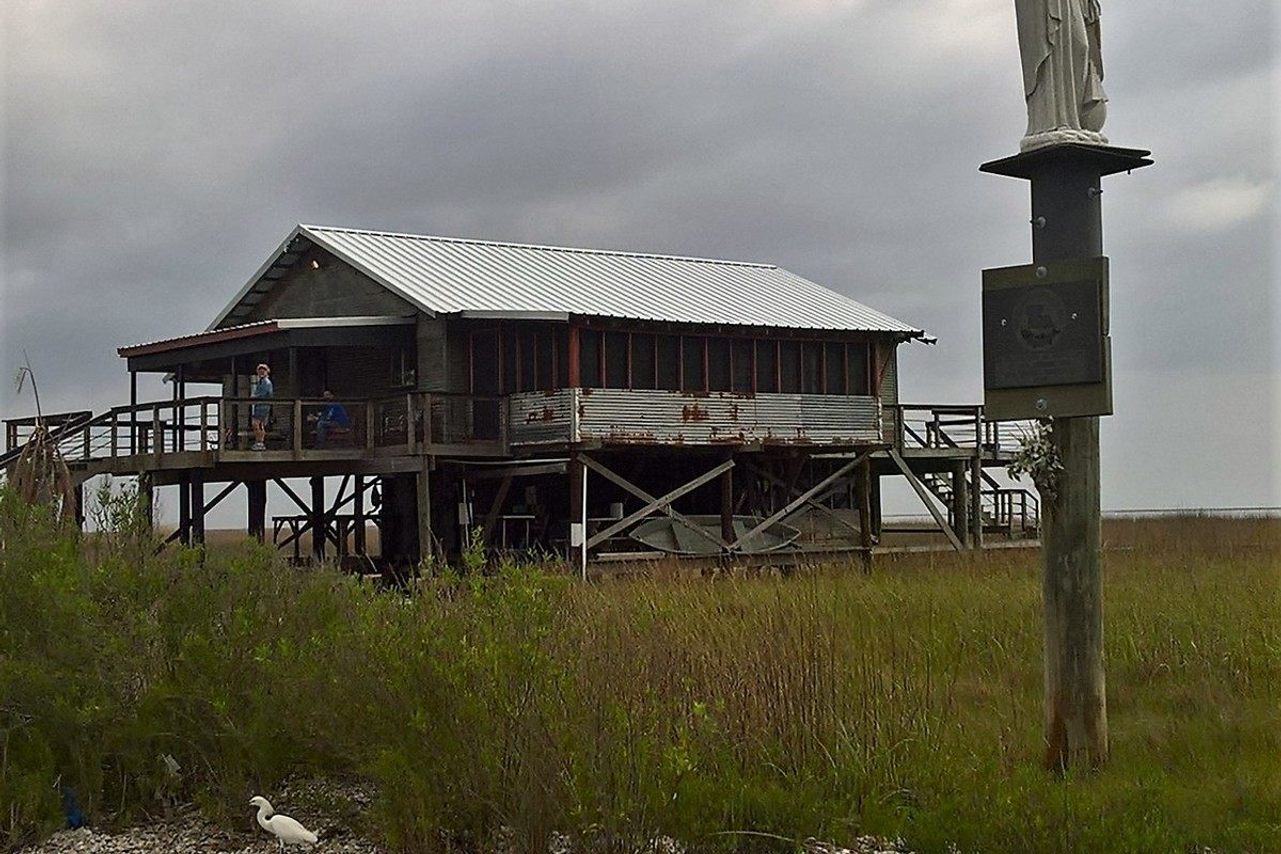
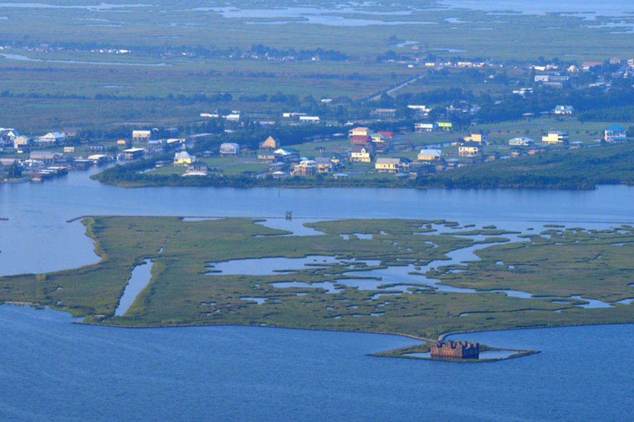
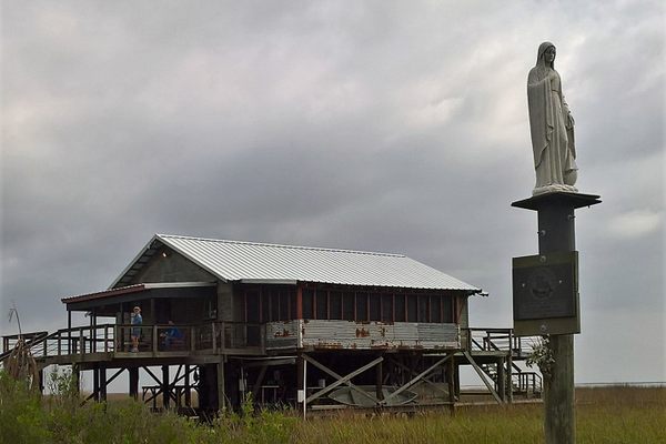
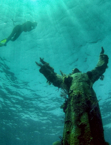
4. Our Lady of the Sea
Beyond the twisting bayous of Terrebonne parish lies the Isle Dernière archipelago, a strip of sandy barrier islands that play a crucial role in protecting the coastline from storm surges.
The group of islands were once a single landmass, known as Last Island. In 1856, that island was hit by the equivalent of a Category 4 hurricane, which was deadly and devastated the area. Over time, the landscape recovered, and a century later, locals installed a beacon to assist fishers returning to the island and serve as a sentinel protecting those heading out to sea.
The statue was christened “Our Lady of the Sea.” Never has a name befitted a statue better, as the sea began almost immediately to reclaim its Lady. (Read more.)
8249 Redfish St, Chauvin, LA 70344

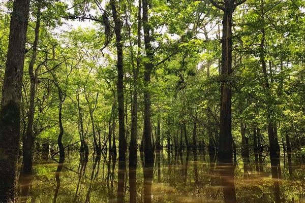
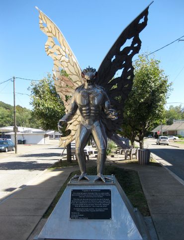
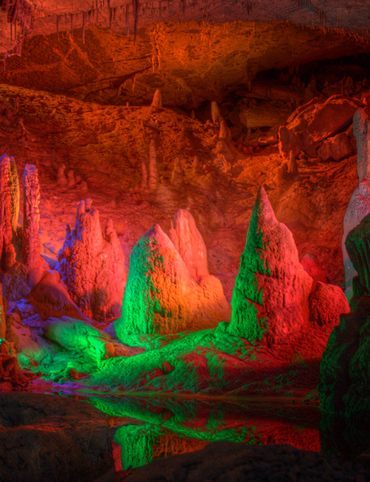
5. Honey Island Swamp
Louisiana lore often includes references to the swamps. The humid, soggy, environments are interspersed throughout much of the southeastern United States, but Honey Island feels special.
Somehow, the surroundings seem both very earthy—you are, after all, surrounded by muddy water—and ethereal, particularly when light flickers through the trees and the air is full of soft hums from bugs and the occasional splash of an oar. Just keep an eye out for one resident, the Honey Island Swamp Monster. As the story goes, this gray-haired, yellow-eyed creature is supposedly the offspring of an escaped circus chimpanzee that mated with a local alligator. (Read more.)
Honey Island Swamp Rd, Parish Governing Authority District 6, LA 70452
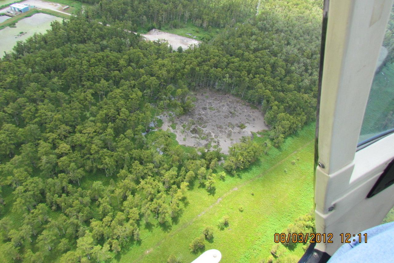
6. Bayou Corne Sinkhole
The Texas Brine Company's massive underground salt dome beneath Baton Rouge was a profitable mining operation, right up until its ground-shaking collapse created a monstrous sinkhole.
Initially, the hole was an eight-acre void—but as the waters and earth rushed to fill in the underground caverns, the maw spread to swallow roughly 25 acres' worth of trees, dirt, and underbrush. The expanding hole continues to devour the landscape. (Read more.)
LA-70, Belle Rose, LA 70341

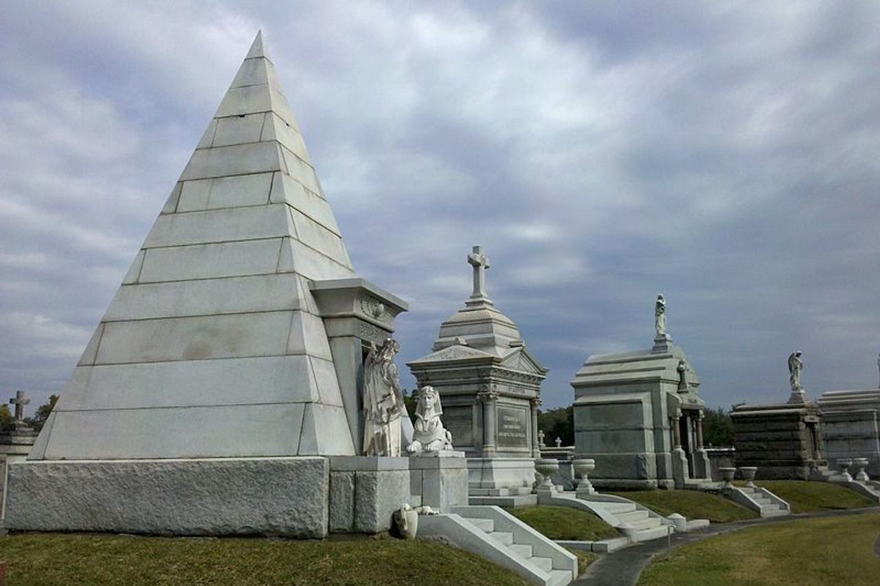
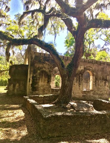
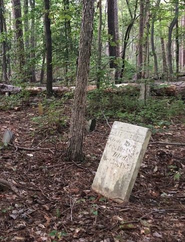
7. Metairie Cemetery
For more than two decades, the Metairie Race Course was a horse racing institution in antebellum New Orleans, home to epic sprints that created and destroyed fortunes in a single lap.
But after serving a stint as a Confederate Army camp during the Civil War, the course went bust. It was transformed into the now-famous cemetery, though it retained the contours of the track. Today, the cemetery is known for its particularly lovely monumental architecture and funeral sculptures, which are dedicated to some of the city’s noteworthy early heroes and notorious figures. To keep their inhabitants dry, many of the striking resting places are above ground. (Read more.)
5100 Pontchartrain Blvd, New Orleans, LA 70124

4 Underwater Wonders of Florida
6 Spots Where the World Comes to Delaware
6 Wondrous Places to Get Tipsy in Missouri
4 Pop-Culture Marvels in Iowa
7 Stone Spectacles in Georgia
6 Stone-Cold Stunners in Idaho
8 Historic Spots to Stop Along Mississippi's Most Famous River
5 Incredible Trees You Can Find Only in Indiana

5 Famous and Delightfully Obscure Folks Buried in Kentucky
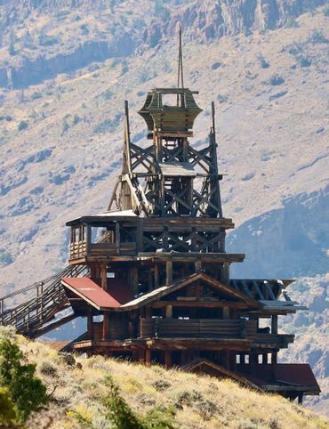
4 Wacky Wooden Buildings in Wyoming
7 Spots to Explore New Jersey’s Horrors, Hauntings, and Hoaxes

4 Out-There Exhibits Found Only in Nebraska

6 Sweet and Savory Snacks Concocted in Utah
12 Places in Massachusetts Where Literature Comes to Life
8 Places to Get Musical in Minnesota
8 Buildings That Prove Oklahoma's an Eclectic Art Paradise
9 Stunning Scientific Sites in Illinois

5 Strange and Satanic Spots in New Hampshire
8 Historic Military Relics in Maryland
5 of Colorado's Least-Natural Wonders
6 Hallowed Grounds in South Carolina
9 Rocking Places in Vermont

Black Apples and 6 Other Southern Specialties Thriving in Arkansas
4 Monuments to Alabama’s Beloved Animals
The Dark History of West Virginia in 9 Sites
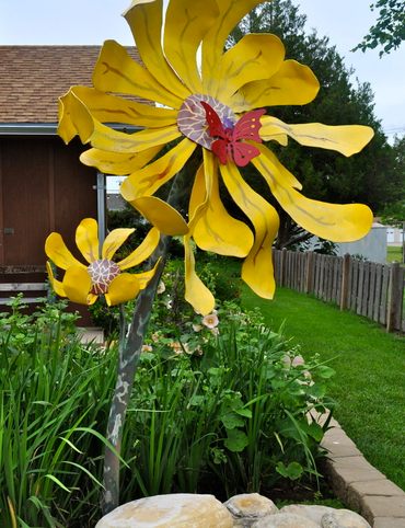
11 Zany Collections That Prove Wisconsin's Quirkiness
7 Inexplicably Huge Animals in South Dakota
6 Fascinating Medical Marvels in Pennsylvania

8 Places in Virginia That Aren’t What They Seem
7 Cool, Creepy, and Unusual Graves Found in North Carolina
7 of Montana's Spellbinding Stone Structures
9 of Oregon’s Most Fascinating Holes and Hollows
Take to the Skies With These 9 Gravity-Defying Sites in Ohio
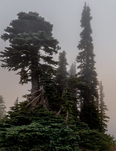
9 Strange and Surreal Spots in Washington State
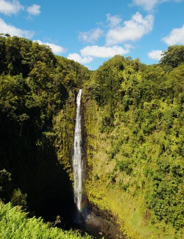
8 Watery Wonders in Hawaiʻi, Without Setting Foot in the Ocean

6 Unusual Eats Curiously Cooked Up in Connecticut
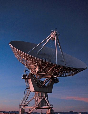
11 Close Encounters With Aliens and Explosions in New Mexico
10 Places to Trip Way Out in Kansas
The Resilience of New York in 10 Remarkable Sites

7 Very Tall Things in Very Flat North Dakota
8 Blissfully Shady Spots to Escape the Arizona Sun
9 Surprisingly Ancient Marvels in Modern California

10 Art Installations That Prove Everything's Bigger in Texas
6 Huge Things in Tiny Rhode Island
7 Underground Thrills Only Found in Tennessee
7 Mechanical Marvels in Michigan
11 Wholesome Spots in Nevada

7 Places to Glimpse Maine's Rich Railroad History
11 Places Where Alaska Bursts Into Color