Trips Places Foods Stories Newsletters

Take your next trip with Atlas Obscura!

Our small-group adventures are inspired by our Atlas of the world's most fascinating places, the stories behind them, and the people who bring them to life.

Visit Adventures
Trips Highlight
Puglia Italy - Matera
Italy • 8 days, 7 nights
Southern Italy: Castles, Caves & Coastal Treasures in Puglia
from
Turkmenistan Gates of Hell Darvaza crater
Turkmenistan • 10 days, 9 nights
Turkmenistan & the Gates of Hell
from
View all trips
Top Destinations
Latest Places
Most Popular Places Random Place Lists Itineraries
Add a Place
Download the App
Top Destinations
View All Destinations »

Countries

  • Australia
  • Canada
  • China
  • France
  • Germany
  • India
  • Italy
  • Japan

Cities

  • Amsterdam
  • Barcelona
  • Beijing
  • Berlin
  • Boston
  • Budapest
  • Chicago
  • London
  • Los Angeles
  • Mexico City
  • Montreal
  • Moscow
  • New Orleans
  • New York City
  • Paris
  • Philadelphia
  • Rome
  • San Francisco
  • Seattle
  • Stockholm
  • Tokyo
  • Toronto
  • Vienna
  • Washington, D.C.
Latest Places
View All Places »
Nagi Gumba
Top floor of castle.
Kifune Castle
 The front of Asian Garden Mall.
Asian Garden Mall
The cable car is one of two in Europe that crosses open ocean.
Dursey Island Cable Car
Latest Places to Eat & Drink
View All Places to Eat »
A slice of cake is the perfect coda to a meal at Piatto Romano.
Piatto Romano
Crunchy and supremely satisfying, suppli might be the ultimate street food snack.
Supplizio
The pedigreed pistachios here are from Bronte.
Gelateria dei Gracchi
This tiny hole-in-the-wall serves one of the world’s most magnificent sandwiches.
Er Buchetto
Seafood features prominently on the menu.
Dakar NOLA
Recent Stories
All Stories Video Podcast
Most Recent Stories
View All Stories »
View of Santa Monica Beach and Los Angeles in afternoon sun. Aerial view from above the pacific ocean water.
Why Did Celebrity Preacher Aimee Semple McPherson Mysteriously Disappear?
about 5 hours ago
The glass-ceilinged atrium of the Bradbury Building was inspired by Edward Bellamy’s utopian literature.
The Bradbury Building Featured in ‘Blade Runner’ Was Inspired by a 19th-Century Utopian Novel
1 day ago
Berza gitana is one of the exemplary dishes of Gitano cuisine.
How Gitano Cuisine Found a Home in Andalusia
1 day ago
Greenland dogs—crucial to the sledge patrol’s transport and defense—pull a patrolman’s sled.
How Greenland’s Dog-Sled Patrol Became Unsung Heroes of World War II
2 days ago

No search results found for
“”

Make sure words are spelled correctly.

Try searching for a travel destination.

Places near me Random place

Popular Destinations

  • Paris
  • London
  • New York
  • Berlin
  • Rome
  • Los Angeles
Trips Places Foods Stories Newsletters
Sign In Join
Places near me Random place
All the United States Nevada Airmail Arrow #32 LA-SL
AO Edited

Airmail Arrow #32 LA-SL

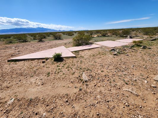
A concrete arrow from a 1920s airmail navigation network.

Mesquite, Nevada

Added By
slgwv
Email
Been Here
Want to go
Added to list
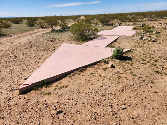
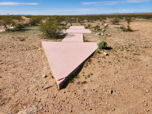
The arrow, looking back toward arrow #31 by Moapa.   slgwv / Atlas Obscura User
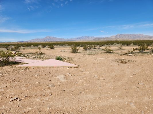
Looking west across the arrow. Mormon Mountains in the distance.   slgwv / Atlas Obscura User
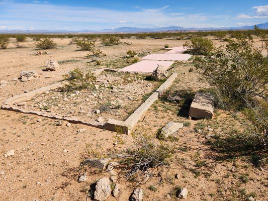
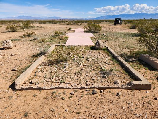
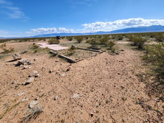
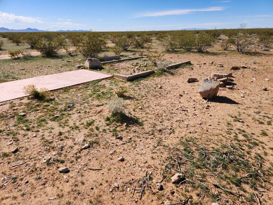
Base of the arrow. Looking generally eastward.   slgwv / Atlas Obscura User
Base of the arrow. Looking generally eastward. The open foundation is where the steel tower stood.   slgwv / Atlas Obscura User
The arrow, looking back toward arrow #31 by Moapa.   slgwv / Atlas Obscura User
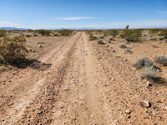
Road to the arrow. Interstate-15 is a bit more than a mile down this road.   slgwv / Atlas Obscura User
The arrow, looking south. Virgin Mountains on the skyline to the left.   slgwv / Atlas Obscura User
Looking southwesterly across the arrow.   slgwv / Atlas Obscura User
Base of the arrow looking south.   slgwv / Atlas Obscura User
Looking easterly. Virgin Mountains on the skyline to the right.   slgwv / Atlas Obscura User
Been Here
Want to go
Added to list

About

This arrow is a surviving remnant of a 1920s federal-government-sponsored airmail navigation network. By then, carrying mail had become the first serious commercial application of air travel. The network consisted of concrete arrows, originally painted yellow and designated as Beacon Stations, that pointed east on east-west routes and north on north-south routes. Each station had a bright light atop a 50-foot steel tower that allowed pilots to navigate from light to light after dark. Without radar, GPS, or reliable radio, night flying was extremely hazardous and could not be done routinely.

Most of the towers were scrapped long ago, but a surprising amount of the concrete arrows remain—this is one of them. It is Beacon Station #32 LA-SL (#32 on the route from Los Angeles to Salt Lake City), positioned east of the surviving Moapa Airmail Arrow, station #31 LA-SL. The two are 17 airline miles apart.

At night, if you stand on this arrow and imagine glimpsing the light on the Moapa station slightly south of west, that glimpse would have been your goal as an airmail pilot.

Related Tags

Aircraft Navigation Mail Geographic Markers

Know Before You Go

Follow Interstate 15 1.9 miles west from the intersection with State Route 170 (the Riverside Road, exit 112) to the truck parking area where the freeway tops out onto Mormon Mesa. Exit right into the parking area, where there is a gate through the fence giving access to the frontage road on the north. Turn right on the frontage road and follow it east for 0.2 miles, then through a shallow bend to the left (north), then back through another shallow bend to right at 0.3 miles. After 0.6 miles, at about 36.78259 N, 114.25890 W, there will be an intersection; keep left (north) here. Now go straight for 1.2 miles; the arrow will be immediately off the road to the left.

These roads will require high clearance but probably not 4wd, at least in dry weather.

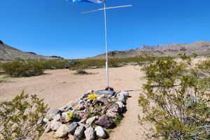
While here, the Davidson Family Gravesite is an easy sidetrip.

Community Contributors

Added By

slgwv

Published

March 3, 2025

Edit this listing

Make an Edit
Add Photos
Sources
  • https://www.dreamsmithphotos.com/arrow/
Airmail Arrow #32 LA-SL
Mesquite, Nevada
United States
36.796502, -114.246998

Nearby Places

Davidson Family Gravesite

Mesquite, Nevada

miles away

Double Negative

Clark County, Nevada

miles away

Moapa Airmail Arrow

Moapa Valley, Nevada

miles away

Explore the Destination Guide

Photo of Nevada

Nevada

United States

Places 265
Stories 24

Nearby Places

Davidson Family Gravesite

Mesquite, Nevada

miles away

Double Negative

Clark County, Nevada

miles away

Moapa Airmail Arrow

Moapa Valley, Nevada

miles away

Explore the Destination Guide

Photo of Nevada

Nevada

United States

Places 265
Stories 24

Related Places

  • Looking back at the contemporary installations.

    Moapa Valley, Nevada

    Moapa Airmail Arrow

    A well-preserved example from a 1920s network of airmail navigation arrows sits near Interstate 15 in southern Nevada.

  • Tip of the arrow, looking back west.  The skylined mountains are Boca Ridge in California.  The blue paint is _not_ original.

    Reno, Nevada

    Airmail Arrow

    A concrete arrow from a 1920s network of airmail beacons is still preserved at the western edge of suburban Reno.

  • Repère Pierre du Niton

    Geneva, Switzerland

    Repère Pierre du Niton

    This stone in Lake Geneva was once the reference point used to determine altitude in Switzerland.

  • El Hierro, Spain

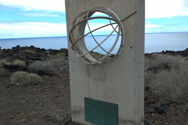
    Monumento Meridiano Cero (Zero Meridian Monument)

    What many consider the original prime meridian and westernmost point of the old world.

  • Center of Edinburgh.

    Edinburgh, Scotland

    'Center of Edinburgh' Bollard

    This mundane post marks the old location of the city's main postal hub.

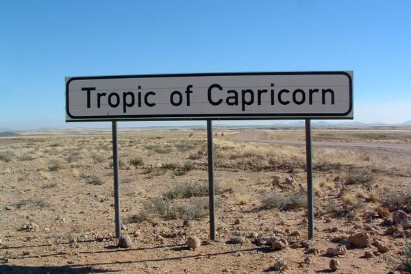
  • A sign marking the Tropic of Capricorn.

    Namibia

    Tropic of Capricorn Crossing

    Road signs in Namibia mark the location of one of the five major circles of latitude.

  • Green Belt sign in Emsworth.

    Pittsburgh, Pennsylvania

    Allegheny County Belt System

    Color-coded signs direct drivers on a network of routes designed to avoid Pittsburgh traffic.

  • World’s Largest Compass Rose

    Edwards Air Force Base, California

    World's Largest Compass Rose

    Etched into a dry lake bed, this massive directional indicator is accurate without magnets.

Aerial image of Vietnam, displaying the picturesque rice terraces, characterized by their layered, verdant fields.
Atlas Obscura Membership

Become an Atlas Obscura Member


Join our community of curious explorers.

Become a Member

Get Our Email Newsletter

Follow Us

Facebook YouTube TikTok Instagram Pinterest RSS Feed

Get the app

Download the App
Download on the Apple App Store Get it on Google Play
  • All Places
  • Latest Places
  • Most Popular
  • Places to Eat
  • Random
  • Nearby
  • Add a Place
  • Stories
  • Food & Drink
  • Itineraries
  • Lists
  • Video
  • Podcast
  • Newsletters
  • All Trips
  • Family Trip
  • Food & Drink
  • History & Culture
  • Wildlife & Nature
  • FAQ
  • Membership
  • Feedback & Ideas
  • Community Guidelines
  • Product Blog
  • Unique Gifts
  • Work With Us
  • About
  • FAQ
  • Advertise With Us
  • Advertising Guidelines
  • Privacy Policy
  • Cookie Policy
  • Terms of Use
Atlas Obscura

© 2025 Atlas Obscura. All Rights Reserved.