About
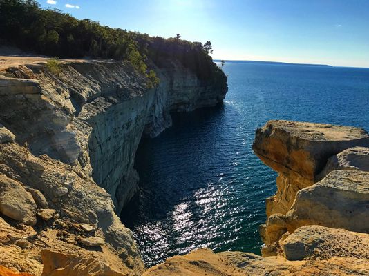
Trekking along the scenic trail that runs through the Upper Peninsula’s Pictured Rocks National Lakeshore, hikers are treated to a stunning display of natural beauty. Here, exertion isn’t the only thing that will take visitors’ breath away. Vivid sandstone cliffs, gurgling waterfalls, shallow caves, undulating sand dunes, emerald and turquoise water, and a fragrant array of coniferous and deciduous trees make for stupendous scenery.
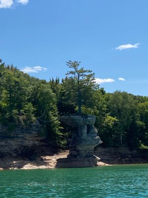
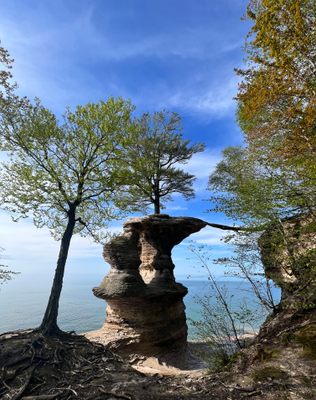
Though all of it is worth taking in, hikers should keep their eyes peeled for one feature in particular: Chapel Rock, once known as La Chappelle.
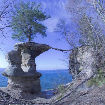
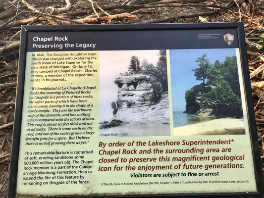
Composed of Cambrian age sandstone dating back approximately 500 million years, Chapel Rock is the result of the erosion caused by a proglacial lake somewhat confusingly referred to as “Nipissing Great Lakes.” This giant body of water consisted of separate basins joined by straits, and once occupied present-day Lake Superior, Lake Huron, Lake Michigan, and Georgian Bay. Around 3,800 years ago, the high waters of Nipissing Great Lakes carved through the soft sandstone, resulting in today’s dramatic formation, which juts out into Lake Superior.
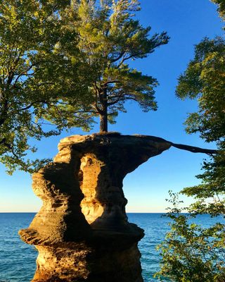
Although Chapel Rock’s stone is mostly beige, its base is a warm orange, thanks to mineral concentrations. The sandstone cliffs that comprise Pictured Rocks are full of iron, copper, manganese, and limonite, which impart red, orange, blue, green, brown, black, and white hues. Not long ago, a natural rock bridge spanned the area between Chapel Rock and the mainland. It collapsed in the 1940s, leaving the formation unconnected with the rest of the shore. Thankfully, the rest of the structure has remained intact and is protected from climbers by order of the Lakeshore Superintendent.
The rock isn’t the only thing that has proven to be remarkably durable. Charles Penny, a member of the Douglass Houghton expedition responsible for exploring Lake Superior’s southern shore, admiringly described a single pine tree that grew like a “spire” out of the sparse dirt covering the top of the outcropping. Till this day, the same resilient pine stands sentinel over Chapel Rock, connected to the mainland by its extensive root system.
This lone tree and sandstone outcropping on which it stands are so popular with locals, the site was commemorated on the Michigan-themed U.S. quarter in 2018 representing the Pictured Rocks National Lakeshore.
Related Tags
Know Before You Go
You can hike out to Chapel Rock via the Lakeshore North Country National Scenic Trail, or you can park at the trailhead at the end of Chapel Lake Road and hike three miles to the rock and beach. An easier alternative is to take one of the Pictured Rock boat tours leaving from Munising, which travel to Chapel Rock before turning around to return to Munising. Plan your trip there in accordance with daylight hours.
Community Contributors
Added By
Edited By
Published
March 27, 2019
Sources
- http://upper-michigan.com/chapel-rock/
- https://www.nps.gov/piro/planyourvisit/scenicsites.htm
- https://www.munising.org/attractions/pictured-rocks/
- https://www.mlive.com/news/2018/02/us_mint_launches_michigan_quar.html
- http://geo.msu.edu/extra/geogmich/glaciallake_nip.html
- http://upper-michigan.com/chapel-rock/
- https://www.nps.gov/piro/planyourvisit/scenicsites.htm
- https://www.munising.org/attractions/pictured-rocks/
- https://www.mlive.com/news/2018/02/us_mint_launches_michigan_quar.html
- http://geo.msu.edu/extra/geogmich/glaciallake_nip.html
- https://www.google.com/url?sa=t&rct=j&q=&esrc=s&source=web&cd=4&cad=rja&uact=8&ved=2ahUKEwjc66rnxqfhAhUCd98KHdmLAioQFjADegQIEBAM&url=https%3A%2F%2Fwww.livescience.com%2F28098-cambrian-period.html&usg=AOvVaw2ye_HdaMsPJUA-yzOAhWh8


