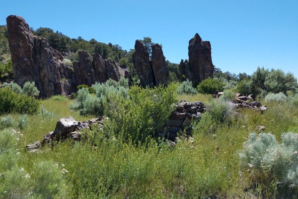
Trips Places Foods Stories Newsletters
Loading...
Loading...
Loading...
Loading...

No search results found for
“”

Make sure words are spelled correctly.

Try searching for a travel destination.

Places near me Random place

Popular Destinations

  • Paris
  • London
  • New York
  • Berlin
  • Rome
  • Los Angeles
Trips Places Foods Stories Newsletters
Sign In Join
Places near me Random place
All Spain Ardales El Caminito del Rey (The King's Little Pathway)

El Caminito del Rey (The King's Little Pathway)

Spanning the El Chorro gorge, this pathway used to be one of the most dangerous crossings in the world.

Ardales, Spain

Added By
Elliot Frantz
Email
Been Here
Want to go
Added to list
  ANDARA RUTAS
  ANDARA RUTAS
  gingercinnamon / Atlas Obscura User
Glass sky walk   jensimmons1016 / Atlas Obscura User
  jensimmons1016 eed50aba / Atlas Obscura User
  gingercinnamon / Atlas Obscura User
Old vs. New   scamb66 / Atlas Obscura User
The catwalk   jensimmons1016 eed50aba / Atlas Obscura User
  coljay72 / Atlas Obscura User
  gingercinnamon / Atlas Obscura User
The new path on top of the old path   jensimmons1016 / Atlas Obscura User
  jensimmons1016 eed50aba / Atlas Obscura User
  coljay72 / Atlas Obscura User
Been Here
Want to go
Added to list

About

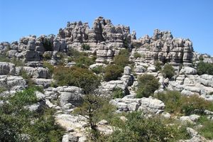
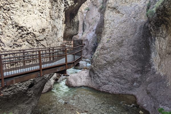
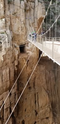
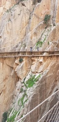
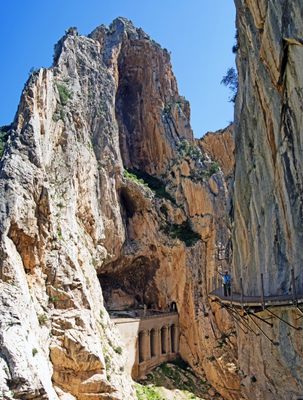
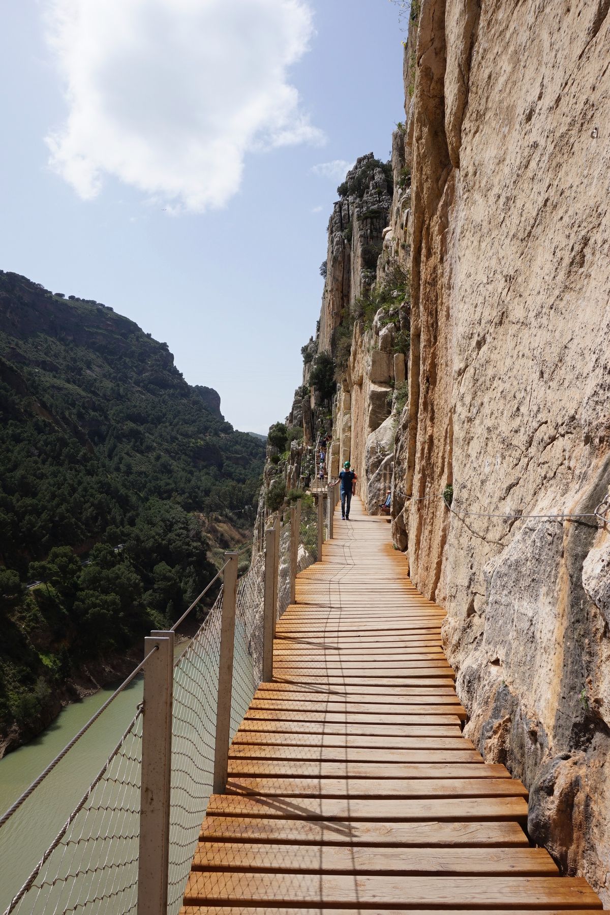
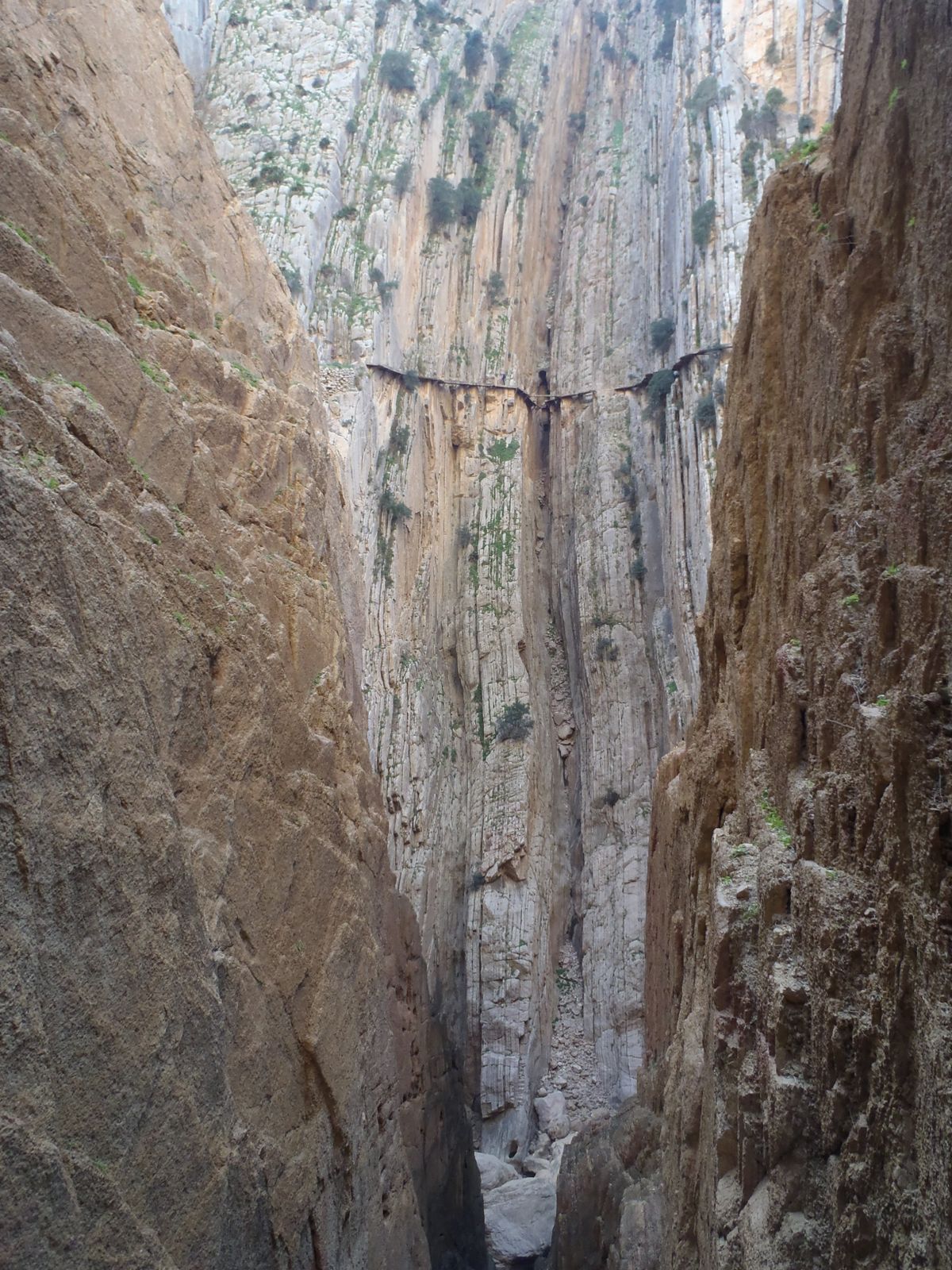
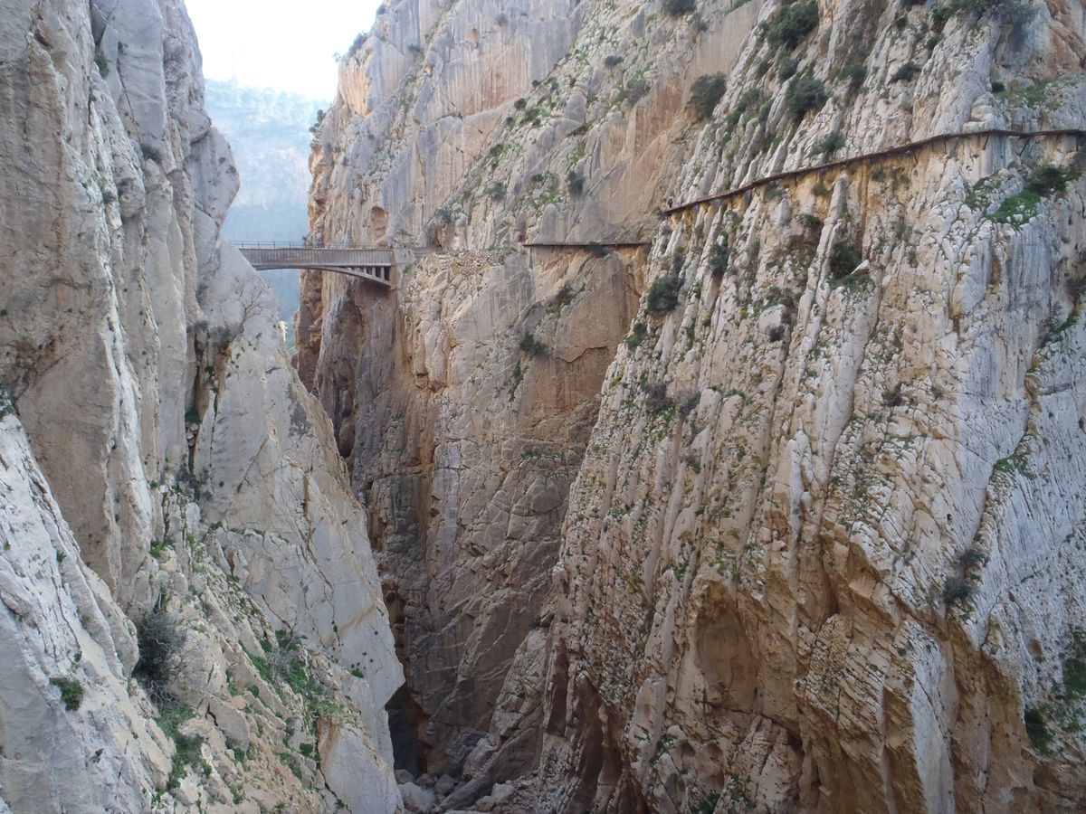
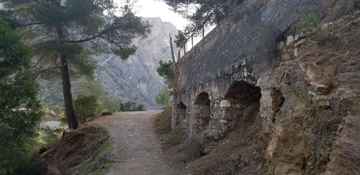
In 1901, a pathway was built across the El Chorro gorge to provide easier access to the hydroelectric plants at the nearby falls. It took four years to finish. Recently renovated, it was once considered one of the most dangerous pathways in the world, regularly drawing visitors hoping to cross it.

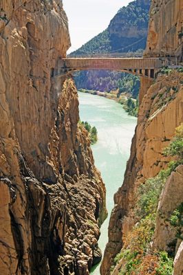
Twenty years after the pathway was completed, King Alfonso XIII crossed the pathway for the inauguration of a new dam. This led to the pathway's modern name, "The King's Little Pathway," or "El Caminito Del Rey." After the King's crossing, however, the bridge began to fall into disrepair.

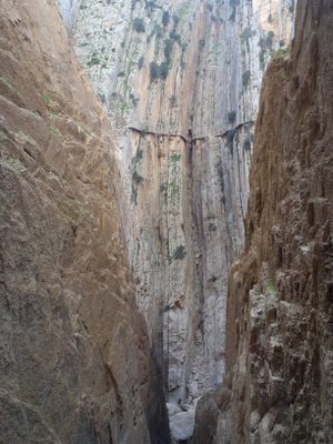
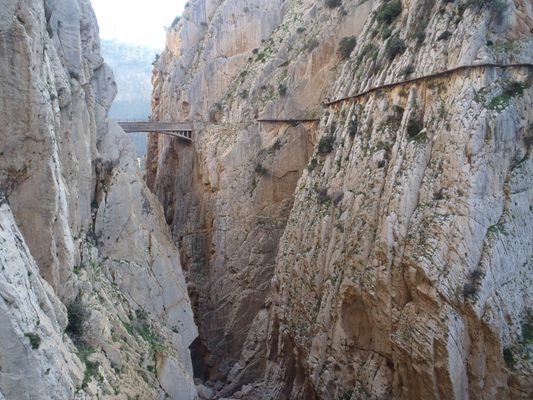
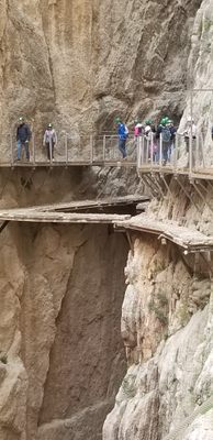
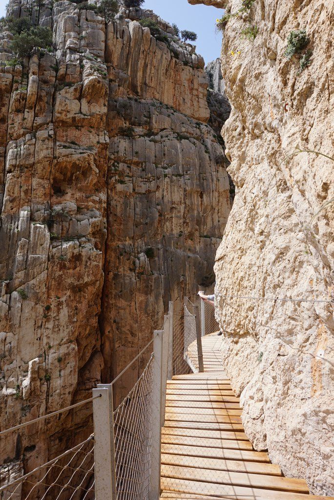
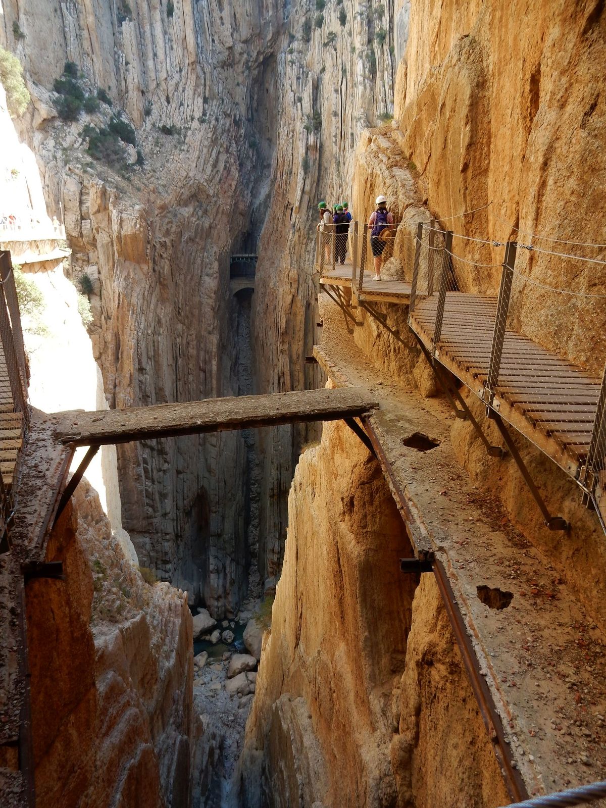
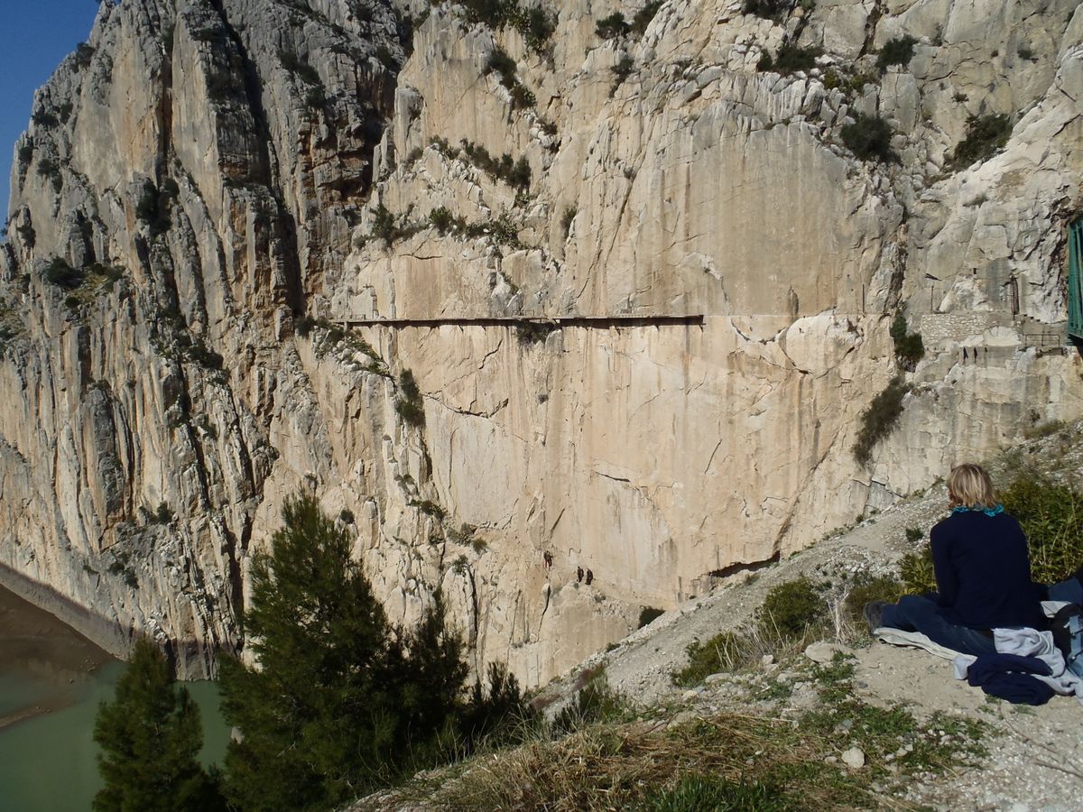
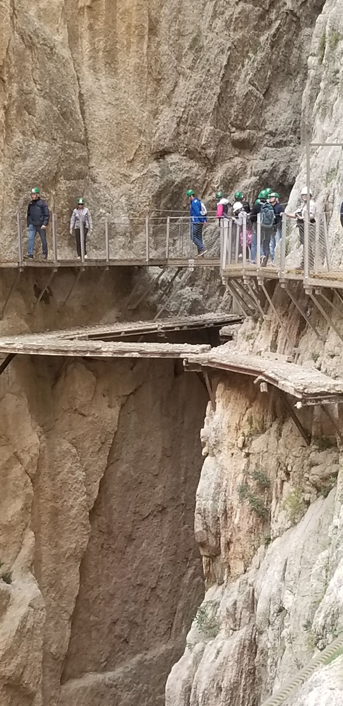
The path itself runs 100 meters above the river below and is only 1 meter wide. It has no handrails and some of the concrete path has fallen down the gorge, leaving only a steel beam left in place.

Before the trail was renovated, there was a cable running the length of the path which one could clip onto. However, the integrity of this cable was unknown. Between 1999 and 2000, four deaths occurred due to the instability of the path.

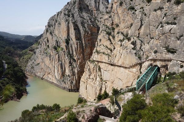
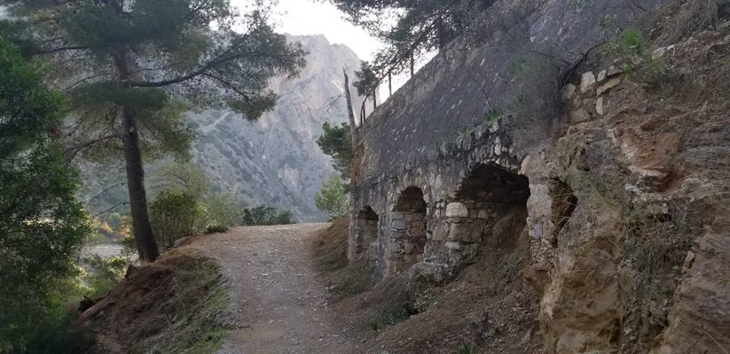
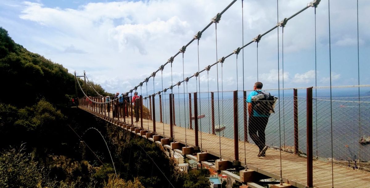
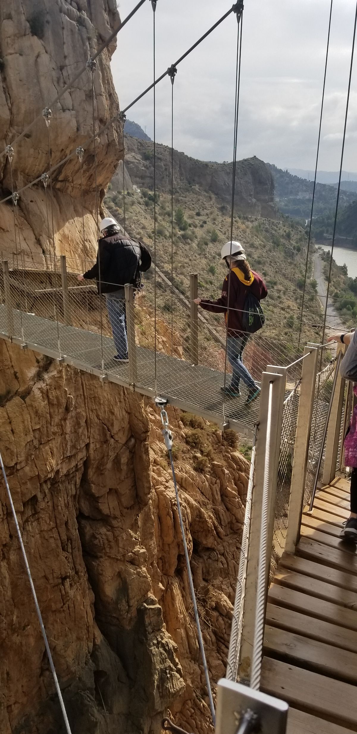
In March 2014 restoration works were started jointly by the regional government of Andalusia and the local government of Malaga. The Caminito del Rey is now fully renovated and safe to walk on, but your time slot to walk the length must be pre-booked on the attraction website.

Related Tags

Trails Canyons Ruins

Know Before You Go

The pathway is located about 60 miles south of Cordoba and just 3 miles from the small town of El Chorro.Parking is available very near the start of the site from unofficial sites from around €4. Tickets are available at the starting point for €10. Total walk length is 5 km and is fairly easy. A bus is available for the return trip for around €1.70 and is well worth it. 

Opening hours differ across the seasons, with longer hours during the warm season, so check the official website to plan accordingly. Also, keep in mind El Caminito del Rey route is linear, stretching from north to south, so visitors need to organize transportation both to the start and endpoint.

Community Contributors

Added By

ProfessorElliot

Edited By

scamb66, Alexanders, cr3, MrCarl...

  • scamb66
  • Alexanders
  • cr3
  • MrCarl
  • turbotas
  • jensimmons1016
  • gingercinnamon
  • TeaAndCoffeeLover
  • jensimmons1016 eed50aba
  • coljay72

Published

April 4, 2012

Edit this listing

Make an Edit
Add Photos
Sources
  • Wikipedia: Caminito del Ray: http://en.wikipedia.org/wiki/Caminito_del_Rey
  • SSQQ: El Camino del Ray: http://www.ssqq.com/archive/vinlin27e.htm
  • Vacation Ideas: El Caminito del Ray - The Most Dangerous Walkway in the World: http://www.vacationideas.me/europe/el-caminito-del-rey-most-dangerous-walkway-world/
  • http://www.caminitodelrey.org
  • https://www.google.com/maps/place/El+Caminito+del+Rey,+sendero+del+Kiosko/@36.931623,-4.8036877,17z/data=!4m12!1m6!3m5!1s0xd72bea52b26f92f:0xe4eede58e183b247!2sEl+Caminito+del+Rey,+sendero+del+Kiosko!8m2!3d36.931623!4d-4.801499!3m4!1s0xd72bea52b26f92f:0xe4eede58e183b247!8m2!3d36.931623!4d-4.801499
  • http://www.caminitodelrey.info/?cod=5111
  • https://rove.me/to/spain/caminito-del-rey
El Caminito del Rey (The King's Little Pathway)
Ardales
Spain
36.915833, -4.772778
Visit Website

Nearby Places

Torcal de Antequera

Antequera, Spain

miles away

Museo Internacional de Arte Belenista (International Museum of Nativity Art)

Mollina, Spain

miles away

Dinero DIY

Cártama, Spain

miles away

Explore the Destination Guide

Photo of Spain

Spain

Europe

Places 757
Stories 37

Nearby Places

Torcal de Antequera

Antequera, Spain

miles away

Museo Internacional de Arte Belenista (International Museum of Nativity Art)

Mollina, Spain

miles away

Dinero DIY

Cártama, Spain

miles away

Explore the Destination Guide

Photo of Spain

Spain

Europe

Places 757
Stories 37

Related Places

  • The water tank

    Oxford, England

    Slade Camp

    A lost World War II military camp and post-war suburb swallowed by the woods.

  • Healy, Alaska

    Suntrana Canyon

    This often-overlooked canyon dazzles and intrigues with its many layers of colors, shapes and odd formations.

  • Washburn's Station

    Willow Grove, Nevada

    Washburn's Station

    It bustled briefly in the late 1860s, but little is now left at this stage stop on the Hamilton/Pioche Stage and Freight Road

  • An empty vein between two rocks that was once rich with iron ore.

    York, South Carolina

    Colonial Iron Mine

    During the American Revolutionary War, iron excavated from this mine was used to make swords, cannons, and more.

  • Mogollon, New Mexico

    Catwalk Recreation Area

    Explore a misty river canyon from a metal bridge system.

  • Point of Rocks Stage Station

    Rock Springs, Wyoming

    Point of Rocks Stagecoach Station

    This sandstone building is a relic of the Overland Trail.

  • Rapid Wedge in Gulf Hagas

    Monson, Maine

    Gulf Hagas

    The “Grand Canyon of Maine” is a three-mile gorge full of striking geological features.

  • Looking downstream.

    Boulder City, Nevada

    Black Canyon National Water Trail

    See Hoover Dam and the bypass bridge from a perspective usually off-limits to the public, and float the upper part of the Black Canyon National Water Trail.

Aerial image of Vietnam, displaying the picturesque rice terraces, characterized by their layered, verdant fields.
Atlas Obscura Membership

Become an Atlas Obscura Member


Join our community of curious explorers.

Become a Member

Get Our Email Newsletter

Follow Us

Facebook YouTube TikTok Instagram Pinterest RSS Feed

Get the app

Download the App
Download on the Apple App Store Get it on Google Play
  • All Places
  • Latest Places
  • Most Popular
  • Places to Eat
  • Random
  • Nearby
  • Add a Place
  • Stories
  • Food & Drink
  • Itineraries
  • Lists
  • Video
  • Podcast
  • Newsletters
  • All Trips
  • Family Trip
  • Food & Drink
  • History & Culture
  • Wildlife & Nature
  • FAQ
  • Membership
  • Feedback & Ideas
  • Community Guidelines
  • Product Blog
  • Unique Gifts
  • Work With Us
  • About
  • FAQ
  • Advertise With Us
  • Advertising Guidelines
  • Privacy Policy
  • Cookie Policy
  • Terms of Use
Atlas Obscura

© 2025 Atlas Obscura. All Rights Reserved.