Trips Places Foods Stories Newsletters

Take your next trip with Atlas Obscura!

Our small-group adventures are inspired by our Atlas of the world's most fascinating places, the stories behind them, and the people who bring them to life.

Visit Adventures
Trips Highlight
Central Asia yurt night stars
Uzbekistan • 15 days, 14 nights
Central Asia Road Trip: Backroads & Bazaars
from
A view of Brașov’s Old Town.
Romania • 12 days, 11 nights
Legends of Romania: Castles, Ruins & Culinary Delights
from
View all trips
Top Destinations
Latest Places
Most Popular Places Random Place Lists Itineraries
Add a Place
Download the App
Top Destinations
View All Destinations »

Countries

  • Australia
  • Canada
  • China
  • France
  • Germany
  • India
  • Italy
  • Japan

Cities

  • Amsterdam
  • Barcelona
  • Beijing
  • Berlin
  • Boston
  • Budapest
  • Chicago
  • London
  • Los Angeles
  • Mexico City
  • Montreal
  • Moscow
  • New Orleans
  • New York City
  • Paris
  • Philadelphia
  • Rome
  • San Francisco
  • Seattle
  • Stockholm
  • Tokyo
  • Toronto
  • Vienna
  • Washington, D.C.
Latest Places
View All Places »
Grotte de Glace
Sinquerim Beach Bastion
Port Tobacco Schoolhouse
Barracks / munitions storage.
Vloethemveld
Latest Places to Eat & Drink
View All Places to Eat »
Names on the bartop.
The Dive
Cacio e pepe lasagna combines two classics.
C'è Pasta... E Pasta!
Spaghetto taratatà is named for the sound of rattling sabers.
Giano Restaurant
The gnocchi here get blanketed in a sugo with braised oxtail.
Cesare al Pellegrino
Romans insist you should feel the cracked peppercorns and cheese grains on your tongue.
Flavio al Velavevodetto
Recent Stories
All Stories Video Podcast
Most Recent Stories
View All Stories »
Green-Wood Cemetery, overlooking New York Harbor.
Where Our Team Looked for Joy During Pandemic Lockdowns
about 21 hours ago
The 2,653-mile-long Pacific Crest Trail spans the entire West Coast from Canada to Mexico.
Meet the Volunteers Who Keep Thru-Hikers Moving
1 day ago
The Haskell Free Library and Opera House building on the U.S.-Canadian border.
Could New Border Restrictions Literally Tear the Haskell Free Library Apart?
2 days ago
A woman peering into the cave of Sarah Bishop c. 1900.
The Curious History of New England’s Hermit Tourism
2 days ago

No search results found for
“”

Make sure words are spelled correctly.

Try searching for a travel destination.

Places near me Random place

Popular Destinations

  • Paris
  • London
  • New York
  • Berlin
  • Rome
  • Los Angeles
Trips Places Foods Stories Newsletters
Sign In Join
Places near me Random place
All the United States Utah Teec Nos Pos Four Corners Monument
AO Edited

Four Corners Monument

The marker offers a rare chance to be in four U.S. states at once, though there's some controversy over its geographic accuracy.

Teec Nos Pos, Utah

Added By
mightyquinn
Email
Been Here
Want to go
Added to list
  WhiskeyBristles / Atlas Obscura User
  WhiskeyBristles / Atlas Obscura User
Four Corners Monument   Struhs/Public Domain
Four Corners Monument   Staplegunther/CC BY 3.0
Four Corners Monument   Rich Torres/CC BY 3.0
Four Corners Monument   David Baron/CC SA 2.0
  GREG MEYER md / Atlas Obscura User
  breaingram / Atlas Obscura User
  GREG MEYER md / Atlas Obscura User
Four Corners From Air   Wonderer / Atlas Obscura User
  GREG MEYER md / Atlas Obscura User
  GREG MEYER md / Atlas Obscura User
Been Here
Want to go
Added to list

About

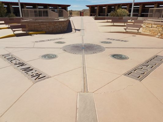
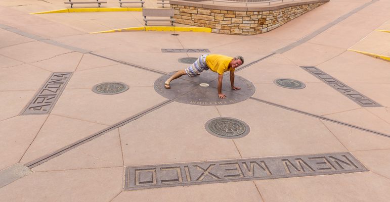
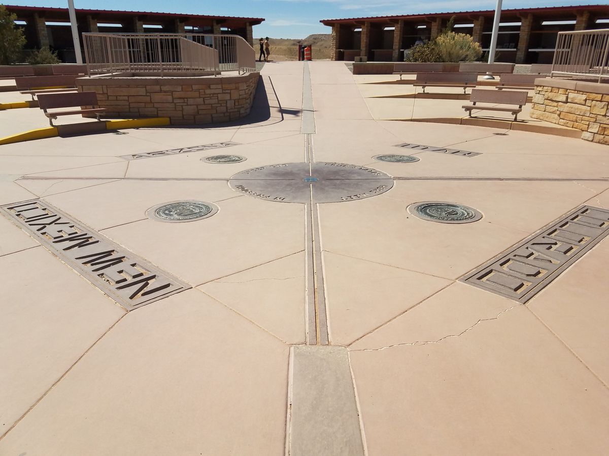
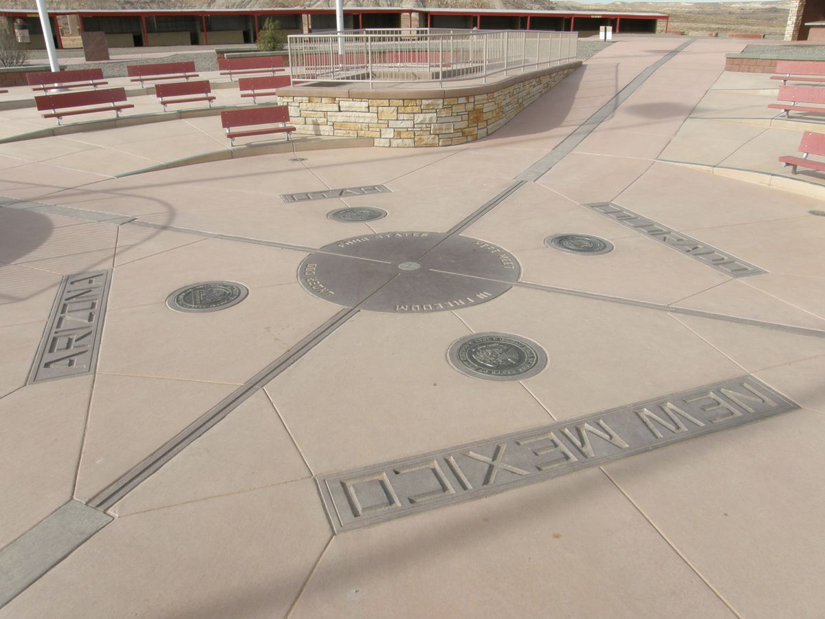
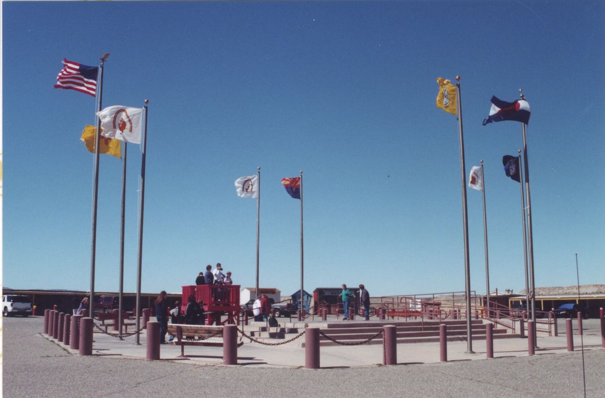
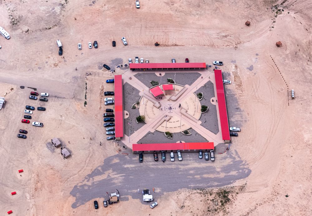
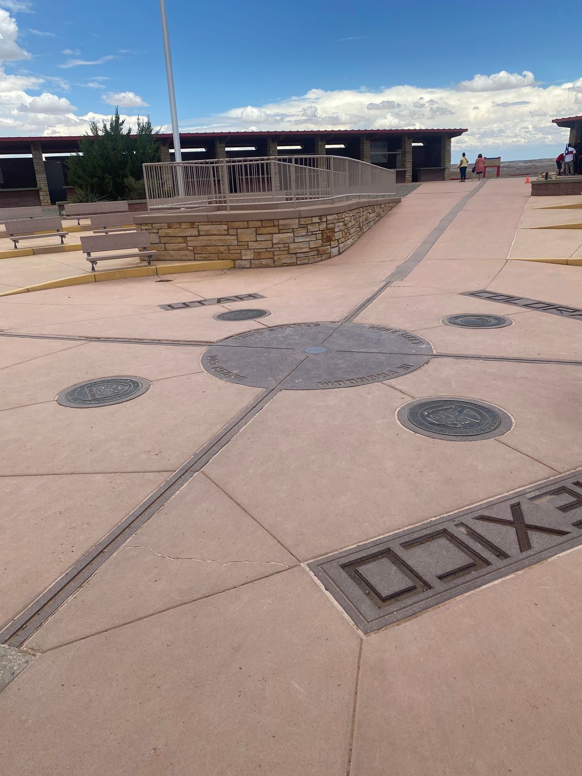
About 250,000 people a year come to get a photo taken, sprawling awkwardly over the granite disk, with each limb in a different U.S. state. But are they awkwardly sprawling on the right spot?

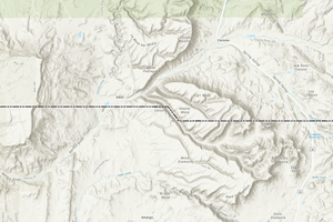
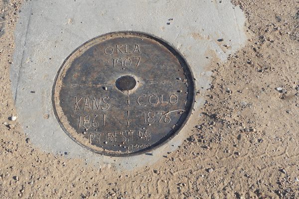
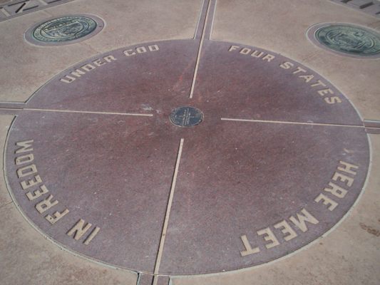
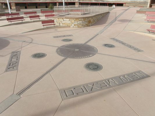
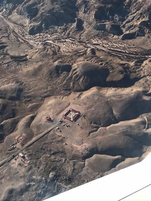
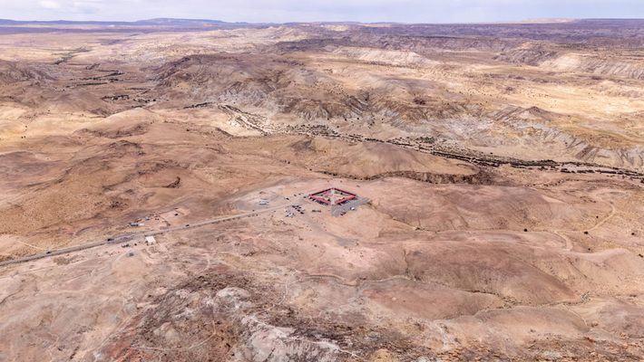
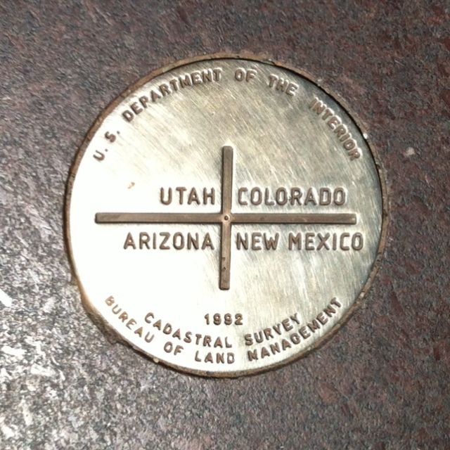
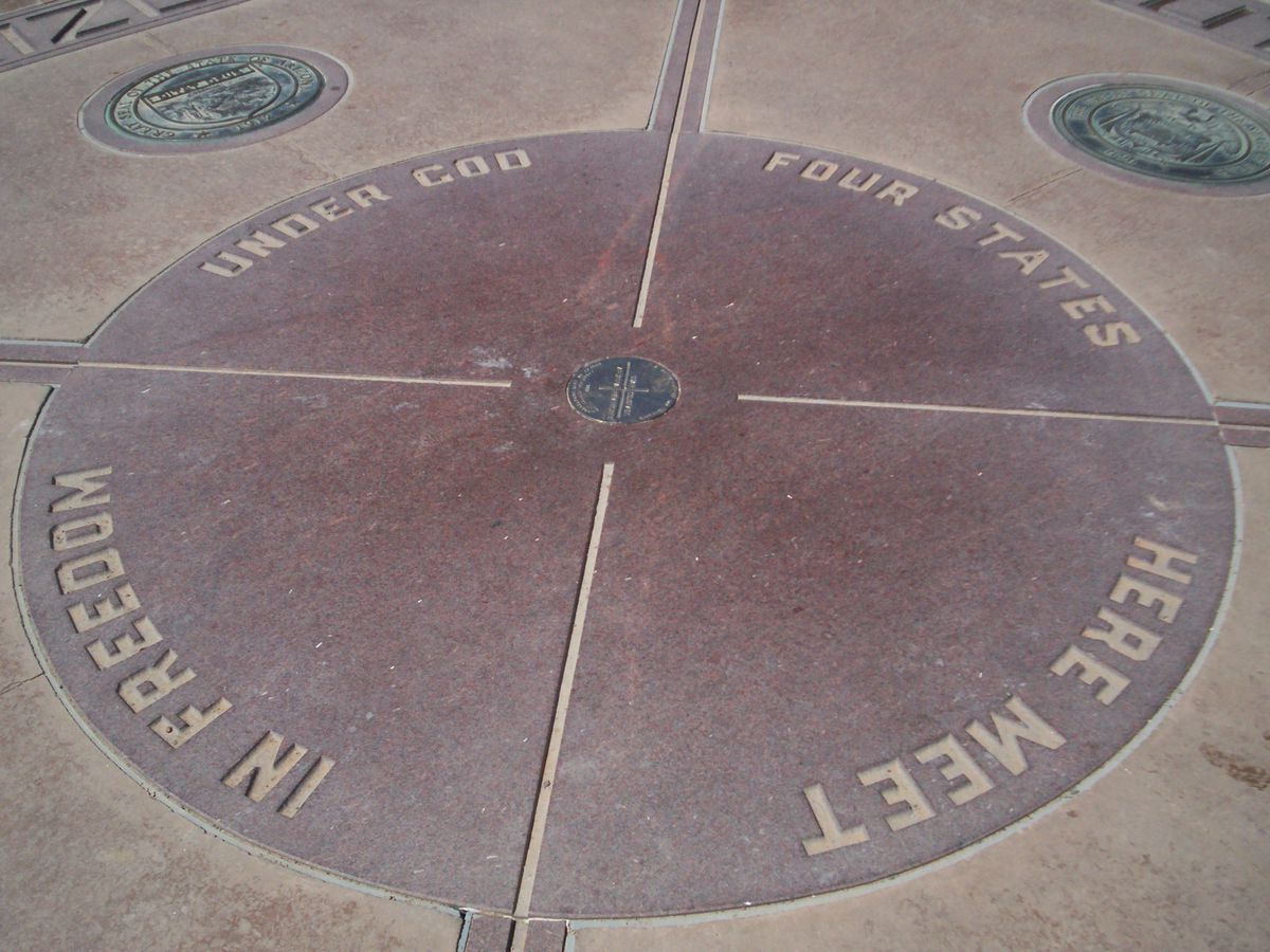
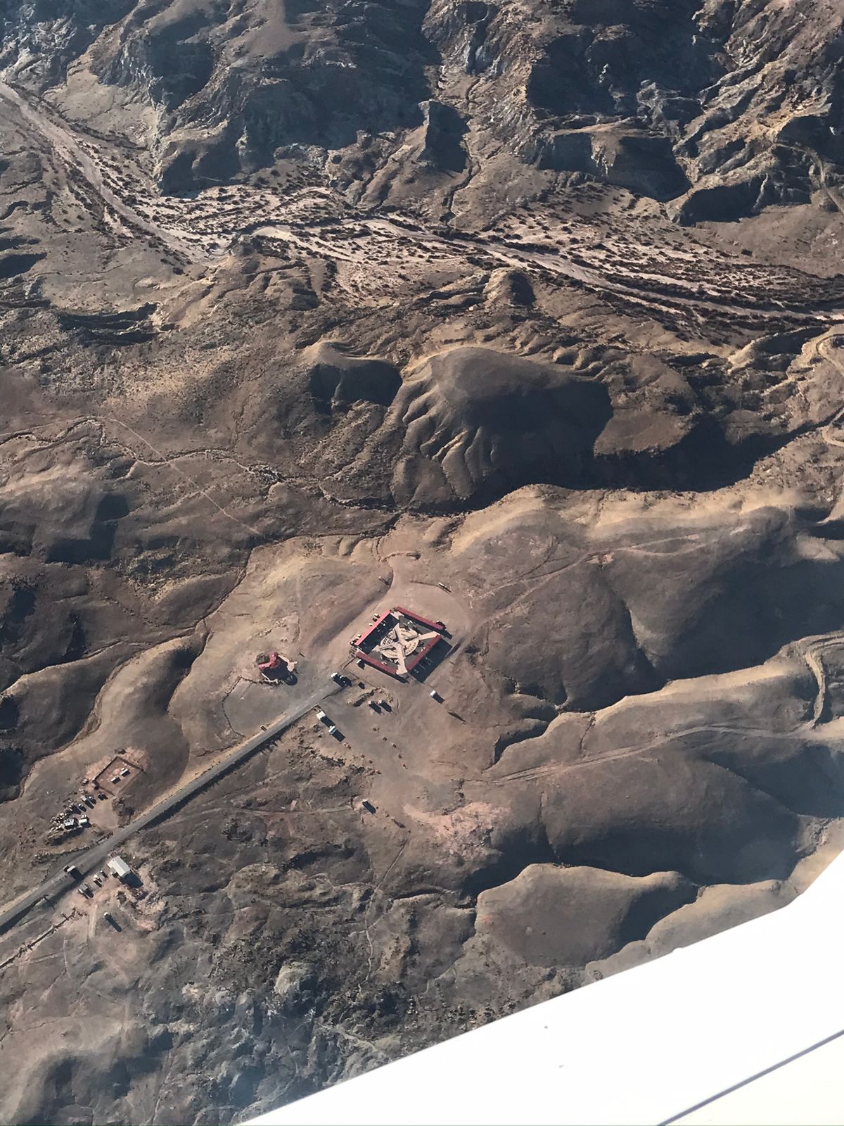
The Four Corners Monument marks the point where New Mexico, Arizona, Colorado, and Utah all meet. It's a rare geographical occurrence, and the only one of its kind in the U.S.: a quadripoint. As early as 1908 people came to take photos at the site, and the Navajo Nation Parks and Recreation Department built a monument there. Yet there’s been confusion regarding the accuracy of the monument for almost as long as it's been standing.

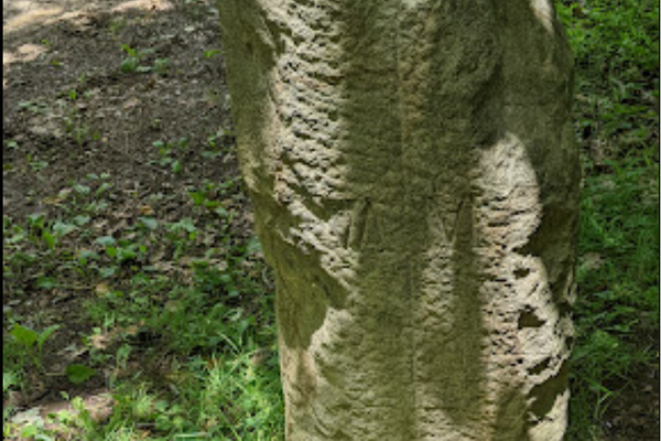
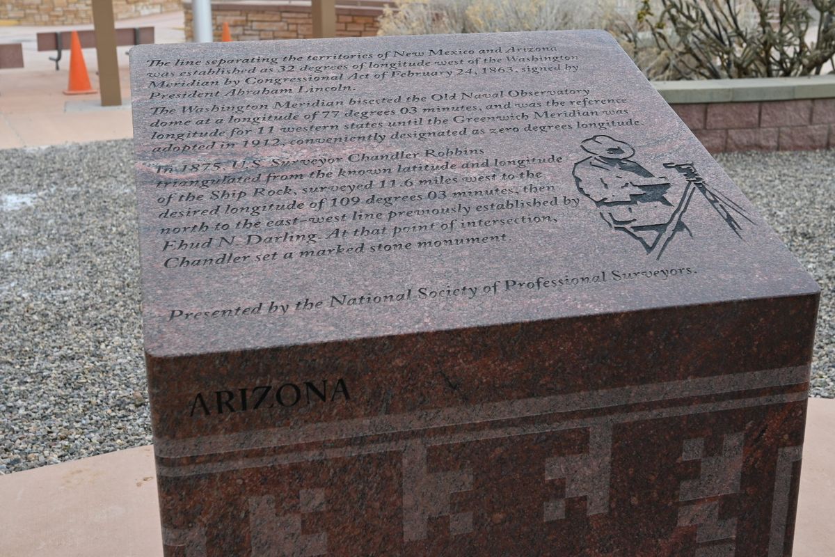
Just before the Civil War, some residents who felt New Mexico was too big, broke off to join the Confederacy as a new territory called Arizona. After the Union won the war, the General Land Office began its efforts to mark the borders between the territories. In 1868 surveyor Ehud Darling marked the border between Colorado and New Mexico, and in 1875 Chandler Robbins marked the border between Arizona and New Mexico. When he crossed Darling’s line he marked it with a piece of sandstone. In 1878, two years after Colorado became a state, a new surveyor marked the Colorado-Utah border starting from Robbins’ sandstone marker.

The Four Corners Monument is located where Robbins placed his sandstone so long ago, but modern GPS clearly shows it’s not quite right. According to today’s technology, it’s about two and a half miles off, but that’s not exactly correct either. Considering the intentions of the original survey, it only sits about 1,800 feet from where it should’ve been marked initially.

In 1925 the Supreme Court ruled to consider it the official border, and, according to the National Geodetic Survey, “once a monument has been established and accepted by the parties involved... the location of the physical monument is the ultimate authority.” Regardless of any deviation from the map, it can’t not be right; the monument trumps the scientific details.

Related Tags

Monuments Borders History Geographic Markers Geographic Oddities

Know Before You Go

Because the monument has become highly commercialized, there is an entrance fee of $8/person due at the gate. Also, dogs are only welcome in the parking area except for service animals. Try the fry bread at Grandma's! It's totally worth it.

Community Contributors

Added By

mightyquinn

Edited By

CorpseLady84, ayamamoto, RedstoneTravels, WhiskeyBristles...

  • CorpseLady84
  • ayamamoto
  • RedstoneTravels
  • WhiskeyBristles
  • Michael Inscoe
  • breaingram
  • GREG MEYER md
  • Wonderer
  • dscottlumpkin

Published

August 1, 2017

Edit this listing

Make an Edit
Add Photos
Four Corners Monument
597 NM-597
Teec Nos Pos, Utah, 86514
United States
36.998979, -109.045182
Visit Website
Get Directions

Nearby Places

Ute Mountain Tribal Park

Towaoc, Colorado

miles away

Shiprock

Shiprock, New Mexico

miles away

17 Room Ruin

Bluff, Utah

miles away

Explore the Destination Guide

Photo of Utah

Utah

United States

Places 155
Stories 29

Nearby Places

Ute Mountain Tribal Park

Towaoc, Colorado

miles away

Shiprock

Shiprock, New Mexico

miles away

17 Room Ruin

Bluff, Utah

miles away

Explore the Destination Guide

Photo of Utah

Utah

United States

Places 155
Stories 29

Related Stories and Lists

Puzzle Monday: On the Map Crossword

maps

By AO Puzzles

Colorado Is Not a Rectangle—It Has 697 Sides

maps

By Frank Jacobs

15 Places Where Borders Get a Little Strange

List

By Jonathan Carey

Related Places

  • Tri-States Monument and Delaware River

    Port Jervis, New York

    Tri-States Monument

    A pair of 19th-century granite markers symbolically record where the state boundaries of New York, New Jersey, and Pennsylvania intersect.

  • Markleysburg, Pennsylvania

    Old Tri-State Monument

    This original Mason-Dixon line cairn placed in the 1760s was put in the wrong location because of the gravitational pull of the Allegheny Mountains.

  • Ras Angela

    Ras Angela, Tunisia

    Ras Angela

    The northernmost point of continental Africa—or is it?

  • Berlin, Germany

    Steinstücken Exclave

    A helicopter memorial commemorating what was once the only way to access this West Berlin exclave.

  • Concordia Monument

    Belvedere, Sint Maarten

    Concordia Monument

    Where Saint-Martin ends and Sint Maarten begins (or vice versa).

  • North face of the monument.  170 miles, 47 chains from Oregon to here.  A “chain” is 66 feet, so there are 80 chains in a mile.

    Verdi, Nevada

    Von Schmidt Monument

    An iron monument on the 120th meridian as surveyed, one of only four marking the boundary between Nevada and California north of Lake Tahoe.

  • Basel, Switzerland

    Dreiländereck

    A futuristic rocket marks the spot where three borders meet.

  • The 3 points where Colorado, Kansas and Oklahoma come together.

    Keyes, Colorado

    3 Points Kansas, Colorado, Oklahoma

    This marker identifies the location where three states converge.

Aerial image of Vietnam, displaying the picturesque rice terraces, characterized by their layered, verdant fields.
Atlas Obscura Membership

Become an Atlas Obscura Member


Join our community of curious explorers.

Become a Member

Get Our Email Newsletter

Follow Us

Facebook YouTube TikTok Instagram Pinterest RSS Feed

Get the app

Download the App
Download on the Apple App Store Get it on Google Play
  • All Places
  • Latest Places
  • Most Popular
  • Places to Eat
  • Random
  • Nearby
  • Add a Place
  • Stories
  • Food & Drink
  • Itineraries
  • Lists
  • Video
  • Podcast
  • Newsletters
  • All Trips
  • Family Trip
  • Food & Drink
  • History & Culture
  • Wildlife & Nature
  • FAQ
  • Membership
  • Feedback & Ideas
  • Community Guidelines
  • Product Blog
  • Unique Gifts
  • Work With Us
  • About
  • FAQ
  • Advertise With Us
  • Advertising Guidelines
  • Privacy Policy
  • Cookie Policy
  • Terms of Use
Atlas Obscura

© 2025 Atlas Obscura. All Rights Reserved.