About
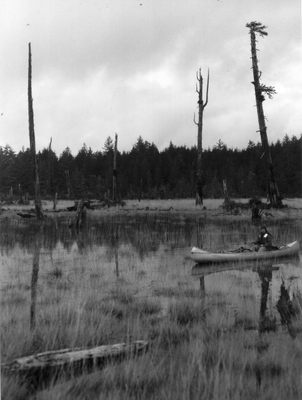
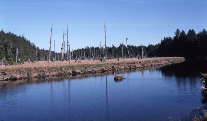
On January 26, 1700, a massive 9.0 earthquake struck the Pacific Ocean, ripping through the Pacific Northwest and creating a tsunami as far away as Japan. It took scientists years to understand the details of this earthquake, since the Native Americans who were the area's only residents at the time kept only oral records of it. One clue, however, was a forest of dead trees standing along the Copalis River in Washington.
In the massive flood, the land on which the trees were standing dropped over six feet and was completely inundated with salt water, turning the dense forest into a marsh. The now-dead trees have remained standing ever since, ghostly grey poles dotting the landscape.
Although an enormous tsunami had been recorded in Edo-period Japan around 1700, and Native American and First Nations peoples had passed down stories of this devastating earthquake that could be dated to approximately the same time, scientific investigation of the ghost forest at Copalis provided detailed evidence of this seismic event.
The enormous grove of ghostly red cedars, geologists Brian Atwater and David Yamaguchi discovered, was killed by an inundation of salt water. The 1700 Cascadia Earthquake, whose date was confirmed by reports from the Kwakwaka'wakw indigenous group of British Columbia to records kept from 18th century Japan, had caused the trees to die all at once, rather than over time as had been previously supposed. For more information on the research Atwater and Yamaguchi conducted at Copalis, see this USGS report.
Related Tags
Know Before You Go
The ghost forest can be reached by canoe or kayak from an informal launch site in the middle of the town of Copalis Beach. The road access is by a gated private road, so please respect private property.
Published
July 6, 2017

