


About
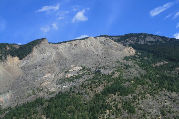
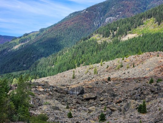
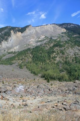
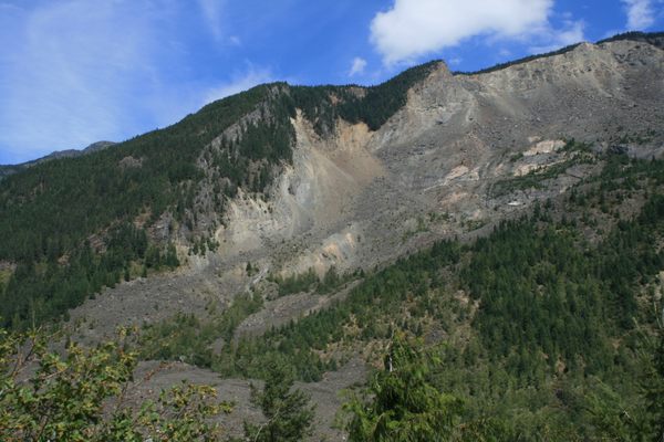
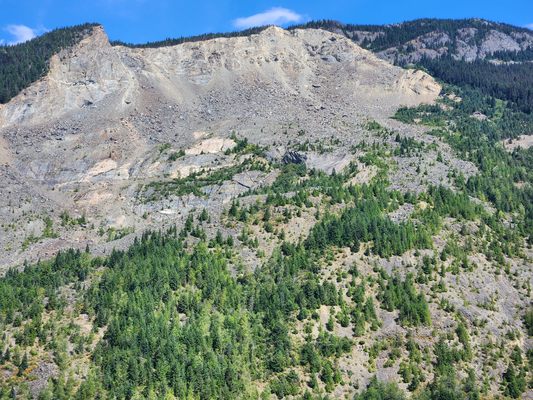
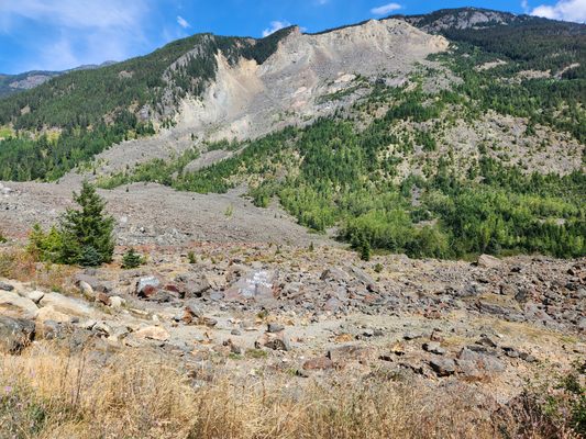
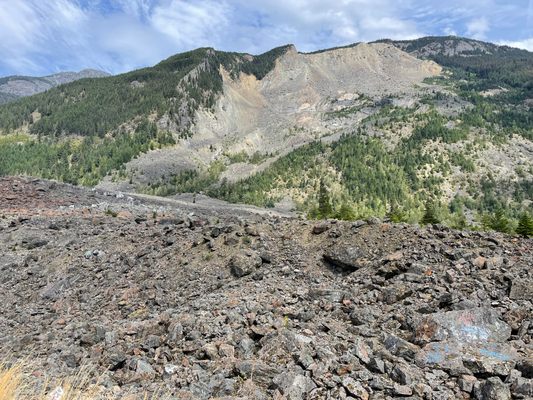
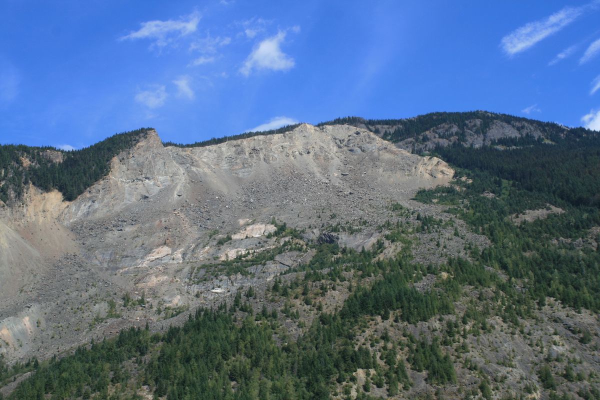
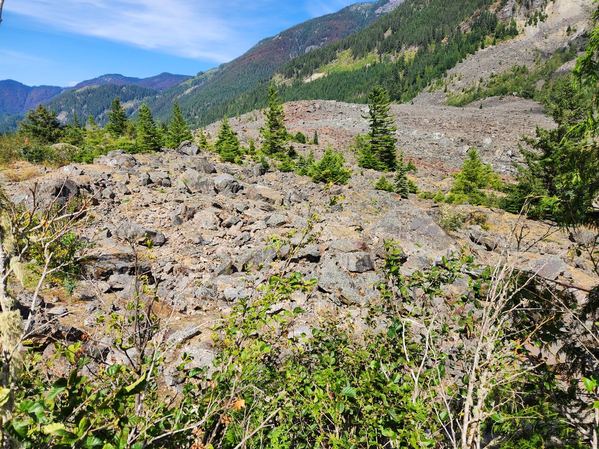
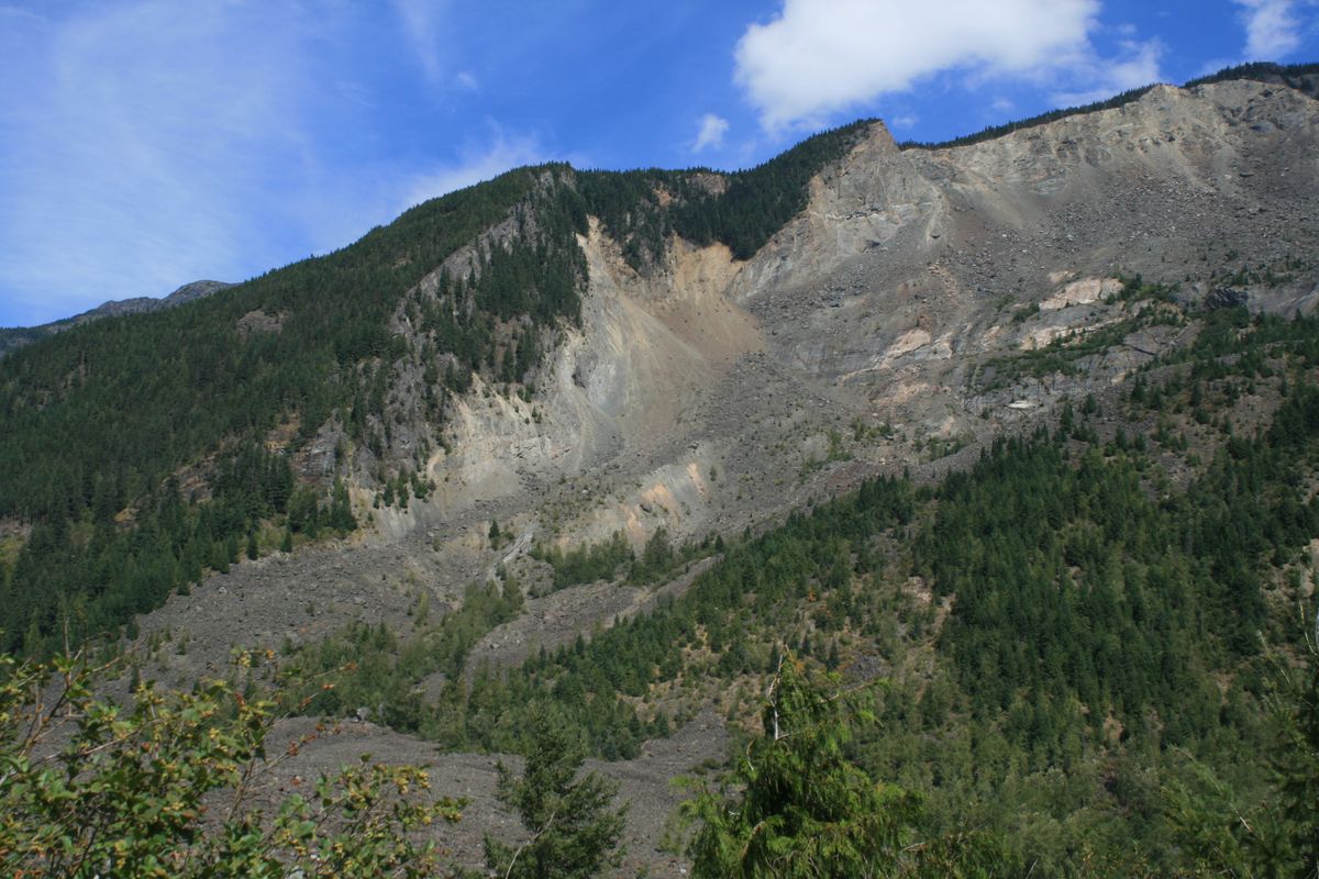
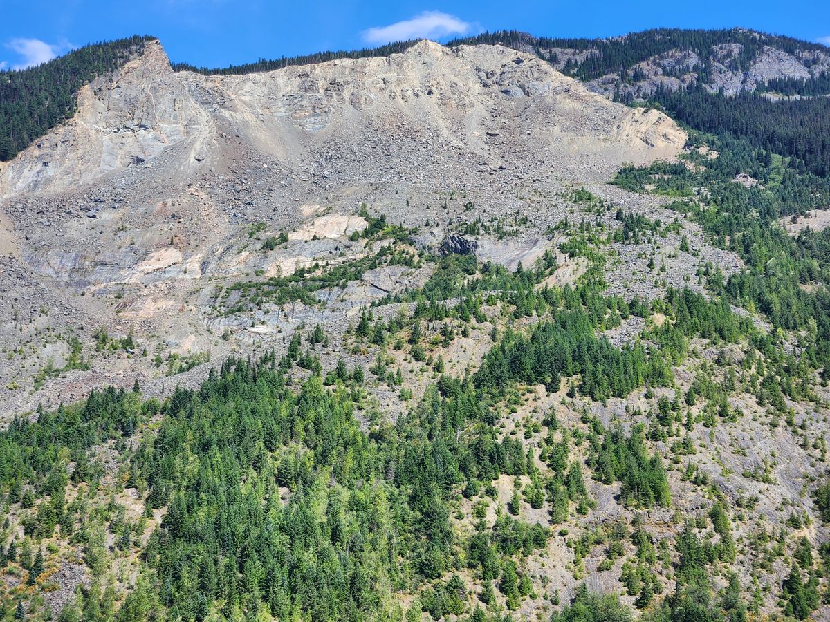
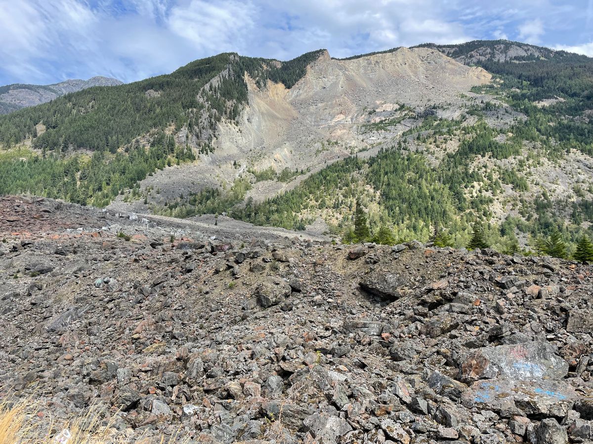
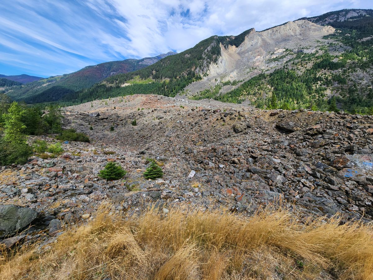
The mountains of British Columbia tend to be extremely steep because they've been oversteepened by deep and extensive glacial downcutting. The result is that slopes are extremely unstable; gravity will have its way eventually.
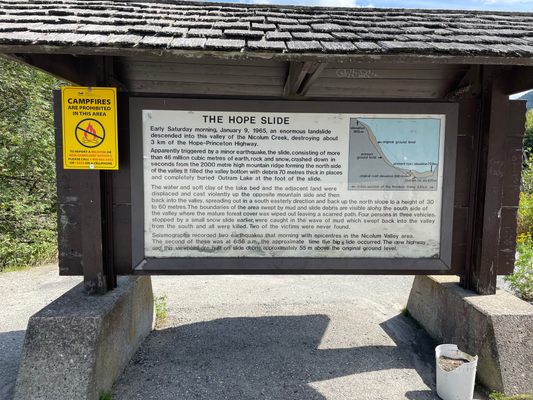
That's what happened in Sunshine Valley around 7 a.m. on January 9, 1965. It was originally thought that a small earthquake might have been the actual trigger of the slide, due to a seismometer reading at the time of the slide. It's now thought, though, that the seismic signal is not a cause but a result of the slide, from the rock slamming into the valley below.
The actual trigger of the slide remains unclear. The failure is consistent with regional patterns of weaker zones in the bedrock, but there seems to be no particular reason for failure at this time. Snow and ice load, in January, may have played a role by adding weight to the slope. It's also speculated that a cold snap may have blocked groundwater seepage by freezing, which led to an increase in groundwater pore pressure and further weakening of the failure zones. Alternatively, ongoing weathering of the weak zones may simply have reached a tipping point. Detailed study indicates that the lower part of the slide failed first, which removed support from upper rocks so that they collapsed in turn.
Tragically, the slide resulted in four fatalities, from parties that had been blocked by a precursor slide across the highway. It could have been worse, however. Debris was continuing to fall across the road, and a truck driver who came up while the people were trying to free their stuck car realized this indicated further sliding was highly probable. After failing to persuade the other parties to turn around, and unable to turn his truck around, the trucker started back on foot and met a bus. He told the bus driver about the slide, and the driver agreed as to the danger. The bus driver backed up the bus, which was carrying about a dozen passengers, about a mile and a half at high speed, with the result that they missed the main slide.
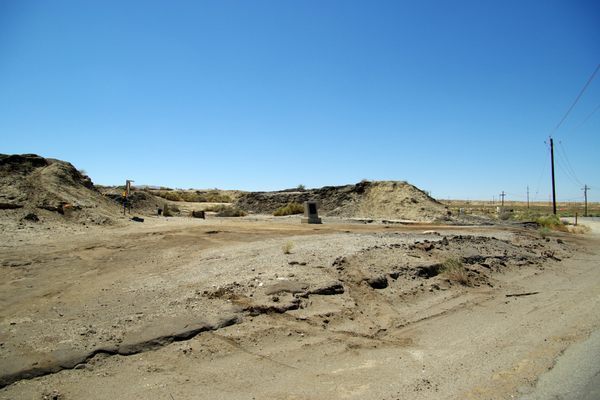
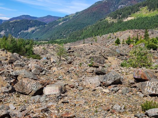
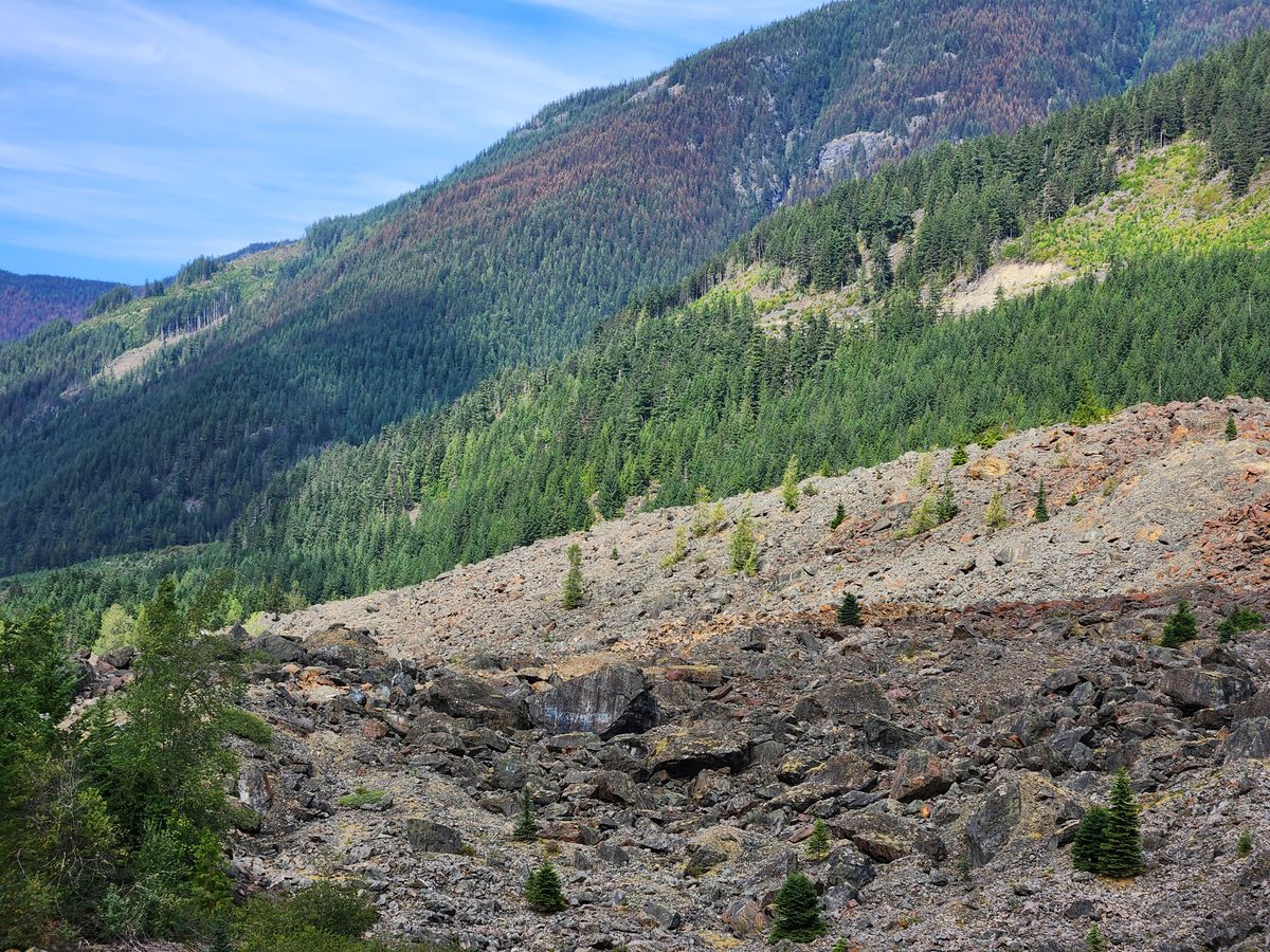
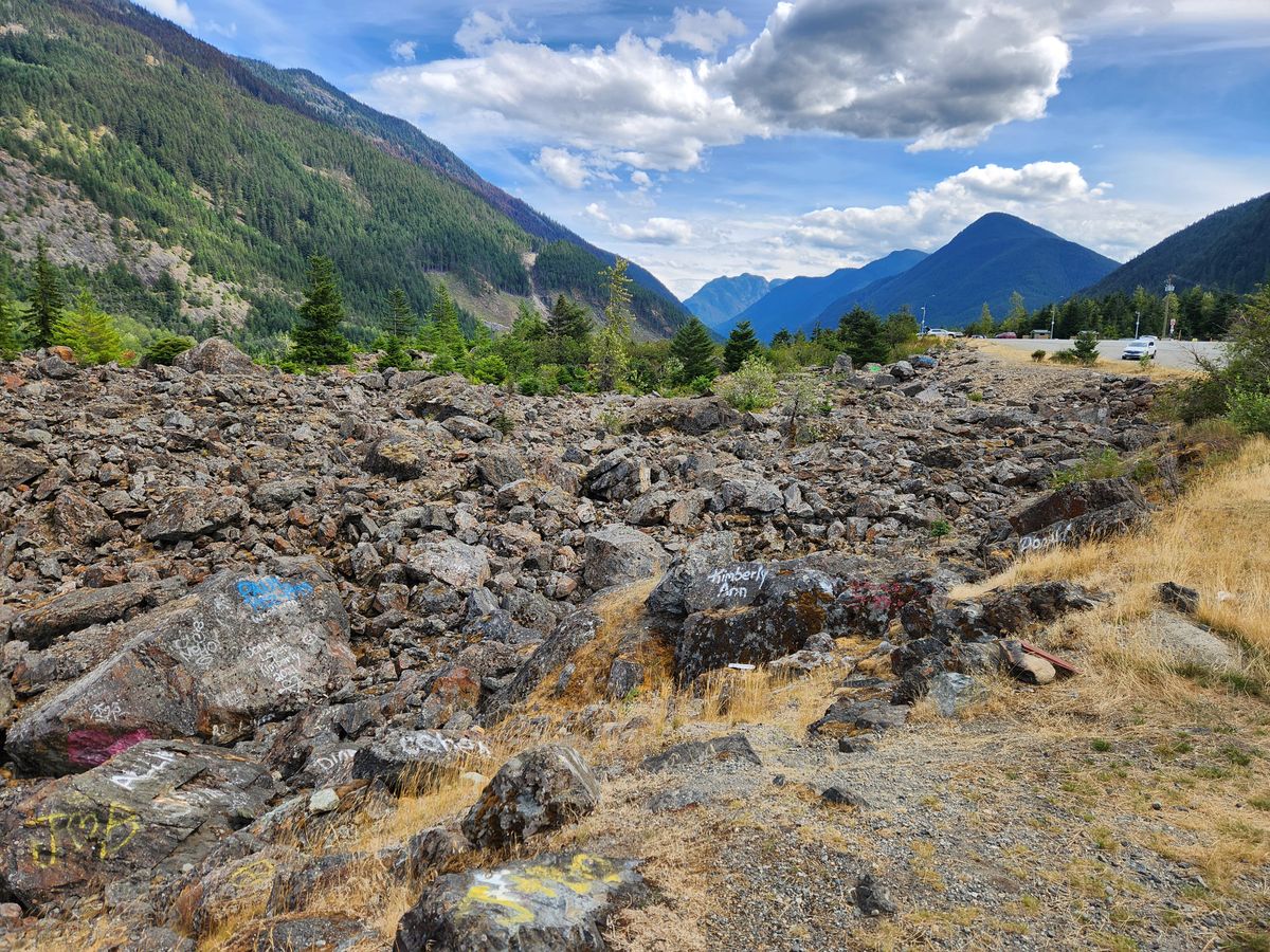
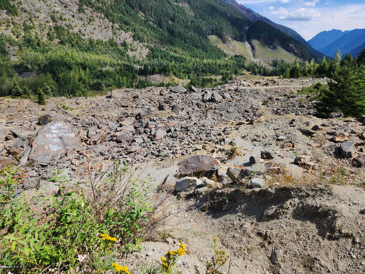
The original highway was buried under over 200 meters of slide debris, and was closed for several weeks. The new alignment, which is farther away from the slope that failed, nonetheless even now is built atop 55 meters of debris.
Related Tags
Know Before You Go
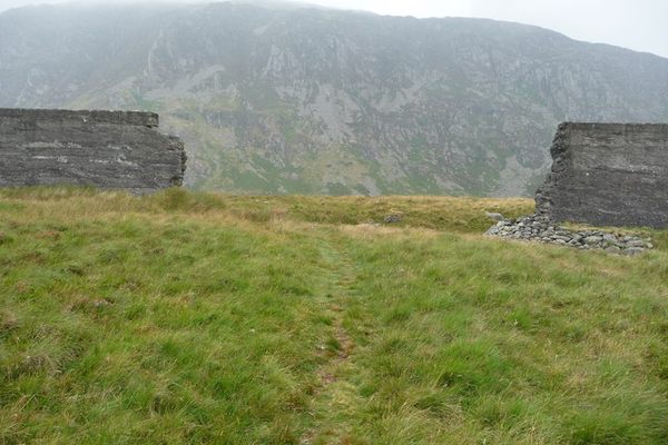
An overlook of the slide site is right off BC Route 3 about 10.5 kilometers from the intersection with BC Route 5 outside Hope. It is well marked.
Community Contributors
Added By
Published
October 21, 2024
Sources
- Brideau, M-A.; Stead, D.; Kinakin, D.; Fecova, K. Influence of tectonic structures on the Hope Slide, British Columbia, Canada. Engineering Geology, 80, 242-259, 2005.
- Saskatoon Star-Phoenix, Saskatoon, Saskatchewan, Canada, January 11, 1965. (online access: https://news.google.com/newspapers?id=dDhgAAAAIBAJ&sjid=5G8NAAAAIBAJ&pg=4692%2C1227317)
- Weichert, D.; Horner, R. B.; Evans, S.G. Seismic signature of landslides: the 1990 Brenda Mine collapse and the 1965 Hope rockslides. Bull. Seismol. Soc. Amer., 84(5), 1523-32, 1994.