About
After World War I, the 1919 Treaty of Versailles brought the Polish state back into existence after 123 years of division and occupation by the Prussian, Austrian, and Russian empires, formalizing the borders of this resurrected Poland by carving out territory from these three failing imperial powers.
Poland's new border was moved even further west after World War II, but during the interwar period between 1919 and 1939, its border with Germany followed more or less the same course as the provincial delimitation between modern Poland's Lubusz and Wielkopolska Voivodeships. This former international border is today overgrown with thick forests that conceal many old, fortified border crossings and bunkers which have become popular landmarks for local hikers.
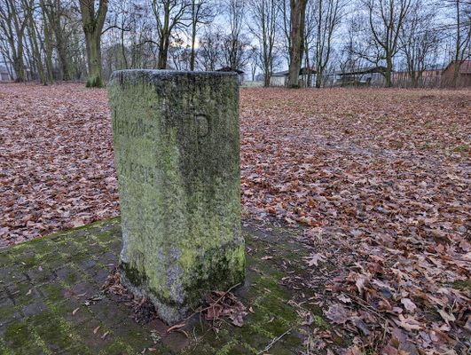
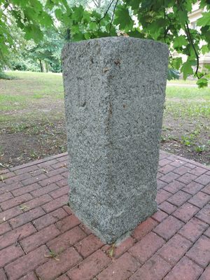
One of the original border markers from the Versailles era stands in a public park in the Polish village of Wierzbno. It's engraved with the date of the Versailles Treaty—June 28, 1919—as well as a "P" for Poland and a "D" for Deutschland (Germany). The actual border crossing was located about one kilometer further east along Poland's national road 24 where the Lubusz Voivodeship meets the Wielkopolska Voivodeship, and is commemorated with a small monument, an information board, and some crumbling ruins of the customs buildings that used to stand there.
A much better preserved Versailles border stone can be found near the Polish coast town of Dębki, by the Piaśnica river.
Related Tags
Know Before You Go
The site is best accessed by car. Passenger trains have not serviced Wierzbno station since 1995, but there are intermittent local bus services from nearby hubs like Gorzów Wielkopolski, Skwierzyna and Międzychód.
Published
June 2, 2023
