About
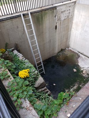
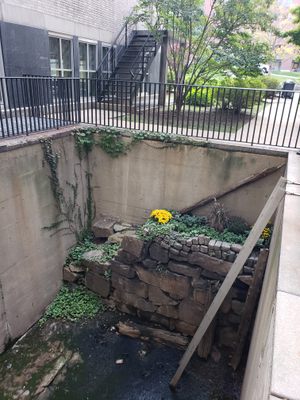
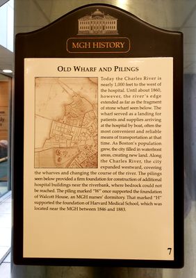
If you are walking down the main corridor of Massachusetts General Hospital, from the Fruit Street entrance towards the rear of the hospital complex, you may notice a small plaque on the wall. Just beside the plaque is a window overlooking a small walled-in trench below containing an interesting rock wall.
Visitors might be surprised to discover that the structure once belonged to a wharf located on the Boston shoreline of the Charles River. The land immediately to the north of this seawall would have originally been tidal flats. This area would have been muddy flats at low tide, but navigable by boat at high tide. This section of the river started to be filled around 1860, creating a man-made piece of land between this location and the river, now well west of the old wharf's location.
Boat travel was much more common during the 19th-century, and the wharf was used regularly for loading and unloading supplies from ships. Patients and visitors also traveled to the hospital by boat, disembarking at two wharves used by the hospital. Also visible are the pilings for the buildings constructed on the water’s edge.
By the late 1850s, the hospital decided to fill in the tidal flats, which were viewed as polluted and unhealthy. In 1860, the hospital created a second wall at the outer edge of the tidal flats, and began to fill in the space between the two walls. For several years, horse-drawn wagons regularly traveled to the edge of the flats and dumped loads of trash and coal ash collected from homes. By 1870, the filling of the flats was completed and buildings were erected on the landfill.
Related Tags
Community Contributors
Added By
Published
December 13, 2019

