Trips Places Foods Stories Newsletters

Take your next trip with Atlas Obscura!

Our small-group adventures are inspired by our Atlas of the world's most fascinating places, the stories behind them, and the people who bring them to life.

Visit Adventures
Trips Highlight
Puglia Italy - Matera
Italy • 8 days, 7 nights
Southern Italy: Castles, Caves & Coastal Treasures in Puglia
from
Turkmenistan Gates of Hell Darvaza crater
Turkmenistan • 10 days, 9 nights
Turkmenistan & the Gates of Hell
from
View all trips
Top Destinations
Latest Places
Most Popular Places Random Place Lists Itineraries
Add a Place
Download the App
Top Destinations
View All Destinations »

Countries

  • Australia
  • Canada
  • China
  • France
  • Germany
  • India
  • Italy
  • Japan

Cities

  • Amsterdam
  • Barcelona
  • Beijing
  • Berlin
  • Boston
  • Budapest
  • Chicago
  • London
  • Los Angeles
  • Mexico City
  • Montreal
  • Moscow
  • New Orleans
  • New York City
  • Paris
  • Philadelphia
  • Rome
  • San Francisco
  • Seattle
  • Stockholm
  • Tokyo
  • Toronto
  • Vienna
  • Washington, D.C.
Latest Places
View All Places »
The ornament collection spans decades.
The Hallmark Collection at the Henry Ford Museum
Crunchy and supremely satisfying, suppli might be the ultimate street food snack.
Supplizio
Front of El Rancho.
Historic El Rancho Hotel
The space is crowded with original artworks kept by the artist.
Hassan Al-Sharq Museum
Latest Places to Eat & Drink
View All Places to Eat »
Crunchy and supremely satisfying, suppli might be the ultimate street food snack.
Supplizio
The pedigreed pistachios here are from Bronte.
Gelateria dei Gracchi
This tiny hole-in-the-wall serves one of the world’s most magnificent sandwiches.
Er Buchetto
Seafood features prominently on the menu.
Dakar NOLA
The kabrit, or twice-cooked goat, with plantains and rice and beans is essential.
Fritai
Recent Stories
All Stories Video Podcast
Most Recent Stories
View All Stories »
Berza gitana is one of the exemplary dishes of Gitano cuisine.
How Gitano Cuisine Found a Home in Andalusia
about 4 hours ago
Greenland dogs—crucial to the sledge patrol’s transport and defense—pull a patrolman’s sled.
How Greenland’s Dog-Sled Patrol Became Unsung Heroes of World War II
about 19 hours ago
1763 Monument in Georgetown, Guyana.
The Berbice Rebellion of 1763 Ended With a Letter
1 day ago
A listener in Toronto explored Casa Loma, and a nearby park that made the city disappear.
How the Pandemic Helped Our Listeners Rediscover Their Own Neighborhoods
2 days ago

No search results found for
“”

Make sure words are spelled correctly.

Try searching for a travel destination.

Places near me Random place

Popular Destinations

  • Paris
  • London
  • New York
  • Berlin
  • Rome
  • Los Angeles
Trips Places Foods Stories Newsletters
Sign In Join
Places near me Random place
All the United States Nevada Fallon Project Shoal Site
AO Edited

Project Shoal Site

On October 26, 1963, a 12-kiloton nuclear device was detonated here in granite some 1,211 feet below the ground surface.

Fallon, Nevada

Added By
slgwv
Email
Been Here
Want to go
Added to list
Looking east at the Sand Springs Range (skylined) from near US-50. The Project Shoal site is near the crest about a quarter of the way from the left edge of the photo.   slgwv / Atlas Obscura User
The monument reads: “A 12-kiloton nuclear device was detonated below this site on October 26, 1963. The nuclear test was conducted as part of the Vela Uniform Program sponsored jointly by the U.S. Department of Defense and the Atomic Energy Commission. The nuclear device was detonated in a granite formation at a depth of 1211 feet. Access was through a horizonal drift that extented from a vertical shaft 1000 feet west of this location. Objectives of the nuclear detonation were to provide data for detection studies and fundamental research in seismology within a granite geologic media in an active seismic area. “No excavation, drilling and/or removal of materials is permitted between a level of plus 5050 feet and plus 3530 feet above mean sea level and out a horizontal distance of 3,300 feet from this surface ground zero location. Any reentry into drill holes or the shaft within this horizontal restricted area is prohibited.”   slgwv / Atlas Obscura User
View south from near the monument.   slgwv / Atlas Obscura User
Another monitoring well.   slgwv / Atlas Obscura User
One of the monitoring wells.   slgwv / Atlas Obscura User
View westward from near the monument.   slgwv / Atlas Obscura User
Survey marker behind the stone marker   cl94 / Atlas Obscura User
Scenery at the test site   cl94 / Atlas Obscura User
The road in is part of the fun here   cl94 / Atlas Obscura User
Been Here
Want to go
Added to list

About

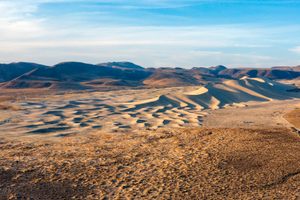
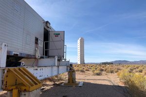
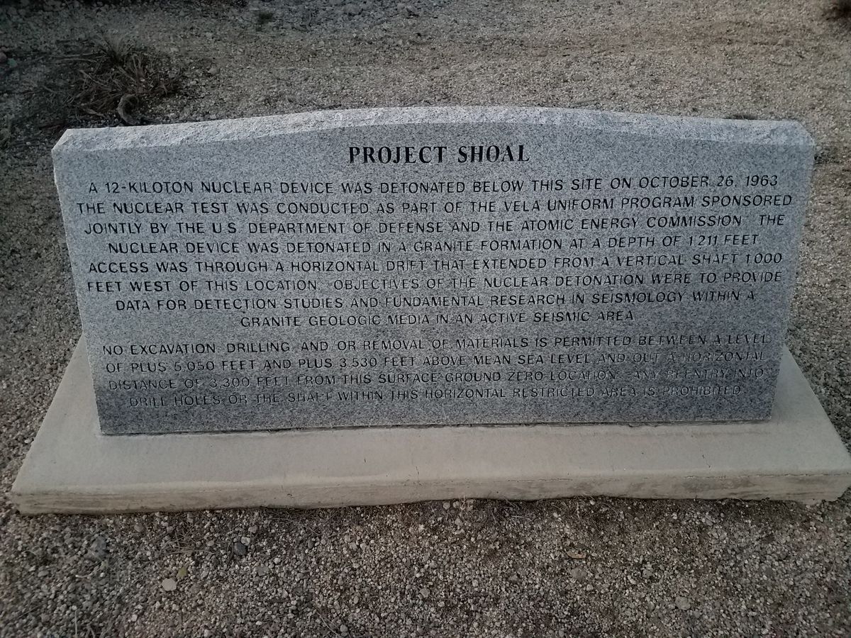
In the early 1960s atmospheric nuclear tests had been forbidden by the Limited Test Ban Treaty. But with the Cold War in full swing, the U.S. Government (and the Soviet government too, for that matter) felt they had to continue testing nuclear explosives, so the focus became testing underground. Nuclear detonations, especially those carried out underground, could be detected seismically and their yields estimated. This led to Project Shoal, which was located about 30 miles east of Fallon, Nevada.

There's a legend from the early days of nuclear testing that a shot carried out in extreme secrecy was immediately announced to the world by outside agencies. At first, security suspected a leak, but it turned out that it hadn't occurred to the brass that something as big as a nuclear explosion would generate an easily recognized seismic signal.

Yields were also capped by the Limited Test-Ban Treaty, so better estimates of them became critical to monitoring treaty compliance. (Both sides, of course, were convinced the other side was exceeding the limits.) Setting off nuclear explosions in different kinds of rock might allow better estimates of the yield by determining how much the seismic signal varied with the rock type.

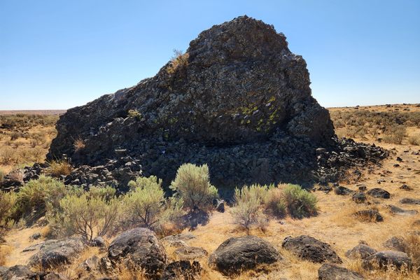
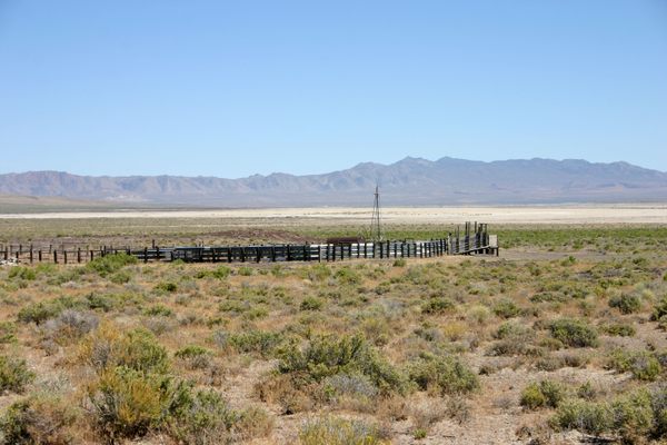
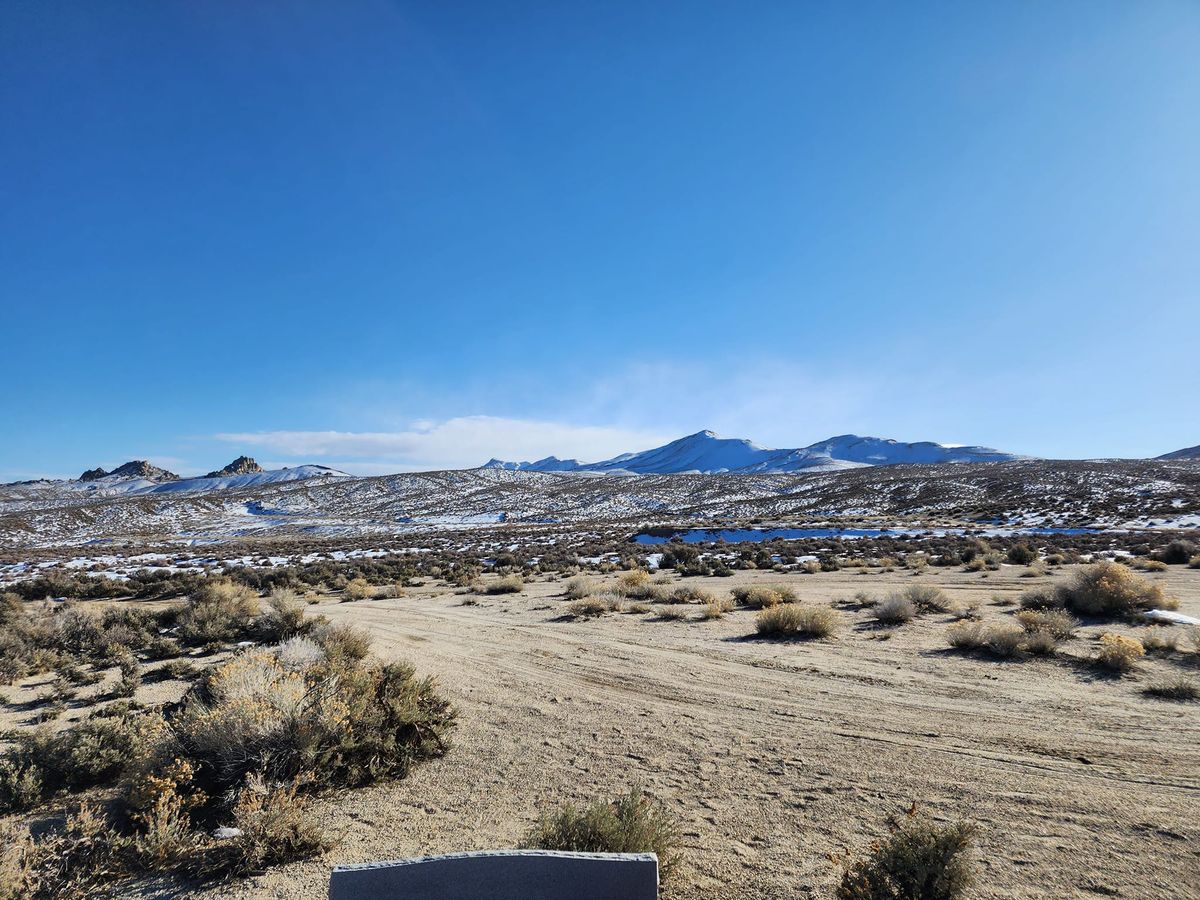
At the site of Project Shoal, carried in the middle of the Sand Springs Range. The bedrock here is granite, which was in short supply on the Nevada Test Site, the usual site of underground tests.

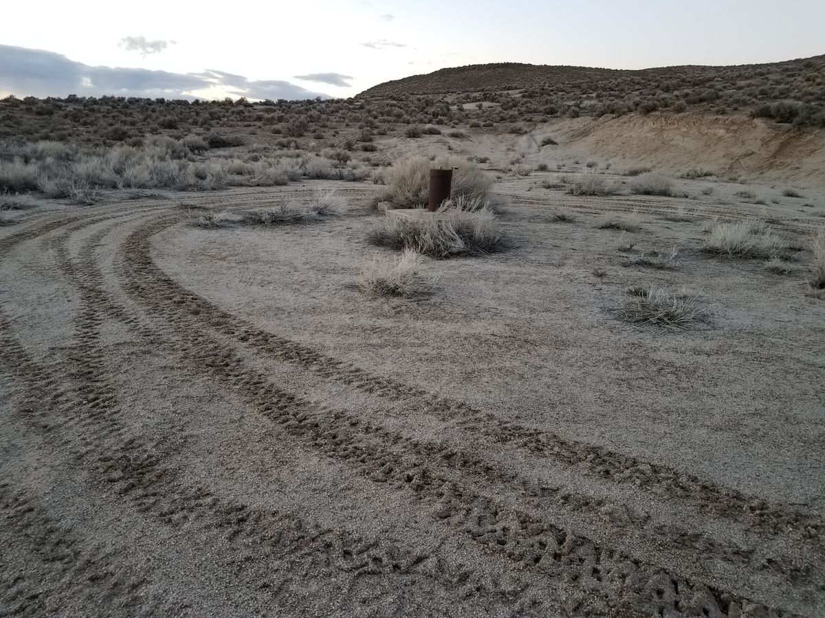
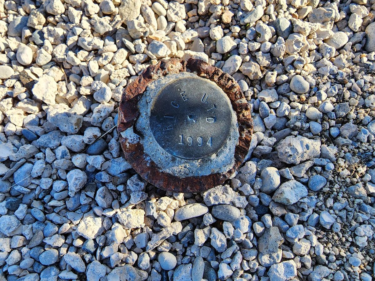
The Project Shoal site is heavily monitored these days. Tritium (hydrogen-3), the radioactive isotope of hydrogen, is of particular interest because the hydrogen is bound up into water—and water contamination, of course, is of extreme importance in these arid lands. Tritium has a relatively short half-life (a little more than 12 years) and does not have a very energetic decay. But there's a lot of it.

Related Tags

Nuclear Rocks Geology Cold War

Know Before You Go

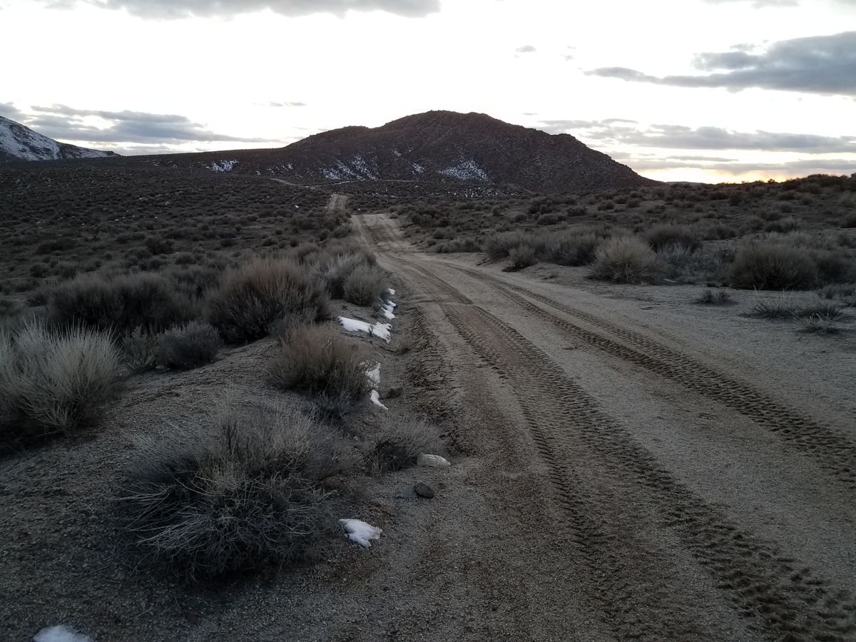
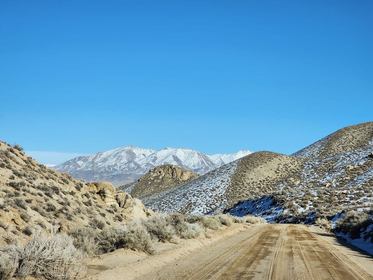
Go 31.9 miles east on US-50 from the intersection of US-50 and US-95 N in Fallon, Nevada to the junction of Nevada SR 839 (the "Scheelite Mine Rd"). Proceed 5 miles south to GZ ("ground zero"; "G2" on some maps due to a cartographer's misreading) road and turn right. It may not be marked; the junction is at 39.20194 N, 118.31354 W. The road is graded and should be passable to ordinary passenger cars in dry weather. Bear right at the junction 3 miles up GZ road; then bear left at the junction in another 0.7 miles. The turnoff to the stone monument is about another 0.2 miles.

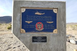
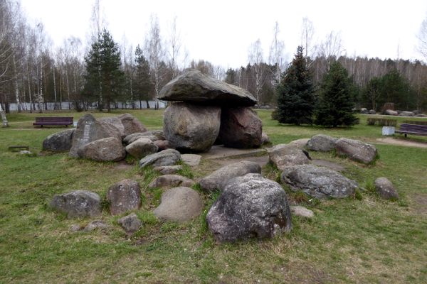
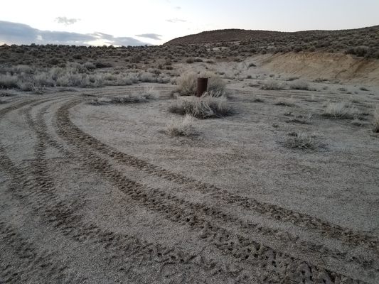
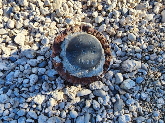
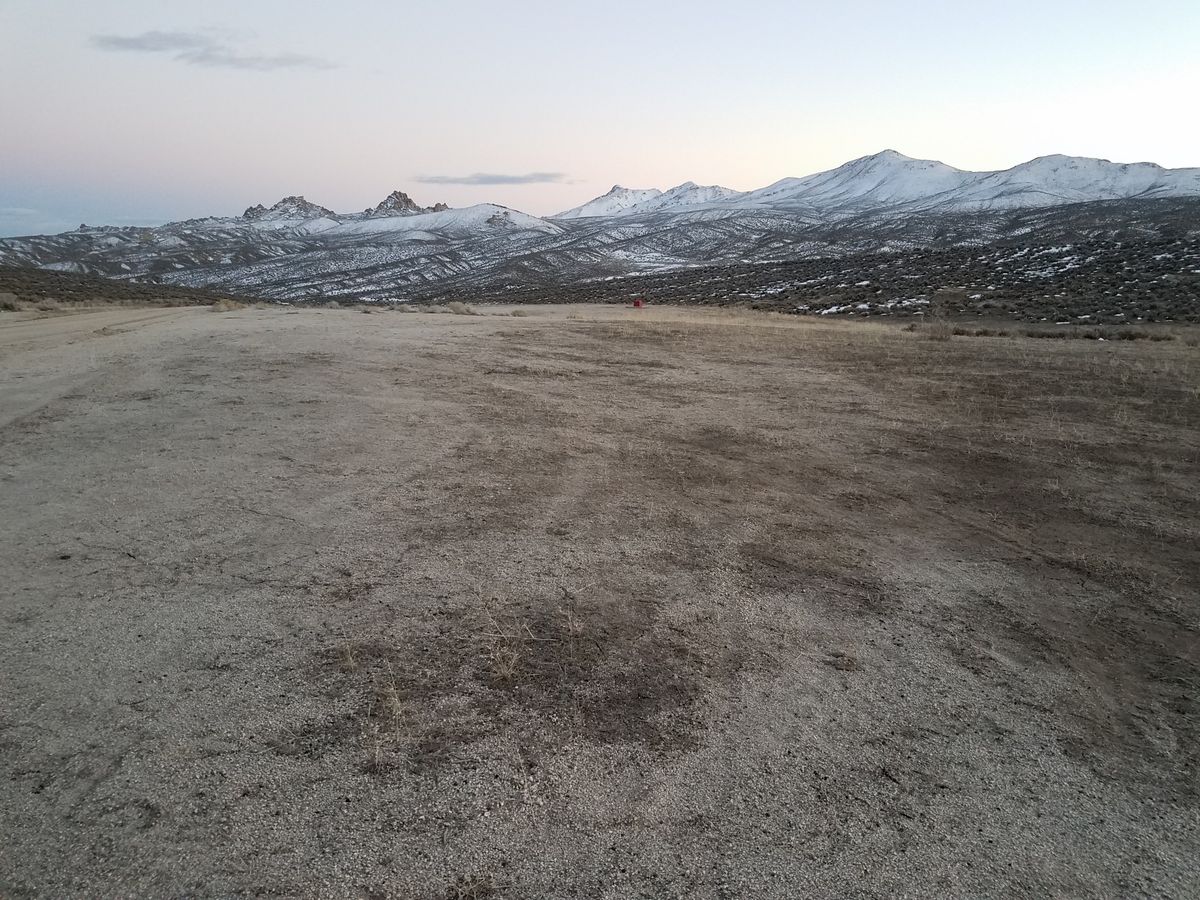
The monument itself is about 250 feet up this access road. In contrast to many historic nuclear test sites, you can drive right up to the monument.

Community Contributors

Added By

slgwv

Edited By

cl94

  • cl94

Published

June 30, 2021

Edit this listing

Make an Edit
Add Photos
Sources
  • https://en.wikipedia.org/wiki/Project_Shoal
  • https://lasvegassun.com/features/finding-nevada/2013/oct/29/heres-nevada-nuclear-blast-site-you-can-visit-if-y/
Project Shoal Site
Unnamed Road
Fallon, Nevada, 89406
United States
39.200334, -118.381205
Get Directions

Nearby Places

Sand Mountain

Fallon, Nevada

miles away

Helicopter Crash Memorial

Fallon, Nevada

miles away

Fairview Peak-Dixie Valley Fault Scarps

Fallon, Nevada

miles away

Explore the Destination Guide

Photo of Fallon

Fallon

Nevada

Places 10

Nearby Places

Sand Mountain

Fallon, Nevada

miles away

Helicopter Crash Memorial

Fallon, Nevada

miles away

Fairview Peak-Dixie Valley Fault Scarps

Fallon, Nevada

miles away

Explore the Destination Guide

Photo of Fallon

Fallon

Nevada

Places 10

Related Stories and Lists

15 Nuclear History Sites That You Can Visit

List

By Jonathan Carey

Related Places

  • The Museum of Stones mimics the shape and topography of Belarus.

    Minsk, Belarus

    Museum of Stones

    A unique park tells the geological history of Belarus in a national “map” of thousands of boulders and blue spruce.

  • Main building

    Vila Nova de Gaia, Portugal

    Geographical Institute of the University of Porto

    A seismograph and a bunker from the Cold War still sit under this university building.

  • Lake Forest, California

    Red Rock Canyon

    A striking geological formation in Southern California.

  • North side of Monster Rock.

    Ephrata, Washington

    Monster Rock

    An enormous boulder deposited by the Scabland floods lies in the Quincy Basin among a host of smaller boulders.

  • Cape Town, South Africa

    Scratch Patch

    An artificial cave littered with semi-precious stones waiting to be picked up.

  • Window arch in the City of Rocks.

    Almo, Idaho

    City of Rocks

    This U.S. natural reserve is an ancient spiritual place and rock climber’s paradise.

  • Colorful sandstone cliff just west of the Colorock Quarry.

    Moapa Valley, Nevada

    Buffington Pockets

    The rocks exposed at Valley of Fire State Park also occur in a much less known but equally spectacular area a few miles to the southwest.

  • The Dragon Mark

    Hanö, Sweden

    Drakmärket (Dragon Mark)

    According to local lore, a flying dragon was blinded by a lighthouse and crashed, leaving a permanent mark on this island rock.

Aerial image of Vietnam, displaying the picturesque rice terraces, characterized by their layered, verdant fields.
Atlas Obscura Membership

Become an Atlas Obscura Member


Join our community of curious explorers.

Become a Member

Get Our Email Newsletter

Follow Us

Facebook YouTube TikTok Instagram Pinterest RSS Feed

Get the app

Download the App
Download on the Apple App Store Get it on Google Play
  • All Places
  • Latest Places
  • Most Popular
  • Places to Eat
  • Random
  • Nearby
  • Add a Place
  • Stories
  • Food & Drink
  • Itineraries
  • Lists
  • Video
  • Podcast
  • Newsletters
  • All Trips
  • Family Trip
  • Food & Drink
  • History & Culture
  • Wildlife & Nature
  • FAQ
  • Membership
  • Feedback & Ideas
  • Community Guidelines
  • Product Blog
  • Unique Gifts
  • Work With Us
  • About
  • FAQ
  • Advertise With Us
  • Advertising Guidelines
  • Privacy Policy
  • Cookie Policy
  • Terms of Use
Atlas Obscura

© 2025 Atlas Obscura. All Rights Reserved.