About
The graves are on private property marked with "No Trespassing" signs so be sure to get permission before visiting.
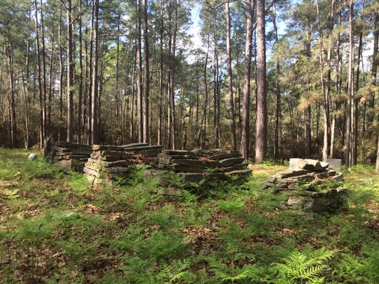
A well-preserved historic gem, the Sturrock Cemetery hides in a hushed clearing of southern yellow pines in East Texas. This little cemetery sits on the outskirts of a faded town (population 100) and at the end of an unmarked dirt road. It is out of cellphone range and sight of power lines, which only contributes to the sense that the cemetery is out of another era.
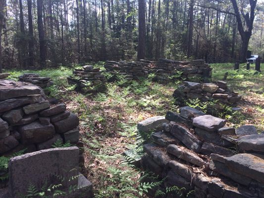
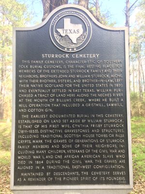
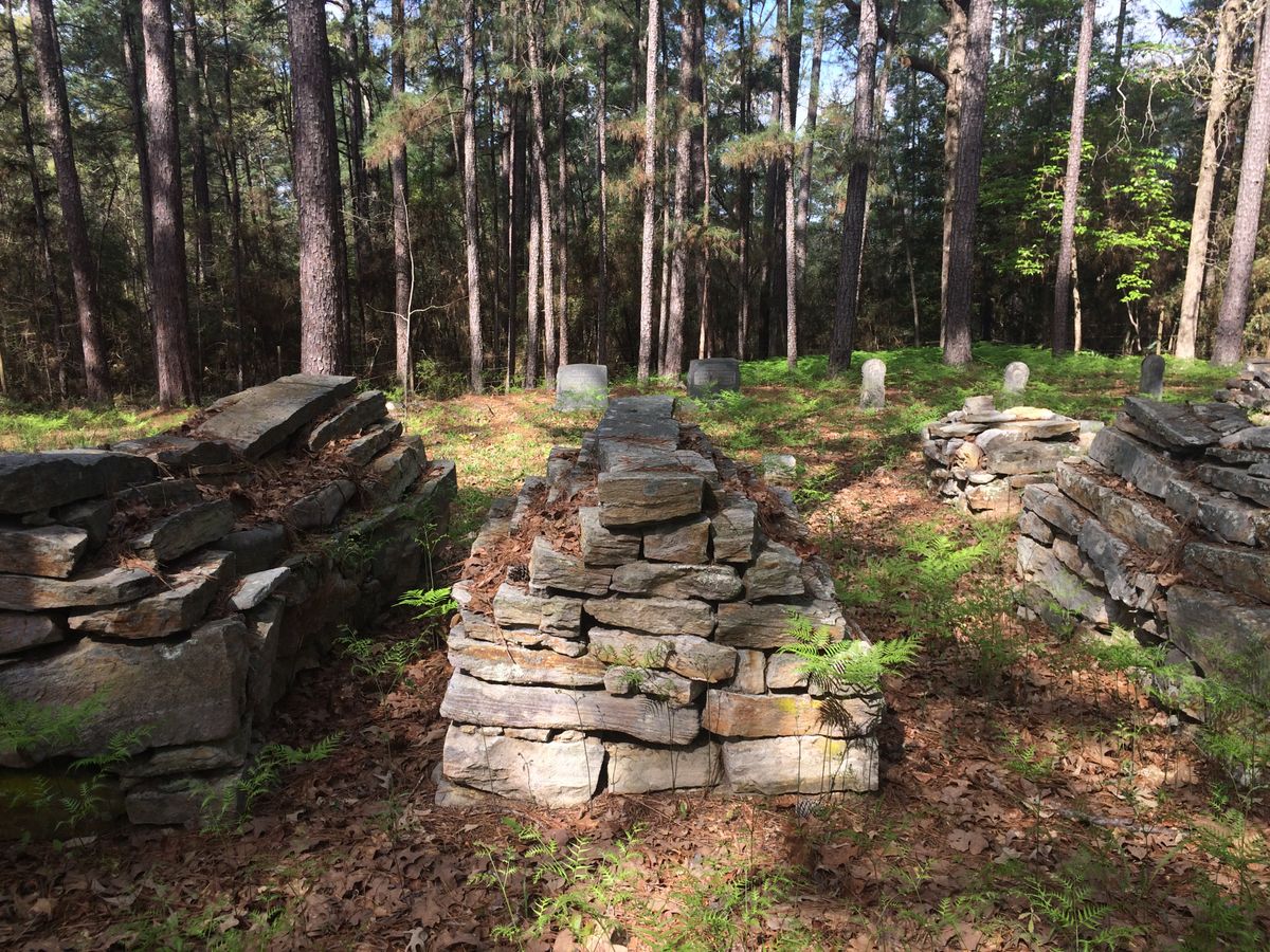
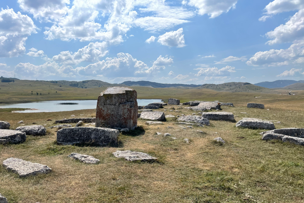
The Sturrock family emigrated from Scotland in the 1830s, settling in Texas and opening several mills and a cotton gin. The first death was the matriarch, Cynthia Frisby Sturrock, who was buried on the family's land by the Neches River in 1853. Her grave marker, a neatly stacked pile of sandstone slabs, was a distinct imitation of ancient Scottish cairns.
Other Sturrocks would follow, each buried in the family cemetery beneath a sandstone cairn. Cutting, transporting, and arranging the heavy rocks would have only been marginally easier using Civil War-era tools rather than Bronze Age ones. The Sturrocks took their technique with them to their graves, and now we can only guess at how they built these low-slung crypts.
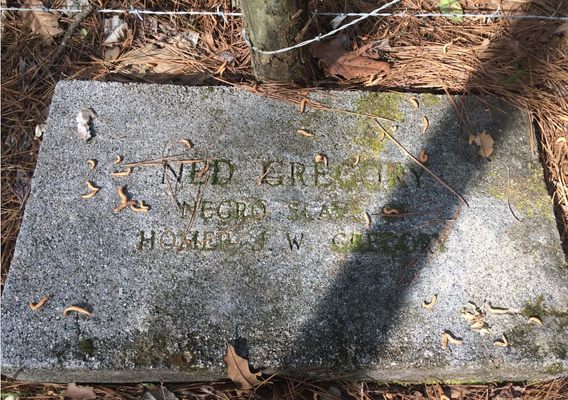
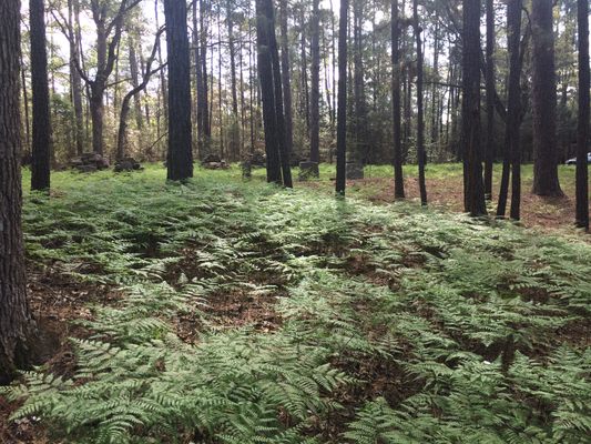
Many of the Sturrock family burials were the result of war. Confederate soldiers were laid to rest in this land, and so were East Texas sons who fought and died during World War I. One grave stands apart from the rest: A single slave is buried along the fence line, separated from the other plots by several yards, a lush carpet of wood ferns, and a racial divide. His marker reads simply, "Ned Gregory, Negro slave of Homer J.W. Gregory."
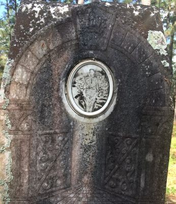
Apart from the remarkable cairn gravestones, there are a few standard headstones. Like Ned Gregory's, they are similarly plainspoken: "Citizen of the Republic of Texas" and "Mrs. Abernathy, Died 1850s." The doll-sized gravestones of newborns tell a timeless tale of plaintive sorrow and hardship.
Related Tags
Know Before You Go
From US 69, go 1.4 miles west on CR 2975. At this point, the road bends sharply to the right and back to the left. There will be a row of mobile homes and houses along the north side of the road. Turn right into the private road at east end of houses. Follow this road northwest across a pasture, 0.3-miles to gate. Continue through woods for another 0.25 mile. Turn left at second fork on the left (west). Go another 0.2-miles northwest. The cemetery is at the end of the road and may not be accessible by automobile due to bad roads.
Community Contributors
Added By
Published
April 26, 2017
Sources
- https://tshaonline.org/handbook/online/articles/hlr33
- http://u.b5z.net/i/u/10211310/f/Tyler_County_Cemeteries_2013.pdf
- https://tshaonline.org/handbook/online/articles/hlr33/search-detail.php?city=Rockland&county=Tyler&an=5457011454
- http://mykindred.com/cloud/TX/getperson.php?personID=I16316&tree=mykindred01
- http://www.stoppingpoints.com/texas/sights.cgi?marker=Sturrock+Cemetery&cnty=tyler
- https://www.findagrave.com/cgi-bin/fg.cgi?page=pis&PIcrid=2168416&PIpi=47568483&PIMode=cemetery
- http://www.countygenweb.com/txmontgomery/tyler_county_cemetery_photo_album.pdf
- http://u.b5z.net/i/u/10211310/f/Tyler_County_Cemeteries_2013.pdf

