Trips Places Foods Stories Newsletters

Take your next trip with Atlas Obscura!

Our small-group adventures are inspired by our Atlas of the world's most fascinating places, the stories behind them, and the people who bring them to life.

Visit Adventures
Trips Highlight
Caucasus - Geghard Monastery, Armenia
Armenia • 15 days, 14 nights
Caucasus Road Trip: Azerbaijan, Georgia & Armenia
from
Taktsang Lhakhang, also known as the “Tiger’s Nest”.
Bhutan • 11 days, 10 nights
Festivals & Temples of Bhutan
from
View all trips
Top Destinations
Latest Places
Most Popular Places Random Place Lists Itineraries
Add a Place
Download the App
Top Destinations
View All Destinations »

Countries

  • Australia
  • Canada
  • China
  • France
  • Germany
  • India
  • Italy
  • Japan

Cities

  • Amsterdam
  • Barcelona
  • Beijing
  • Berlin
  • Boston
  • Budapest
  • Chicago
  • London
  • Los Angeles
  • Mexico City
  • Montreal
  • Moscow
  • New Orleans
  • New York City
  • Paris
  • Philadelphia
  • Rome
  • San Francisco
  • Seattle
  • Stockholm
  • Tokyo
  • Toronto
  • Vienna
  • Washington, D.C.
Latest Places
View All Places »
Southern portion of the Prasat Nakhon Luang
Prasat Nakhon Luang
Lenin’s Head, Tsinandali
The Tunnels of Tabor
What hidden tales lie buried beneath?
Pirate Grave, Portland
Latest Places to Eat & Drink
View All Places to Eat »
The sign declares this the number-one gumbo shop in town.
Gumbo Hut Shioya
The pavlova comes crowned with jewel-like fruit.
Central Park Boathouse
The Village Tavern of Long Grove - exterior.
The Village Tavern
Hunter House Hamburgers
L’Escamoteur
Recent Stories
All Stories Video Podcast
Most Recent Stories
View All Stories »
The Codex Gigas (the Devil’s Bible) open to the portrait of the devil.
Codex Gigas: Who Drew the Devil in This Massive Medieval Bible?
about 10 hours ago
USDA and Washington State agriculture officials tagged this Asian giant hornet. Sept. 10, 2021.
What Ever Happened to the Murder Hornets?
1 day ago
The exterior of the Hall of Records.
Atlas Obscura Mailbag: Urban Exploration, Illegal Carvings, and Repeat Vacations
3 days ago
Biosphere 2 campus (2016)
Biosphere 2: How Volunteers Survived for 2 Years in an Airtight Habitat
4 days ago

No search results found for
“”

Make sure words are spelled correctly.

Try searching for a travel destination.

Places near me Random place

Popular Destinations

  • Paris
  • London
  • New York
  • Berlin
  • Rome
  • Los Angeles
Trips Places Foods Stories Newsletters
Sign In Join
Places near me Random place
All the United States California Palm Springs Tahquitz Creek Falls

Tahquitz Creek Falls

At the western edge of Palm Springs, a rugged desert canyon trail leads to a waterfall at the base of the San Jacinto Mountains.

Palm Springs, California

Added By
slgwv
Email
Been Here
Want to go
Added to list
Top of Tahquitz Creek Falls.   slgwv / Atlas Obscura User
Tahquitz Creek Falls.   slgwv / Atlas Obscura User
Trail to the falls, up the steps to the right.   slgwv / Atlas Obscura User
Tahquitz Creek. Falls are at the obvious notch in the middle distance.   slgwv / Atlas Obscura User
Tahquitz Creek. Looking back; note the pool in the foreground.   slgwv / Atlas Obscura User
Tahquitz Creek.   slgwv / Atlas Obscura User
Looking up Tahquitz Canyon.   slgwv / Atlas Obscura User
The Visitor Center from the parking lot.   slgwv / Atlas Obscura User
Looking east toward Palm Springs from the parking lot.   slgwv / Atlas Obscura User
View out Tahquitz Canyon toward Palm Springs.   slgwv / Atlas Obscura User
Old irrigation headgate in Tahquitz Canyon.   slgwv / Atlas Obscura User
  MtnLady / Atlas Obscura User
Looking back down Tahquitz Canyon.   slgwv / Atlas Obscura User
  MtnLady / Atlas Obscura User
Been Here
Want to go
Added to list

About

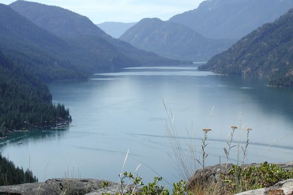
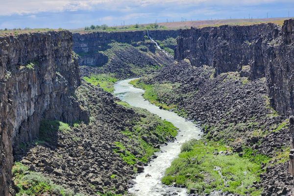
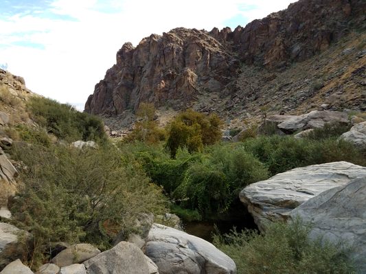
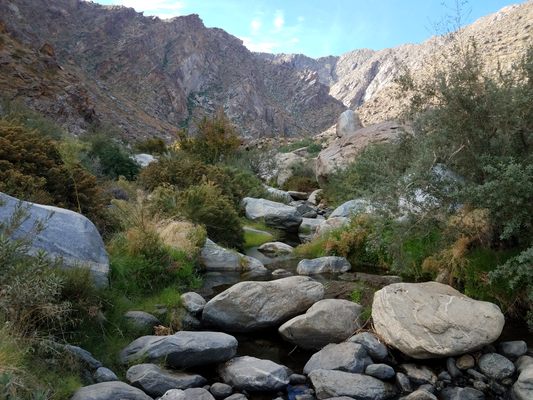
The San Jacinto Mountains, an upthrust fault block resulting from the San Andreas fault system, rise abruptly east of the Los Angeles basin. With a high point at San Jacinto Peak (10,804 feet/3,294 meters), the range is tall enough to intercept the moisture coming from the Pacific, such that the higher elevations support forests and even a winter snow cap. However, this also causes a rain-shadow desert on the eastern side of the range. The mountain precipitation feeds a number of perennial streams that drain to the east, of which one of the largest is Tahquitz (pronounced TAH-keets) Creek.

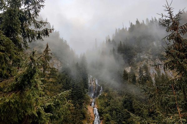
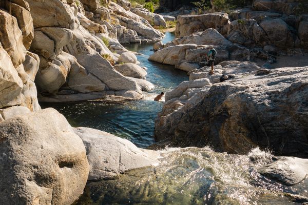
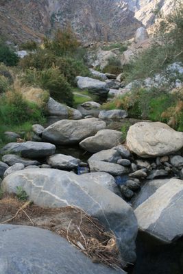
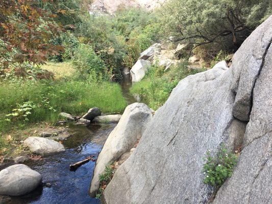
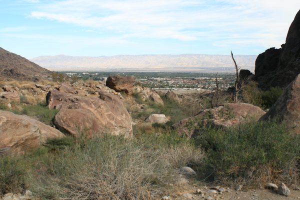
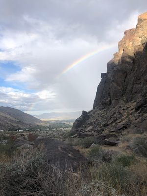
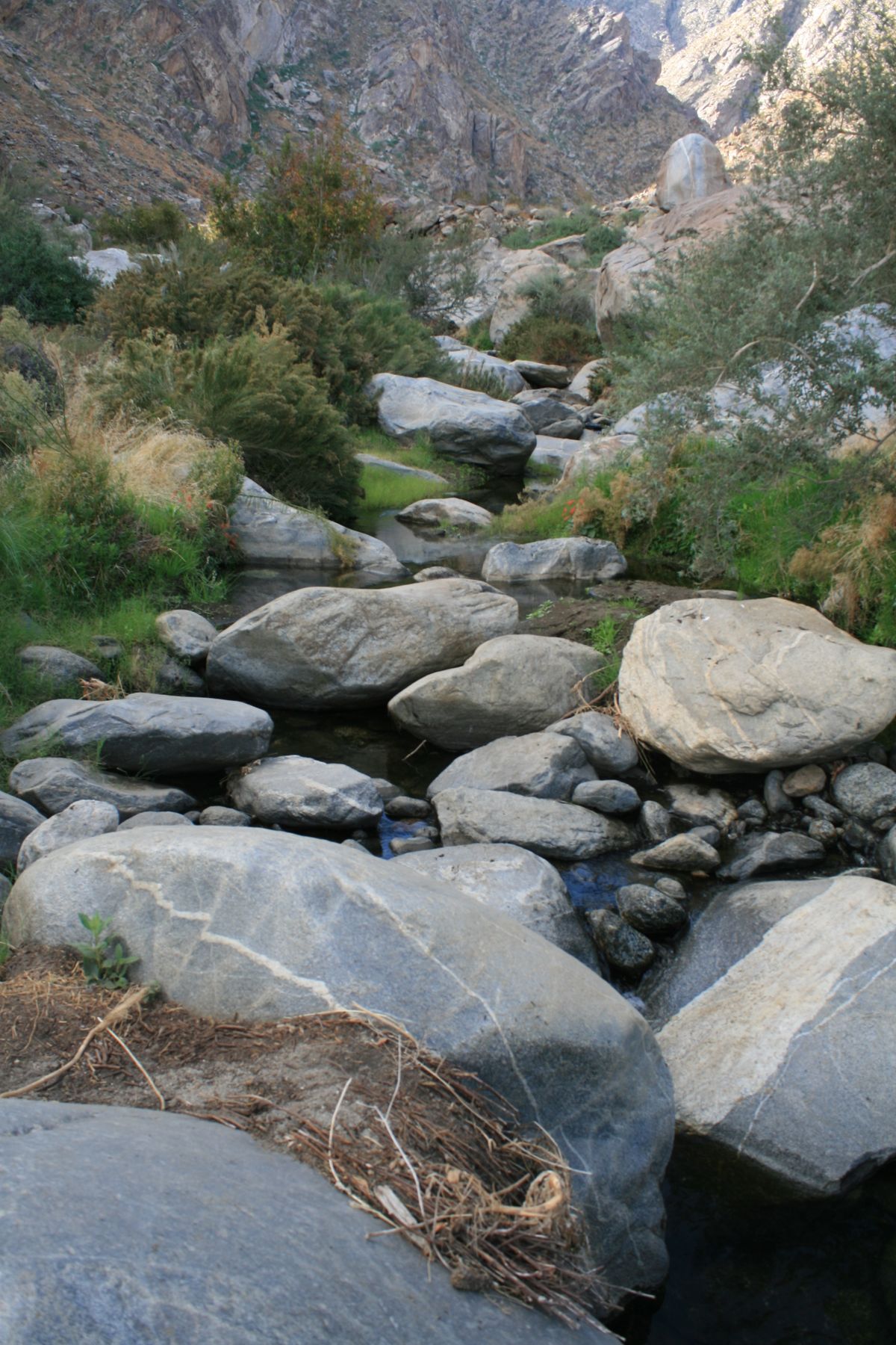
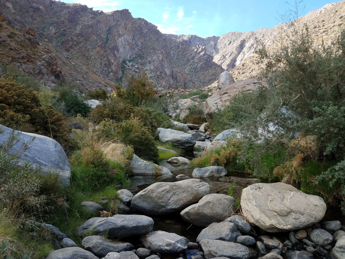
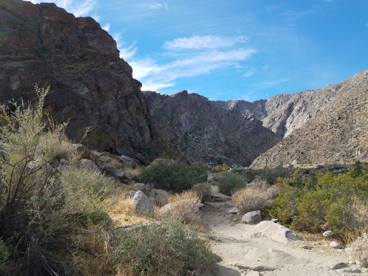
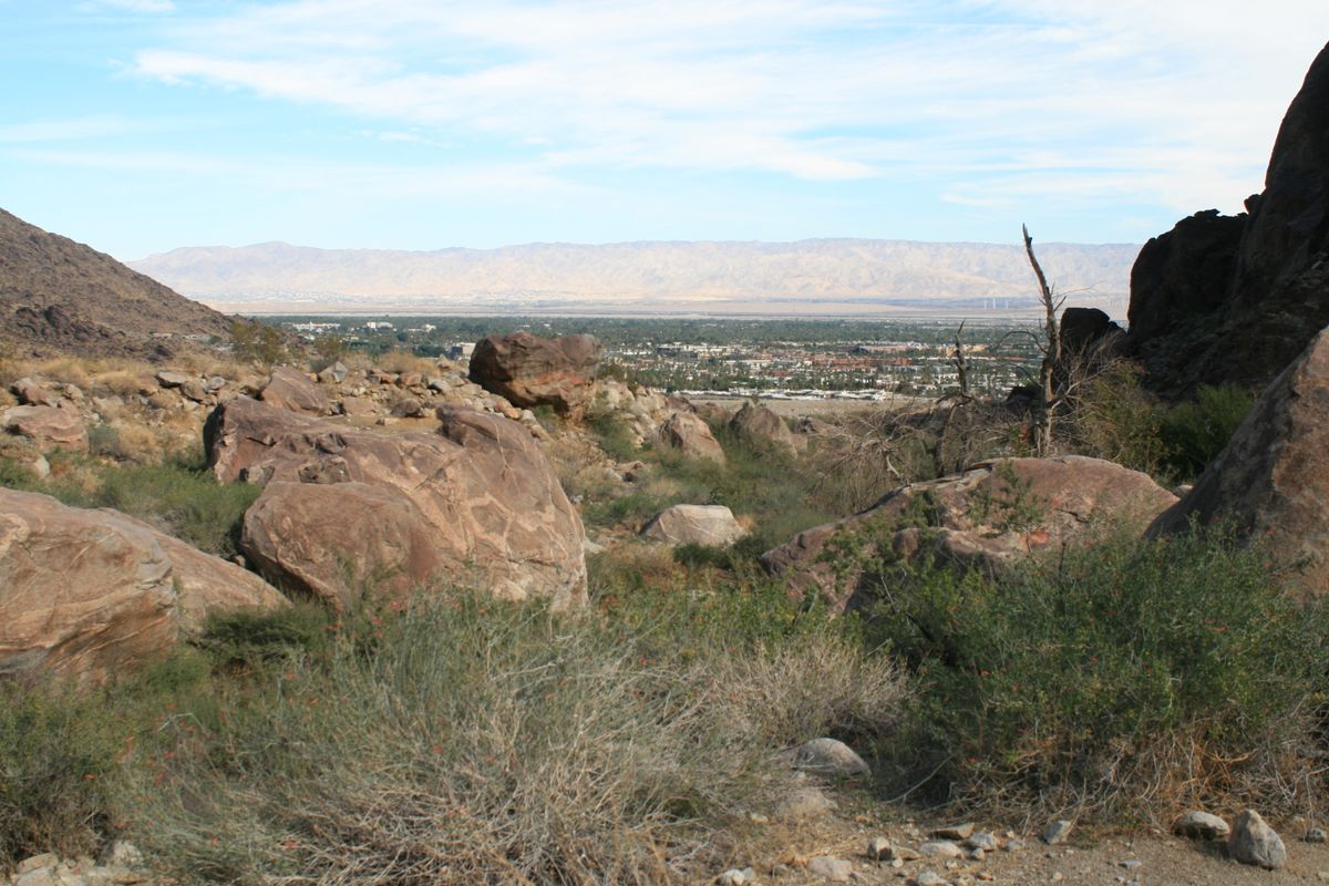
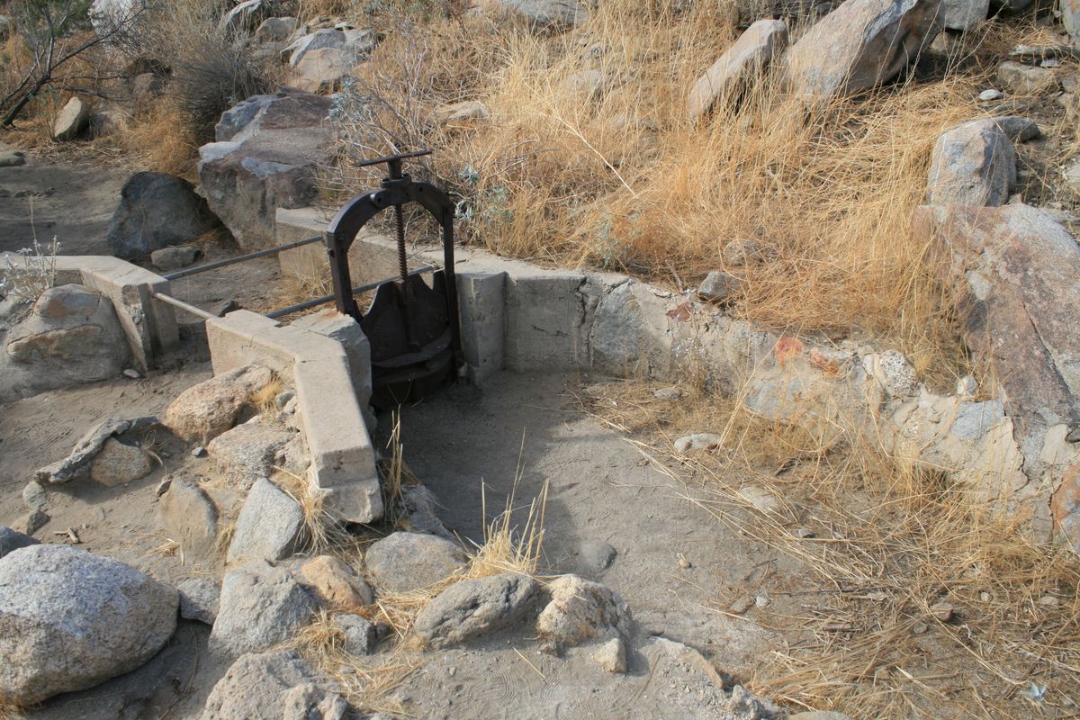
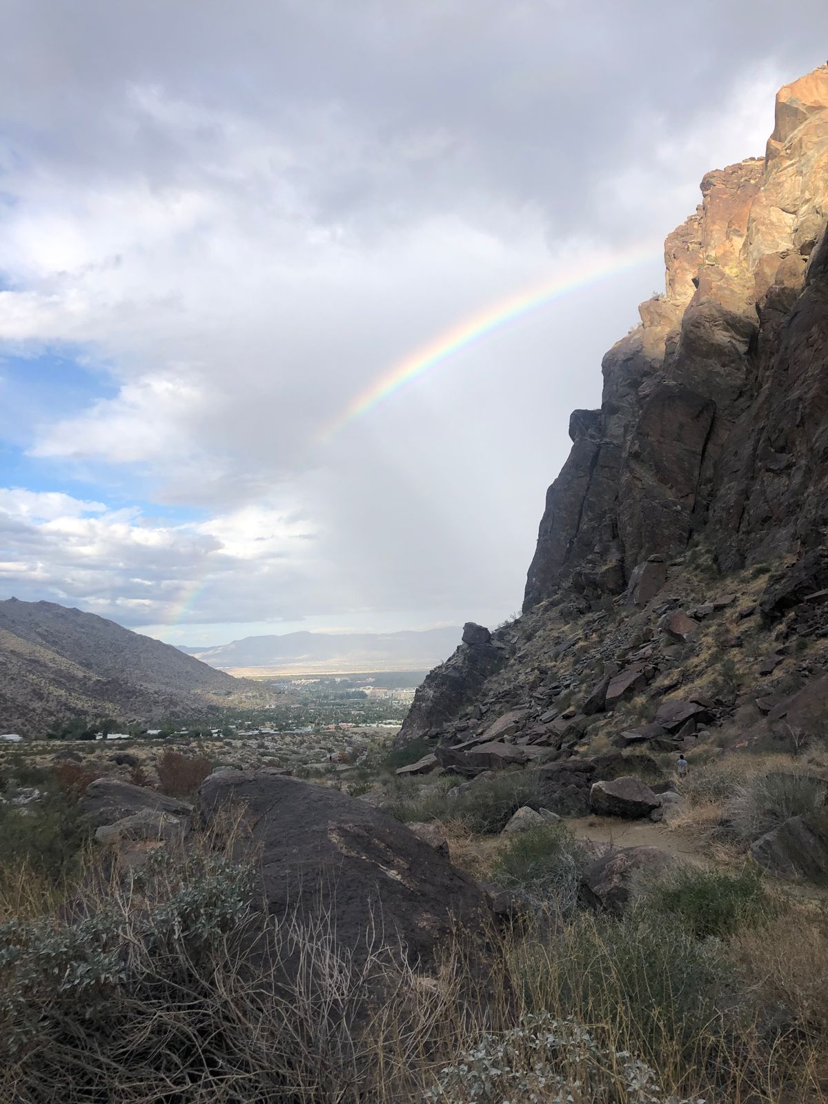
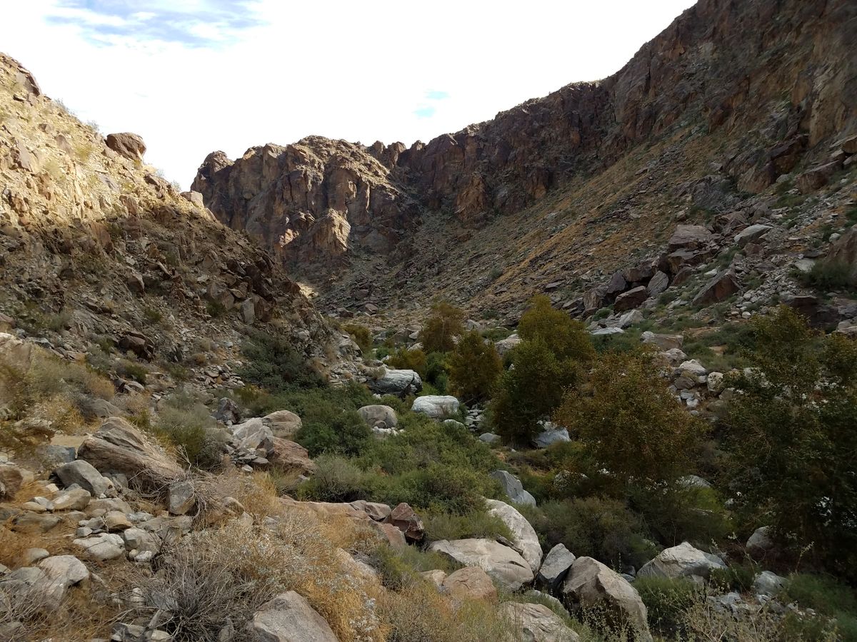
The creek drops steeply down the eastern front of the range through a spectacular canyon, from which it formerly flowed out into the desert where the city of Palm Springs now sits. As with any desert creek, its water was of paramount importance for wildlife and the local human population.

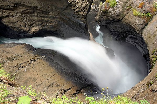
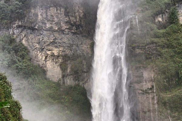
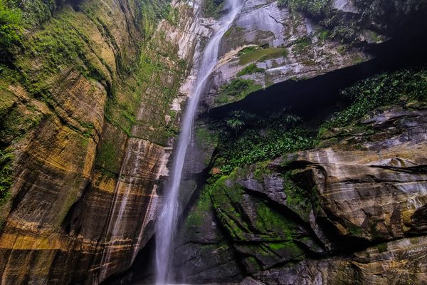
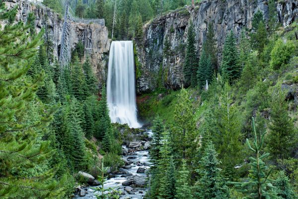
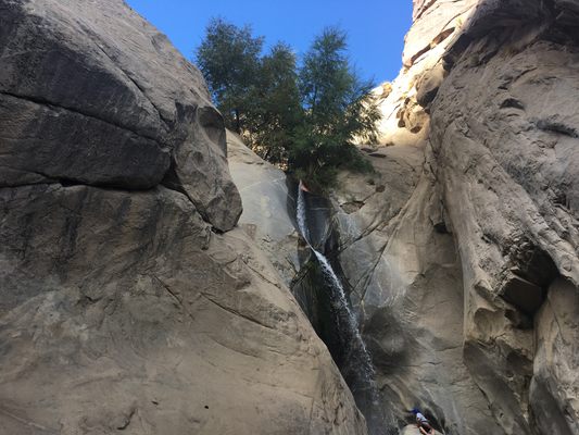
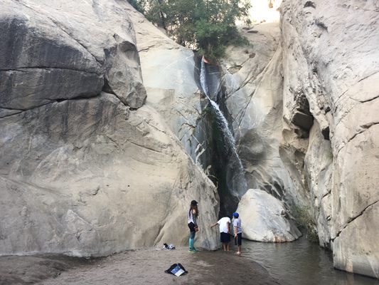
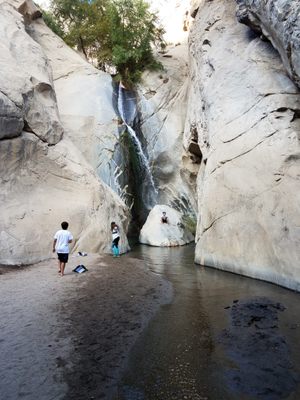
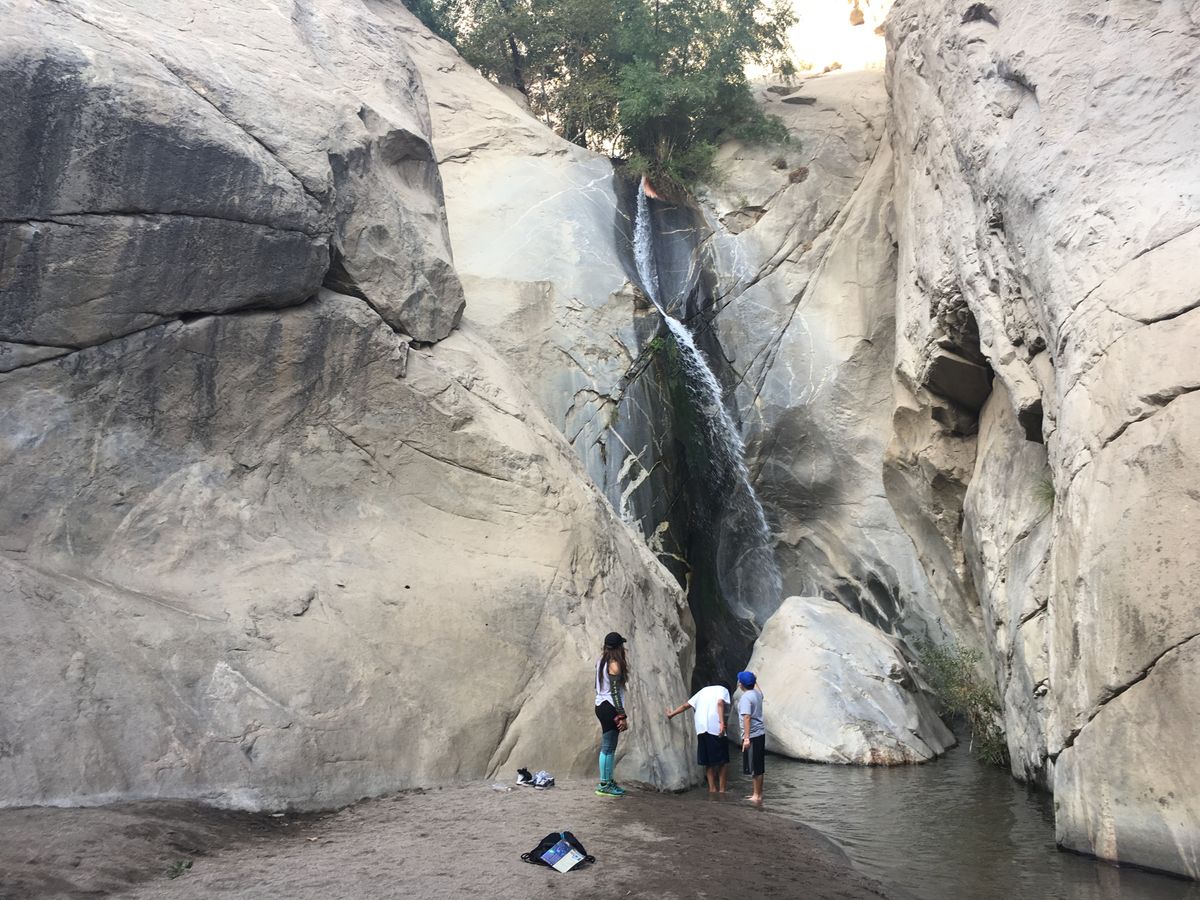
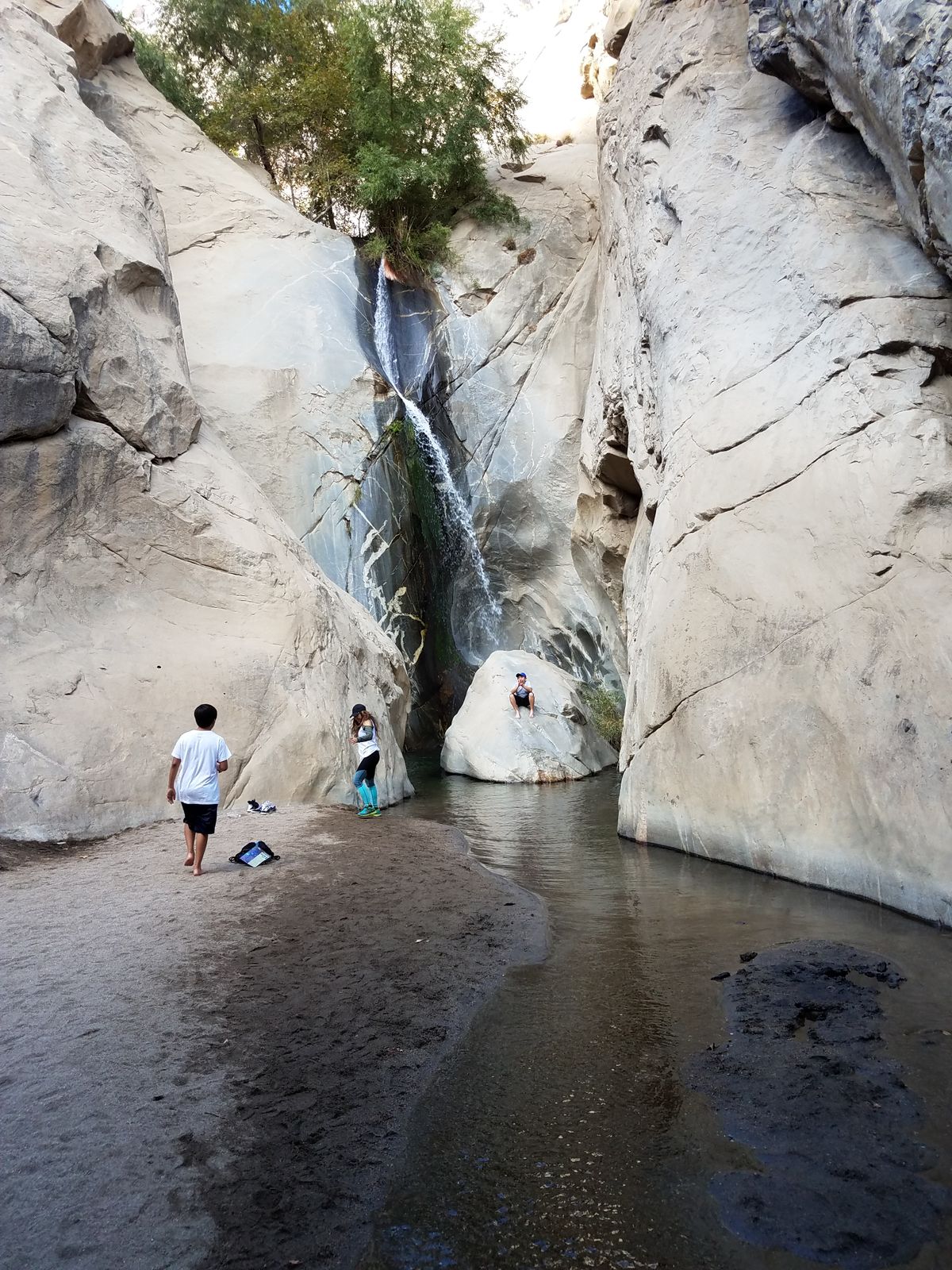
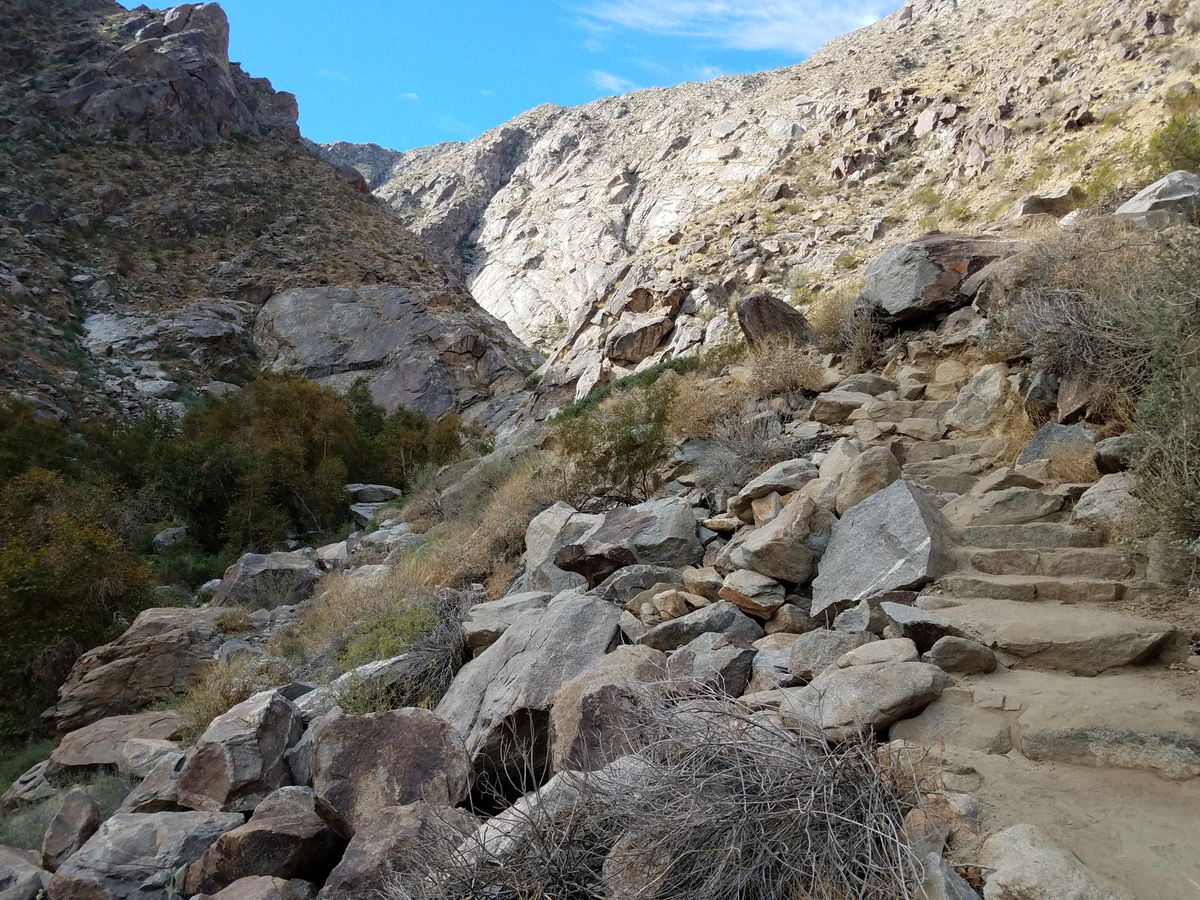
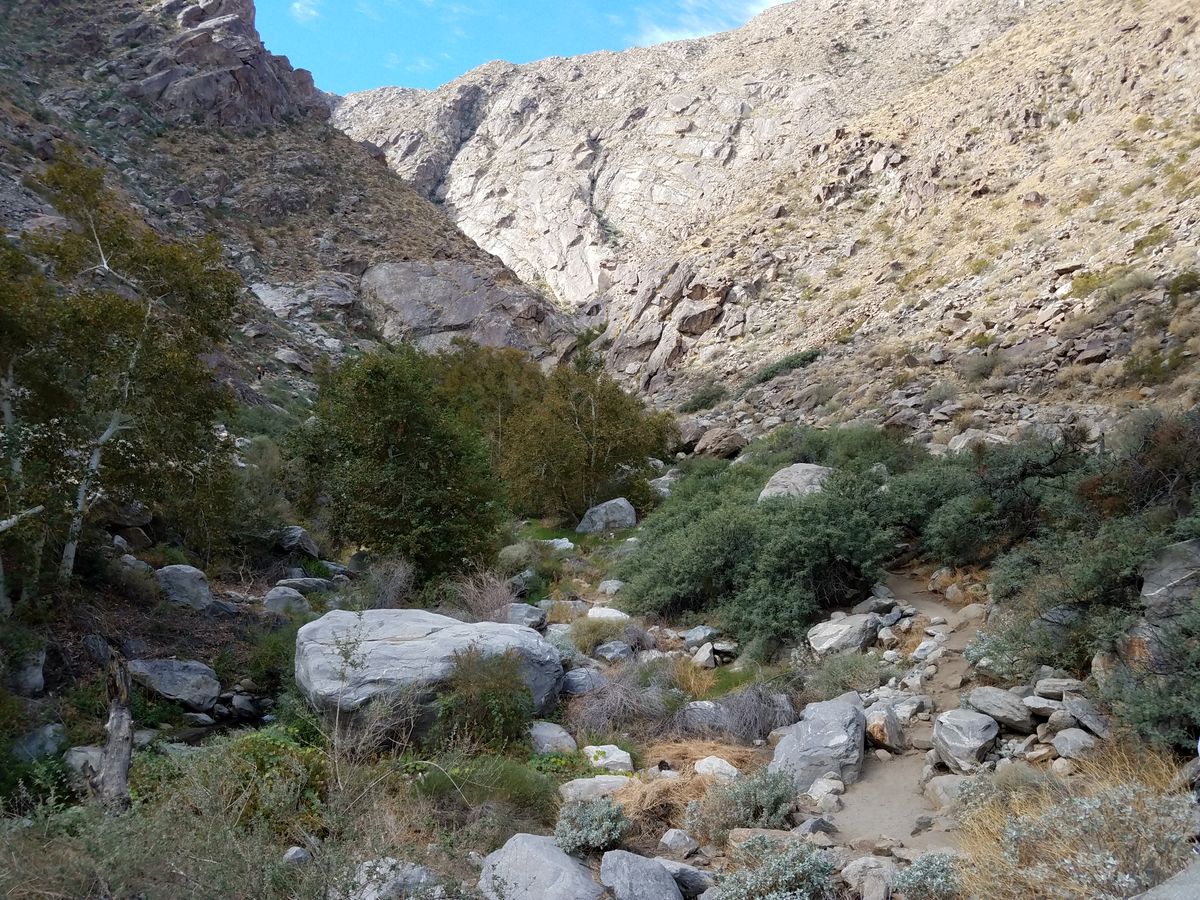
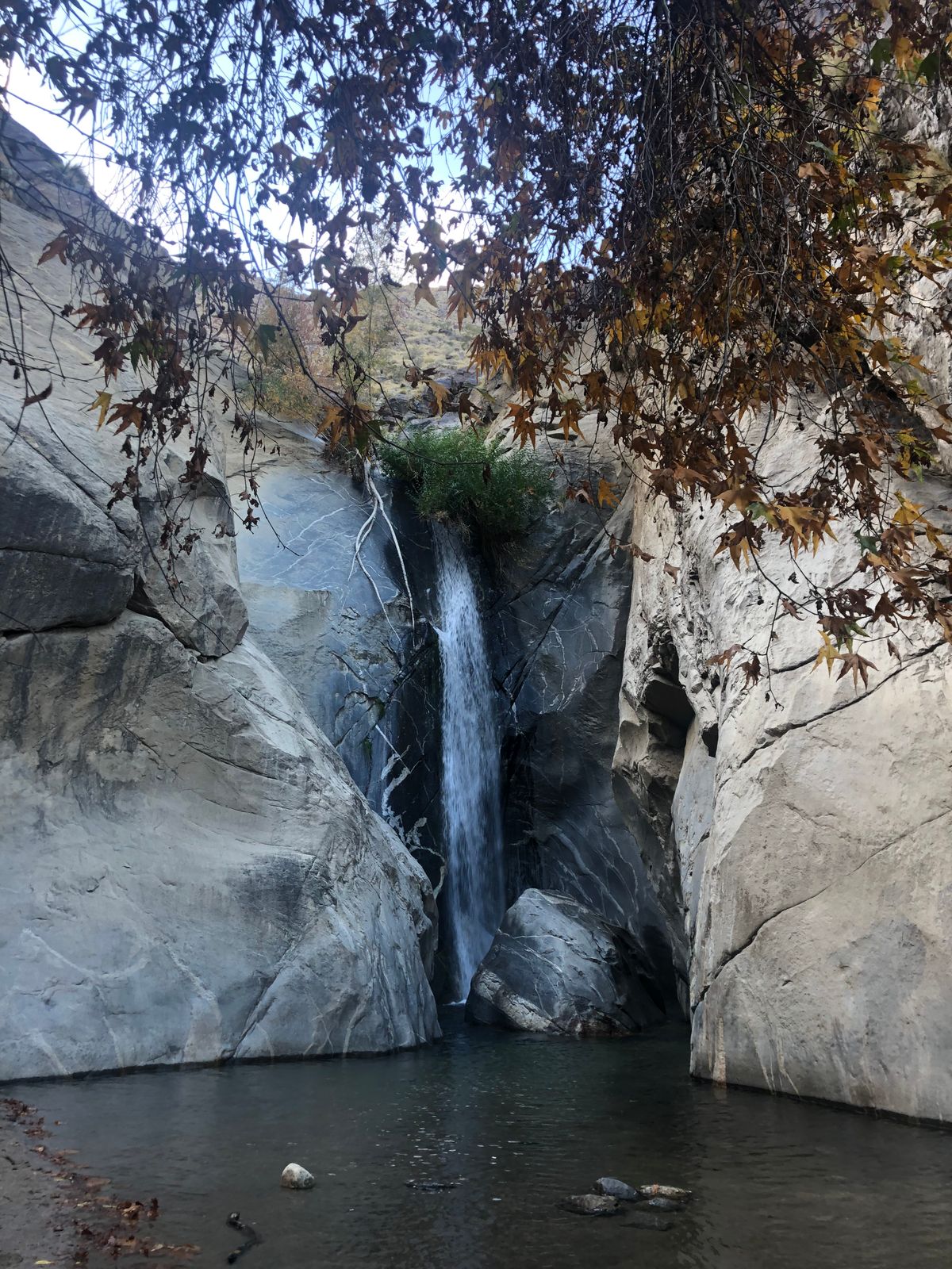
Near the base of the range, where its grade flattens out, the creek flows over a picturesque waterfall some 60 feet high that can be reached by a footpath. The path runs about 1.8 miles through a scenic desert canyon with an altitude gain of 350 feet. The level is moderate and should be within the capabilities of most hikers. Some rock art is also visible. The creek and falls both lie within the Agua Caliente Cahuilla Reservation and the tribe sells hiking permits.

Tahquitz, in the local Native American lore, was a malevolent spirit that dwelled in the mountains.

Related Tags

Water Canyons Mountains Geology Waterfalls

Know Before You Go

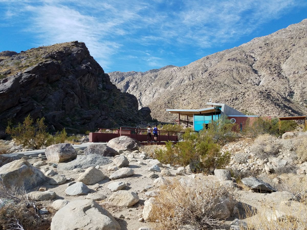
From Palm Springs take West Mesquite Avenue all the way west, where it will make a right-angle bend north and after about 0.1 mile end at a set of parking lots. The Tahquitz Visitor Center will be obvious to the west; head that way. The Center is both the beginning of the trail and the place where you get the trail tickets. As of 2022 tickets are $15 ($7 for children 6-12), but check the website for current prices. Dogs and bicycles are not permitted on the trail.

The trail is open daylight hours only and is only open Friday-Sunday in the summer months.

Community Contributors

Added By

slgwv

Edited By

MtnLady

  • MtnLady

Published

September 8, 2023

Edit this listing

Make an Edit
Add Photos
Tahquitz Creek Falls
228 Stone Terrace
Palm Springs, California, 92264
United States
33.808535, -116.550179
Visit Website
Get Directions

Nearby Places

PS Air Bar

Palm Springs, California

miles away

Moorten Botanical Garden and Cactarium

Palm Springs, California

miles away

Ruddy's General Store Museum

Palm Springs, California

miles away

Explore the Destination Guide

Photo of Palm Springs

Palm Springs

California

Places 15

Related Places

  • Looking down at the water-carved tunnels

    Lauterbrunnen, Switzerland

    Trümmelbach Falls

    Visit Europe's largest subterranean waterfall, carved by water from the glaciers of the towering peaks surrounding the valley.

  • The waterfall from below.

    Florián, Colombia

    Windows of Tisquizoque

    A three-tiered waterfall plummets from a mountain cave with amazing views over the countryside.

  • Mesetas, Colombia

    Cañon del Guejar (Güejar River Canyon)

    River raft through rural Colombia’s ancient rock formations, pristine landscapes, and towering waterfalls.

  • Tumalo Falls.

    Bend, Oregon

    Tumalo Falls

    An attractive free-plunge waterfall outside Bend in the Deschutes National Forest.

  • Lake Chelan above Stehekin (on shore to left).

    Washington

    Lake Chelan

    A narrow fjord-like lake, the third-deepest in the United States, runs for over 50 miles into the Cascades of Washington state.

  • Cascada Cailor

    Borșa, Romania

    Cascada Cailor (Horses Waterfall)

    A stunning waterfall in the mountains of Romania.

  • The cool waters of the upper pool.

    Santiago, Mexico

    Cascada Sol de Mayo

    A 40-foot waterfall hidden in a desert oasis.

  • Looking down the Gorge from the footbridge at its head.

    Tuttle, Idaho

    Malad Gorge

    Some 46,000 years ago, a volcanic eruption led to a flooding event that carved this short canyon with steep vertical walls.

Aerial image of Vietnam, displaying the picturesque rice terraces, characterized by their layered, verdant fields.
Atlas Obscura Membership

Become an Atlas Obscura Member


Join our community of curious explorers.

Become a Member

Get Our Email Newsletter

Follow Us

Facebook YouTube TikTok Instagram Pinterest RSS Feed

Get the app

Download the App
Download on the Apple App Store Get it on Google Play
  • All Places
  • Latest Places
  • Most Popular
  • Places to Eat
  • Random
  • Nearby
  • Add a Place
  • Stories
  • Food & Drink
  • Itineraries
  • Lists
  • Video
  • Podcast
  • Newsletters
  • All Trips
  • Family Trip
  • Food & Drink
  • History & Culture
  • Wildlife & Nature
  • FAQ
  • Membership
  • Feedback & Ideas
  • Community Guidelines
  • Product Blog
  • Unique Gifts
  • Work With Us
  • About
  • FAQ
  • Advertise With Us
  • Advertising Guidelines
  • Privacy Policy
  • Cookie Policy
  • Terms of Use
Atlas Obscura

© 2025 Atlas Obscura. All Rights Reserved.