Trips Places Foods Stories Newsletters
Loading...
Loading...
Loading...
Loading...

No search results found for
“”

Make sure words are spelled correctly.

Try searching for a travel destination.

Places near me Random place

Popular Destinations

  • Paris
  • London
  • New York
  • Berlin
  • Rome
  • Los Angeles
Trips Places Foods Stories Newsletters
Sign In Join
Places near me Random place
All Switzerland Botyre (Ayent) The Bisses of Valais

The Bisses of Valais

Medieval irrigation channels built into the sides of mountains provided Valais with water for hundreds of years.

Botyre (Ayent), Switzerland

Added By
Aaron Netsky
Email
Been Here
Want to go
Added to list
One of the oldest irrigation channels in Valais   GabrielleMerk/CC BY SA 4.0
From the Ayent irrigation system   Le Musée des Bisses
Carved out of stone   Le Musée des Bisses
Often they were built into the sides of mountains   Le Musée des Bisses
It was a dangerous task, putting these up   Le Musée des Bisses
Now they are a scenic tourist attraction   Le Musée des Bisses
  Clay E / Atlas Obscura User
Been Here
Want to go
Added to list

About

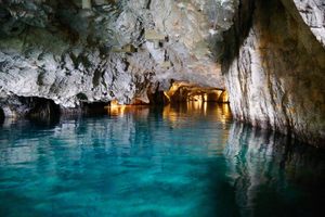
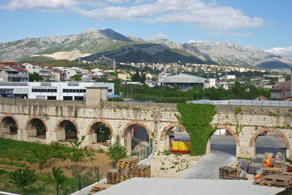
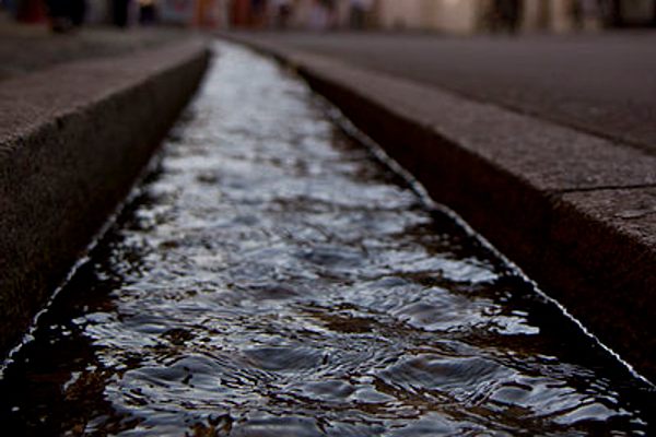
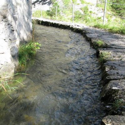
Some of the best places to hike in the state of Valais in Switzerland are ancient pathways that once used to bring water down from mountain streams to farms in the valleys and meadows below.

The creation of these channels, known as bisses, goes back at least as far as the 14th century, though some believe those medieval routes were built where Roman channels had previously been. In the aftermath of the Black Death in the mid-1300s, with a significantly reduced population across Europe, the grain fields in Valais were repurposed to grow hay to raise cattle for the rising demand of beef across the border in Italy.

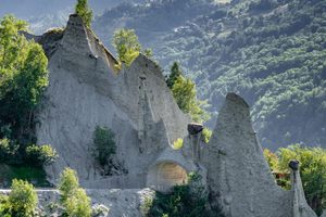
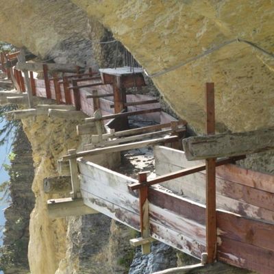
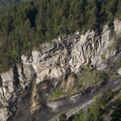
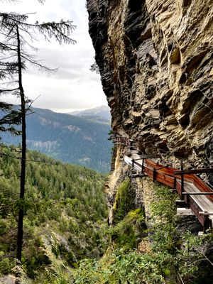
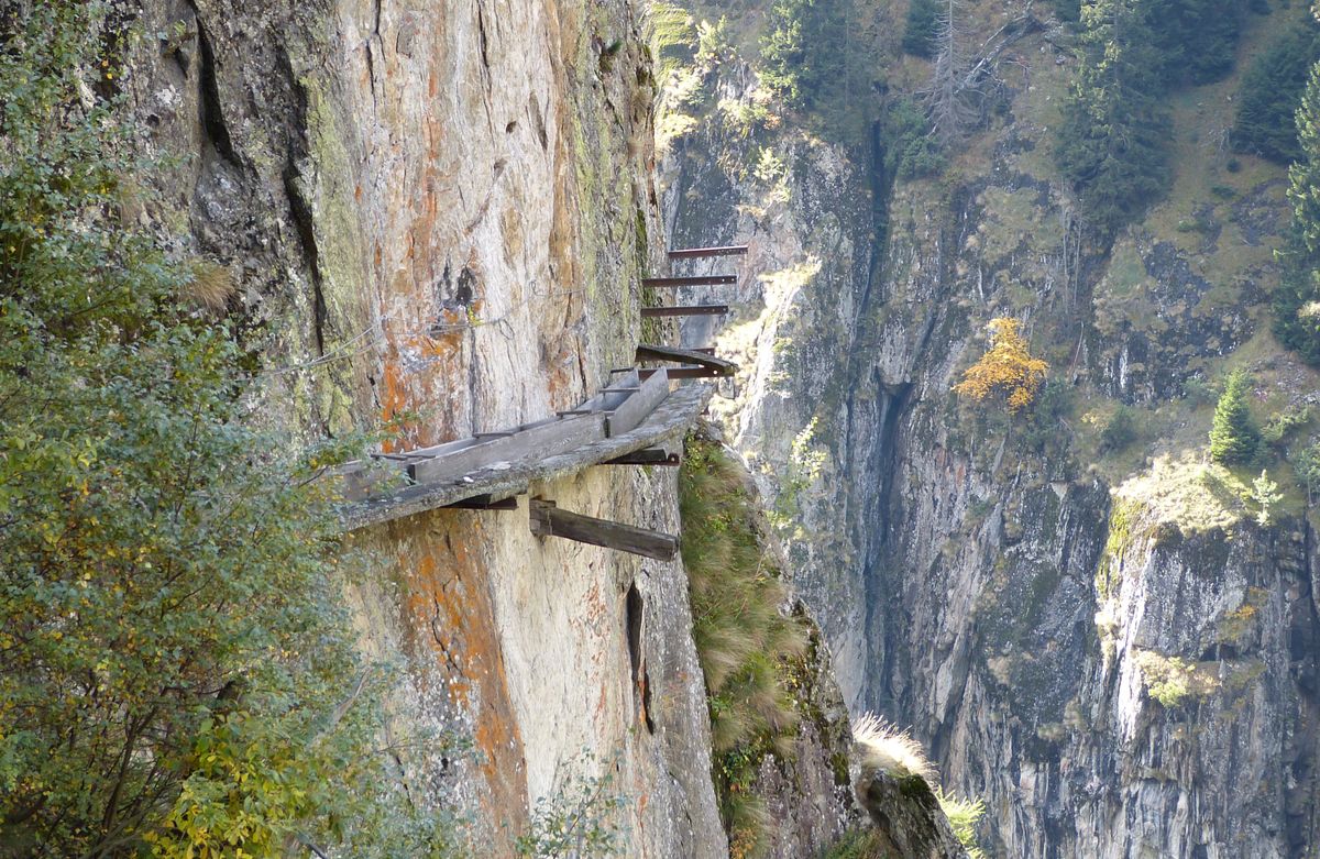
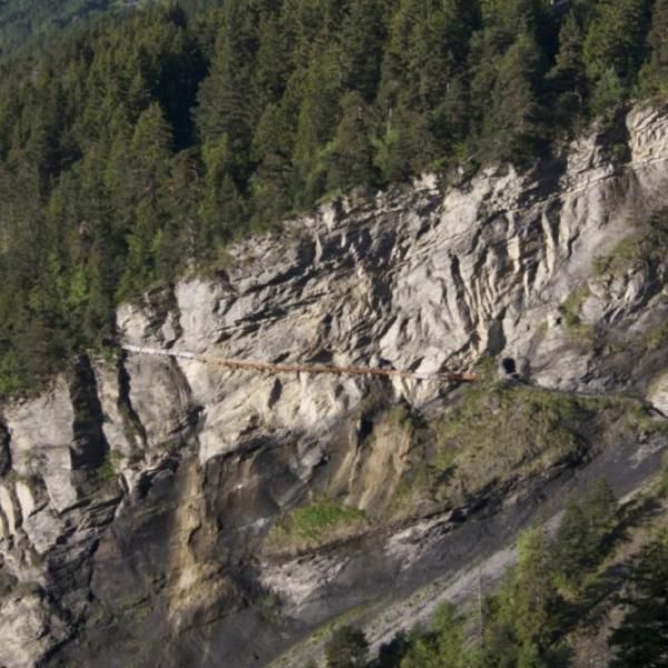
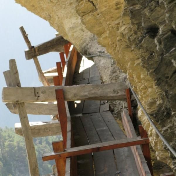
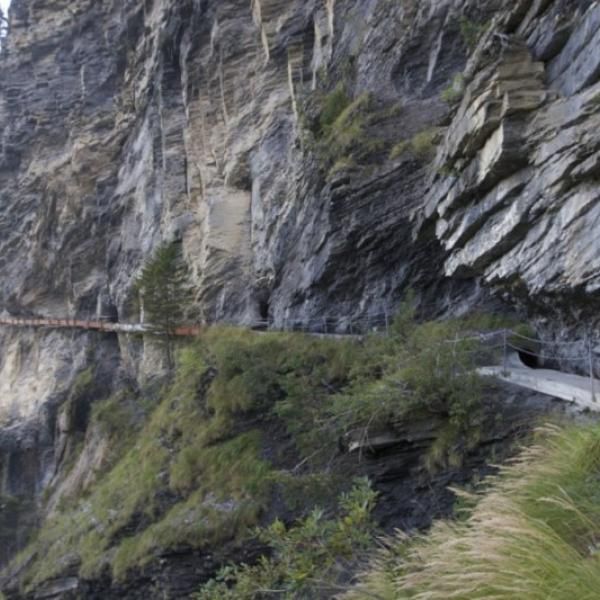
Owners of the fields and pastures pooled their resources to build bisses for irrigation, which was more necessary than it had been for growing grain. A lot of resources were needed, since many of the bisses were built into the sides of mountains and cliffs, which made digging them particularly dangerous hundreds of years ago. They tended to be between 5 and 10 kilometers, though a few stretched more than 20 kilometers.

Over time, they came to be used by vineyards and orchards in the area as well. Those more wealthy landowners, who controlled the water supply, arranged for systems allowing the use of the water by the smaller farmers. The smaller farmers and their families, in turn, helped maintain the bisses, cleaning and repairing them every spring. Canal guards, who lived in cabins along the channels, kept regular watch over the flow of water, making sure it was not interrupted.

For the most part, the bisses that remain have become scenic tourist attractions and inspired hiking trails, though some are still in use. Some of the trails run alongside the bisses, but others are the bisses themselves, repaired and reinforced. Le Musée des Bisses offers a convenient itinerary of some of the most spectacular bisse-adjacent trails, the bisse of Sion, the bisse ‘Ayent, and the Bitailla, in addition to exhibits on the history of the Valais bisses.

The address and coordinates above are for the museum, which provides a good launching point for many hikes through the bisses.

Related Tags

Water Farms Mountains Ancient Waterworks

Community Contributors

Added By

AaronNetsky

Edited By

Clay E

  • Clay E

Published

May 25, 2017

Edit this listing

Make an Edit
Add Photos
Sources
  • http://houseofswitzerland.org/swissstories/history/bisses-valais-irrigation-channels-tourist-hit
  • https://translate.google.com/translate?hl=en&sl=fr&u=http://www.musee-des-bisses.ch/&prev=search
  • https://www.valdanniviers.ch/tourism/irrigation-channels-bisses-275.html
  • https://www.valais.ch/en/activities/hiking/bisses
  • https://m.sierretourisme.ch/tourism/irrigation-channels-bisses.html
  • https://blog.p2pfoundation.net/patterns-commoning-journey-time-irrigation-system-valais-switzerland/2016/12/16
  • http://www.tandfonline.com/doi/abs/10.1080/01426399908706550?journalCode=clar20
  • https://www.postauto.ch/en/excursion-tips/discover-valais-fascinating-irrigation-system-bisses
The Bisses of Valais
Maison Peinte
Rue du Pissieu
Botyre (Ayent)
Switzerland
46.275954, 7.404667
Visit Website
Get Directions

Nearby Places

Lac Souterrain de Saint-Léonard

Saint-Léonard, Switzerland

miles away

Tour des Sorciers

Sion, Switzerland

miles away

Pyramides d'Euseigne

Hérémence, Switzerland

miles away

Explore the Destination Guide

Photo of Switzerland

Switzerland

Europe

Places 173
Stories 21

Nearby Places

Lac Souterrain de Saint-Léonard

Saint-Léonard, Switzerland

miles away

Tour des Sorciers

Sion, Switzerland

miles away

Pyramides d'Euseigne

Hérémence, Switzerland

miles away

Explore the Destination Guide

Photo of Switzerland

Switzerland

Europe

Places 173
Stories 21

Related Places

  • Diokletian Aqueduct

    Split, Croatia

    Dioklecijanov Akvadukt (Diocletian Aqueduct)

    This ancient Roman aqueduct once funneled water to Diocletian's palace.

  • Freiburg Bächle

    Freiburg im Breisgau, Germany

    Freiburg Bächle

    These paved rills bring freshwater into Altstadt and could spell wedding bells for whoever stumbles into the waters.

  • Xian Shi, China

    Huaqing Pools

    These mountain hot springs have seen power struggles, doomed romances, and a generalissimo's attempted escape from mutiny.

  • The cisterns of Tawila.

    Aden, Yemen

    Cisterns of Tawila

    This impressive system of tanks was used to store drinking water as long as 2,000 years ago.

  • Geneva, Switzerland

    Pointe de la Jonction

    Where two rivers meet—but don’t mix.

  • Bonneville Dam

    North Bonneville, Washington

    Bonneville Lock & Dam

    Boats and fish both find their way through this massive hydroelectric structure.

  • Lake Chelan above Stehekin (on shore to left).

    Washington

    Lake Chelan

    A narrow fjord-like lake, the third-deepest in the United States, runs for over 50 miles into the Cascades of Washington state.

  • Looking down at the water-carved tunnels

    Lauterbrunnen, Switzerland

    Trümmelbach Falls

    Visit Europe's largest subterranean waterfall, carved by water from the glaciers of the towering peaks surrounding the valley.

Aerial image of Vietnam, displaying the picturesque rice terraces, characterized by their layered, verdant fields.
Atlas Obscura Membership

Become an Atlas Obscura Member


Join our community of curious explorers.

Become a Member

Get Our Email Newsletter

Follow Us

Facebook YouTube TikTok Instagram Pinterest RSS Feed

Get the app

Download the App
Download on the Apple App Store Get it on Google Play
  • All Places
  • Latest Places
  • Most Popular
  • Places to Eat
  • Random
  • Nearby
  • Add a Place
  • Stories
  • Food & Drink
  • Itineraries
  • Lists
  • Video
  • Podcast
  • Newsletters
  • All Trips
  • Family Trip
  • Food & Drink
  • History & Culture
  • Wildlife & Nature
  • FAQ
  • Membership
  • Feedback & Ideas
  • Community Guidelines
  • Product Blog
  • Unique Gifts
  • Work With Us
  • About
  • FAQ
  • Advertise With Us
  • Advertising Guidelines
  • Privacy Policy
  • Cookie Policy
  • Terms of Use
Atlas Obscura

© 2025 Atlas Obscura. All Rights Reserved.