About
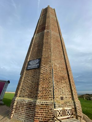
The Naze derived its name from the Old English naes, meaning "nose," for the way this peninsula protrudes into the harsh North Sea. It is defined by three aspects; its prominent tower, the world-renowned fossils buried within its cliffs, and its battle against the sea it borders.
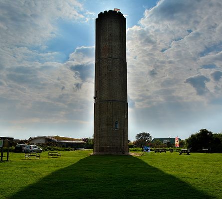
Built in 1720, this 86-foot tower dominated the headland overlooking the destructive waves below. Though later fitted with a beacon, becoming a predecessor to the lighthouses of the 19th century, the Naze Tower originally functioned simply as a navigational marker, providing passing ships a unique feature to note when traversing the otherwise flat and featureless coast. Such structures have been found on the Naze since the late 16th century, it is unlikely however that any earlier iterations saw such varied use of the present bearer of the Naze Tower name.
During its first 80 years as a navigational marker, the tower contained a teahouse run by Martha Ray, the mistress of John Montagu, inventor of the sandwich. Following Ray’s murder by a jealous lover, the tower was commandeered during the Napoleonic Wars to serve as a Naval lookout. This is a role it resumed between 1914 and 1918 during the First World War and similarly in the Second World War when it functioned as a radar station, bearing a dish upon its roof which necessitated the removal of its ornate crenelations.
Now containing a museum which documents its history, as well as the unique geography and ecology of its surroundings, the Naze Tower is Grade II listed, meaning it is the only one of its kind in existence.
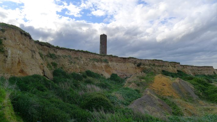
The ground beneath the Naze Tower is also rich in history, quite literally as the Naze cliffs are formed from 54-million-year-old London Clay and 2-million-year-old Red Crag. These are famed for the quality and rarity of the fossils they contain. From shark teeth and whale bones within the sandy Red Crag, to fossilized wood and— especially rare—bird bones within the clay.
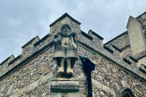
But these cliffs and their ancient contents are rapidly being lost to the sea. Every year, nearly two meters of land is lost to erosion, the effect of which has led to significant losses over the centuries. The medieval village of Walton, for example, is now underwater, and nine miles out to sea. The village's church is similarly submerged; After holding its last service on the July 22, 1798, it was claimed by the waves later that month. There have been plans to rebuild this lost church on its original sunken site using 41 steel beams positioned in the shape of the church, including tower and nave, jutting out of the sea. This ghostly recreation would allow passing ferries and those at the end of Walton’s pier (the second longest in the U.K.) to reflect on the history and land lost over the centuries.
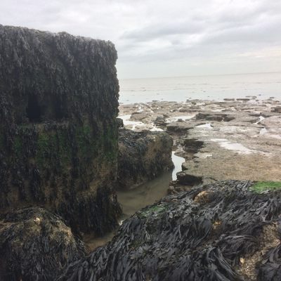
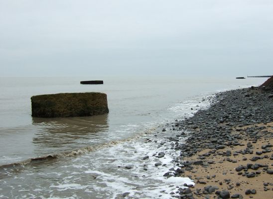
In the last 100 years, the erosion has sent the Second World War pill boxes tumbling down from their cliff top position into the very sea they originally guarded from Nazi invasion.
The tower itself is certainly not immune to this threat. With the sea creeping closer and closer, the Naze Tower, once safely built over a quarter mile away, now stands only 50 meters from the cliff's edge.
Related Tags
Published
May 28, 2021
Sources
- https://en.wikipedia.org/wiki/Naze_Tower
- https://en.wikipedia.org/wiki/Walton-on-the-Naze
- http://www.nazetower.co.uk/tower_museum.html
- http://www.nazetower.co.uk/the_naze.html
- https://www.britainexpress.com/counties/essex/properties/naze-tower.htm
- http://www.losttown.net/the_project/background.html
- http://www.losttown.net/the_project/concept.html
- https://britishlistedbuildings.co.uk/101165846-naze-tower-frinton-and-walton
- http://www.discoveringfossils.co.uk/walton-on-the-naze-essex/
