About
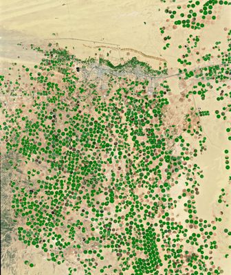
Before exploring a place for which limited information is available, you may look at satellite images of the area. If you know how to interpret the patterns, shapes, and textures in these images, they can be treasure troves of information. A prime example of this is Saudi Arabia's Wadi al-Dawasir, where satellite images show a heavy concentration of green circles running along a large north-south corridor.
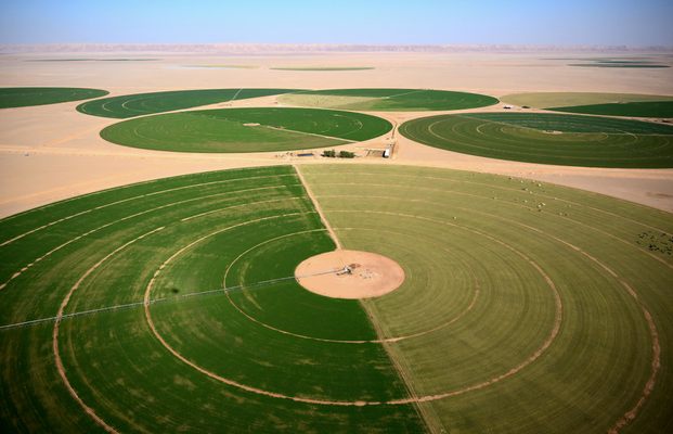
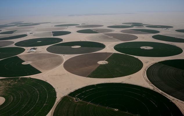
While the term “crop circle” usually refers to circles created by flattening a crop in a field, Wadi al-Dawasir’s crop circles are quite literally, circles made of crops. Most are alfalfa plantations, with a negligible number producing either wheat or other vegetables. Each measures just under a kilometer in diameter and although they are all green, their shades and hues vary according to the type, thickness, and health of the crop. These round fields are the result of center pivot irrigation: A well at the center of each circle reaches down to aquifers at depths of 100-200 meters (300-650 feet). Water from the aquifer is pumped up and mixed with fertilizer, which is distributed via rotating sprinklers.
This form of irrigation is quite widespread, but in Wadi al-Dawasir it has created a vast expanse of closely arranged crop circles that stand in stark contrast to the desert background—nothing grows beyond the irrigation system's reach. In fact, Wadi al-Dawasir lies on the edge of Rub’ al Khali, also known as the Empty Quarter, 650,000 square kilometers (250,000 square miles) of inhospitable desert.
Alfalfa is a good source of vitamins and minerals, and most grown in Wadi al-Dawasir is used to feed livestock throughout Saudi Arabia. In an attempt to reduce the import of alfalfa, Saudi Arabia incentivized farmers to produce this crop. In the short and medium term, this strategy is paying off, but long-term sustainability may be more problematic.
Even though Wadi al-Dawasir receives much more rainfall than the Empty Quarter does, it still receives less than 20 centimeters (7.8 inches) of rain a year, much less than what is needed to replenish the underground reservoir of water. This means that the aquifers on which local agriculture relies are slowly but surely running dry. A study conducted by UN-ESCWA and BGR shows that the level of water in these aquifers has been decreasing by approximately six meters a year since the 1980s. There is still a substantial amount of water left, but if extraction continues at this pace, water will run out within the next few decades.
Related Tags
Know Before You Go
The most spectacular views of the crop circles of Wadi al-Dawasir can be enjoyed from a high vintage point, which is inexistent in the area. The use of drones is not advised, as strict laws regulate the use of these devices in Saudi Arabia. The next best option is to catch a flight to or from Wadi al-Dawasir (WAE), or hire a private aircraft.
Community Contributors
Added By
Published
May 25, 2022
