Trips Places Foods Stories Newsletters

Take your next trip with Atlas Obscura!

Our small-group adventures are inspired by our Atlas of the world's most fascinating places, the stories behind them, and the people who bring them to life.

Visit Adventures
Trips Highlight
Puglia Italy - Matera
Italy • 8 days, 7 nights
Southern Italy: Castles, Caves & Coastal Treasures in Puglia
from
Turkmenistan Gates of Hell Darvaza crater
Turkmenistan • 10 days, 9 nights
Turkmenistan & the Gates of Hell
from
View all trips
Top Destinations
Latest Places
Most Popular Places Random Place Lists Itineraries
Add a Place
Download the App
Top Destinations
View All Destinations »

Countries

  • Australia
  • Canada
  • China
  • France
  • Germany
  • India
  • Italy
  • Japan

Cities

  • Amsterdam
  • Barcelona
  • Beijing
  • Berlin
  • Boston
  • Budapest
  • Chicago
  • London
  • Los Angeles
  • Mexico City
  • Montreal
  • Moscow
  • New Orleans
  • New York City
  • Paris
  • Philadelphia
  • Rome
  • San Francisco
  • Seattle
  • Stockholm
  • Tokyo
  • Toronto
  • Vienna
  • Washington, D.C.
Latest Places
View All Places »
The wall extends for 500 meters as a visual testament to the pandemic.
The National Covid Memorial Wall
The pedigreed pistachios here are from Bronte.
Gelateria dei Gracchi
This tiny hole-in-the-wall serves one of the world’s most magnificent sandwiches.
Er Buchetto
Edward Gorey’s Grave
Latest Places to Eat & Drink
View All Places to Eat »
The pedigreed pistachios here are from Bronte.
Gelateria dei Gracchi
This tiny hole-in-the-wall serves one of the world’s most magnificent sandwiches.
Er Buchetto
Seafood features prominently on the menu.
Dakar NOLA
The kabrit, or twice-cooked goat, with plantains and rice and beans is essential.
Fritai
Twelve Mile Limit is the kind of bar with a whole roster of regulars.
Twelve Mile Limit
Recent Stories
All Stories Video Podcast
Most Recent Stories
View All Stories »
Greenland dogs—crucial to the sledge patrol’s transport and defense—pull a patrolman’s sled.
How Greenland's Dog-Sled Patrol Became Unsung Heroes of World War II
6 minutes ago
1763 Monument in Georgetown, Guyana
The Berbice Rebellion of 1763 Ended With a Letter
about 6 hours ago
A listener in Toronto explored Casa Loma, and a nearby park that made the city disappear.
How the Pandemic Helped Our Listeners Rediscover Their Own Neighborhoods
1 day ago
You don’t need a time machine to journey through history.
Dear Atlas: Where Can I Take a Trip Through Ancient History?
1 day ago

No search results found for
“”

Make sure words are spelled correctly.

Try searching for a travel destination.

Places near me Random place

Popular Destinations

  • Paris
  • London
  • New York
  • Berlin
  • Rome
  • Los Angeles
Trips Places Foods Stories Newsletters
Sign In Join
Places near me Random place
All the United States California Swall Meadows White Mountain Peak
AO Edited

White Mountain Peak

A small research station sits at the summit of this mountain, which is one of the few U.S. peaks higher than 14,000 feet outside of the Sierra Nevada.

Swall Meadows, California

Added By
slgwv
Email
Been Here
Want to go
Added to list
Up the trail to White Mountain Peak (on the left).   slgwv / Atlas Obscura User
White Mountain Peak. There’s still about 2000 ft of elevation to gain!   slgwv / Atlas Obscura User
The Summit Hut on White Mountain Peak.   slgwv / Atlas Obscura User
Approaching the Summit Hut from below.   slgwv / Atlas Obscura User
Silhouetted bighorn sheep off the trail.   slgwv / Atlas Obscura User
Old observatory above Barcroft Station.   slgwv / Atlas Obscura User
The trail back to Barcroft Station. Looking south.   slgwv / Atlas Obscura User
The University of California’s Barcroft Field Station.   slgwv / Atlas Obscura User
At Barcroft Field Station.   slgwv / Atlas Obscura User
Looking west from the White Mountains Road to Owens Valley and the Sierra Nevada.   slgwv / Atlas Obscura User
White Mountains Road. This is past the Bristlecone Interpretive Area.   slgwv / Atlas Obscura User
Looking back southeasterly down the trail off the flank of White Mountain Peak. Irrigated lands in Fish Lake Valley in the distance..   slgwv / Atlas Obscura User
Looking back down the trail into Nevada. Some irrigated lands in Fish Lake Valley are visible. The playa (dry lake bed) in the distance is Columbus Salt Marsh by the site of Coaldale, Nevada.   slgwv / Atlas Obscura User
Looking west from the trail. The Sierra Nevada by Mammoth, California, is skylined in the center.   slgwv / Atlas Obscura User
Looking north along the White Mountains from the trail.   slgwv / Atlas Obscura User
White Mountain Peak from the trail.   slgwv / Atlas Obscura User
Looking west to the Sierra Nevada. Owens Valley, with some irrigated land visible, in the foreground.   slgwv / Atlas Obscura User
Looking west down a canyon to irrigated farms in the Owens Valley.   slgwv / Atlas Obscura User
Looking south off the trail on the flank of White Mountain Peak. Fish Lake Valley, partly in Nevada, to the left. A shoulder of the Sierra Nevada appears on the skyline at extreme right.   slgwv / Atlas Obscura User
Looking back down the trail, more or less south. The distant skylined range is the Sierra Nevada.   slgwv / Atlas Obscura User
View off the trail. The elevation here is about 12,500 ft/3810 m.   slgwv / Atlas Obscura User
Trail to White Mountain Peak (skylined). Looking north.   slgwv / Atlas Obscura User
Approaching the Summit Hut from the trail below.   slgwv / Atlas Obscura User
It’s a long way to the Summit Hut (skylined)!   slgwv / Atlas Obscura User
Looking up to White Mountain Peak. The Summit Hut is barely visible.   slgwv / Atlas Obscura User
View east into Fish Lake Valley and Nevada. The round green features reflect irrigation.   slgwv / Atlas Obscura User
Been Here
Want to go
Added to list

About

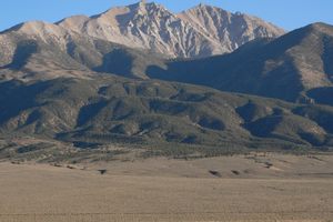
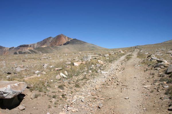
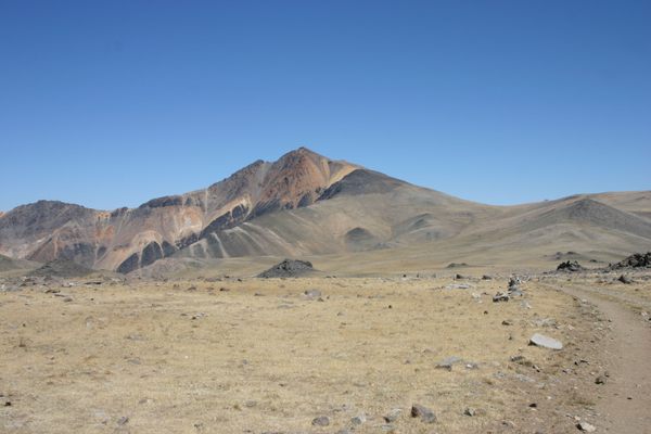
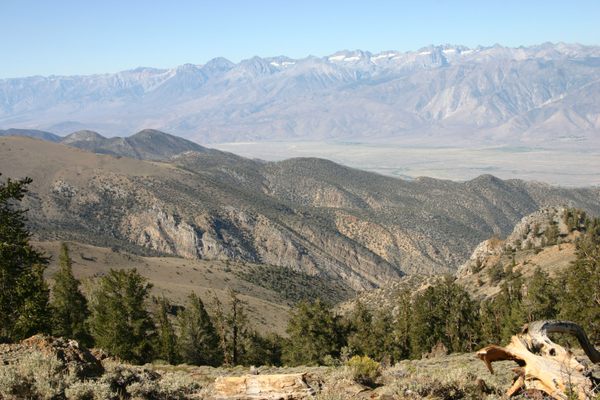
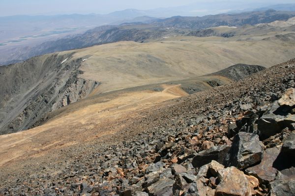
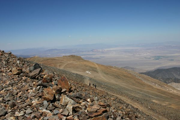
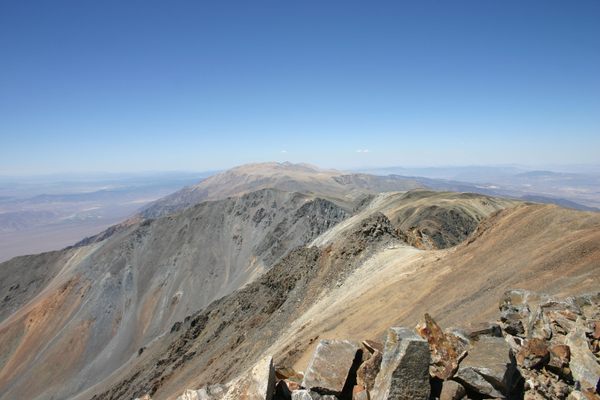
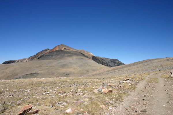
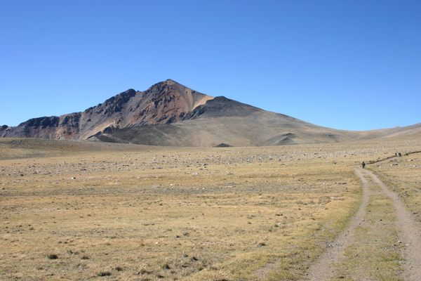
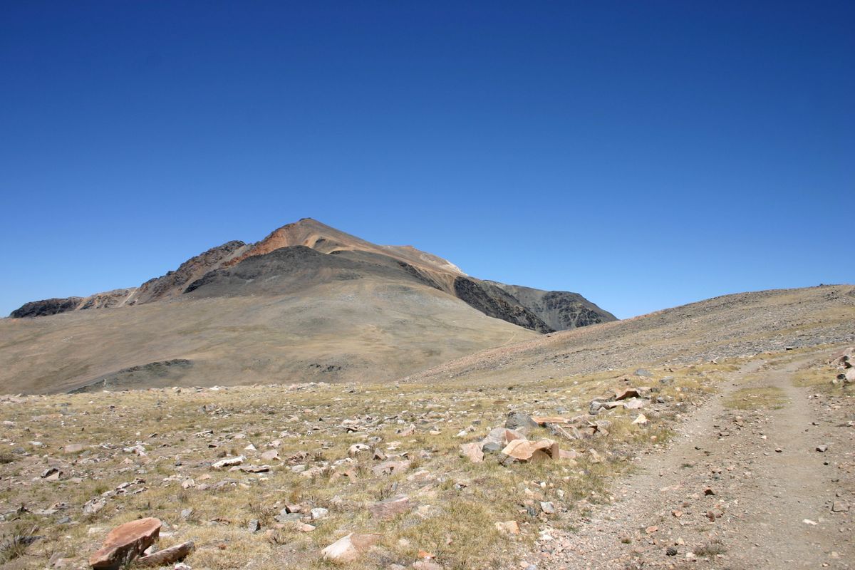
If ever there were a mountain range that gets no respect, it's the White Mountains of California. As they consist of a wide ridge some 60 miles long, much of it over 10,000 feet and including White Mountain Peak, California's third-highest at 14,252 feet (4,344 meters), this neglect might seem at first sight puzzling. The Whites' problem is that they lie in the shadow of the Sierra Nevada—both literally and figuratively.

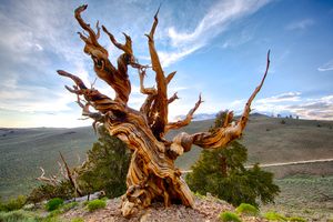
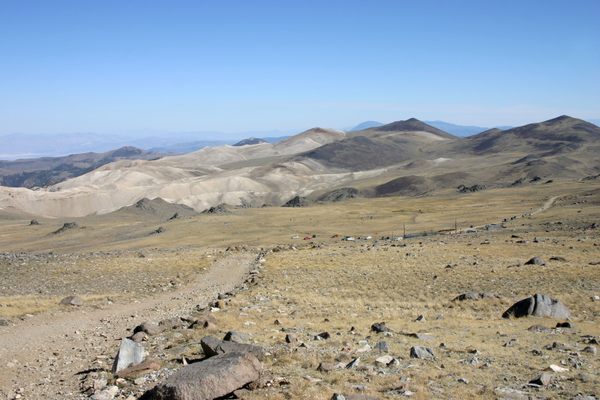
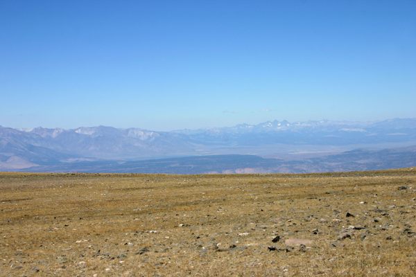
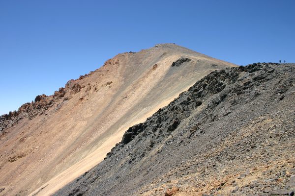
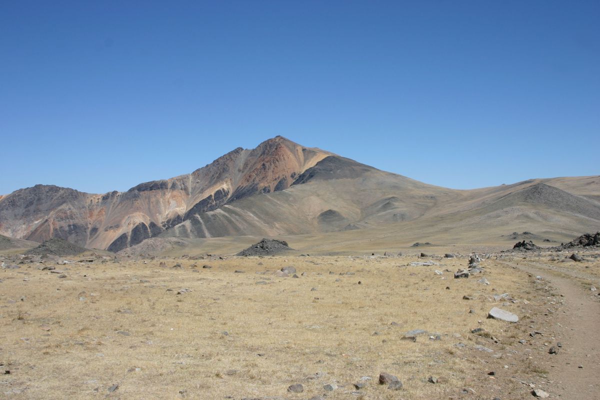
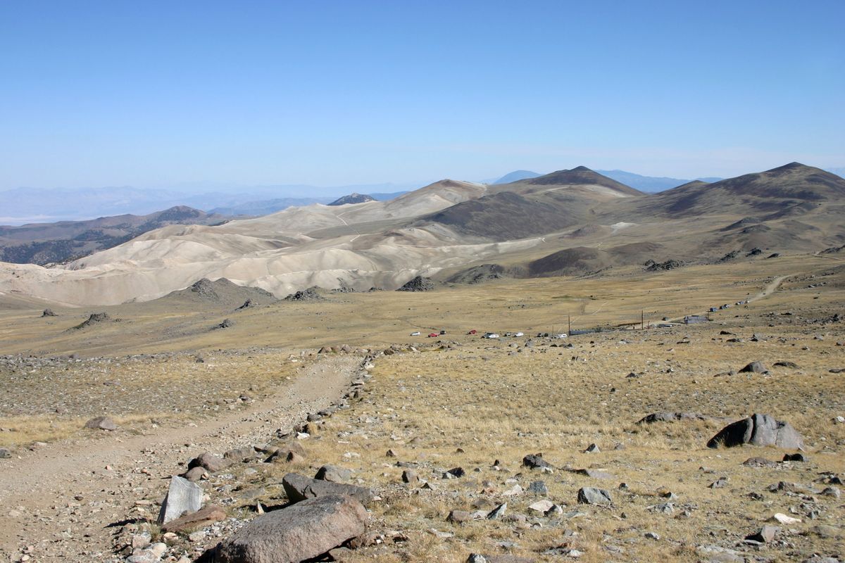
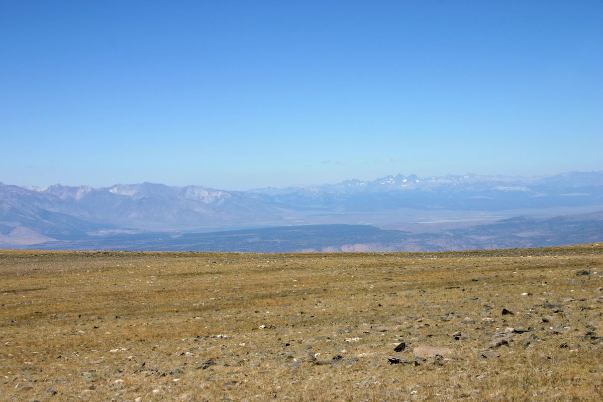
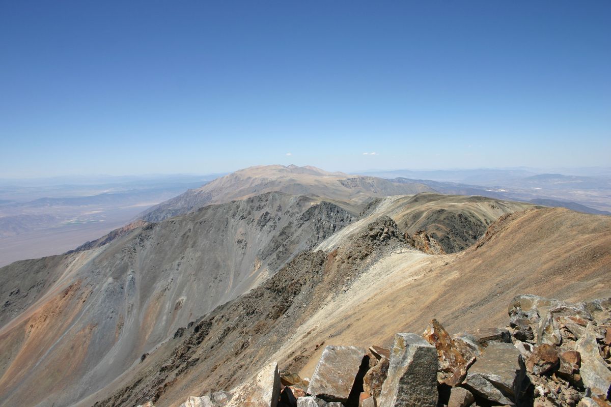
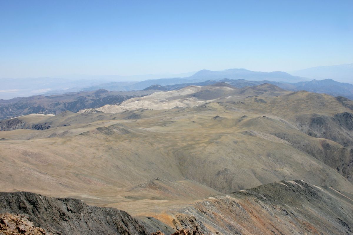
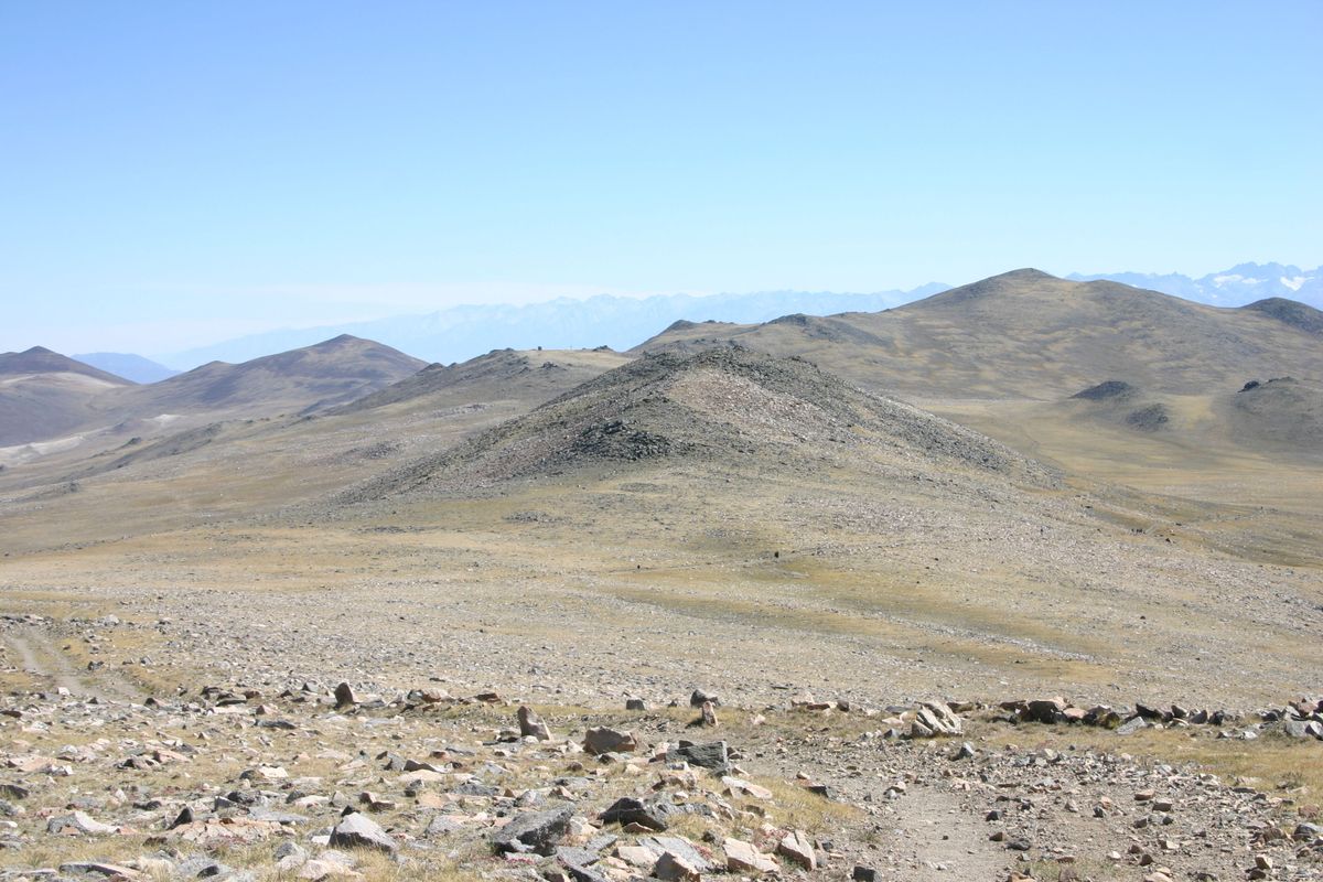
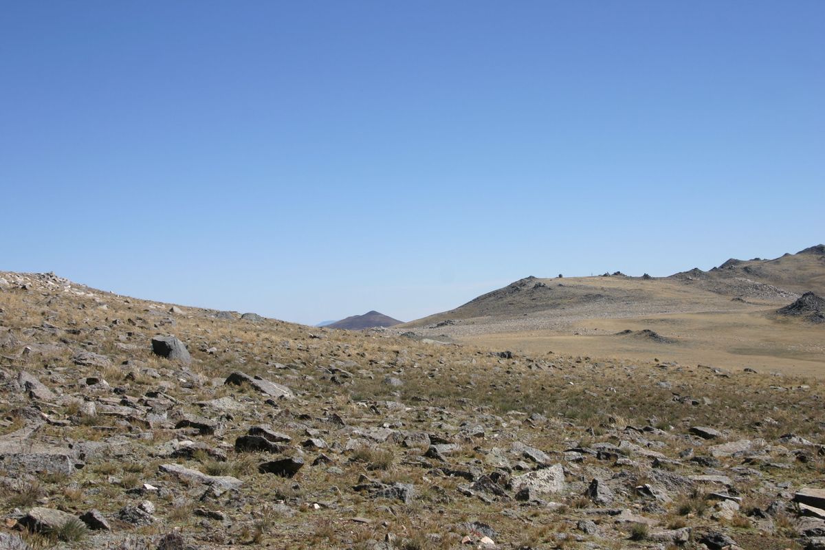
The abundant alpine lakes, streams, and meadows (not to mention the snowfields and glaciers) that are characteristic of the Sierra simply don't exist in the White Mountains. The dry climate of this range is much more like the ranges in the Great Basin to the east. And, although the White Mountains support one of the largest stands of bristlecone pines, famous for their great ages, forest cover overall is nonetheless minimal. To make up for the lack of greenery, the brilliantly colored rocks that make up much of the range do have a stark beauty of their own.

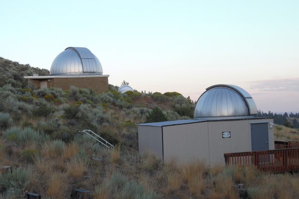
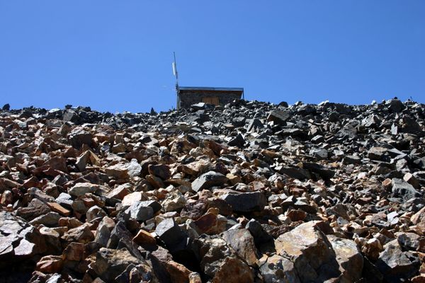
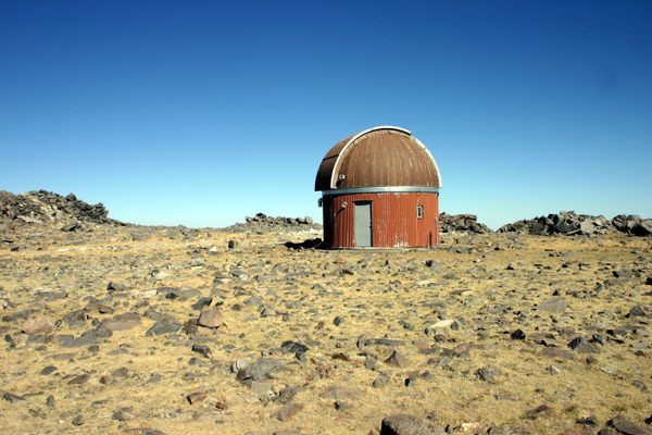
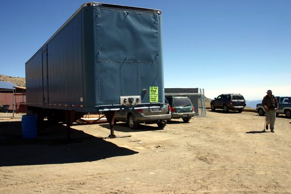
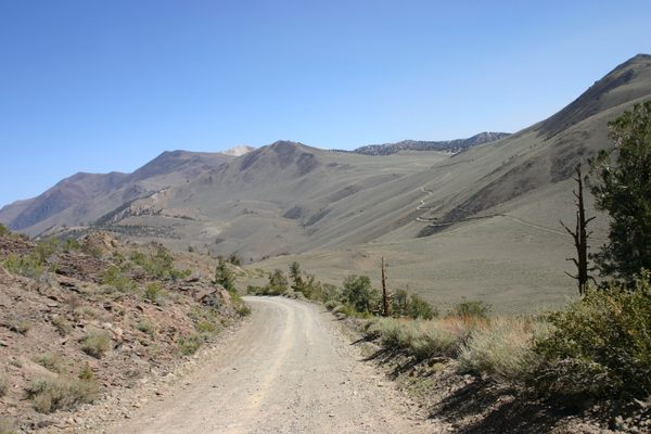
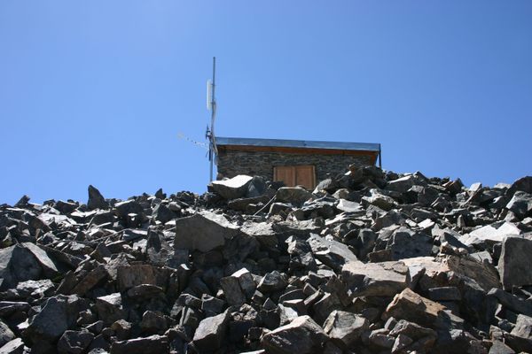
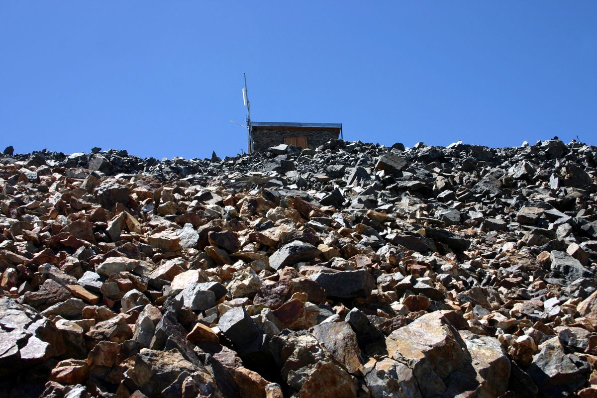
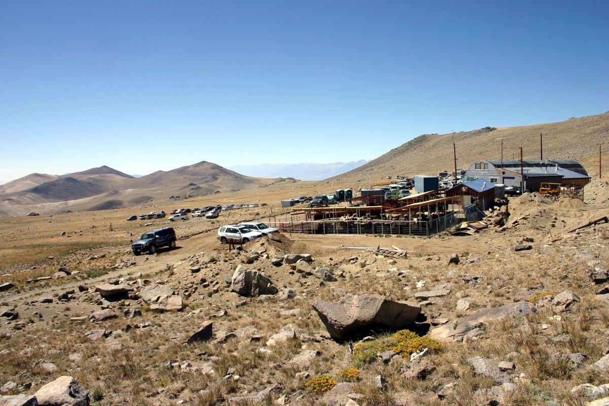
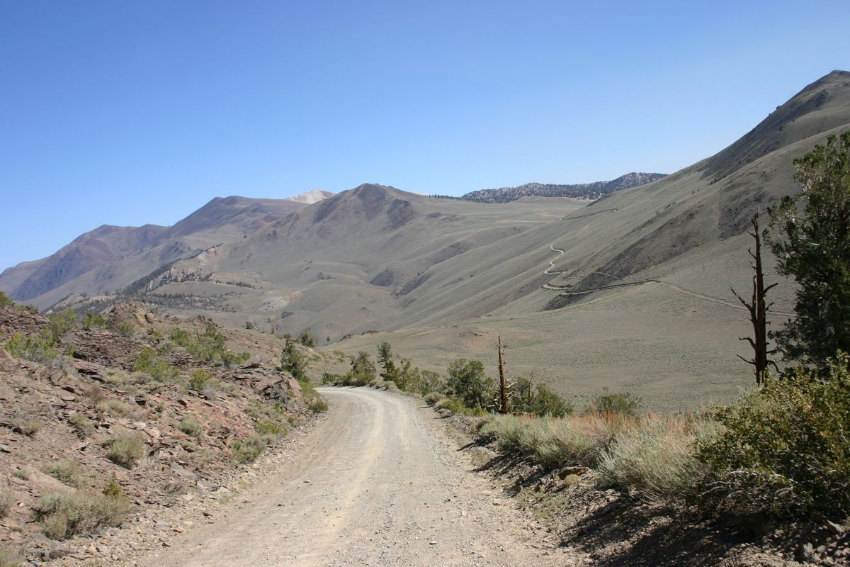
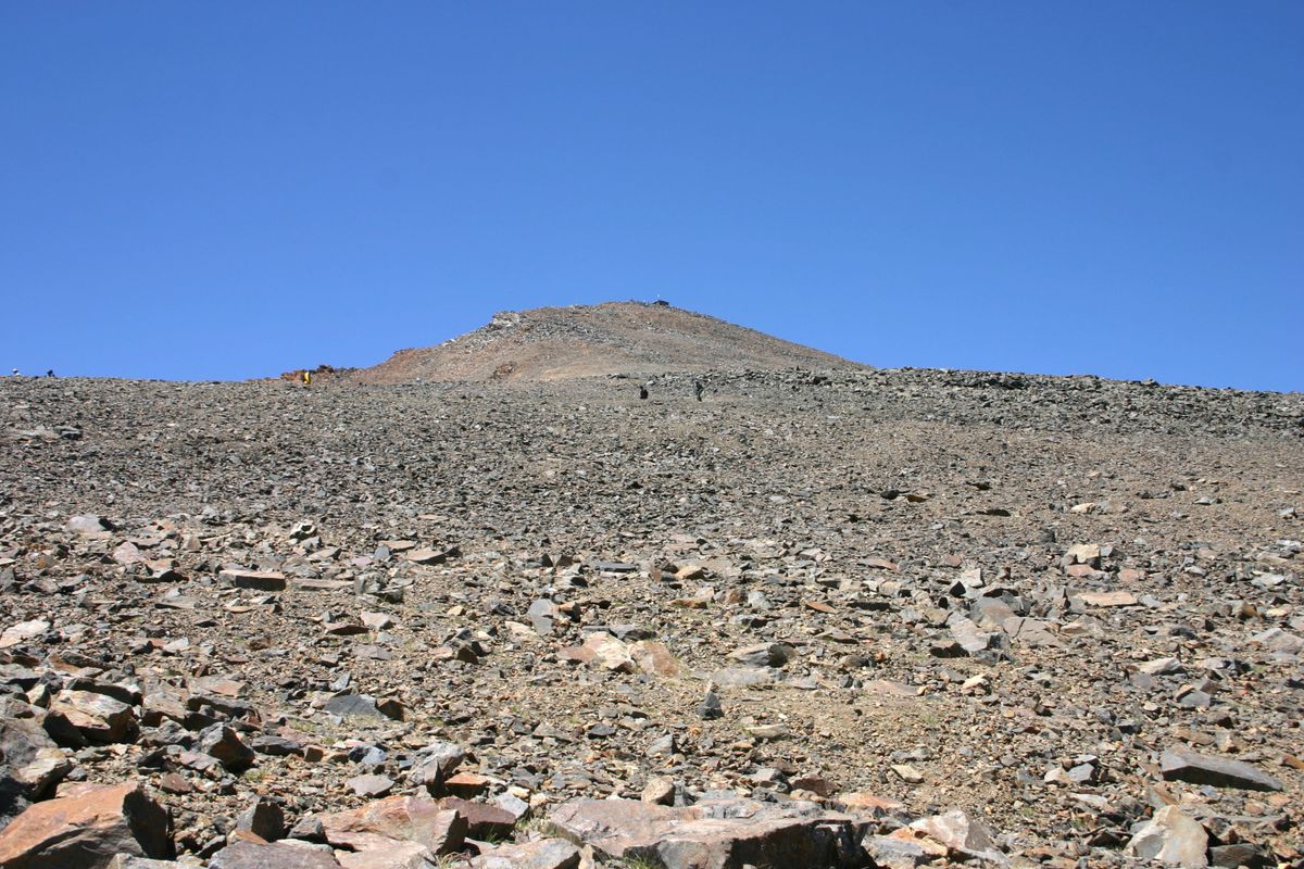
The White Mountains also contain several University of California high-altitude research stations, in particular the Barcroft Field Station at 12,470 feet (3,800 meters). It's on a dirt road that continues as a Jeep track all the way to the top of White Mountain Peak, where a summit hut is maintained as part of the research installation.

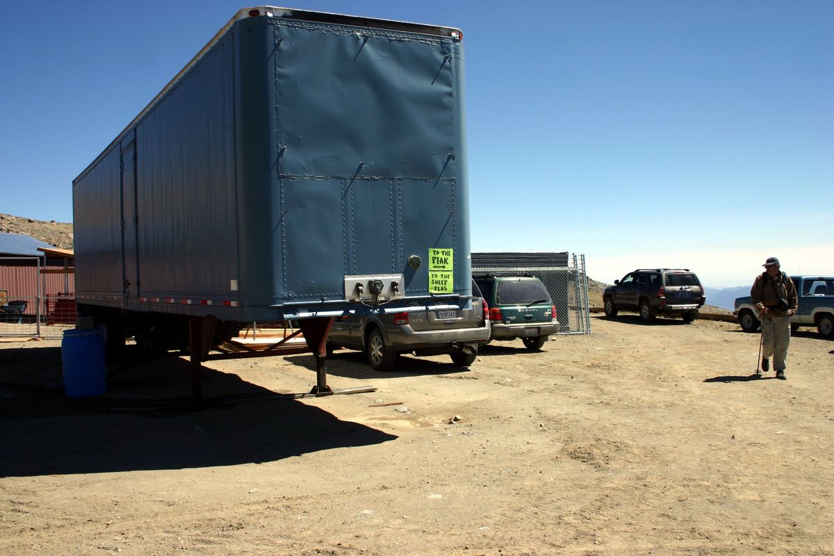
Normally the road to the Barcroft Station is gated about two miles before the station to prevent public vehicle access, although non-motorized travel all the way to the summit is permitted. Twice a year, however, the Barcroft Field Station holds an "open house" during which the public can drive all the way to the station, although motorized traffic on the Jeep road beyond is still not allowed. The UC personnel will have displays and give talks on their research.

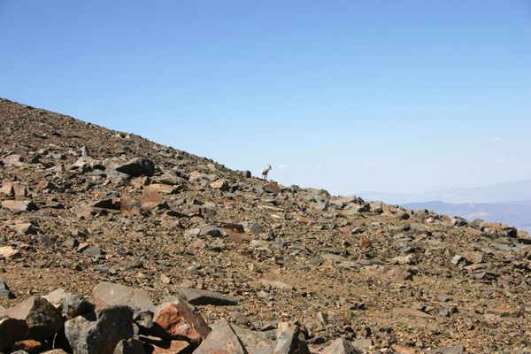
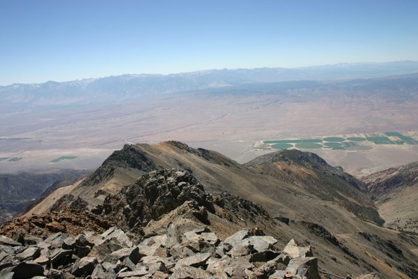
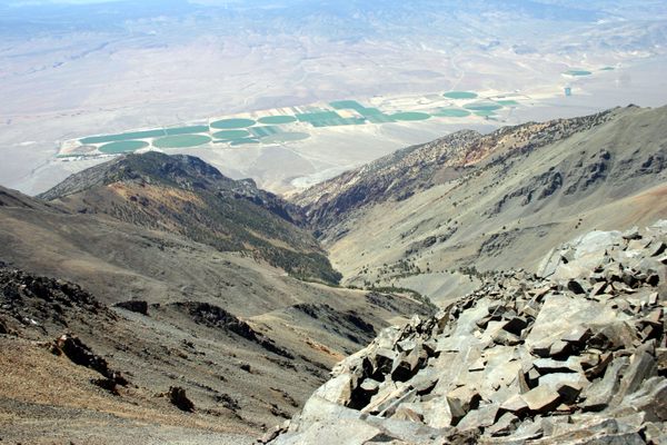
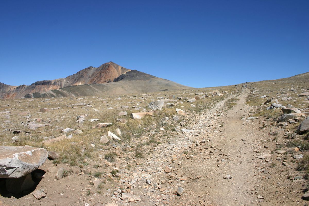
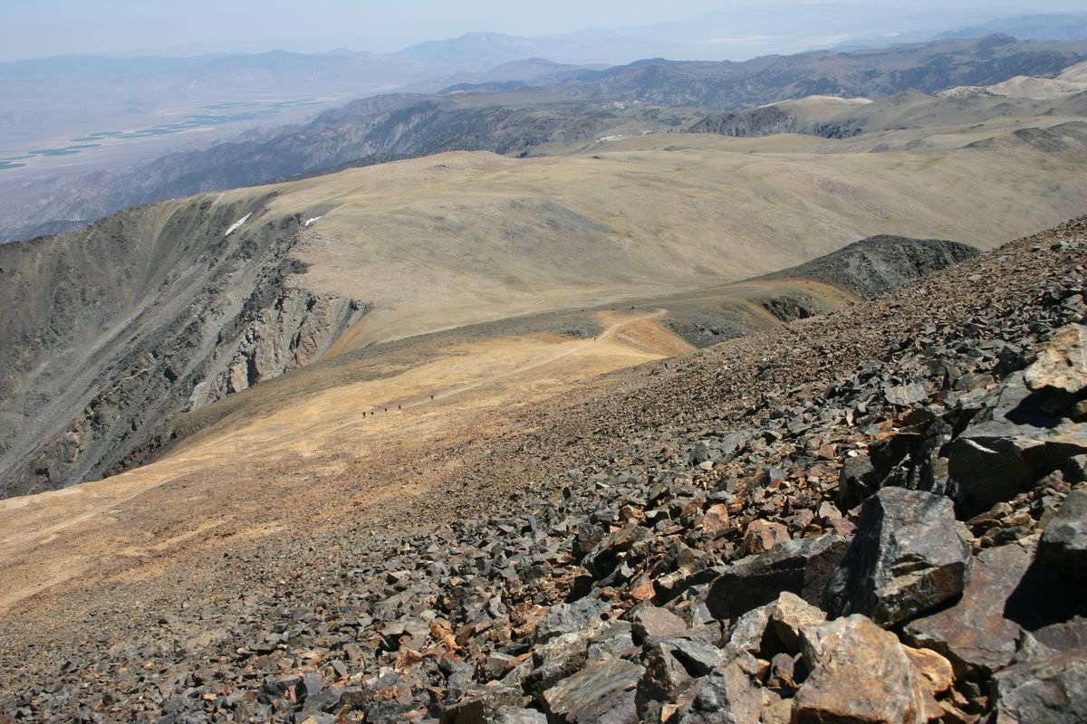
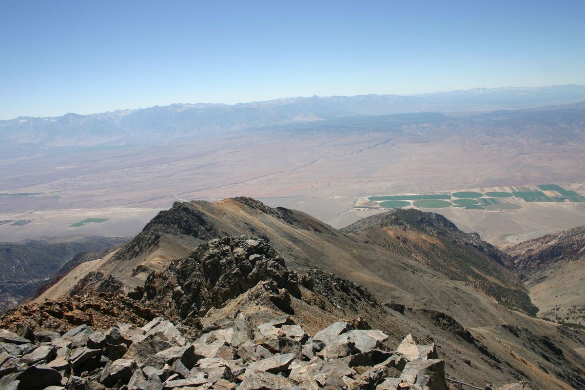
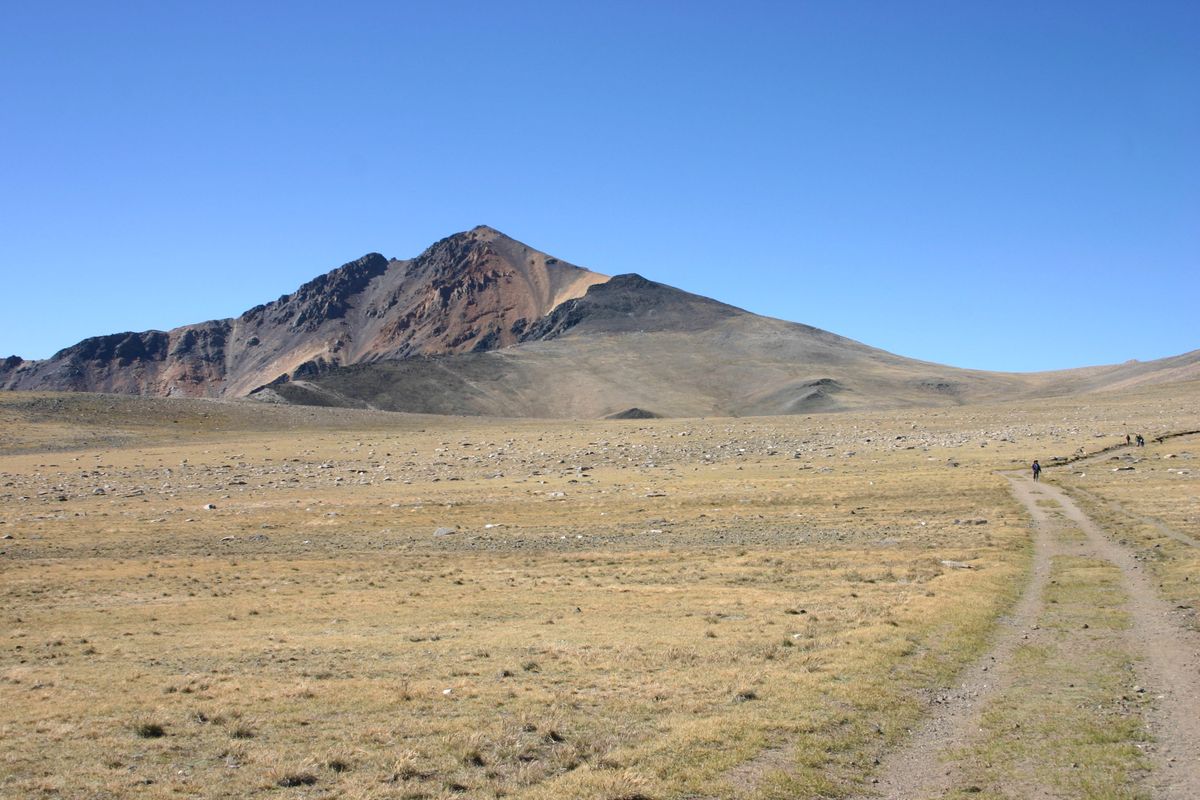
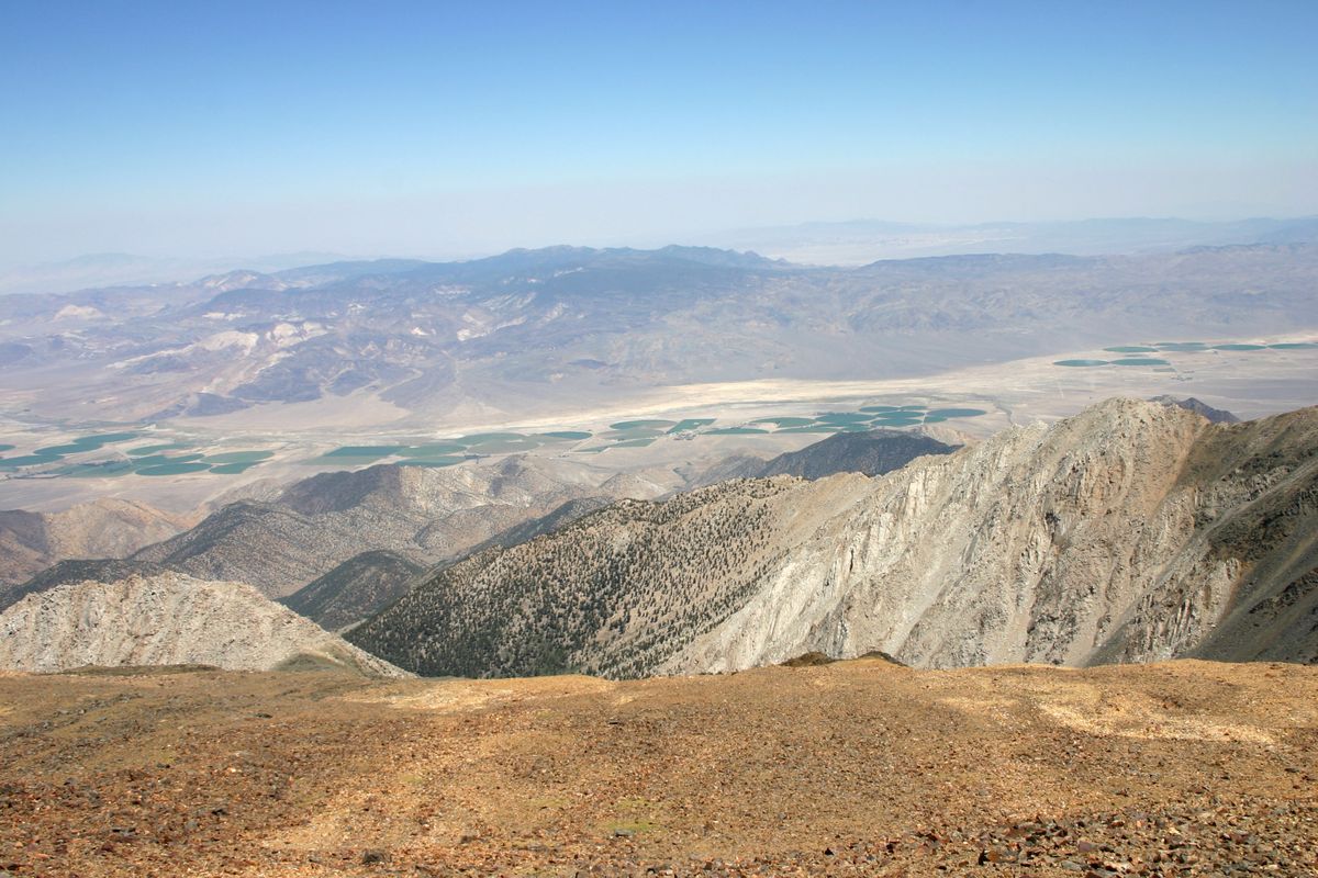
You can also continue, on foot or mountain bike, to White Mountain Peak and so get a two-mile head start on the usual trail. In addition, medical technicians will be at the Summit Hut to check your blood oxygen, if you wish—though be warned, there tends to be a long wait! In any case, the sweeping views from the trail and summit are well worth the trip.

Related Tags

Science Environment Hiking Mountains

Know Before You Go

From Big Pine, California take State Route 168 12.8 miles east to the White Mountain Road (USFS 01) and turn left (north). It is now 25.5 miles to the gate to the Barcroft Station. The road is paved for the first 10 miles, to the Bristlecone Visitor Center, and graded thereafter. If it's Open House the gate will be open and you can proceed all the way to the Barcroft field station, another 2 miles. Although the road should be passable to passenger cars as far as the station, high clearance will be useful once there because parking is limited.

 Covid precautions have currently (2021) postponed the open house. Check the website for updates and schedules.

Community Contributors

Added By

slgwv

Published

February 3, 2022

Edit this listing

Make an Edit
Add Photos
Sources
  • https://wmrc.edu/summit-hut/
  • https://wmrc.edu/barcroft-station/
White Mountain Peak
Swall Meadows, California, 93514
United States
37.634354, -118.255739
Visit Website

Nearby Places

Boundary Peak

Dyer, Nevada

miles away

Laws Railroad Museum

Bishop, California

miles away

Methuselah Tree

Big Pine, California

miles away

Explore the Destination Guide

Photo of California

California

United States

Places 1,494
Stories 135

Nearby Places

Boundary Peak

Dyer, Nevada

miles away

Laws Railroad Museum

Bishop, California

miles away

Methuselah Tree

Big Pine, California

miles away

Explore the Destination Guide

Photo of California

California

United States

Places 1,494
Stories 135

Related Places

  • The view of the Blue Ridge Mountains here is spectacular.

    Canton, North Carolina

    Black Balsam Knob

    On a clear afternoon, you can see mountain peaks more than 40 miles away from this clearing in the Pisgah National Forest.

  • Vacant since the 1960s, this tower still offers the best view around.

    Cosby, Tennessee

    Mount Cammerer Lookout Tower

    Trek up to an abandoned fire lookout from the 1930s for an unimpeded view.

  • Memorials at the symbolic cemetery

    Vysoké Tatry, Slovakia

    Symbolic Cemetery at Popradské Pleso

    A serene memorial that honors the adventurous spirits of climbers who lost their lives in the High Tatras.

  • Telescope domes at Pine Mountain Observatory.

    Millican, Oregon

    Pine Mountain Observatory

    In the high desert east of Bend, the University of Oregon maintains a research observatory on a remote mountain peak.

  • Looking north along Winter Ridge.  Summer Lake on the right.

    Paisley, Oregon

    Fremont National Recreation Trail

    A remote trail traverses the little-known Gearhart Mountains of southern Oregon.

  • An archway superimposes mountaineers made of metal over the visage of Pike’s Peak.

    Colorado Springs, Colorado

    AdAmAn Alley

    An unexpected alley with light shows and nature views.

  • Though beautiful anytime, the fall colors are always a draw for visitors.

    Kingston, Arkansas

    Hawksbill Crag

    This impressive ledge seems to float above the Upper Buffalo Wilderness.

  • The desk atop Hancock Hill in 2021.

    Alpine, Texas

    Sul Ross Desk

    A group of college students hauled a desk up a mountain more than 40 years ago. The notebooks inside have become a makeshift time capsule.

Aerial image of Vietnam, displaying the picturesque rice terraces, characterized by their layered, verdant fields.
Atlas Obscura Membership

Become an Atlas Obscura Member


Join our community of curious explorers.

Become a Member

Get Our Email Newsletter

Follow Us

Facebook YouTube TikTok Instagram Pinterest RSS Feed

Get the app

Download the App
Download on the Apple App Store Get it on Google Play
  • All Places
  • Latest Places
  • Most Popular
  • Places to Eat
  • Random
  • Nearby
  • Add a Place
  • Stories
  • Food & Drink
  • Itineraries
  • Lists
  • Video
  • Podcast
  • Newsletters
  • All Trips
  • Family Trip
  • Food & Drink
  • History & Culture
  • Wildlife & Nature
  • FAQ
  • Membership
  • Feedback & Ideas
  • Community Guidelines
  • Product Blog
  • Unique Gifts
  • Work With Us
  • About
  • FAQ
  • Advertise With Us
  • Advertising Guidelines
  • Privacy Policy
  • Cookie Policy
  • Terms of Use
Atlas Obscura

© 2025 Atlas Obscura. All Rights Reserved.