An Explorer’s Famed Infographic May Have a Big, Fatal Flaw
Alexander von Humboldt might have been using the wrong mountain.
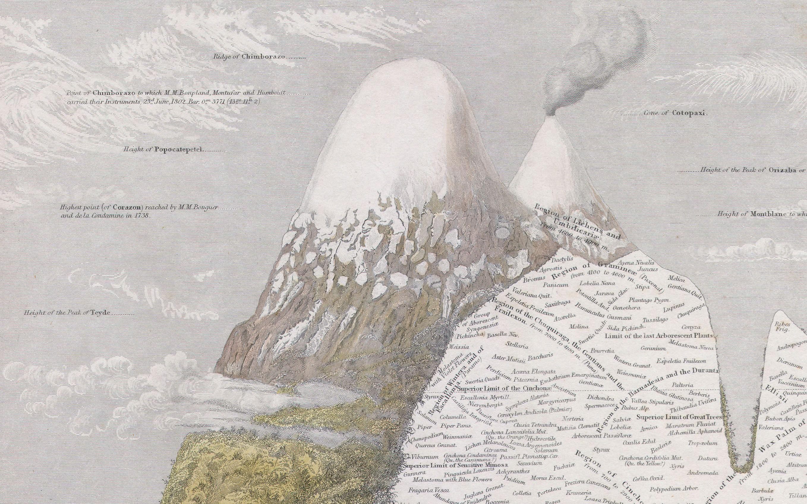
In 1807, explorer and naturalist Alexander von Humboldt published Tableau Physique, a diagram that depicts Chimborazo and Cotopaxi, two volcanoes of the Andes, and, in a sort of cross-section, the vegetation that grows on them at different elevations. The illustration was based on Humboldt’s first major scientific expedition to South America, at just 29, with friend and fellow botanist Aimé Bonpland. The Tableau Physique helped establish the concepts of vegetation belts and biogeography, and has been used by countless scientists to understand how plant ranges shift due to climate change. However, an error in the Tableau Physique has gone unnoticed until now. Humboldt may have based part of it on the wrong mountain.
Despite its historical significance, little scrutiny has been given to the data used to create Tableau Physique. A team of researchers, led by geographical historian Pierre Moret of Toulouse University in France, conducted an investigation into Humboldt’s research, including a resurvey of sites he visited. The team first compared information in Tableau to two subsequent publications by Humboldt, a comparison that revealed science in a constant state of revision. They discovered that Humboldt increased the number of taxa in the region above 3,900 meters with each publication. Also, many of the alpine plants he listed were recorded at incorrect elevations. According to the team’s research, published in Proceedings of the National Academy of Sciences, for the high-altitude sections, “This diagram was an intuitive construct based on unverified, incorrectly recorded field data.”

For the resurvey, the researchers used Humboldt’s travel diary to retrace his route. “Not all the documents he published present the level of accuracy we needed for our resurvey. So we preferred to return to primary data of his field diaries,” says Moret, via email. The team found around 31 high-altitude plant species with “unambiguous locality data and verifiable elevation information registered by Humboldt and Bonpland on Mt. Antisana,” another volcano in the Andes—notably not Chimborazo.
The team believes Humboldt and Bonpland spent four days on Antisana and made many of their discoveries there. The research team also located the cave where the two men camped in 1802 and conducted fieldwork. It’s not entirely clear how Humboldt got things so mixed up. He could have simply been confused about his location or the elevations he was working at, or perhaps he just mislabeled everything. But there is another theory.
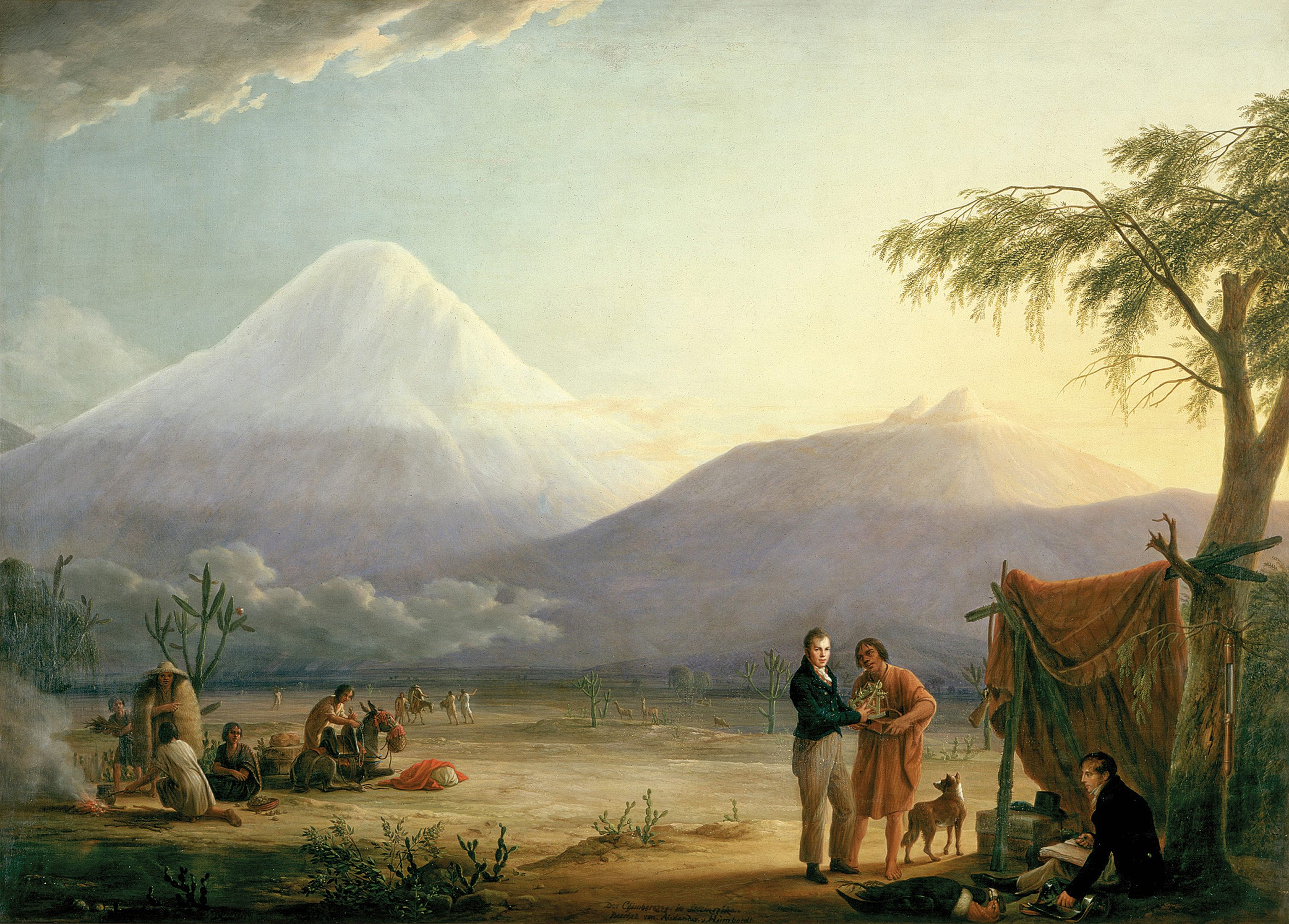
While many of his discoveries were made on other mountains, Humboldt gave Chimborazo pride of place in his work. During the 17th century, Chimborazo (in Ecuador, like Cotopaxi and Antisana) was considered the tallest mountain in the world (at least when measured from the center of the Earth). According to the study, Humboldt featured the mountain to “satisfy the continuous questions about reaching the highest altitude by man.” The climb had already garnered Humboldt international fame, and he was described as the most famous man in the world after Napoleon. He was not about to let the climb be forgotten, despite his other burgeoning research, so he could have ascribed some of his observations to the mountain that represented his greatest public achievement, whether they had been recorded there or not. “It does change our image of Humboldt: a giant in the history of science, far ahead of his time for the wideness and accuracy of his observations,” says Moret. The findings of the study are also a cautionary tale in using historical data as an infallible baseline for modern environmental change.













Follow us on Twitter to get the latest on the world's hidden wonders.
Like us on Facebook to get the latest on the world's hidden wonders.
Follow us on Twitter Like us on Facebook