About
In a city known for its architecture, 300 South Wacker Drive was a forgettable contribution. The building was a typical structure of the 1970s: steel, glass, and very boring. It was overshadowed (literally and figuratively) by the Sears Tower, which sits kitty-corner.
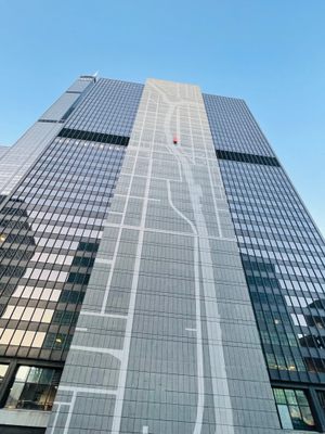
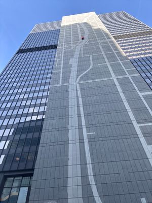
Purchased by a Boston real estate firm in 2013, New York based ESI Design was tasked with transforming the 35-story tall slab of concrete on the building’s backside into a map of Chicago.
The map is simply done, with streets and the Chicago River represented in gray on a black surface. The only color is a bright red rectangle representing 300 Wacker’s location on the map. At night, the rectangle is the only part of the map that is lit up.
Related Tags
Know Before You Go
The map is best viewed from the opposite side of the Chicago River, along the Jackson Blvd Bridge or Van Buren St Bridge.
Community Contributors
Added By
Published
October 9, 2019

