About
Although there are still those who can point out the site, a passerby would never suspect that remnants of a near untakeable fortress are hidden just out of sight here. Most who pass through the Yser Valley only look out for what's left over from the First World War, which famously ravaged Flanders Fields.
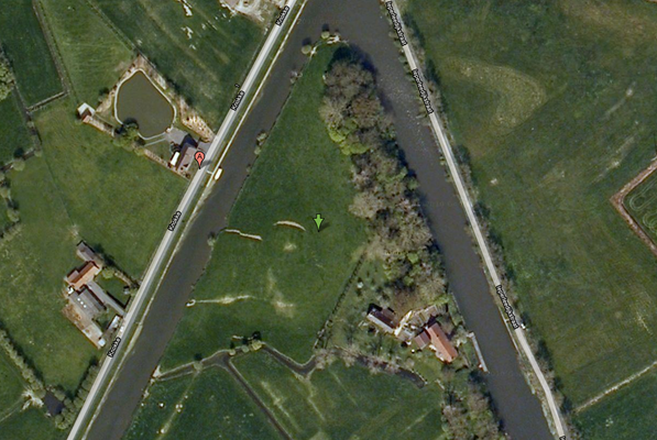
Yet here, on a lane along the river bordered with trees—a haunt for fishermen, hikers, and bikers—are the foundations calling out from a more distant warlike past. Little can be seen, as only the foundations remain, outlined by ditches that once were moats.
Fort de Knocke, as it was known, was constructed by the Spanish circa 1579, at the confluence of the Yser and the Ieperlee (Yperlee) Rivers. The continuous conflict between Spain and France at the time meant that the fortress changed hands quite a few times. As part of the Hapsburg Empire, Flanders at the time answered to Spain. It had long been a possession of France, however, and the Count of Flanders was answerable to the King of France. France conquered the fortress at last.
The Marquis de Vauban, a military engineer and Marshal of France, began work enlarging the fort in 1678 to fully fill the wedge of land between the rivers. This position meant that the entire surroundings of the fortress could be flooded, when needed, rendering it nearly untakeable. (Interestingly, during World War I, a similar tactic was used to stop the Germans, as the Yser valley was flooded.)
After a short period of Dutch possession in 1712, the fort returned to Habsburg hands, and Emperor Joseph II of Austria ordered it to be razed in 1744.
Now, it is used as agricultural land, and it makes an idyllic field for an easy walk on a lazy Sunday afternoon.
Related Tags
Know Before You Go
From Dixmude, follow the river Yser downstream.
Community Contributors
Added By
Published
July 6, 2010
