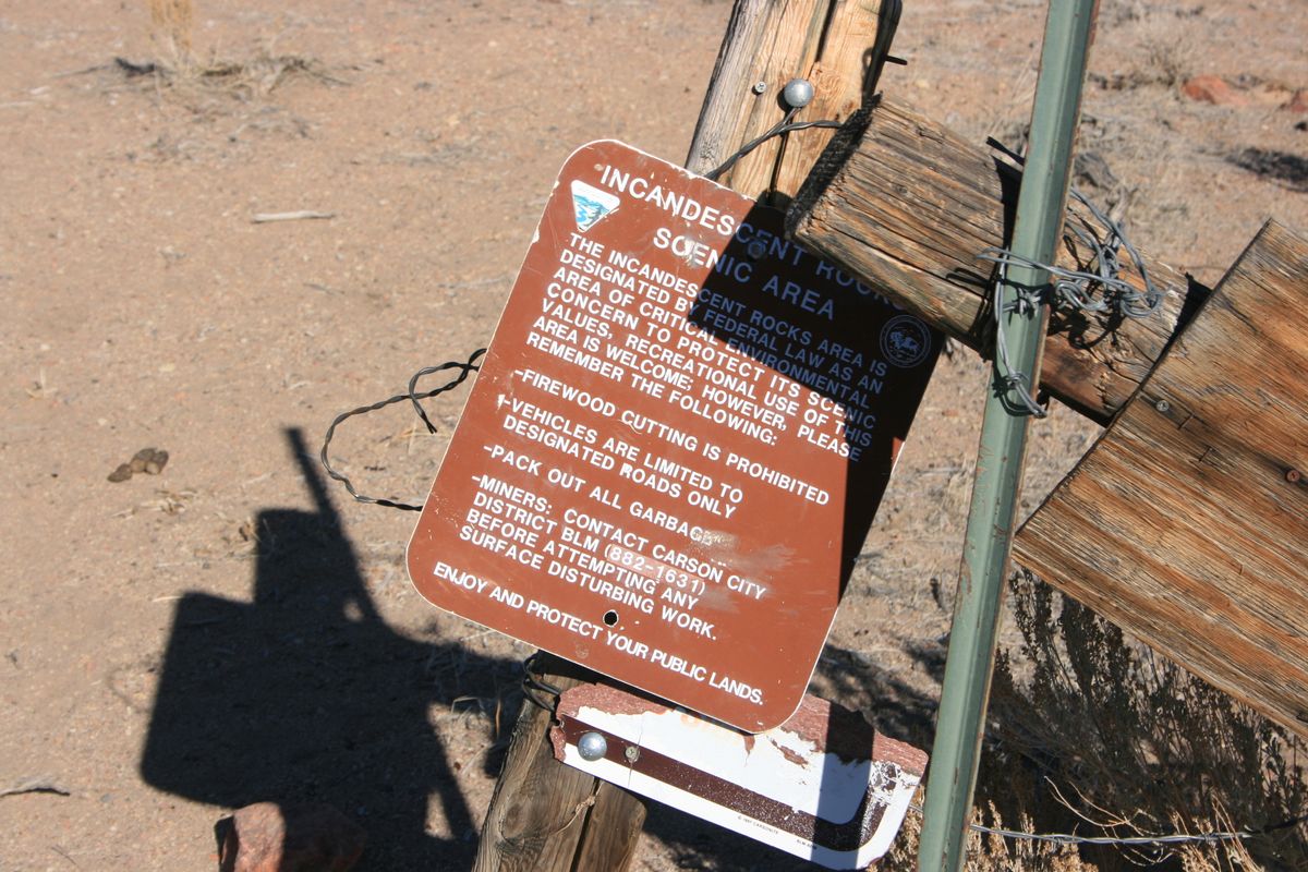
Trips Places Foods Stories Newsletters

Take your next trip with Atlas Obscura!

Our small-group adventures are inspired by our Atlas of the world's most fascinating places, the stories behind them, and the people who bring them to life.

Visit Adventures
Trips Highlight
Central Asia yurt night stars
Uzbekistan • 15 days, 14 nights
Central Asia Road Trip: Backroads & Bazaars
from
Caucasus - Geghard Monastery, Armenia
Armenia • 15 days, 14 nights
Caucasus Road Trip: Azerbaijan, Georgia & Armenia
from
View all trips
Top Destinations
Latest Places
Most Popular Places Random Place Lists Itineraries
Add a Place
Download the App
Top Destinations
View All Destinations »

Countries

  • Australia
  • Canada
  • China
  • France
  • Germany
  • India
  • Italy
  • Japan

Cities

  • Amsterdam
  • Barcelona
  • Beijing
  • Berlin
  • Boston
  • Budapest
  • Chicago
  • London
  • Los Angeles
  • Mexico City
  • Montreal
  • Moscow
  • New Orleans
  • New York City
  • Paris
  • Philadelphia
  • Rome
  • San Francisco
  • Seattle
  • Stockholm
  • Tokyo
  • Toronto
  • Vienna
  • Washington, D.C.
Latest Places
View All Places »
Al Jazirah Al Hamra Heritage Village
Complejo Cultural Fábrica Imbabura
Guptill's Arena
In this deceptively simple dish, top-quality ingredients are paramount.
Kor Panich
Latest Places to Eat & Drink
View All Places to Eat »
In this deceptively simple dish, top-quality ingredients are paramount.
Kor Panich
Customize your bowl with sliced pork, pork balls, fish cake, and offal.
Rung Rueang
Pasties are an Upper Michigan tradition dating back to mining days.
Lehto’s Pasties
Stock up on picnic supplies with a side of history.
Horton Bay General Store
Take some of Michigan’s produce home with you.
American Spoon
Recent Stories
All Stories Video Podcast
Most Recent Stories
View All Stories »
Podcast: Finding ‘The Great Gatsby’ in Louisville
about 14 hours ago
Here’s which treats you can safely lug home without risking a fine.
Dear Atlas: What International Food Can I Legally Bring Into the U.S.?
1 day ago
Cely’s map is not only accurate, but captures the unique characteristics of Congaree’s trees and waterways.
How One Biologist Drew a Hyper-Accurate, Ranger-Approved Map of Congaree National Park
3 days ago
Though they’re protected inside the park, wolves can be killed when they cross its borders.
Wolves Have a Bad Reputation. One Yellowstone Naturalist Is Trying to Fix It.
3 days ago

No search results found for
“”

Make sure words are spelled correctly.

Try searching for a travel destination.

Places near me Random place

Popular Destinations

  • Paris
  • London
  • New York
  • Berlin
  • Rome
  • Los Angeles
Trips Places Foods Stories Newsletters
Sign In Join
Places near me Random place
All the United States Nevada Sutcliffe Incandescent Rocks

Incandescent Rocks

Colorful outcrops and cliffs just north of Reno provide a scenic backdrop for hiking and mountain biking.

Sutcliffe, Nevada

Added By
slgwv
Email
Been Here
Want to go
Added to list
Incandescent rocks.   slgwv / Atlas Obscura User
Looking east to Pyramid Lake.   slgwv / Atlas Obscura User
Stressed juniper.   slgwv / Atlas Obscura User
A painted hill.   slgwv / Atlas Obscura User
“Pig rock.” An informal name, but it fits!   slgwv / Atlas Obscura User
Painted rocks.   slgwv / Atlas Obscura User
Side canyon.   slgwv / Atlas Obscura User
Mine portal.   slgwv / Atlas Obscura User
Red rocks and prospect roads.   slgwv / Atlas Obscura User
Weathered claim stake.   slgwv / Atlas Obscura User
Looking east to Pyramid Lake.   slgwv / Atlas Obscura User
Red ramparts.   slgwv / Atlas Obscura User
Old mining road.   slgwv / Atlas Obscura User
Twisted juniper.   slgwv / Atlas Obscura User
Summit view south toward Reno.   slgwv / Atlas Obscura User
Hidden arch.   slgwv / Atlas Obscura User
Cavernous weathering.   slgwv / Atlas Obscura User
Red rocks–this is not Utah!   slgwv / Atlas Obscura User
Precarious perch.   slgwv / Atlas Obscura User
Looking east; Pyramid Lake in the distance.   slgwv / Atlas Obscura User
Red outcrops.   slgwv / Atlas Obscura User
Red cliff and prospecting roads.   slgwv / Atlas Obscura User
Abandoned mine adit.   slgwv / Atlas Obscura User
Red cliffs.   slgwv / Atlas Obscura User
Catching the sunset.   slgwv / Atlas Obscura User
Sunset color.   slgwv / Atlas Obscura User
Lengthening shadows.   slgwv / Atlas Obscura User
Arches and caverns.   slgwv / Atlas Obscura User
Red ramparts.   slgwv / Atlas Obscura User
Looking east; Needle Rock is the distant spire on the right.   slgwv / Atlas Obscura User
The sign could use a little love.   slgwv / Atlas Obscura User
Colorful layers.   slgwv / Atlas Obscura User
Painted hills.   slgwv / Atlas Obscura User
Windows.   slgwv / Atlas Obscura User
View through the arch.   slgwv / Atlas Obscura User
Natural arch.   slgwv / Atlas Obscura User
Cavernous weathering.   slgwv / Atlas Obscura User
Been Here
Want to go
Added to list

About

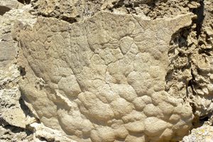
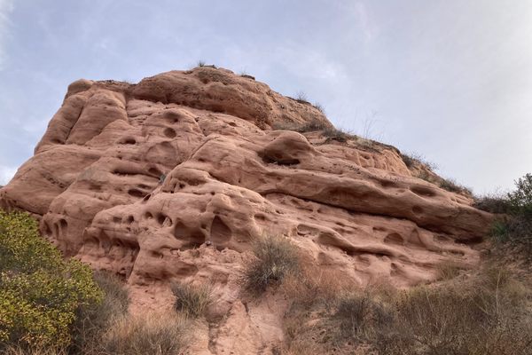
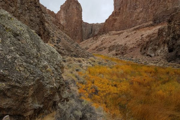
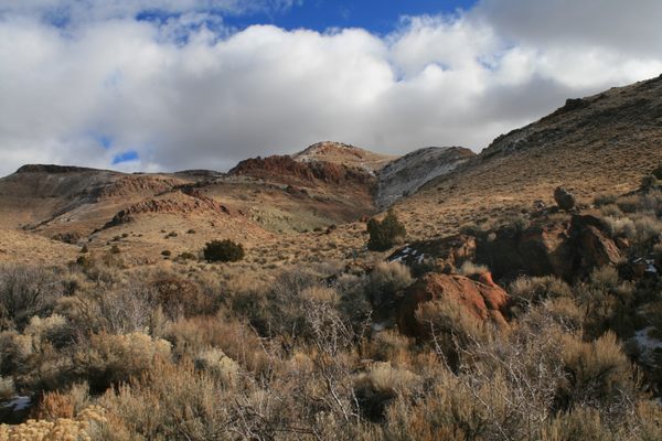
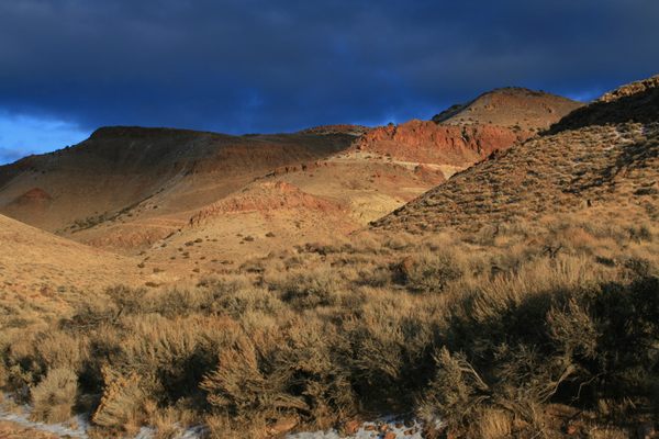
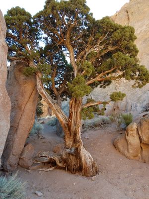
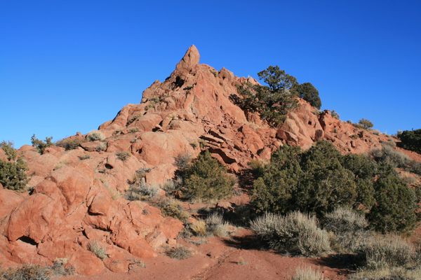
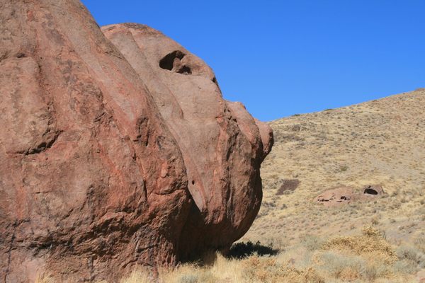
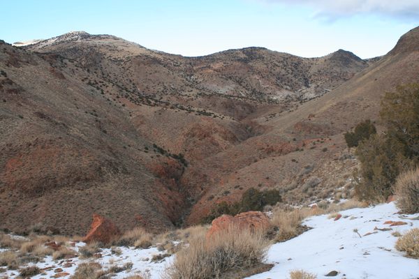
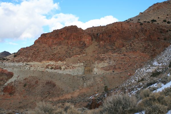
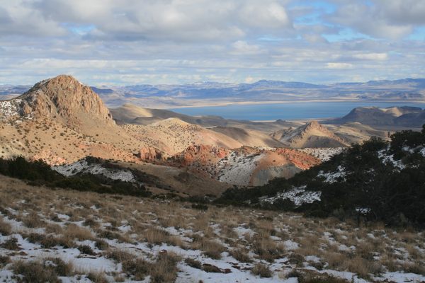
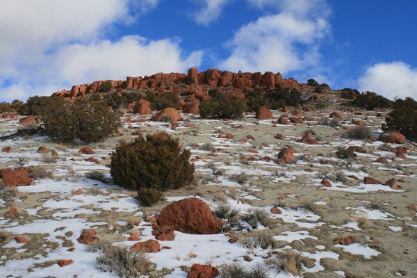
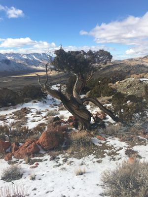
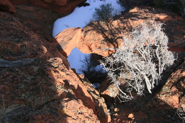
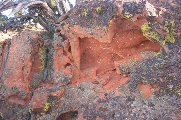
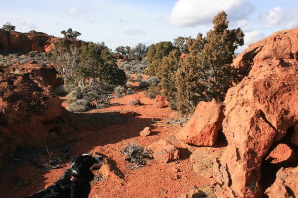
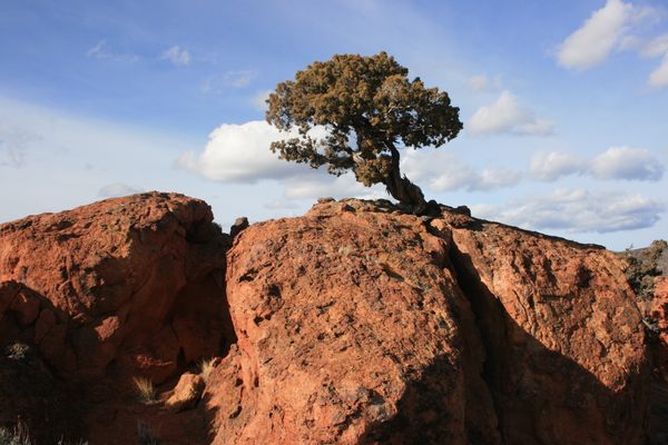
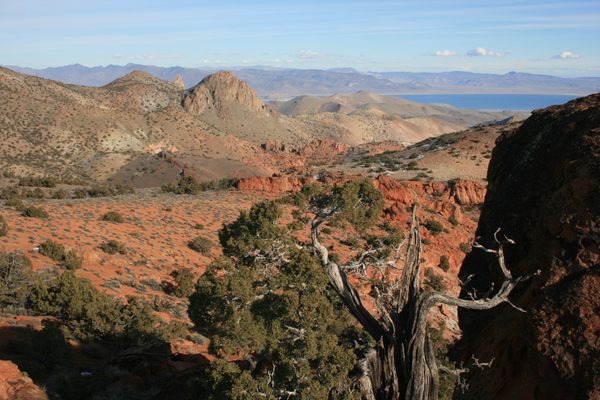
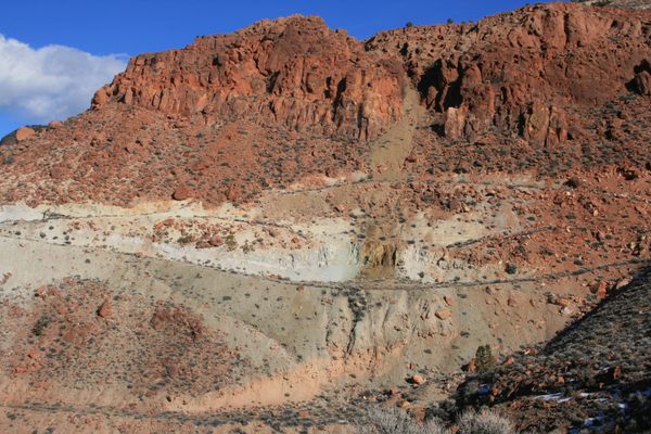
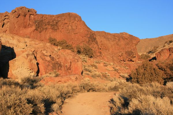
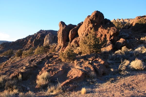
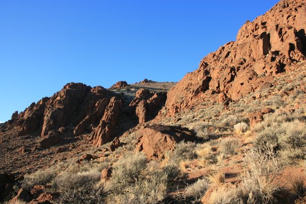
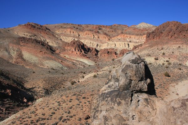
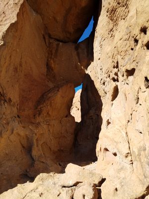
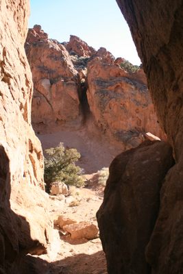
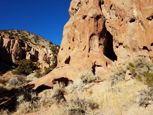
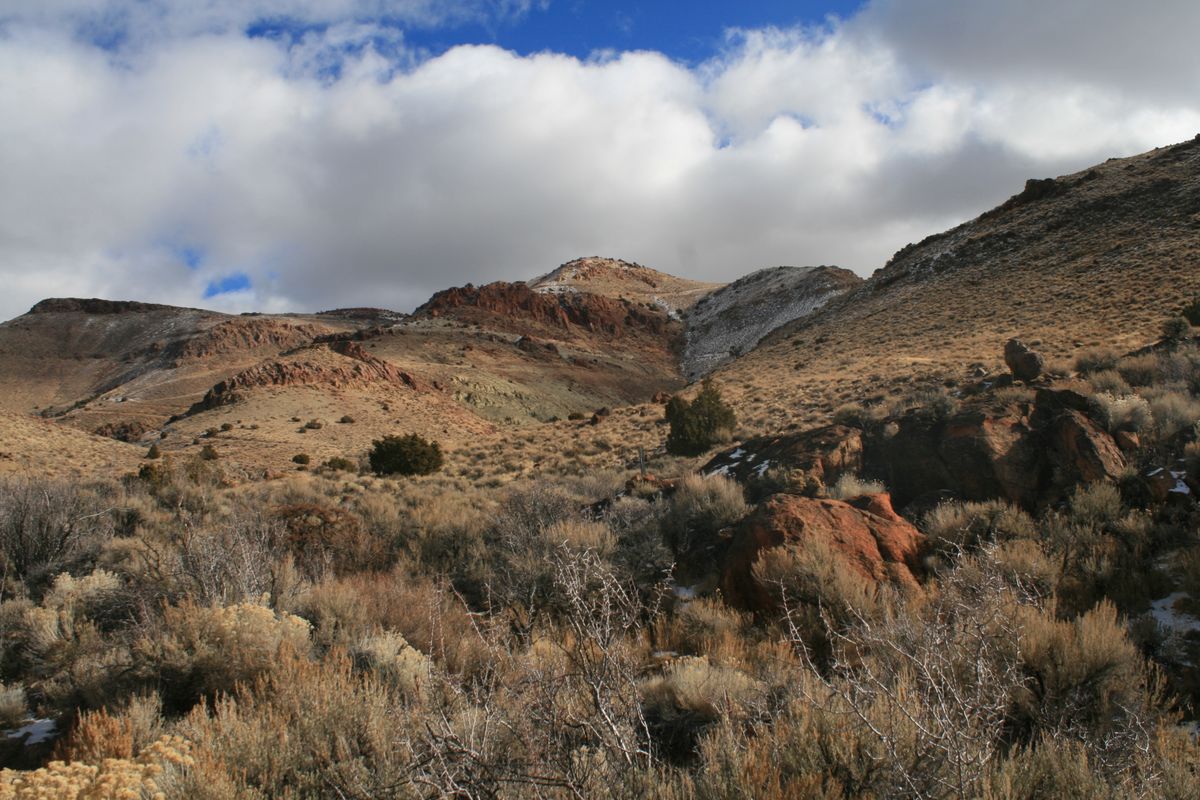
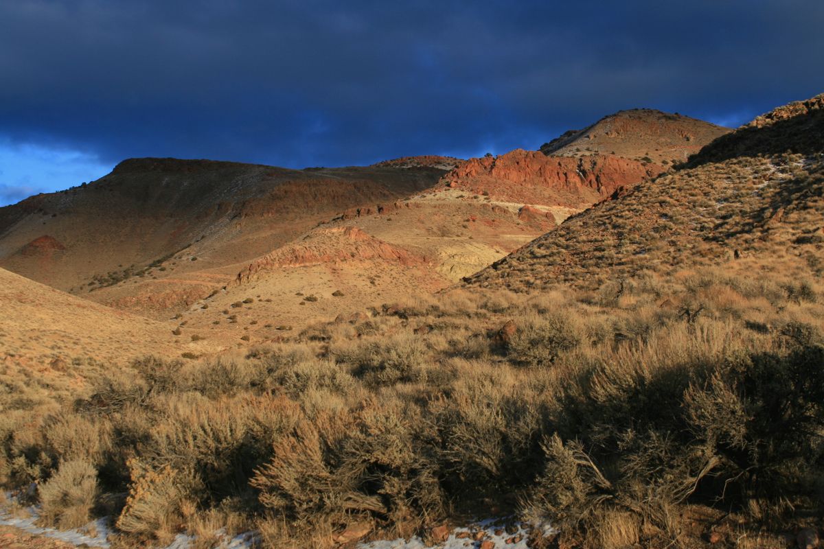
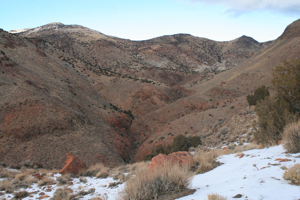
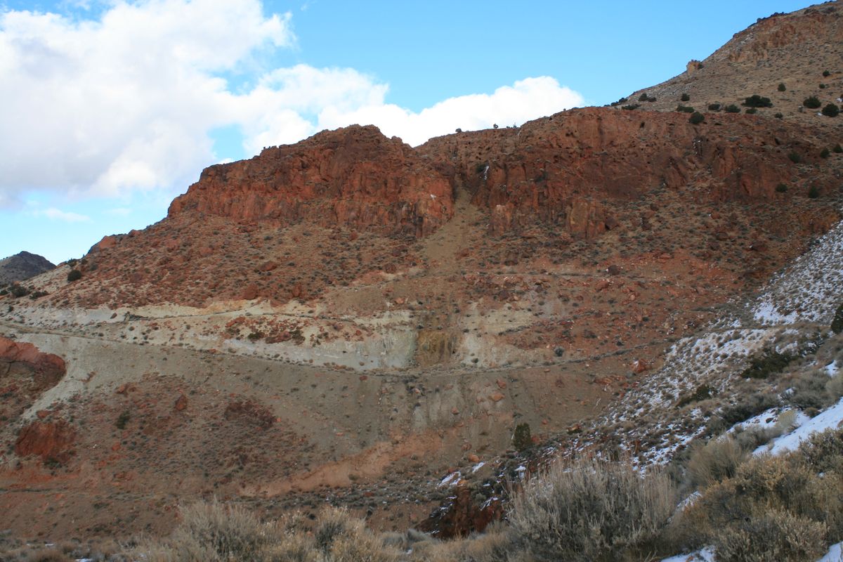
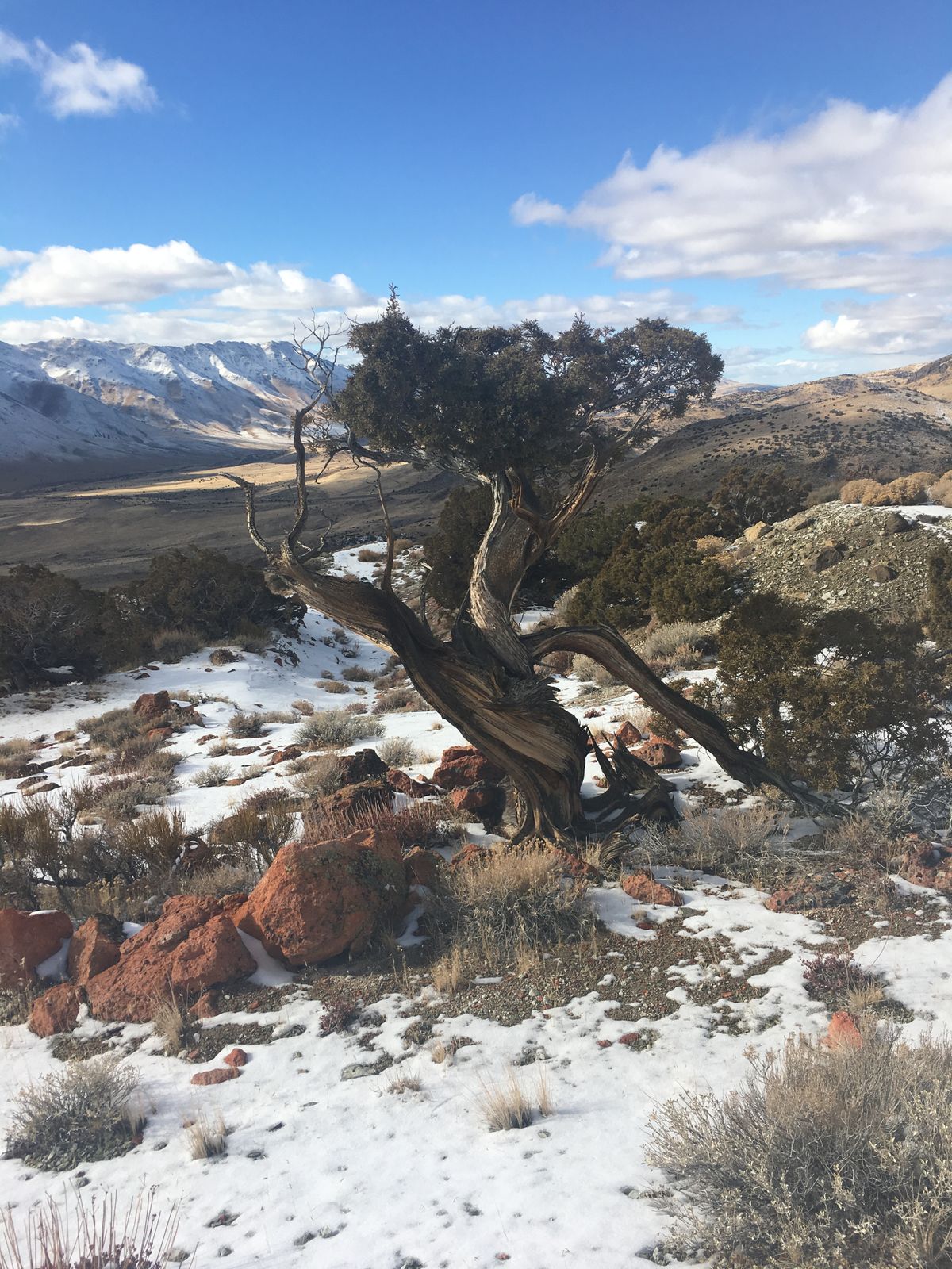
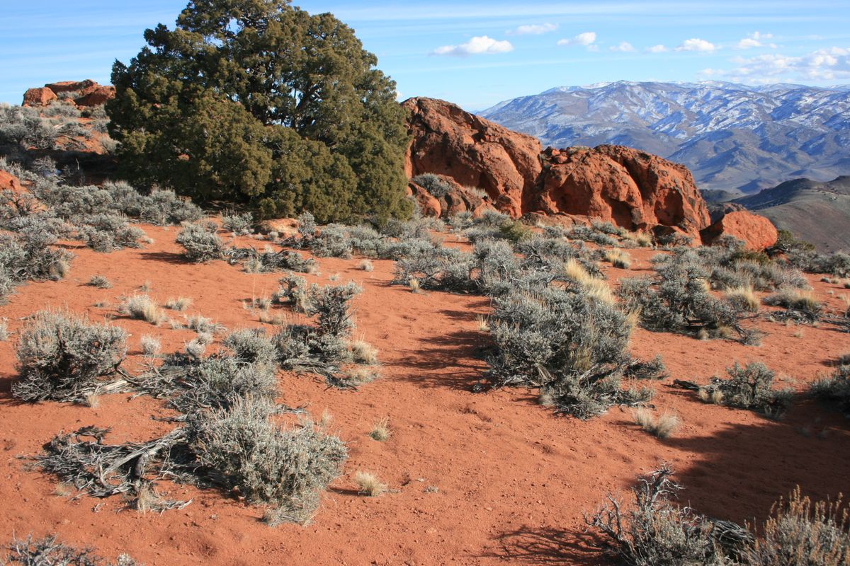
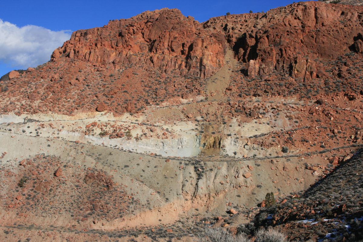
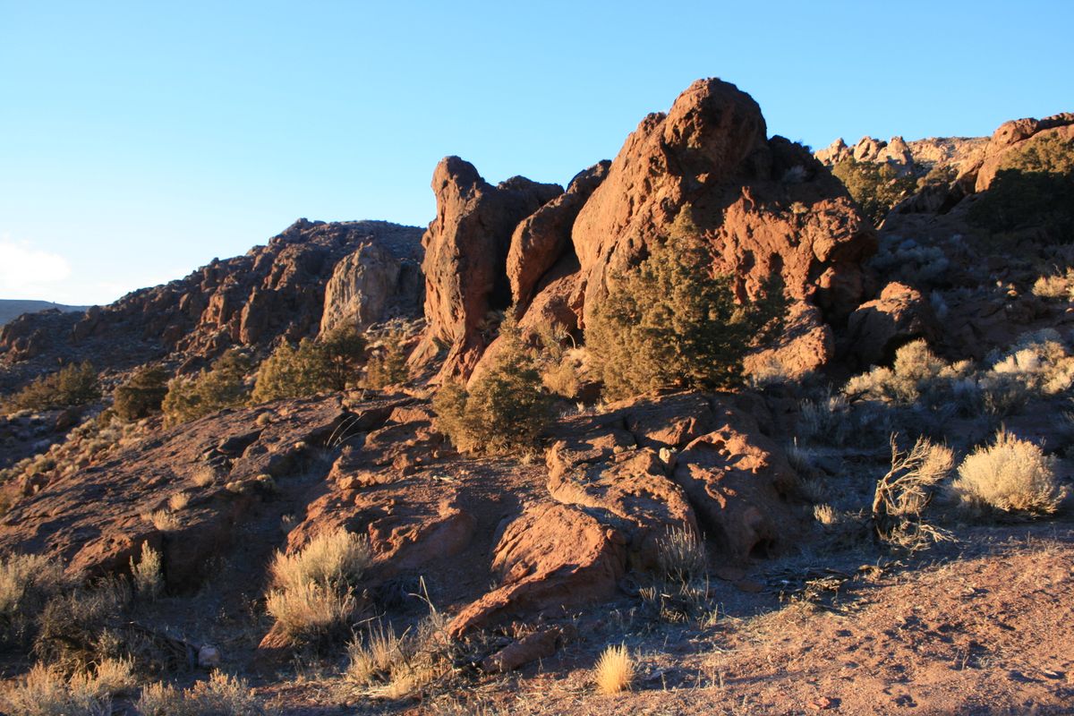
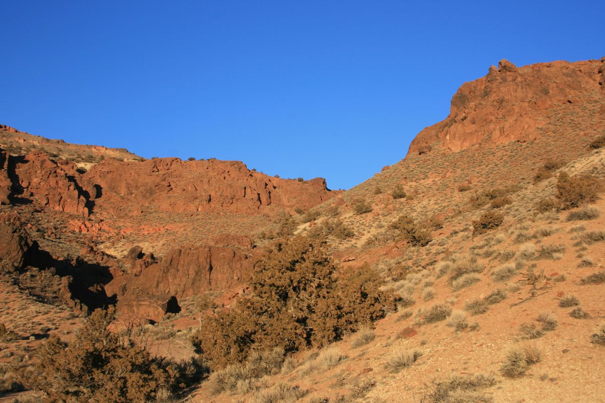
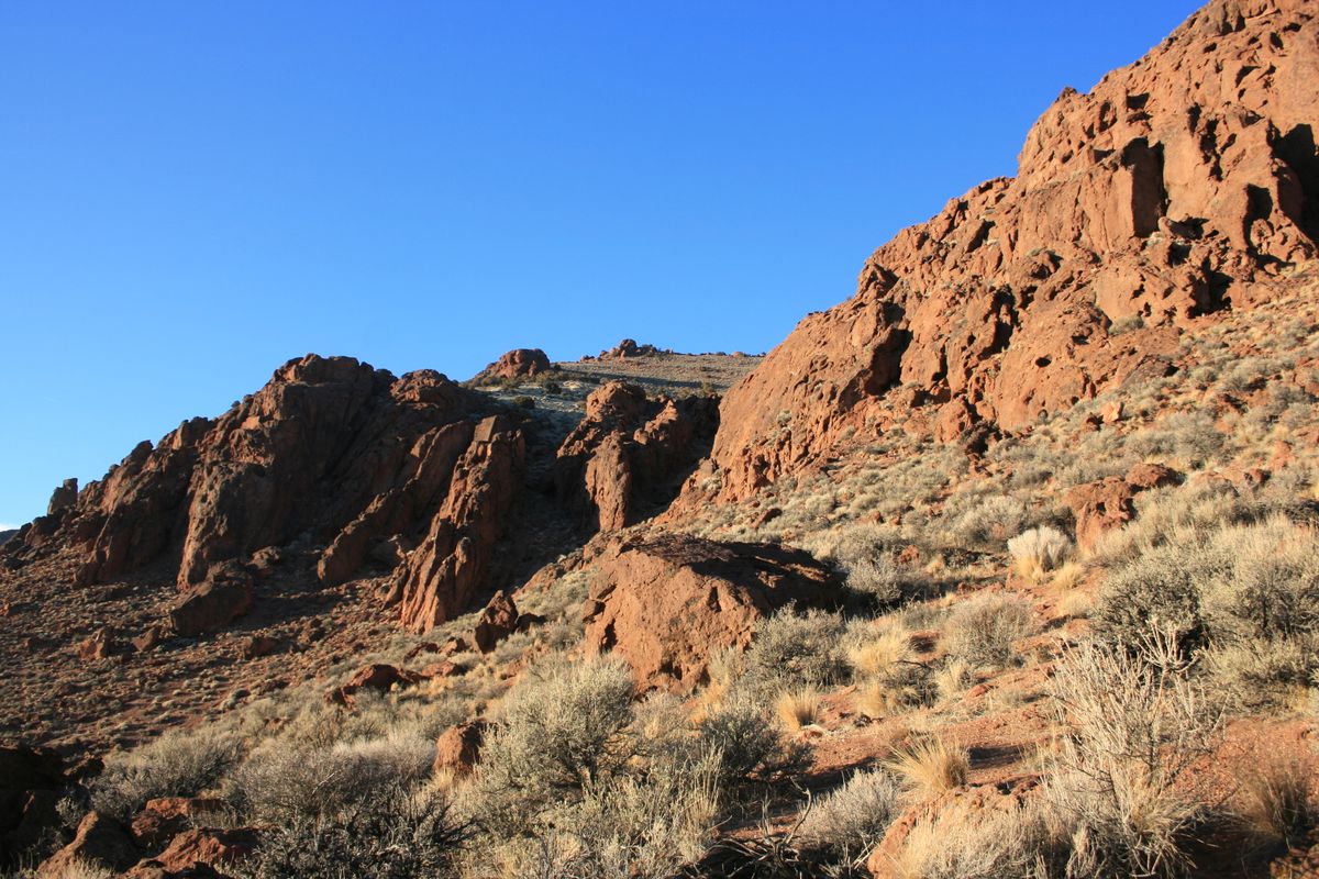
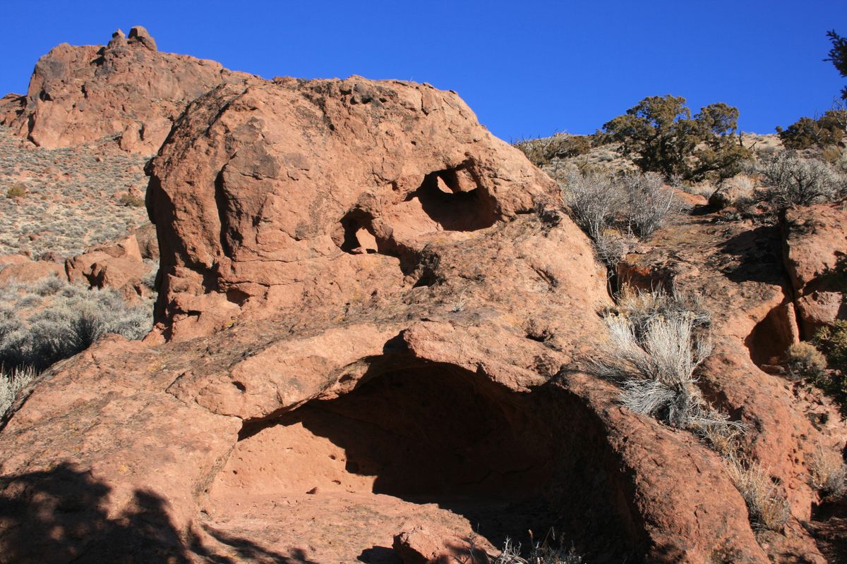
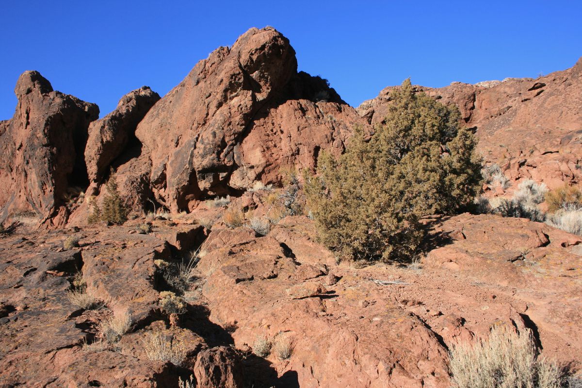
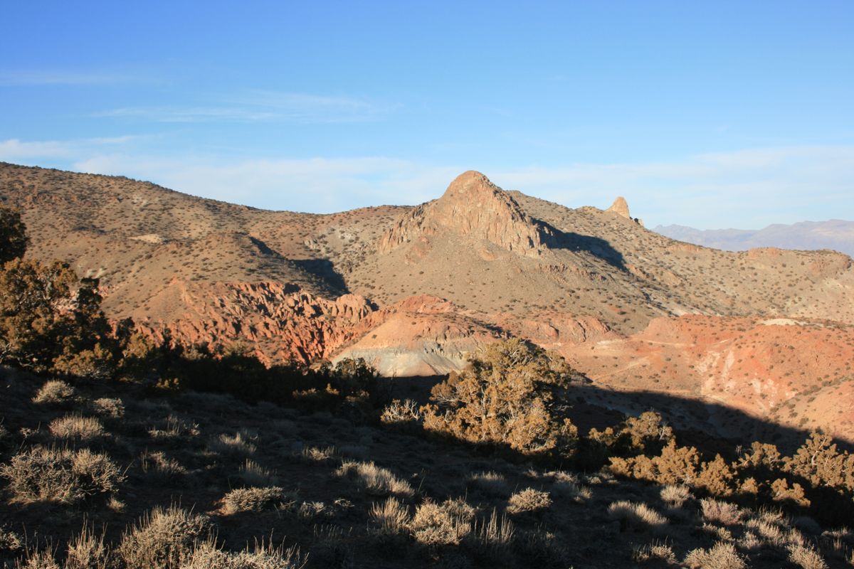
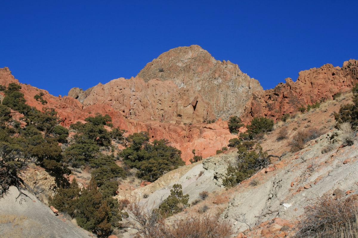
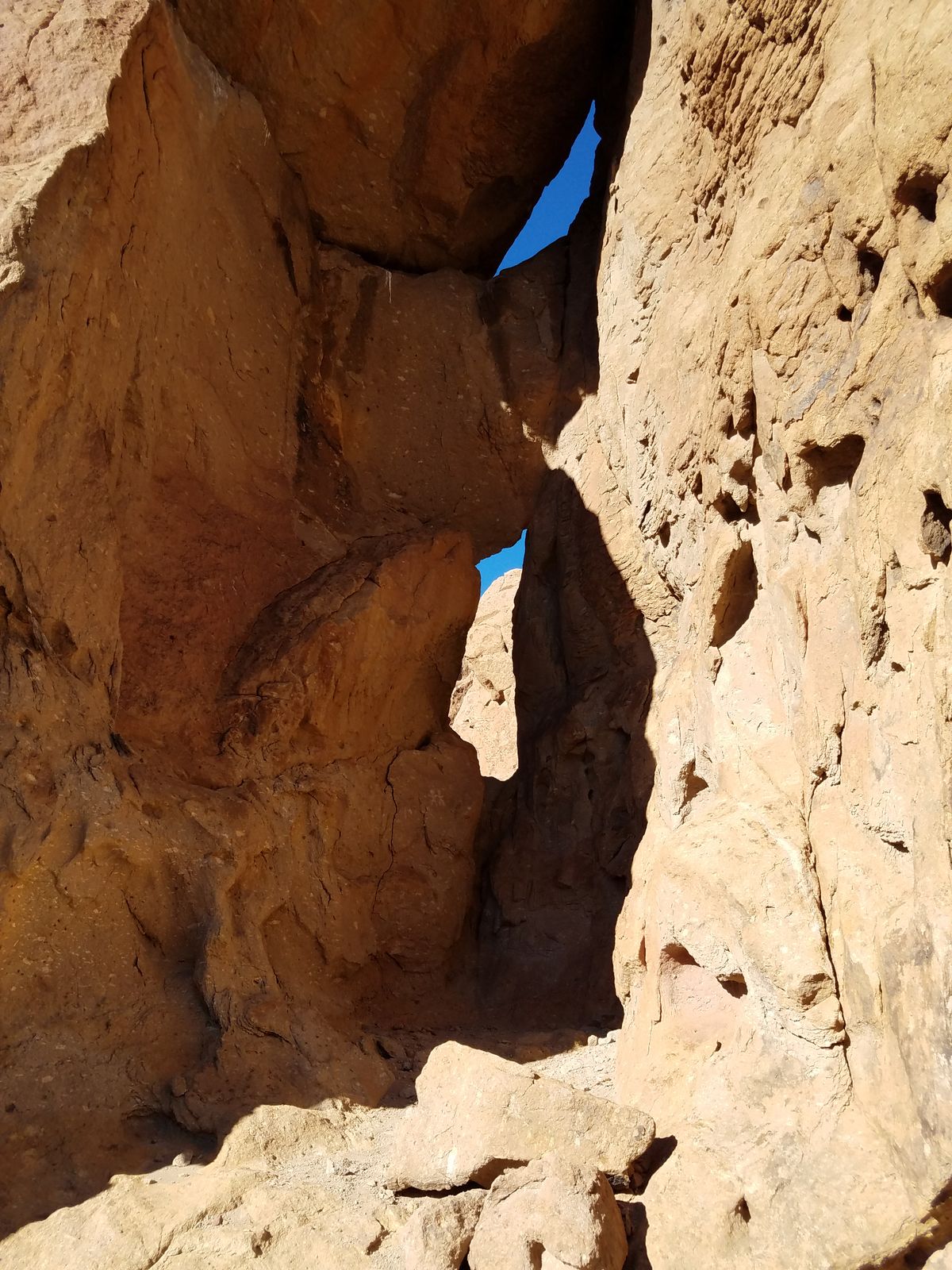
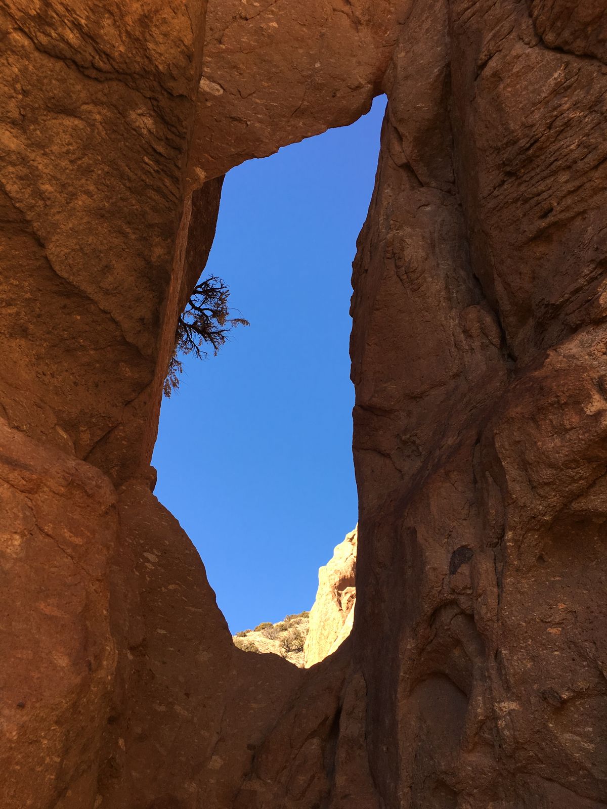
About 25 miles north of Reno, the Incandescent Rocks consist of colorful layers of volcanic rock weathered into photogenic cliffs, buttes, caves, and arches. In this area and the nearby Painted Hills, the hues range from light pinkish and orange to deep red, and contrast strikingly with most of the surrounding area. Indeed, the rocks seem transplanted from the red-rock country of the Colorado Plateau.

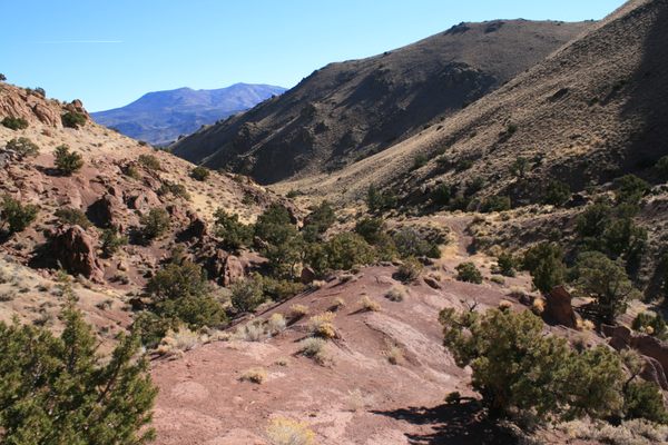
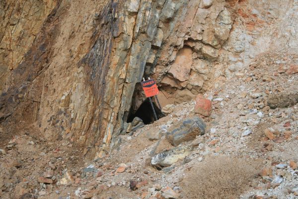
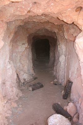
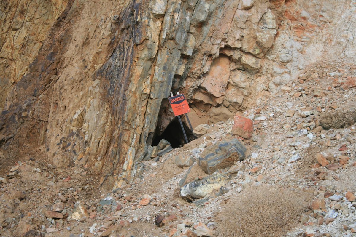
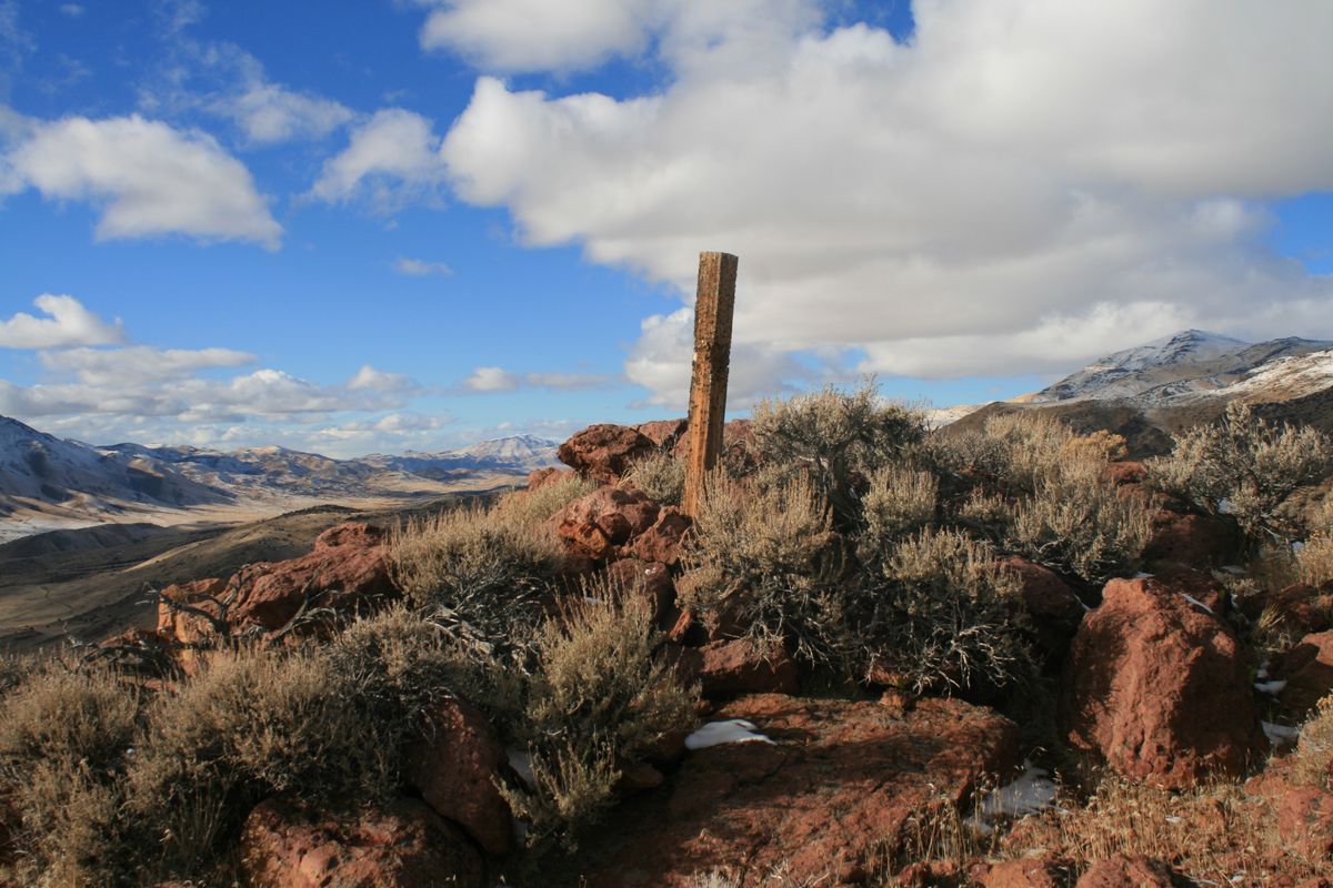
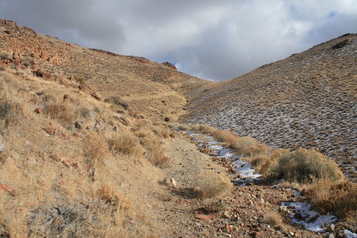
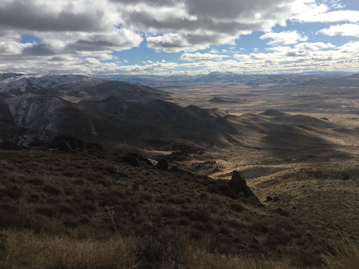
The area was prospected for uranium in the 1950s and there are even a couple of abandoned mines from that era. The old prospecting roads are largely impassible now except to extreme four-wheel-drive vehicles, but they provide a convenient network of access trails. They also remain open to dirt bikes and ATVs, however, so hikers need to exercise some caution. In any event, the terrain is open enough in most areas that cross-country hiking is easy.  

Related Tags

Hiking Geology Rocks

Know Before You Go

Several primitive roads head into the area generally from the south, as shown on the USGS Tule Peak 7.5' quadrangle map. In all cases, high clearance and 4wd are desirable, but even so most vehicles will need to park when the old track becomes too extreme. Begin hiking or biking from this point.

To get to the Incandescent Rocks (west) side, turn west at the intersection of the Pyramid Highway (Nevada State Route 445) with Grass Valley Road (intersection at 39.840392 N, 119.658100 W). Follow this road 2.6 miles. It will bend north, then dogleg west, then go north again, and finally bend slightly to the left at another intersection (at 39.865356 N, 119.677118 W). Go straight north here 0.2 miles to a T-junction (at 36.867901 N, 119.677054 W) with an unimproved road. For the closer access point, turn left and go 0.8 mile to a junction with a primitive road coming in from the right (north) at 39.873105 N, 119.689650 W. For another access point, continue another 0.5 miles west to another intersection with a primitive road at 39.875619 N, 119698979 W. This is the old track that leads to the abandoned mines.

To get to the Painted Hills (east) side, stay on SR 445 to an intersection (at 39.864706 N, 119.646234 W) with a graded (but probably unmarked) road coming in from the left.   Turn here. For one access point, follow this road 1.4 miles to a junction at 39.890427 N, 119.632050 W, where a primitive road comes in from the left.   Another access point is reached 0.3 miles farther, where a primitive road comes in from the left at 39.894214 N, 119.630098 W. When following this road, bear right at the intersection at 39.899251 N, 119.634067 W to continue to the top of the ridge.

Community Contributors

Added By

slgwv

Published

August 3, 2022

Edit this listing

Make an Edit
Add Photos
Sources
  • https://citeseerx.ist.psu.edu/viewdoc/download?doi=10.1.1.258.6094&rep=rep1&type=pdf
  • https://allaroundnevada.com/incandescent-rocks/
  • https://citeseerx.ist.psu.edu/viewdoc/download?doi=10.1.1.258.6094&rep=rep1&type=pdf
  • https://allaroundnevada.com/incandescent-rocks/
Incandescent Rocks
Sutcliffe, Nevada, 89510
United States
39.890773, -119.665833

Nearby Places

Pyramid Lake

Reno, Nevada

miles away

Mud Slough

Nixon, Nevada

miles away

Winnemucca Lake

Nixon, Nevada

miles away

Explore the Destination Guide

Photo of Nevada

Nevada

United States

Places 265
Stories 24

Nearby Places

Pyramid Lake

Reno, Nevada

miles away

Mud Slough

Nixon, Nevada

miles away

Winnemucca Lake

Nixon, Nevada

miles away

Explore the Destination Guide

Photo of Nevada

Nevada

United States

Places 265
Stories 24

Related Places

  • Lake Forest, California

    Red Rock Canyon

    A striking geological formation in Southern California.

  • Mexican Hat

    Mexican Hat, Utah

    Mexican Hat

    This balancing rock is one of Utah's most unusual geological formations.

  • Brady’s Rocks are the southernmost surface exposure of the massive Niagara Escarpment.

    Eagle, Wisconsin

    Brady's Rocks

    These modest Midwestern formations are kin to Niagara Falls' impressive cliffs, more than 600 miles away.

  • Rare foggy day

    Ojai, California

    Piedra Blanca

    Unusual white sandstone formations in the Los Padres National Forest.

  • The Cobbler

    Arrochar, Scotland

    The Cobbler (Ben Arthur)

    This uniquely shaped rock formation is one of Scotland's most iconic mountains and gives spectacular views in all directions.

  • Near eastern mouth of Thousand Creek Gorge.

    Winnemucca, Nevada

    Thousand Creek Gorge

    A spectacular but little-known slot canyon in extreme northern Nevada, with sheer walls nearly 500 feet high and a perennial stream.

  • The Arch

    Ajo, Arizona

    Arch Canyon Trail

    A strenuous, unofficial trail leads to spectacular views in one of America's most remote national monuments.

  • Kisapáti, Hungary

    The Basalt Organ

    Take a hike to this unique rock formation formed by lava flows.

Aerial image of Vietnam, displaying the picturesque rice terraces, characterized by their layered, verdant fields.
Atlas Obscura Membership

Become an Atlas Obscura Member


Join our community of curious explorers.

Become a Member

Get Our Email Newsletter

Follow Us

Facebook YouTube TikTok Instagram Pinterest RSS Feed

Get the app

Download the App
Download on the Apple App Store Get it on Google Play
  • All Places
  • Latest Places
  • Most Popular
  • Places to Eat
  • Random
  • Nearby
  • Add a Place
  • Stories
  • Food & Drink
  • Itineraries
  • Lists
  • Video
  • Podcast
  • Newsletters
  • All Trips
  • Family Trip
  • Food & Drink
  • History & Culture
  • Wildlife & Nature
  • FAQ
  • Membership
  • Feedback & Ideas
  • Community Guidelines
  • Product Blog
  • Unique Gifts
  • Work With Us
  • About
  • FAQ
  • Advertise With Us
  • Advertising Guidelines
  • Privacy Policy
  • Cookie Policy
  • Terms of Use
Atlas Obscura

© 2025 Atlas Obscura. All Rights Reserved.