Trips Places Foods Stories Newsletters

Take your next trip with Atlas Obscura!

Our small-group adventures are inspired by our Atlas of the world's most fascinating places, the stories behind them, and the people who bring them to life.

Visit Adventures
Trips Highlight
Macchu Picchu
Peru • 10 days, 9 nights
Peru: Machu Picchu & the Last Incan Bridges
from
Central Asia yurt night stars
Uzbekistan • 15 days, 14 nights
Central Asia Road Trip: Backroads & Bazaars
from
View all trips
Top Destinations
Latest Places
Most Popular Places Random Place Lists Itineraries
Add a Place
Download the App
Top Destinations
View All Destinations »

Countries

  • Australia
  • Canada
  • China
  • France
  • Germany
  • India
  • Italy
  • Japan

Cities

  • Amsterdam
  • Barcelona
  • Beijing
  • Berlin
  • Boston
  • Budapest
  • Chicago
  • London
  • Los Angeles
  • Mexico City
  • Montreal
  • Moscow
  • New Orleans
  • New York City
  • Paris
  • Philadelphia
  • Rome
  • San Francisco
  • Seattle
  • Stockholm
  • Tokyo
  • Toronto
  • Vienna
  • Washington, D.C.
Latest Places
View All Places »
Customize your bowl with sliced pork, pork balls, fish cake, and offal.
Rung Rueang
A typical Khettara well.
Jorf Khettaras
Little Bighorn Battlefield National Monument
Shadow Room
The Museum of Lost Tales
Latest Places to Eat & Drink
View All Places to Eat »
Customize your bowl with sliced pork, pork balls, fish cake, and offal.
Rung Rueang
Pasties are an Upper Michigan tradition dating back to mining days.
Lehto’s Pasties
Stock up on picnic supplies with a side of history.
Horton Bay General Store
Take some of Michigan’s produce home with you.
American Spoon
The local catch is delicious fried as well.
Terry's of Charlevoix
Recent Stories
All Stories Video Podcast
Most Recent Stories
View All Stories »
Podcast: Finding ‘The Great Gatsby’ in Louisville
33 minutes ago
Here’s which treats you can safely lug home without risking a fine.
Dear Atlas: What International Food Can I Legally Bring Into the U.S.?
1 day ago
Cely’s map is not only accurate, but captures the unique characteristics of Congaree’s trees and waterways.
How One Biologist Drew a Hyper-Accurate, Ranger-Approved Map of Congaree National Park
2 days ago
Though they’re protected inside the park, wolves can be killed when they cross its borders.
Wolves Have a Bad Reputation. One Yellowstone Naturalist Is Trying to Fix It.
2 days ago

No search results found for
“”

Make sure words are spelled correctly.

Try searching for a travel destination.

Places near me Random place

Popular Destinations

  • Paris
  • London
  • New York
  • Berlin
  • Rome
  • Los Angeles
Trips Places Foods Stories Newsletters
Sign In Join
Places near me Random place
All India Leh Kardung La

Kardung La

Over 3 miles up in the Himalayas this pass is one of the highest drivable roads in the world.

Leh, India

Added By
Ken J
Email
Been Here
Want to go
Added to list
The top of Kardung La   John Hill/cc by-sa 4.0
The office and gift shop.   John Hill/cc by-sa 4.0
The (incorrect) elevation marker.   vaidyanathan/cc by-sa 3.0
View of the glacier.   KenJ / Atlas Obscura User
Prayer flags.   KenJ / Atlas Obscura User
Three-mile high club.   KenJ / Atlas Obscura User
Sign with (incorrect) elevation.   KenJ / Atlas Obscura User
Been Here
Want to go
Added to list

About

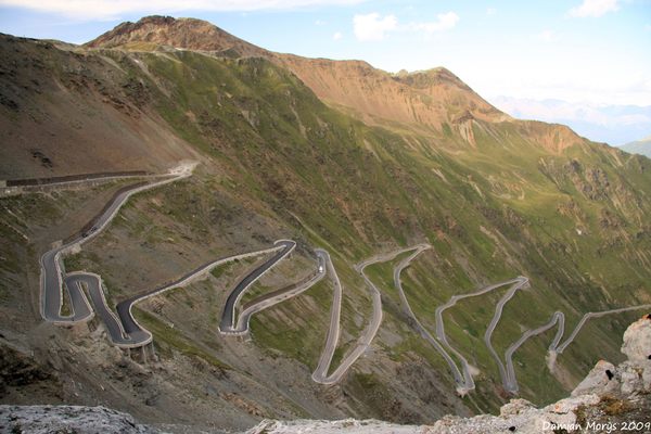
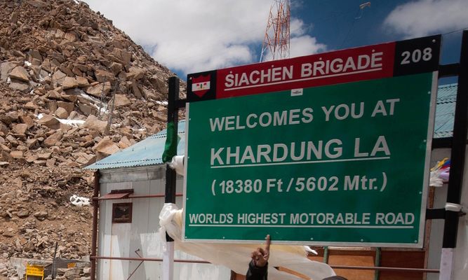
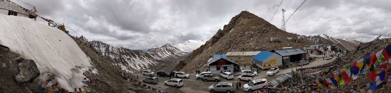
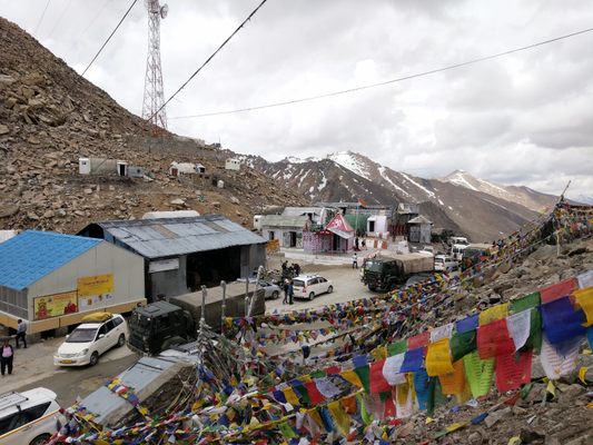
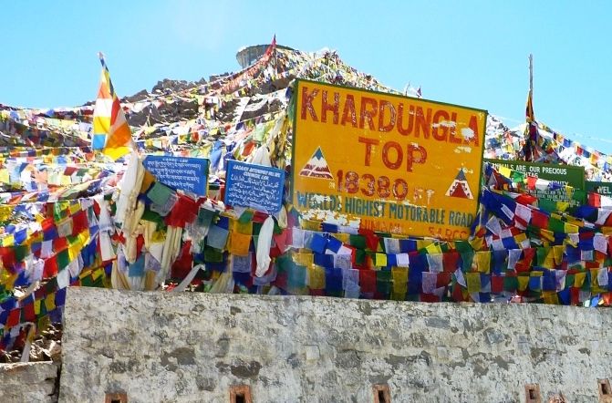
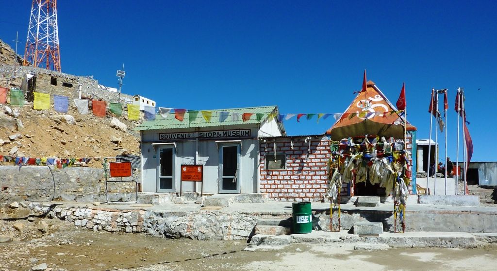
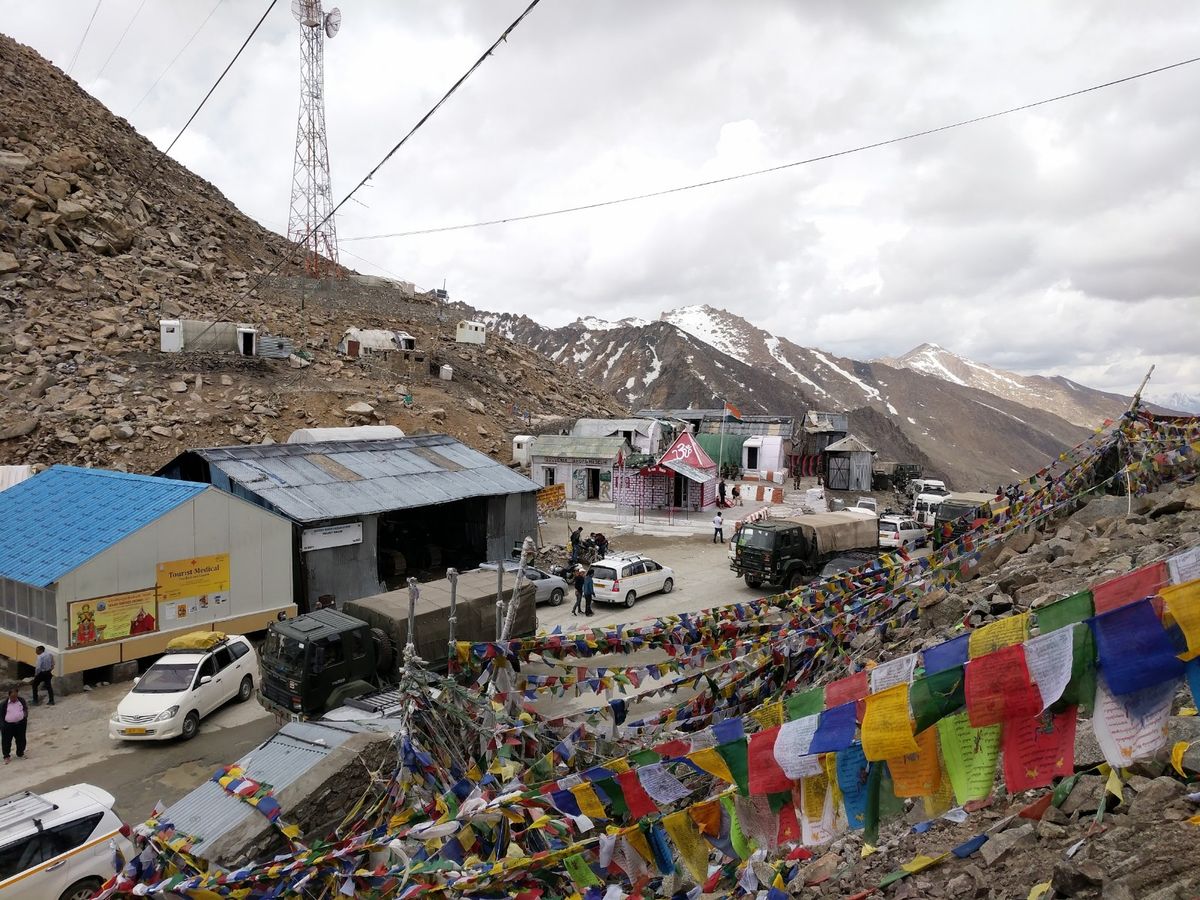
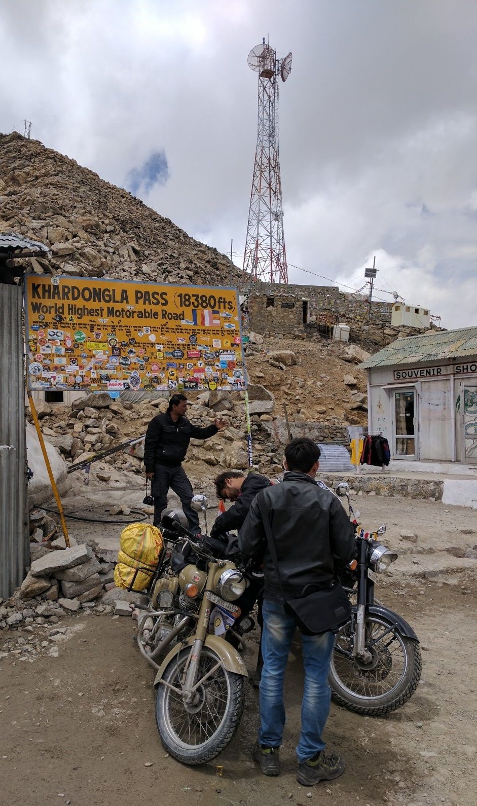
A thousand fluttering prayer flags, a small shrine, the obligatory gift shop, and the extreme elevation (marked incorrectly) on the official Kardung La signpost welcome visitors to a view on top of the world.

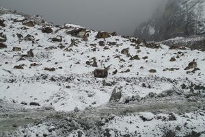
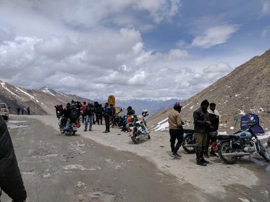
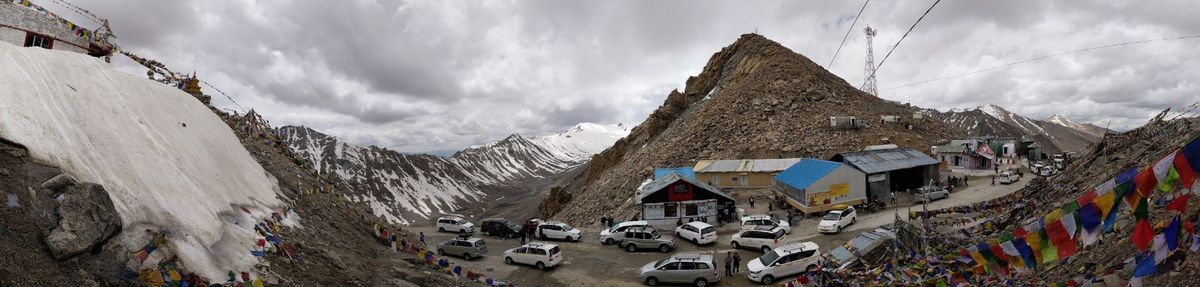
Over 17,500 feet high on the west side of the Himalaya Mountains you'll find this windy roadside marker looking down on glaciers, and a few people celebrating their long journey. This is the top of Kardung La (Kardung Pass), which claims to be the world’s highest motorable road at 3.3 miles above sea level.

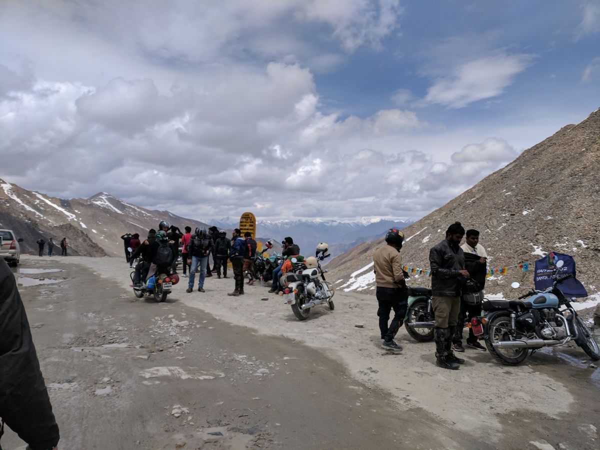
Unlike conquering Mount Everest, there's no need for months of training and tons of supplies to reach Kardung Pass. This roadside point can be accessed in your own car, but a few days at a lower altitude to acclimate your body to the high elevation is a must. Oxygen tanks are also a good idea, even if you're just traveling the roads below.

Like many other extreme places, there is some dispute over how accurate the title "highest road" is. The official government sign claims an elevation of 18,380 feet, but with modern GPS it's widely understood that the pass is actually 17,582 feet high. Other adventurers even dispute the very definition of what a general "road" is and claim nearby roads are higher if you have four-wheel drive to make it up. Regardless of the veracity of the claim, the drive to this marker on top of the world is an amazing journey.

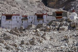
Kardung La is the high spot on the road as it passes from Leh to the Nubra valley. From the pass, you can continue down to the valley below, where you may find camels left behind from the Silk Road days.

Related Tags

World Record Roads Mountains Elevation

Know Before You Go

While it is possible to fly into Leh and simply drive up 25 miles with any local taxi, this is strongly discouraged. The elevation at Leh itself is 11,483 feet (about 2.2 miles), which can cause even healthy people to suffer effects of AMS, possibly even fatal, and traveling to the top of Kardung La adds an additional mile of height.

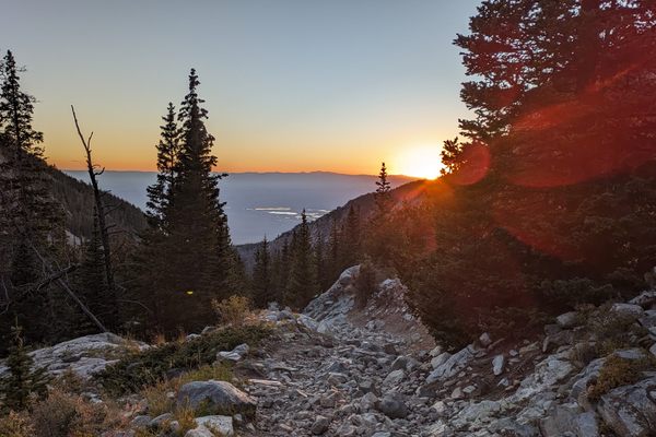
Most people taking up the Kardung La challenge begin at least several hundred miles away at Manali (an elevation of only 1 mile) and space out several overnight stays at or below 2 miles high. This takes several days but the trade-off is that at each rugged pass climbed the scenery changes in incredible ways. In addition to breathtaking views (literally), this journey will span a few cultures as well. Be respectful and carry lots of water, and possibly extra fuel. Permits must be obtained along the way and may be limited, so be prepared to stay overnight with only a few hours of electricity.

Atlas Obscura Adventures

Delhi and Rajasthan: Colors of India

Discover Colorful Rajasthan: From Delhi to Jaipur and Beyond.

Book Now

Community Contributors

Added By

KenJ

Edited By

Meg

  • Meg

Published

July 31, 2019

Edit this listing

Make an Edit
Add Photos
Kardung La
Khardung La Rd
Leh, 194101
India
34.278762, 77.60455
Get Directions

Nearby Places

Zamskhang Palace Ruins

Tegar, India

miles away

Siachen Glacier

India / Pakistan

miles away

Unlock Hundarman Museum of Memories

India

miles away

Explore the Destination Guide

Photo of India

India

Asia

Places 338
Stories 107

Nearby Places

Zamskhang Palace Ruins

Tegar, India

miles away

Siachen Glacier

India / Pakistan

miles away

Unlock Hundarman Museum of Memories

India

miles away

Explore the Destination Guide

Photo of India

India

Asia

Places 338
Stories 107

Related Places

  • Looking down Lake Como road at sunset

    Blanca, Colorado

    Lake Como Road

    The worst road in Colorado is the main gateway to some of its highest peaks.

  • Apishapa Arch

    Aguilar, Colorado

    Apishapa Arch

    A short tunnel built straight through a magmatic dike.

  • The toilet’s signage.

    Fort Valley, Arizona

    Highest Toilet in Arizona

    At 11,500 feet in elevation, there is no toilet in the state closer to the sky than this one.

  • The Nagoe Pass.

    Kamakura, Japan

    Kamakura's Seven Entrances

    Narrow passes cut out of mountains surround the medieval capital of Japan.

  • The top quarter of the Stelvio Pass.

    Stelvio, Italy

    Stelvio Pass

    One of the highest mountain passes in Europe has been ranked among the best driving roads in the world.

  • Tuhinj Valley

    Laze v Tuhinju, Slovenia

    Tuhinj Valley

    A beautiful drive through the foot of the Alps traces the path of 15th-century Turkish raids.

  • The refuge at Chacaltaya, home to the world’s highest restaurant.

    Milluni, Bolivia

    Abandoned Chacaltaya Ski Resort

    The world’s highest ski resort was deserted after an 18,000-year-old glacier melted away.

  • Lake Pontchartrain Causeway.

    New Orleans, Louisiana

    Lake Pontchartrain Causeway

    The world-record holder for the longest bridge stretching continuously over water.

Aerial image of Vietnam, displaying the picturesque rice terraces, characterized by their layered, verdant fields.
Atlas Obscura Membership

Become an Atlas Obscura Member


Join our community of curious explorers.

Become a Member

Get Our Email Newsletter

Follow Us

Facebook YouTube TikTok Instagram Pinterest RSS Feed

Get the app

Download the App
Download on the Apple App Store Get it on Google Play
  • All Places
  • Latest Places
  • Most Popular
  • Places to Eat
  • Random
  • Nearby
  • Add a Place
  • Stories
  • Food & Drink
  • Itineraries
  • Lists
  • Video
  • Podcast
  • Newsletters
  • All Trips
  • Family Trip
  • Food & Drink
  • History & Culture
  • Wildlife & Nature
  • FAQ
  • Membership
  • Feedback & Ideas
  • Community Guidelines
  • Product Blog
  • Unique Gifts
  • Work With Us
  • About
  • FAQ
  • Advertise With Us
  • Advertising Guidelines
  • Privacy Policy
  • Cookie Policy
  • Terms of Use
Atlas Obscura

© 2025 Atlas Obscura. All Rights Reserved.