Trips Places Foods Stories Newsletters

Take your next trip with Atlas Obscura!

Our small-group adventures are inspired by our Atlas of the world's most fascinating places, the stories behind them, and the people who bring them to life.

Visit Adventures
Trips Highlight
Taktsang Lhakhang, also known as the “Tiger’s Nest”.
Bhutan • 11 days, 10 nights
Festivals & Temples of Bhutan
from
Macchu Picchu
Peru • 10 days, 9 nights
Peru: Machu Picchu & the Last Incan Bridges
from
View all trips
Top Destinations
Latest Places
Most Popular Places Random Place Lists Itineraries
Add a Place
Download the App
Top Destinations
View All Destinations »

Countries

  • Australia
  • Canada
  • China
  • France
  • Germany
  • India
  • Italy
  • Japan

Cities

  • Amsterdam
  • Barcelona
  • Beijing
  • Berlin
  • Boston
  • Budapest
  • Chicago
  • London
  • Los Angeles
  • Mexico City
  • Montreal
  • Moscow
  • New Orleans
  • New York City
  • Paris
  • Philadelphia
  • Rome
  • San Francisco
  • Seattle
  • Stockholm
  • Tokyo
  • Toronto
  • Vienna
  • Washington, D.C.
Latest Places
View All Places »
Saint Anthony’s Sign of the Cross
The plane as it lies
Douglas C-47B Crash Site
Museum of Perfume
Charlotte Temple’s Grave
Latest Places to Eat & Drink
View All Places to Eat »
The sign declares this the number-one gumbo shop in town.
Gumbo Hut Shioya
The pavlova comes crowned with jewel-like fruit.
Central Park Boathouse
The Village Tavern of Long Grove - exterior.
The Village Tavern
Hunter House Hamburgers
L’Escamoteur
Recent Stories
All Stories Video Podcast
Most Recent Stories
View All Stories »
Omni Parker House Hotel
The Omni Parker House: Inside the History of Boston’s Most Iconic Hotel
about 3 hours ago
The cute capybara.
Animal Takeover: Brace Yourself for Adorable Hordes
1 day ago
The Codex Gigas (the Devil’s Bible) open to the portrait of the devil.
Codex Gigas: Who Drew the Devil in This Massive Medieval Bible?
2 days ago
USDA and Washington State agriculture officials tagged this Asian giant hornet. Sept. 10, 2021.
What Ever Happened to the Murder Hornets?
3 days ago

No search results found for
“”

Make sure words are spelled correctly.

Try searching for a travel destination.

Places near me Random place

Popular Destinations

  • Paris
  • London
  • New York
  • Berlin
  • Rome
  • Los Angeles
Trips Places Foods Stories Newsletters
Sign In Join
Places near me Random place
All Guatemala Guatemala City Mapa en Relieve
AO Edited

Mapa en Relieve

An impressive century-old, to-scale topographical map of Guatemala.

Guatemala City, Guatemala

Added By
Meg Neal
Email
Been Here
Want to go
Added to list
Eastern coast of guatemala, showing what was ehne British honduras (Now Belize).   dfculbert / Atlas Obscura User
Volcanos!   Meg Neal
Relief Map.   Meg Neal
Pacific ocean border to the left.   Meg Neal
The line of tall volcanos by the Pacific coast creates the ideal conditions for growing coffee.   Meg Neal
Details of the map.   Meg Neal
Relief Map.   Meg Neal
A plaque at the site.   Meg Neal
Bust of the engineer, Francisco Vela.   Meg Neal
Relief Map.   Meg Neal
The view from atop one of the observation towers.   Meg Neal
Replica of Lake Atitlan. Surrounded by volcanos, it’s often described as the most beautiful lake in the world.   Meg Neal
Awesome   Collector of Experiences / Atlas Obscura User
Been Here
Want to go
Added to list

About

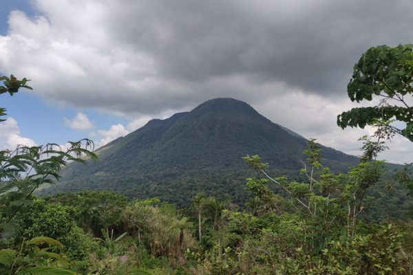
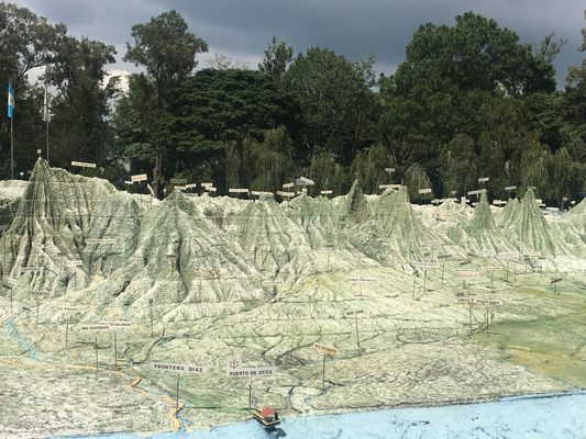
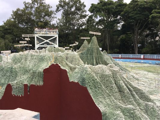
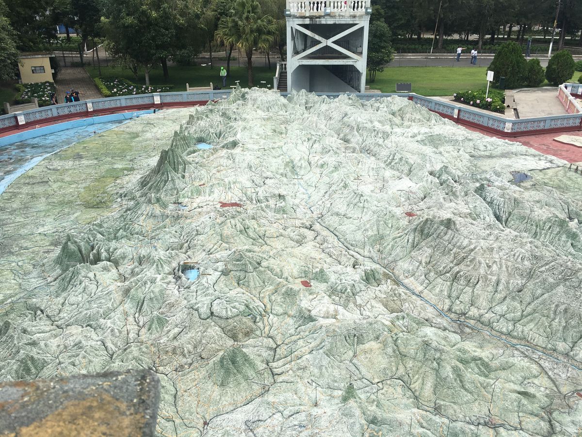
For a relatively small country (at about 42,000 square miles it’s roughly the size of Tennessee), Guatemala has an exceptionally diverse climate packed within its borders. The landscape ranges from lush tropical jungles to Pacific blank sand beaches to snow-peaked, high-elevation volcanoes. The best way to get a snapshot of this unique geography is right in the center of the capital city, at this century-old, to-scale topographical map of the country.

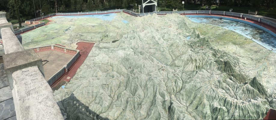
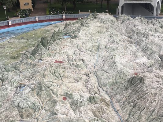
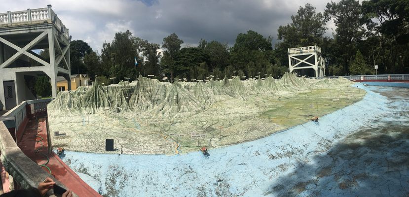
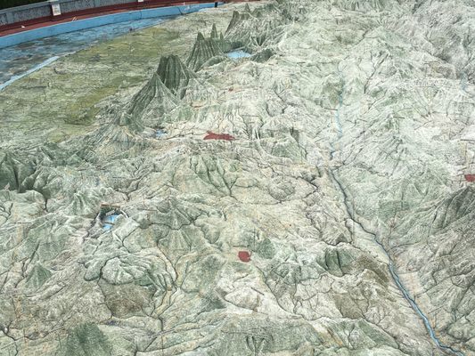
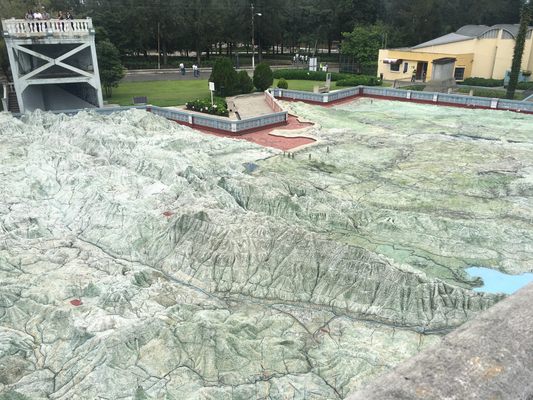
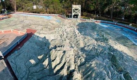
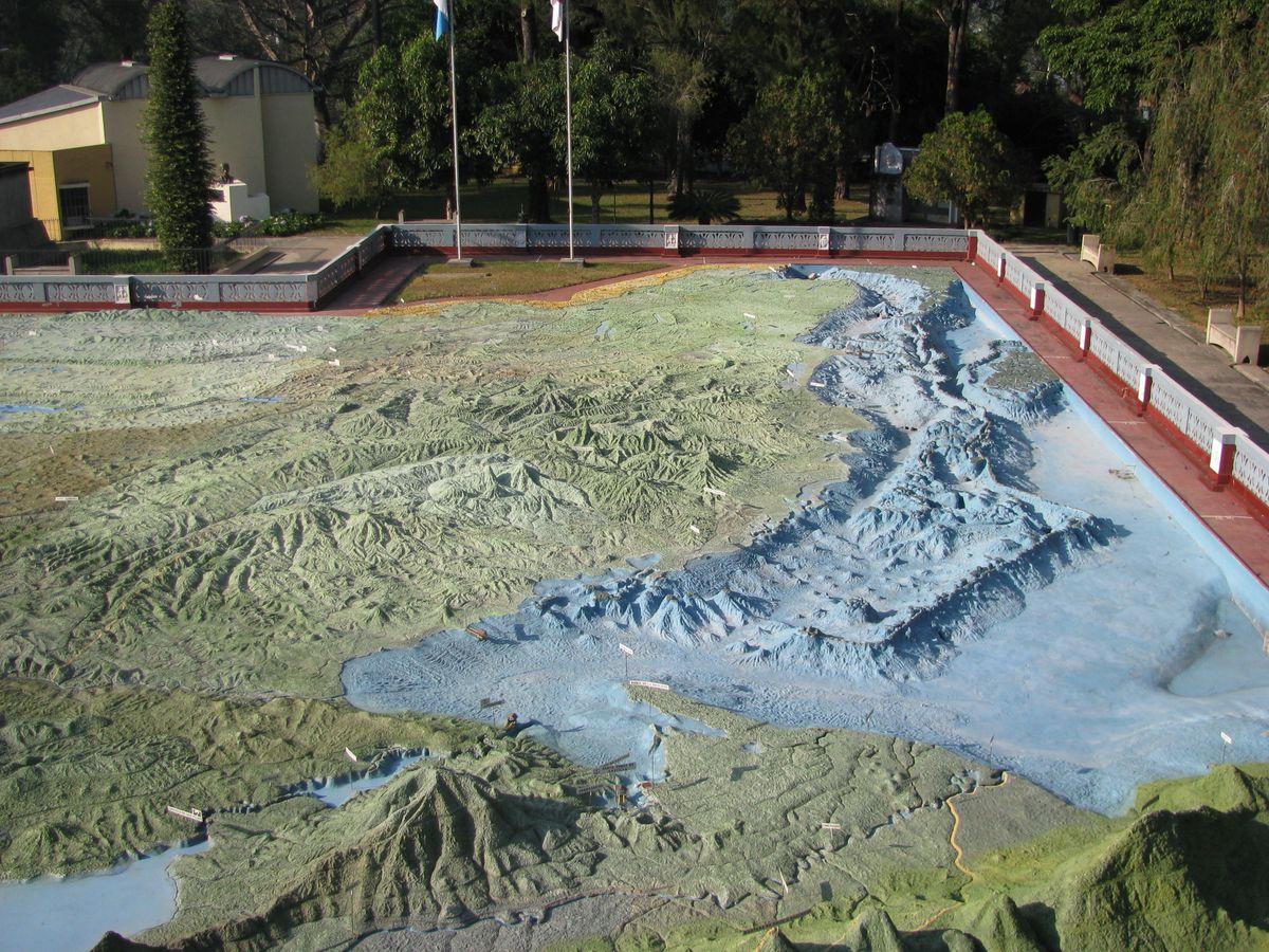
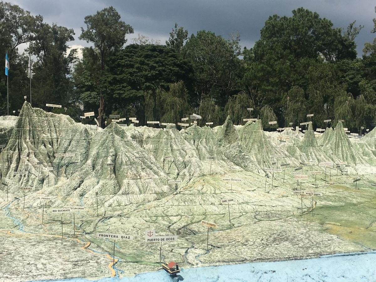
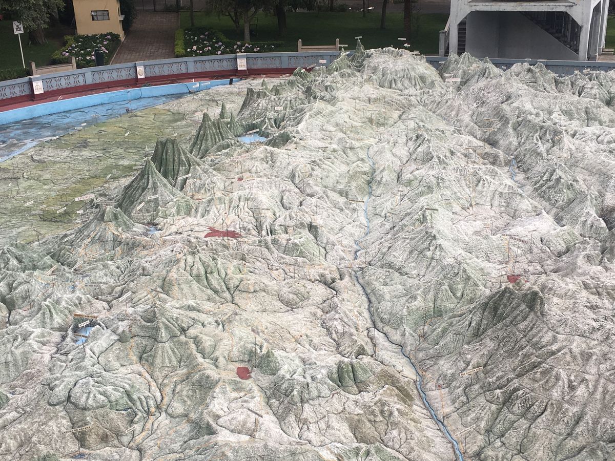
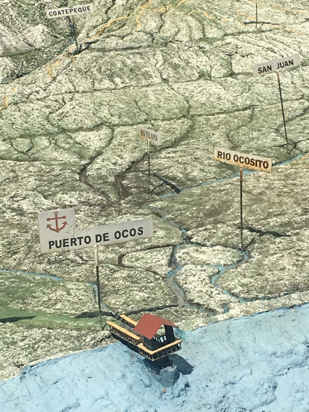
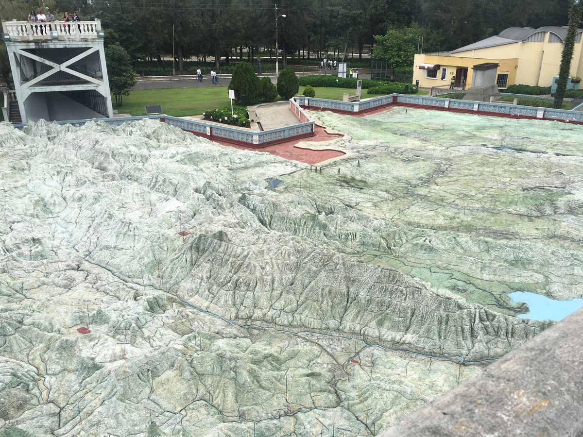
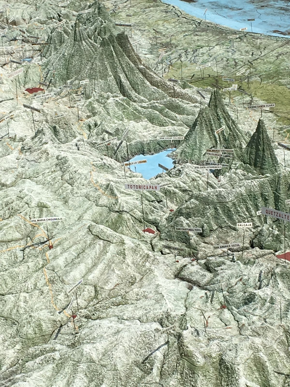
The Mapa en Relieve (Relief Map) in Guatemala City is a large, impressively accurate 3D replica of the country's remarkable terrain. It depicts in intricate detail the major cities, towns, volcanoes, rivers, lakes, plateaus, and valleys blanketing the landscape, at a scale of 1:10,000 kilometers. This is all the more impressive considering the map was made more than 100 years ago, without the help of satellites and modern technology.

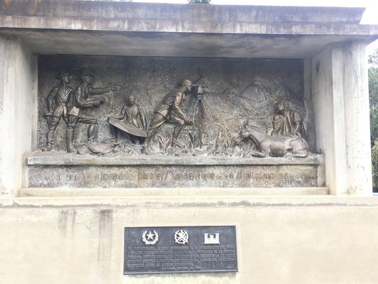
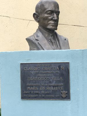
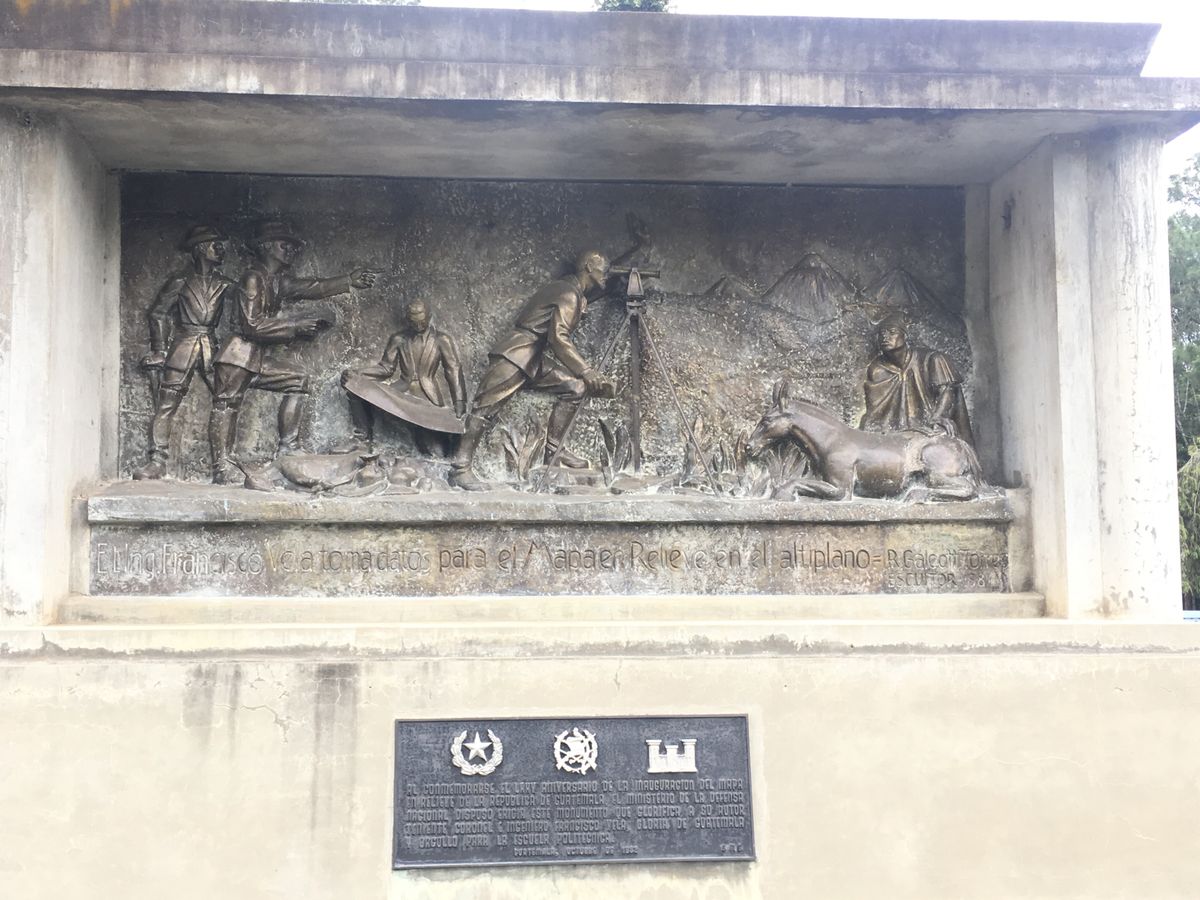
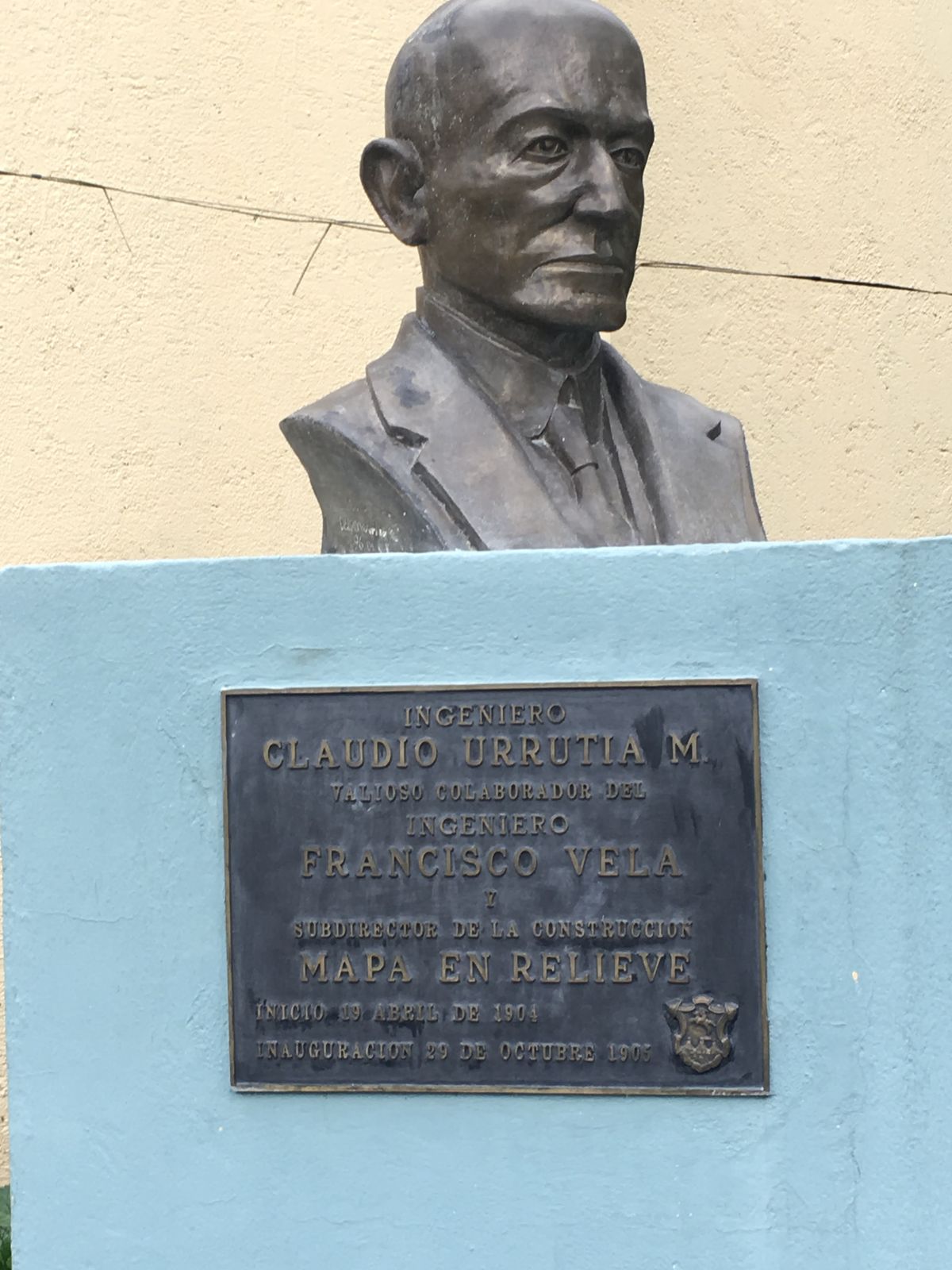
The map was unveiled in 1905. Its creators spent some 15 years traveling the country by donkey and horseback surveying the highs and lows of the land. Engineer Francisco Vela directed the construction of the map, and Costa Rican engineer Claudio Urrutia was the main explorer. He even invented a tool to help accurately measure the topography, a theodolite called the "Mira Urrutia", or Urrutia Viewer. (He is only now getting recognition for his accomplishments, thanks to the help of his descendants.)

Once the wealth of data was collected, it took Vela’s team 18 months to build the map. All these years (and several major hurricanes) later, the map still stands intact, though a little worse for the wear. It's a real engineering wonder and a gem of Guatemala City. But while it's regularly visited by schoolchildren in the area, the relief map is frequently overlooked by tourists. That's a shame, because for visitors planning to travel around the country, taking in a birds-eye view of the landscape from one of the site’s observation towers is the perfect starting point to get your bearings. 

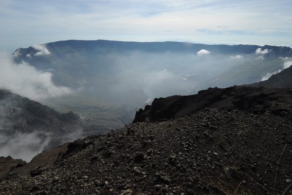
Looking down at the counters of the map, you’re struck by how extremely mountainous the terrain is, except at the coasts (the country is bordered by the Pacific and Caribbean) and the vast stretch of lowlands to the north. The landscape is covered in hills, valleys, rivers, and lush forests. (The name Guatemala is derived from a Mayan word for a “place of many trees.”) There are 37 volcanoes packed into the highlands, three of which are active. At an elevation of nearly 14,000 feet, Tajumulco Volcano is the highest point in Central America.

The 1,800-square-foot map (which, due to the era it was made includes Belize, now a free sovereign independent country) is one of the only cement 3D scale maps in the world. But even more impressive is the rare glimpse it provides at this country's uniquely beautiful landscape.

Related Tags

Maps Marvelous Maps And Measures Geographic Markers Mountains Volcanoes Science Engineering Geology

Know Before You Go

Located at Parque Minerva at the end of Av. Simon Cañas in Zone 2. Cost is 25Q

Community Contributors

Added By

Meg

Edited By

Collector of Experiences, cpmaverick, kostas1964ath, linkogecko...

  • Collector of Experiences
  • cpmaverick
  • kostas1964ath
  • linkogecko
  • wesbydesigns
  • dfculbert

Published

September 7, 2017

Edit this listing

Make an Edit
Add Photos
Sources
  • http://www.revuemag.com/2011/07/guatemala-in-scale/
  • https://www.tripadvisor.com/Attraction_Review-g292006-d309362-Reviews-Relief_Map-Guatemala_City_Guatemala_Department.html
Mapa en Relieve
Av. Simeón Cañas
Guatemala City
Guatemala
14.660365, -90.508787
Visit Website
Get Directions

Nearby Places

Pinula Aqueduct

Guatemala City, Guatemala

miles away

All Saints Day Kite Festival

Santiago Sacatepéquez, Guatemala

miles away

Casa Popenoe

Antigua, Guatemala

miles away

Explore the Destination Guide

Photo of Guatemala City

Guatemala City

Guatemala

Places 3
Stories 1

Nearby Places

Pinula Aqueduct

Guatemala City, Guatemala

miles away

All Saints Day Kite Festival

Santiago Sacatepéquez, Guatemala

miles away

Casa Popenoe

Antigua, Guatemala

miles away

Explore the Destination Guide

Photo of Guatemala City

Guatemala City

Guatemala

Places 3
Stories 1

Related Places

  • Winona, Missouri

    Rocky Falls

    A 40-foot waterfall flows into this unique natural swimming hole.

  • Tambora’s caldera.

    Indonesia

    Mount Tambora

    Mount Tambora is the site of the largest and deadliest volcanic eruption in recorded human history.

  • Obsidian Dome

    June Lake, California

    Obsidian Dome

    A natural dome made of volcanic glass in Inyo National Forest.

  • The museum has other letters, mementoes and equipment.

    Brisbane, Australia

    Museum of Lands, Mapping, and Surveying

    Its collection highlights the monumental tasks undertaken to map Queensland.

  • Vaalserberg, Vaals, Netherlands.

    Vaals, Netherlands

    Vaalserberg

    The tallest mountain in mainland Netherlands isn't actually very tall.

  • Mount Banahaw.

    Quezon, Philippines

    Mount Banahaw

    This volcano in the Philippines is believed to have miraculous healing powers.

  • Cabezon Peak

    New Mexico

    Cabezon Peak

    This towering volcanic plug stands out among the dramatic formations that dot this otherworldly desert valley.

  • The datum.

    Stockholm, Sweden

    Normalhöjdpunkten

    Hidden in plain sight, Sweden's official ordnance datum is now abandoned.

Aerial image of Vietnam, displaying the picturesque rice terraces, characterized by their layered, verdant fields.
Atlas Obscura Membership

Become an Atlas Obscura Member


Join our community of curious explorers.

Become a Member

Get Our Email Newsletter

Follow Us

Facebook YouTube TikTok Instagram Pinterest RSS Feed

Get the app

Download the App
Download on the Apple App Store Get it on Google Play
  • All Places
  • Latest Places
  • Most Popular
  • Places to Eat
  • Random
  • Nearby
  • Add a Place
  • Stories
  • Food & Drink
  • Itineraries
  • Lists
  • Video
  • Podcast
  • Newsletters
  • All Trips
  • Family Trip
  • Food & Drink
  • History & Culture
  • Wildlife & Nature
  • FAQ
  • Membership
  • Feedback & Ideas
  • Community Guidelines
  • Product Blog
  • Unique Gifts
  • Work With Us
  • About
  • FAQ
  • Advertise With Us
  • Advertising Guidelines
  • Privacy Policy
  • Cookie Policy
  • Terms of Use
Atlas Obscura

© 2025 Atlas Obscura. All Rights Reserved.