Trips Places Foods Stories Newsletters

Take your next trip with Atlas Obscura!

Our small-group adventures are inspired by our Atlas of the world's most fascinating places, the stories behind them, and the people who bring them to life.

Visit Adventures
Trips Highlight
Macchu Picchu
Peru • 10 days, 9 nights
Peru: Machu Picchu & the Last Incan Bridges
from
Central Asia yurt night stars
Uzbekistan • 15 days, 14 nights
Central Asia Road Trip: Backroads & Bazaars
from
View all trips
Top Destinations
Latest Places
Most Popular Places Random Place Lists Itineraries
Add a Place
Download the App
Top Destinations
View All Destinations »

Countries

  • Australia
  • Canada
  • China
  • France
  • Germany
  • India
  • Italy
  • Japan

Cities

  • Amsterdam
  • Barcelona
  • Beijing
  • Berlin
  • Boston
  • Budapest
  • Chicago
  • London
  • Los Angeles
  • Mexico City
  • Montreal
  • Moscow
  • New Orleans
  • New York City
  • Paris
  • Philadelphia
  • Rome
  • San Francisco
  • Seattle
  • Stockholm
  • Tokyo
  • Toronto
  • Vienna
  • Washington, D.C.
Latest Places
View All Places »
Al Jazirah Al Hamra Heritage Village
Complejo Cultural Fábrica Imbabura
Guptill's Arena
In this deceptively simple dish, top-quality ingredients are paramount.
Kor Panich
Latest Places to Eat & Drink
View All Places to Eat »
In this deceptively simple dish, top-quality ingredients are paramount.
Kor Panich
Customize your bowl with sliced pork, pork balls, fish cake, and offal.
Rung Rueang
Pasties are an Upper Michigan tradition dating back to mining days.
Lehto’s Pasties
Stock up on picnic supplies with a side of history.
Horton Bay General Store
Take some of Michigan’s produce home with you.
American Spoon
Recent Stories
All Stories Video Podcast
Most Recent Stories
View All Stories »
Podcast: Finding ‘The Great Gatsby’ in Louisville
about 10 hours ago
Here’s which treats you can safely lug home without risking a fine.
Dear Atlas: What International Food Can I Legally Bring Into the U.S.?
1 day ago
Cely’s map is not only accurate, but captures the unique characteristics of Congaree’s trees and waterways.
How One Biologist Drew a Hyper-Accurate, Ranger-Approved Map of Congaree National Park
3 days ago
Though they’re protected inside the park, wolves can be killed when they cross its borders.
Wolves Have a Bad Reputation. One Yellowstone Naturalist Is Trying to Fix It.
3 days ago

No search results found for
“”

Make sure words are spelled correctly.

Try searching for a travel destination.

Places near me Random place

Popular Destinations

  • Paris
  • London
  • New York
  • Berlin
  • Rome
  • Los Angeles
Trips Places Foods Stories Newsletters
Sign In Join
Places near me Random place
All the United States Maine Millinocket Mount Katahdin

Mount Katahdin

The highest point in Maine is a grand gift to the state citizens that also happens to be one end of the Appalachian Trail.

Millinocket, Maine

Added By
Thomas Harper
Email
Been Here
Want to go
Added to list
Mount Katahdin   Rebecca on Flickr
Mount Katahdin   Josh Delp on Flickr
  Mitch Lang / Atlas Obscura User
Katahdin from Abol Bridge   nrudiak / Atlas Obscura User
  Mitch Lang / Atlas Obscura User
Katahdin In Fall   nrudiak / Atlas Obscura User
  Mitch Lang / Atlas Obscura User
Been Here
Want to go
Added to list

About

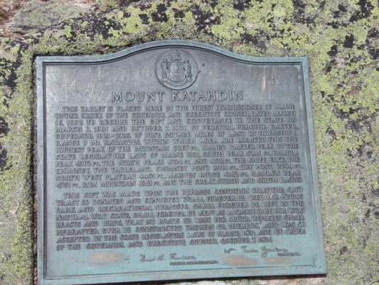
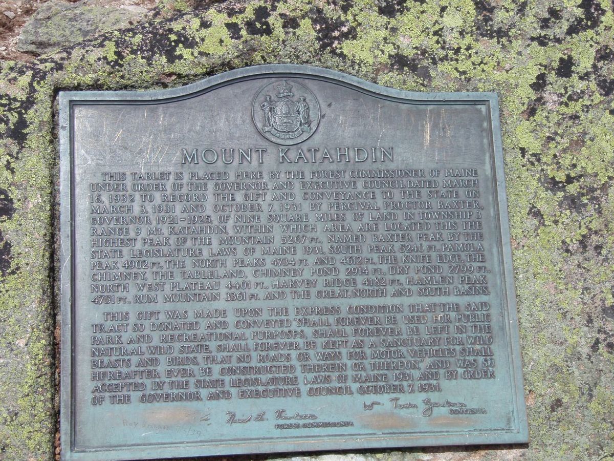
"Man is born to die. His works are short-lived. Buildings crumble, monuments decay, wealth vanishes. But Katahdin in all its glory, forever shall remain the mountain of the people of Maine." - Percival Baxter

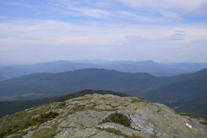
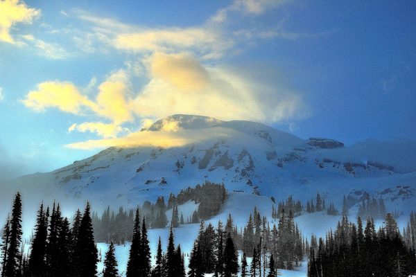
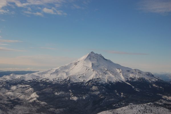
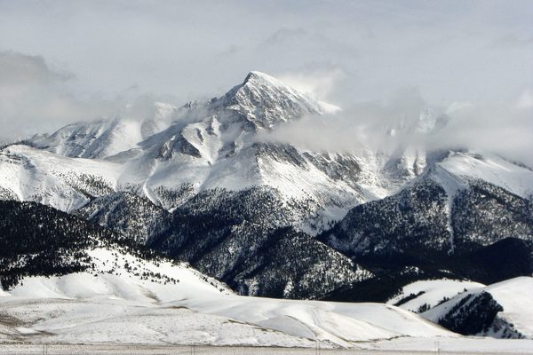
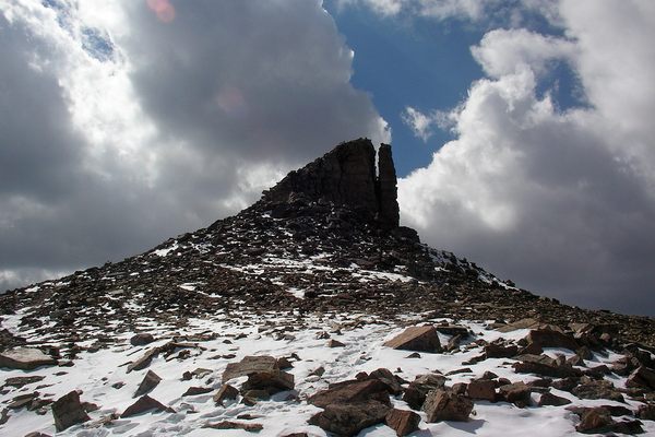
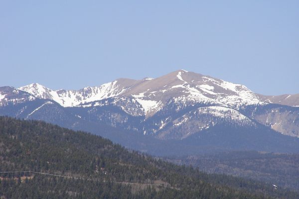
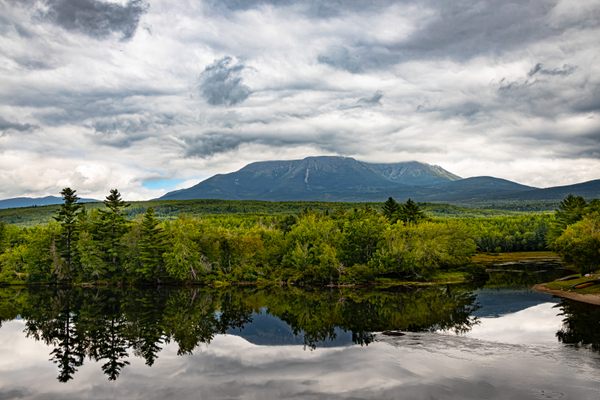
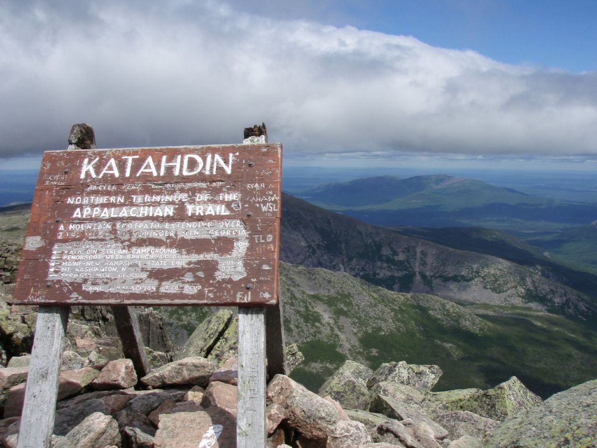
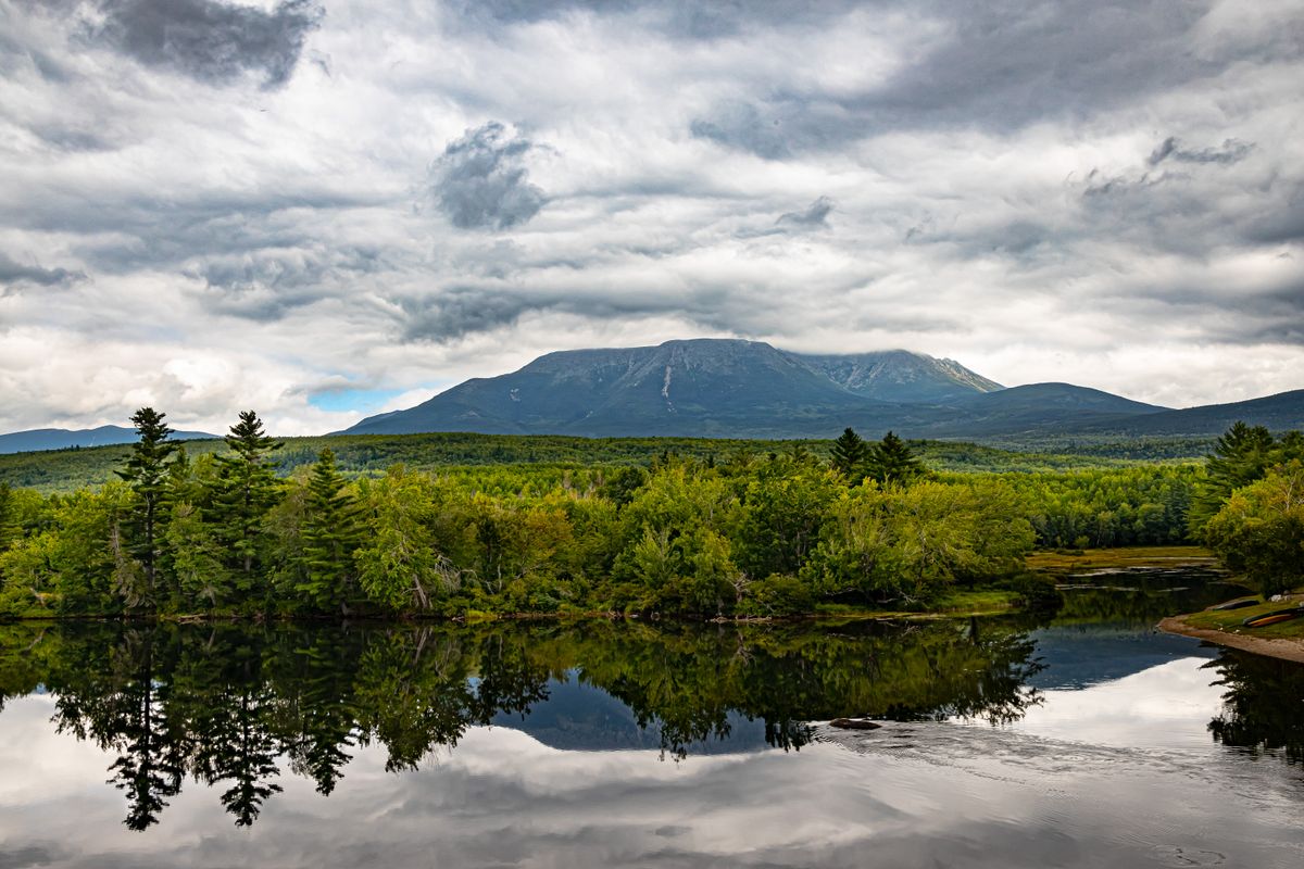
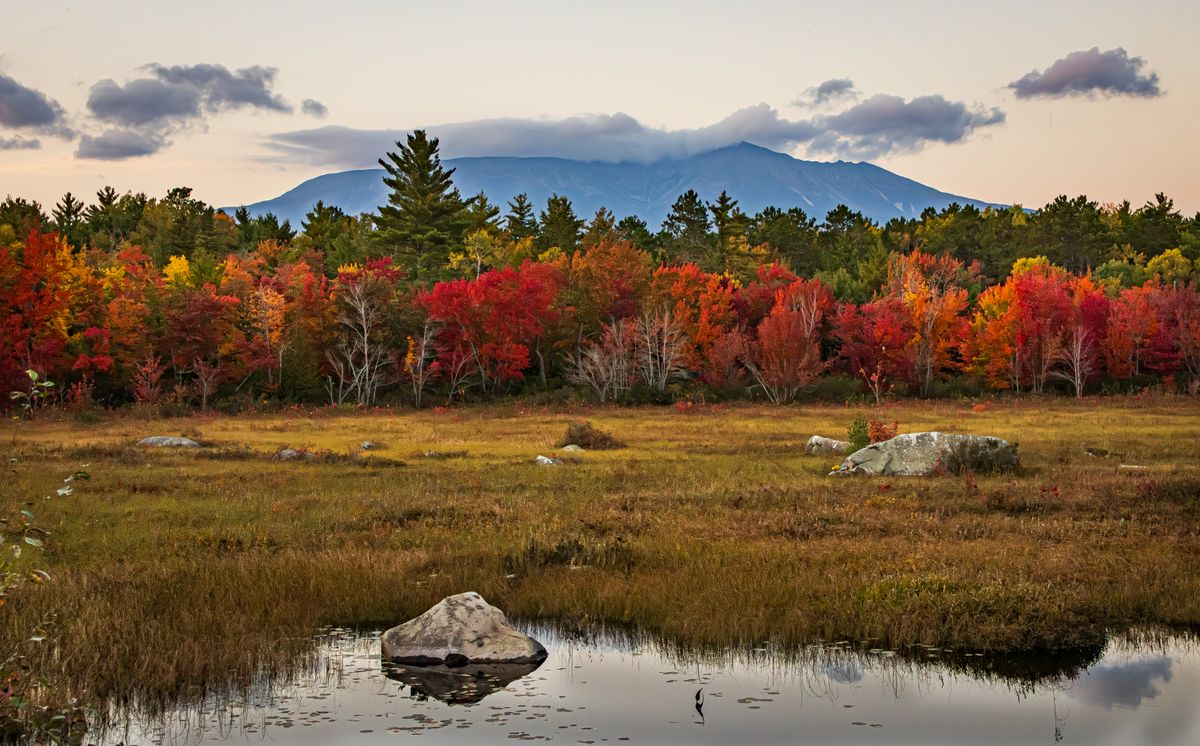
Named Mount Katahdin, meaning "The Greatest Mountain," by the Penobscot American Indians, this scenic mountain is many things to many people including the northern end of the Appalachian Trail and the highest point in Maine at 5,270 feet above sea level, but above all it is a gift to the citizens of Maine. 

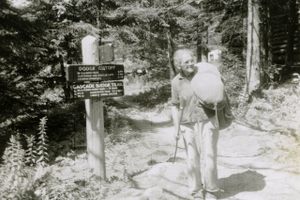
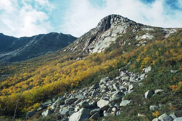
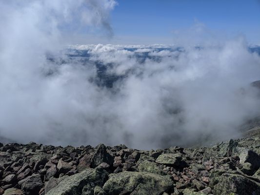
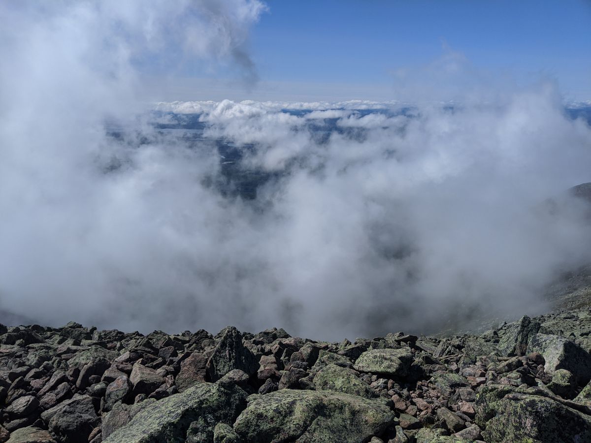
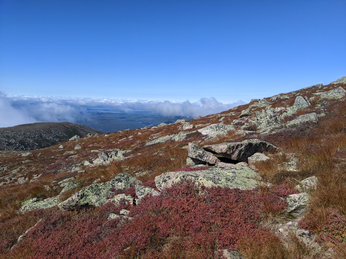
To highpointers and peakbaggers, Katahdin is one of the most difficult hikes in the eastern part of the country. Eight main trails of varying difficulty can be climbed, the easiest of which, the Hunt/Appalachian Trail, has a mile-long scramble up 1,000 feet over a boulder field. Iron rungs have even been added to assist climbers on the scramble in its most difficult parts. The Hunt Trail runs 5.2 miles up to the summit, known as Baxter Peak, and almost half of the hike is above the tree line. Climbers on this route might also see hikers who have hiked all the way up from Georgia, with this the final push toward their Appalachian finish.

To hikers, Katahdin is the northern end of the Appalachian Trail. The trail is usually hiked from south to north, starting at Springer Mountain, Georgia, starting in March or April and finishing on Katahdin in late summer or early autumn. Hikers wishing to complete the trail may opt to be "section-hikers," who hike the trail one section at a time over a period of years, or "thru-hikers," who complete the trail in one months-long hike.

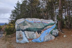
To Mainers, the Katahdin climb is a rite of passage. Governor Percival Baxter, heir to a large real estate and fish canning fortune, bought the land around the mountain and deeded it to the people of Maine. Now known as Baxter State Park, the park's mission is to be left as wild as possible. It has its own Authority and is not part of the Maine system. It has its own regulations. There are no paved roads, gas stations, or electricity in the park. Access is controlled through reservations, of which Maine residents get first choice. Maine residents also enter the park for free. Visitors should make reservations online or be at the Togue Pond gate well before it opens at 6 AM to enter the park.

To photographers, Katahdin forms a backdrop for incredible nature and wildlife photography. Fall foliage peak is typically in early October. Winter blankets the mountain and surroundings with snow. Over 180 types of birds have been sighted in the park.

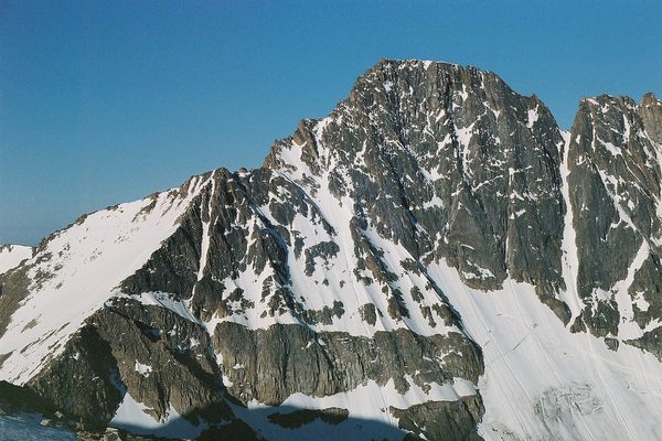
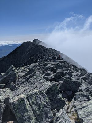
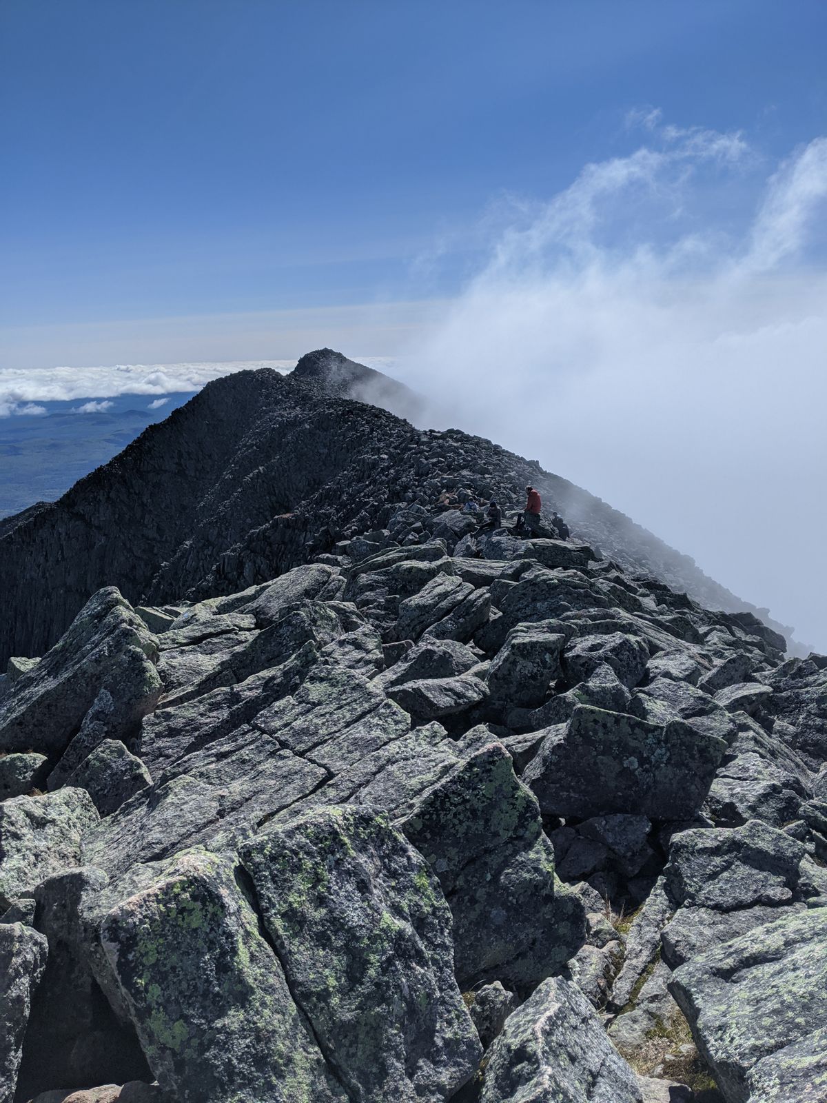
To mountaineers, Katahdin is a challenging winter climb, has many rock climbing areas, and is also home to the Knife Edge. This ridge connects Pamola Peak with Baxter Peak and is completely exposed. In places the ridge is only three feet wide. There have been fatalities on the ridge due to falls and exposure.

Related Tags

Mountains State High Points Geographic Markers

Know Before You Go

For the Hunt / Appalachian Trail, from Millinocket, ME, go 18 miles to the Togue Pond gate house. On entering, turn left and drive 7.7 miles to the Katahdin Stream campground. Hike 5.2 miles to the summit.

Community Contributors

Added By

thomasharper

Edited By

EricGrundhauser, Mitch Lang, nrudiak

  • EricGrundhauser
  • Mitch Lang
  • nrudiak

Published

July 1, 2014

Edit this listing

Make an Edit
Add Photos
Sources
  • http://www.summitpost.org/katahdin/150219
  • http://en.wikipedia.org/wiki/Appalachian_Trail
  • http://en.wikipedia.org/wiki/Percival_Baxter
  • http://en.wikipedia.org/wiki/Mount_Katahdin
  • http://www.baxterstateparkauthority.com/pdf/outdoors/BSP%2049%20Birdlist.pdf
Mount Katahdin
Mount Katahdin
Millinocket, Maine, 04462
United States
45.904491, -68.922267
Get Directions

Nearby Places

Pockwockamus Rock

Millinocket, Maine

miles away

Eagle Lake Tramway

Northwest Piscataquis, Maine

miles away

Katahdin Iron Works

Brownville, Maine

miles away

Explore the Destination Guide

Photo of Millinocket

Millinocket

Maine

Places 2

Nearby Places

Pockwockamus Rock

Millinocket, Maine

miles away

Eagle Lake Tramway

Northwest Piscataquis, Maine

miles away

Katahdin Iron Works

Brownville, Maine

miles away

Explore the Destination Guide

Photo of Millinocket

Millinocket

Maine

Places 2

Related Stories and Lists

The First Woman to Thru-Hike the Appalachian Trail Alone Did It as a 'Lark'

women

By Philip D'Anieri

The Most Wondrous State Parks to Visit During the Government Shutdown

List

By Kerry Wolfe

The Highest Places in America

List

By Meg Neal

The Summit Scaling Subculture of Highpointing

geographic markers

By Thomas Harper

Related Places

  • Mount Denali

    Denali National Park and Preserve, Alaska

    Denali

    The king of U.S. high points towers over every other peak on the continent.

  • Mount Rainier

    Ashford, Washington

    Mount Rainier

    The highest point in Washington state is a volcano covered in glaciers.

  • Mount Hood

    Government Camp, Oregon

    Mount Hood

    Despite a legend that says this highest peak in Oregon was climbed in high heels, scores of people have died on its slopes.

  • Gannett Peak

    Cora, Wyoming

    Gannett Peak

    The easiest way to the highest point in Wyoming is only accessible via one hefty fee.

  • Granite Peak

    Granite Peak

    The highest point in Montana is as rugged and singular as the state itself.

  • Borah Peak

    Mackay, Idaho

    Borah Peak

    This highest peak in Idaho can only be reached by traversing a formation known as "Chicken-Out Ridge."

  • Kings Peak

    Duchesne County, Utah

    Kings Peak

    The highest peak in Utah is the hardest to reach, but only if explorers choose the hard way.

  • Wheeler Peak

    Taos Ski Valley, New Mexico

    Wheeler Peak

    This highest peak in New Mexico is named after an explorer who had a habit of lending his moniker to peaks.

Aerial image of Vietnam, displaying the picturesque rice terraces, characterized by their layered, verdant fields.
Atlas Obscura Membership

Become an Atlas Obscura Member


Join our community of curious explorers.

Become a Member

Get Our Email Newsletter

Follow Us

Facebook YouTube TikTok Instagram Pinterest RSS Feed

Get the app

Download the App
Download on the Apple App Store Get it on Google Play
  • All Places
  • Latest Places
  • Most Popular
  • Places to Eat
  • Random
  • Nearby
  • Add a Place
  • Stories
  • Food & Drink
  • Itineraries
  • Lists
  • Video
  • Podcast
  • Newsletters
  • All Trips
  • Family Trip
  • Food & Drink
  • History & Culture
  • Wildlife & Nature
  • FAQ
  • Membership
  • Feedback & Ideas
  • Community Guidelines
  • Product Blog
  • Unique Gifts
  • Work With Us
  • About
  • FAQ
  • Advertise With Us
  • Advertising Guidelines
  • Privacy Policy
  • Cookie Policy
  • Terms of Use
Atlas Obscura

© 2025 Atlas Obscura. All Rights Reserved.