Trips Places Foods Stories Newsletters

Take your next trip with Atlas Obscura!

Our small-group adventures are inspired by our Atlas of the world's most fascinating places, the stories behind them, and the people who bring them to life.

Visit Adventures
Trips Highlight
Borneo orangutan
Malaysia • 12 days, 11 nights
Wild Borneo: Secrets of an Ancient Rainforest
from
Pastel de nata
Portugal • 8 days, 7 nights
Portugal: A Culinary Adventure from Porto to Lisbon
from
View all trips
Top Destinations
Latest Places
Most Popular Places Random Place Lists Itineraries
Add a Place
Download the App
Top Destinations
View All Destinations »

Countries

  • Australia
  • Canada
  • China
  • France
  • Germany
  • India
  • Italy
  • Japan

Cities

  • Amsterdam
  • Barcelona
  • Beijing
  • Berlin
  • Boston
  • Budapest
  • Chicago
  • London
  • Los Angeles
  • Mexico City
  • Montreal
  • Moscow
  • New Orleans
  • New York City
  • Paris
  • Philadelphia
  • Rome
  • San Francisco
  • Seattle
  • Stockholm
  • Tokyo
  • Toronto
  • Vienna
  • Washington, D.C.
Latest Places
View All Places »
The cave is in a hillside not far from Algeria’s National Library.
The Cave of Cervantes
Glymur
Bones on display in the museum.
RSU Anatomy Museum
The sign declares this the number-one gumbo shop in town.
Gumbo Hut Shioya
Latest Places to Eat & Drink
View All Places to Eat »
The sign declares this the number-one gumbo shop in town.
Gumbo Hut Shioya
The pavlova comes crowned with jewel-like fruit.
Central Park Boathouse
The Village Tavern of Long Grove - exterior.
The Village Tavern
Hunter House Hamburgers
L’Escamoteur
Recent Stories
All Stories Video Podcast
Most Recent Stories
View All Stories »
 Fenway Park at night
How Was Your First Trip With Your Significant Other?
32 minutes ago
Ivan the Terra Bus
The Bus, the Myth, the Legend: Ivan the Terra Bus
1 day ago
Pigeons were included in a series of 1891 illustrations entitled “Household Pets.”
What Makes a Pest a Pest?
2 days ago
Burros Alfa and Beto, seen here with Luis Soriano in 2008, have been helping the teacher deliver books for more than 20 years.
How One Man and His ‘Biblioburro’ Spreads Literacy in Rural Colombia
4 days ago

No search results found for
“”

Make sure words are spelled correctly.

Try searching for a travel destination.

Places near me Random place

Popular Destinations

  • Paris
  • London
  • New York
  • Berlin
  • Rome
  • Los Angeles
Trips Places Foods Stories Newsletters
Sign In Join
Places near me Random place
All the United States Washington, D.C. Potomac Park Flood Levee

Potomac Park Flood Levee

This mysterious structure by the Washington Monument is a flood barrier designed to protect the White House against rising waters.

Washington, D.C.

Added By
Elliot Carter
Email
Been Here
Want to go
Added to list
View of the Potomac Park Levee   Elliot Carter
Photo from Washington Monument. Yellow dashes indicate 17th Street   Library of Congress
Floodmap of downtown D.C.   Army Corps of Engineers
  Jason Michael Walker / Atlas Obscura User
  breaingram / Atlas Obscura User
  Collector of Experiences / Atlas Obscura User
Levee   bribolio / Atlas Obscura User
  Runawaydc / Atlas Obscura User
  MtnLady / Atlas Obscura User
  Jason Michael Walker / Atlas Obscura User
Been Here
Want to go
Added to list

About

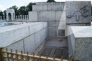
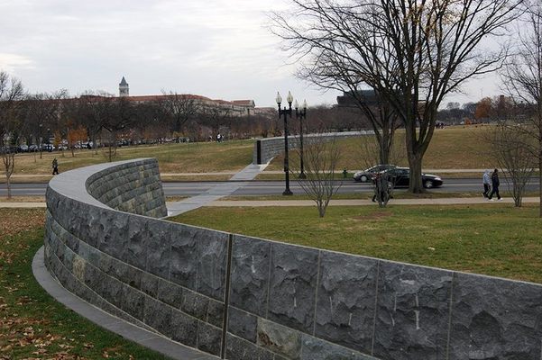
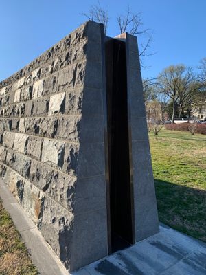
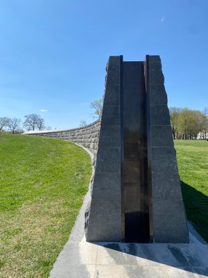
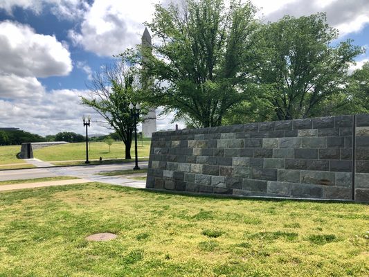
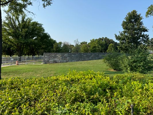
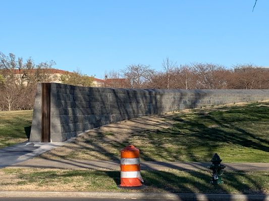
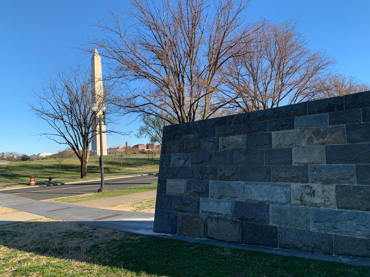
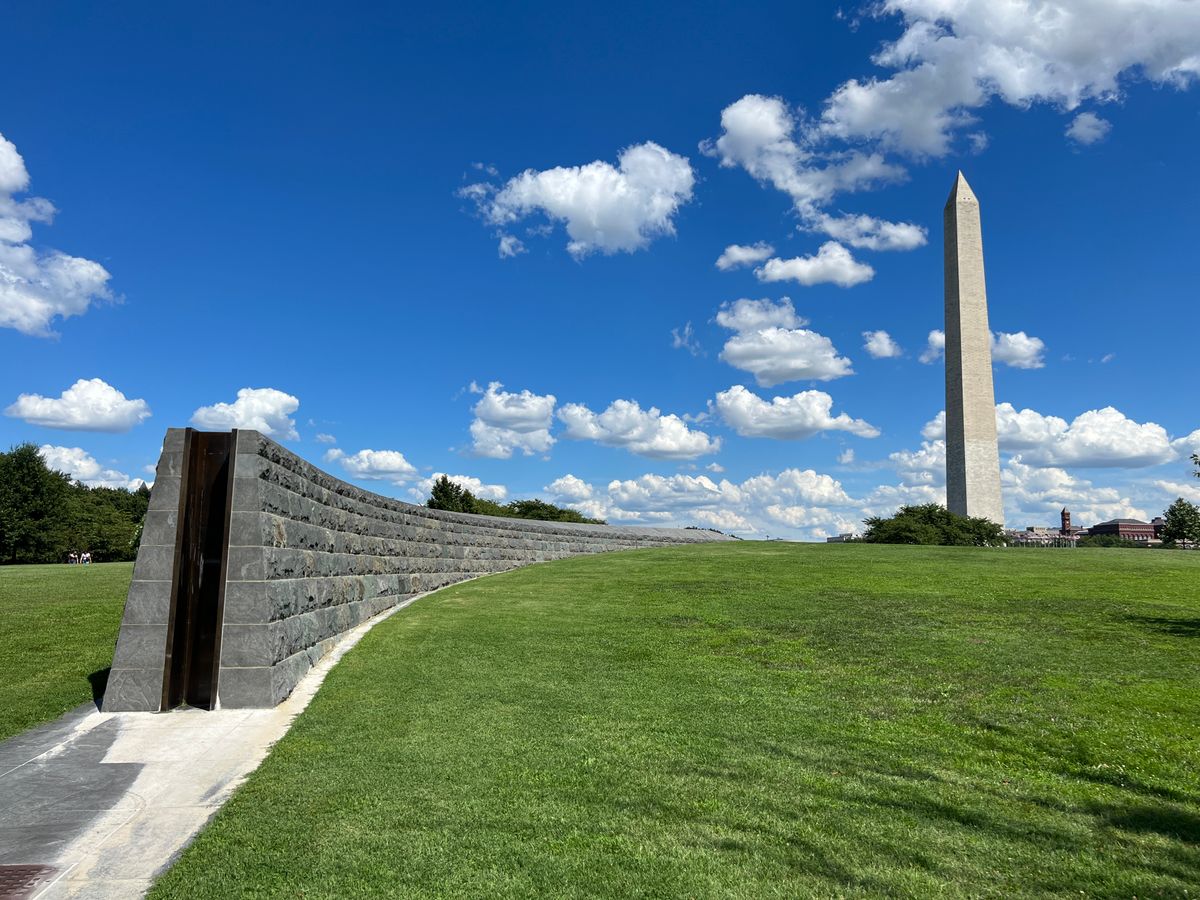
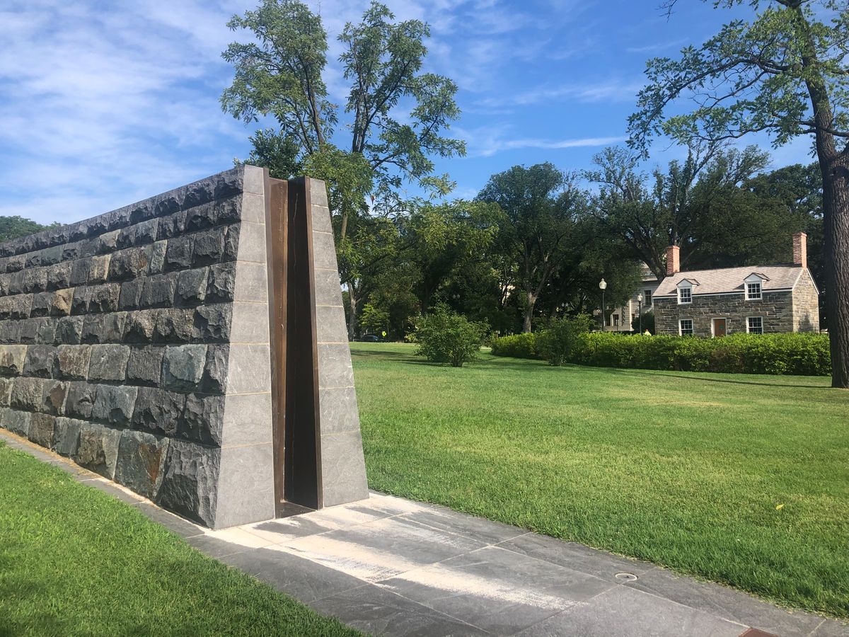
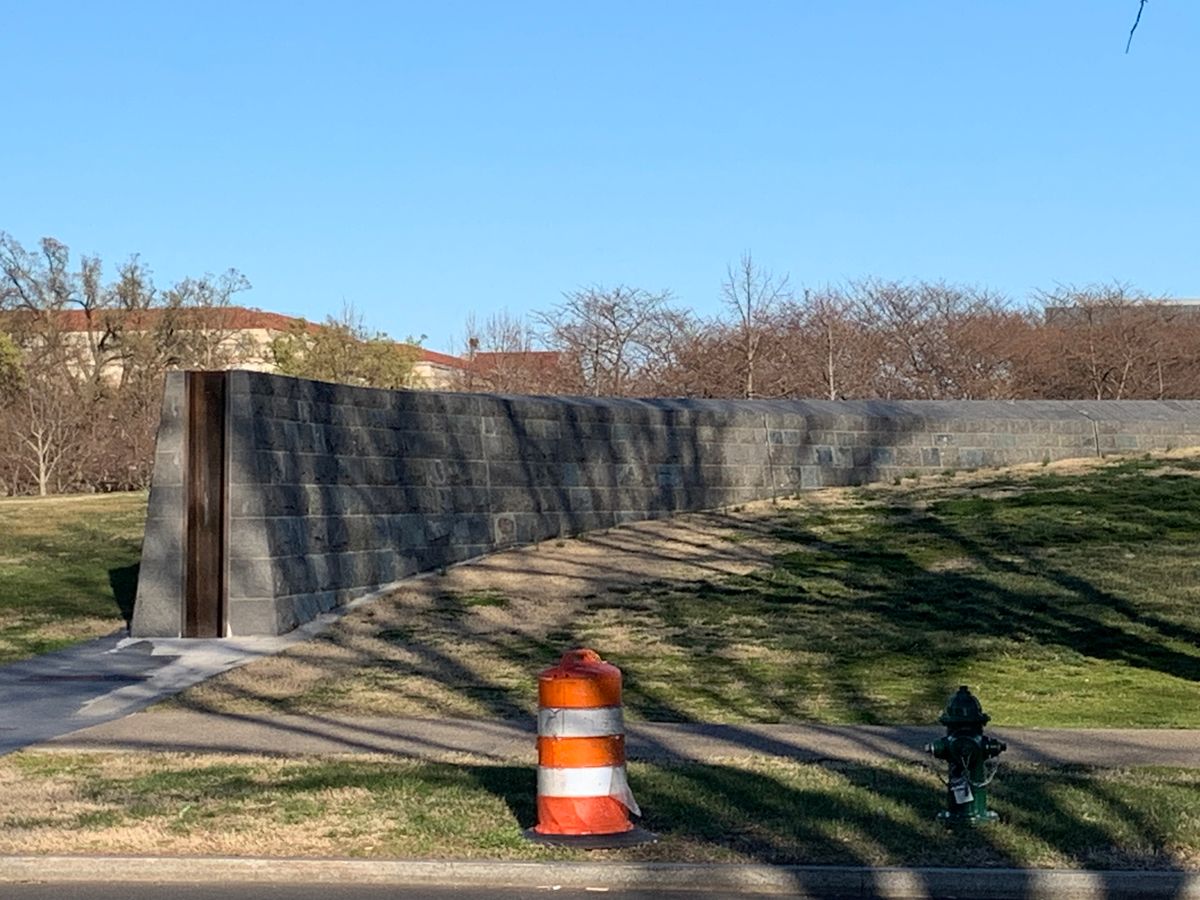
These stone walls by the Washington Monument aren’t a part of any memorial or historic structure. They’re part of a temporary dam that can span 17th Street and hold back a 100-year flood. The dam is the newest part of the 80-year-old Potomac Park levee.

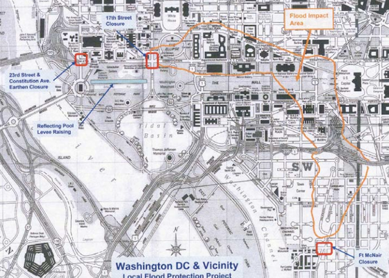
Washington's Federal Triangle neighborhood is uniquely vulnerable to flooding. First, the area is built on low lying land; if the river crests East Potomac Park it would quickly rush downhill and inundate the cross streets off Constitution Avenue. The second threat comes from rain runoff; Federal Triangle is the lowest point in a drainage basin stretching from the ballpark to Fort Totten.

The stakes are even higher because of what’s in those Federal Triangle buildings. Flood damage to the National Archives, EPA, IRS and Department of Justice could be devastating.

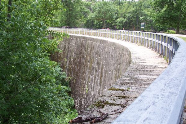
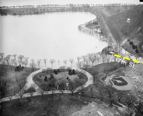
The original Potomac Park Levee was a temporary structure built during a flood in 1936 to keep rising waters from reaching downtown. That weather event spurred Congress to authorize the construction of a larger earthen barrier and make the levee permanent. The Army Corps of Engineers completed the project in 1939. Most people walking along the sloping footpaths around the tidal basin don't realize that they're standing on manmade berms that were carefully laid out to prevent a watery disaster.

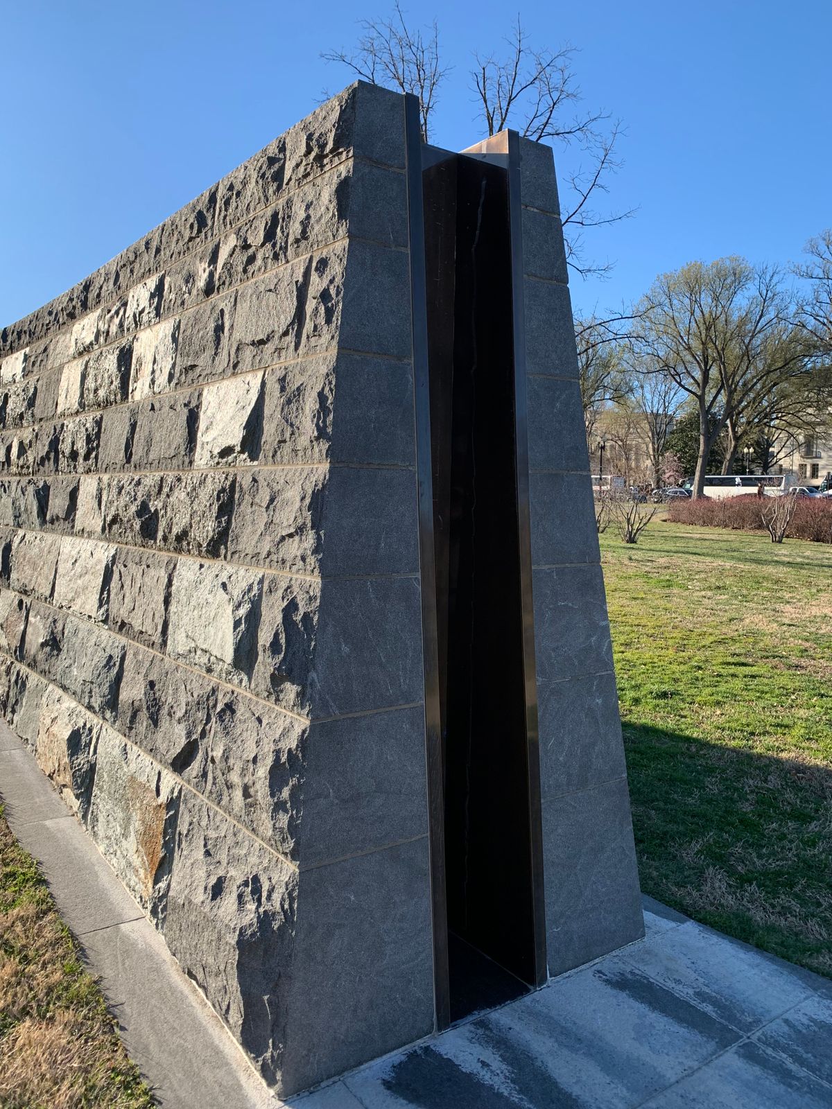
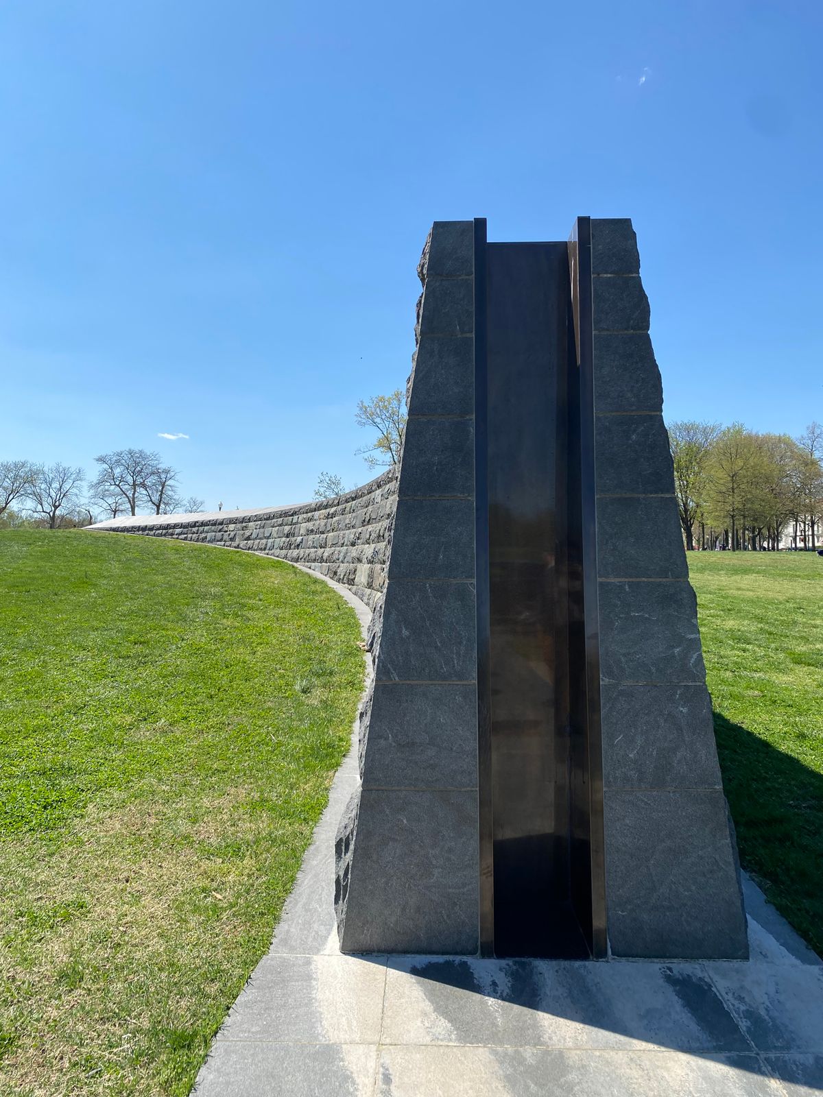
17th Street was the only gap in the levee—a deliberate but foolish engineering decision. The gap provided a pleasant even grade for automobile drivers traveling north to south, and it centralized the risk of a flood, so during a storm engineers could focus their efforts on a single preplanned fail-safe rather than fighting the waters at a thousand different locations along the levee.

In the event of flood conditions, the plan called for a hastily built sandbag wall to plug the gap. Unfortunately, in the case of the floods of 1937, 1942, 1972, and 2006, that wasn’t good enough.

Washington finally moved to address the issue with construction of the present-day stone and cement structure. The gap in the center can be filled in with posts and panels that are capable of holding back waters up to 19 feet above sea level. They’re stored ready to go on trucks in Bladensburg and can be assembled in a few hours. The crews practice once a year to keep up their readiness and check the equipment.

Related Tags

Government Water Dams Climate Change Floods Infrastructure

Know Before You Go

The Potomac Park Levee is in between the Washington Monument and the Lincoln Memorial, on 17th Street.

Community Contributors

Added By

Elliot Carter

Edited By

Collector of Experiences, breaingram, bribolio, Jason Michael Walker...

  • Collector of Experiences
  • breaingram
  • bribolio
  • Jason Michael Walker
  • MtnLady
  • Runawaydc

Published

January 12, 2017

Edit this listing

Make an Edit
Add Photos
Sources
  • http://architectofthecapital.org/posts/2016/12/4/potomac-park-levee
Potomac Park Flood Levee
17th Street & Constitution Avenue NW
Washington, District of Columbia
United States
38.891351, -77.039459
Get Directions

Nearby Places

The Lockkeeper's House

Washington, D.C.

miles away

Organization of American States Building

Washington, D.C.

miles away

Kilroy Was Here

Washington, D.C.

miles away

Explore the Destination Guide

Photo of Washington, D.C.

Washington, D.C.

United States

Places 285
Stories 50

Related Places

  • The never-used headgate structure at the west end of the dam.

    Bend, Oregon

    Tumalo Dam

    The ruins of a failed dam that was built over land later described as a "sponge."

  • The Pilchowice dam and hydroelectric power plant (north end)

    Pilchowice, Poland

    Pilchowice Hydroelectic Dam

    The tallest stone dam in Poland was opened by Kaiser Wilhelm II himself.

  • Lower area of the spillway.

    Lenexa, Kansas

    Lake Lenexa Dam and Spillway

    An artistically engineered dam designed to honor the relationship between humankind and nature.

  • Water up to the spillway at high water levels in June, 2017.

    Fallon, Nevada

    Lahontan Dam and the Newlands Project

    The first project by the Bureau of Reclamation illustrates both the upsides and downsides of reclamation.

  • Parker Dam seen from Arizona.

    Parker, Arizona

    Parker Dam

    This huge dam across the Colorado River caused an armed standoff between two U.S. states.

  • Stone Arch Dam.

    Elgin, Ontario

    The Stone Arch Dam

    Thanks to its curved shape, this incredibly durable dam "whispers" to visitors.

  • Covão dos Conchos.

    Portugal

    Covão dos Conchos

    This gaping hole in the middle of a remote mountain lake looks like a portal to another dimension.

  • Memorial.

    South Yorkshire, England

    Dale Dyke Dam Marker and Memorials

    The collapse of the brand-new dam caused one of the worst floods in British history.

Aerial image of Vietnam, displaying the picturesque rice terraces, characterized by their layered, verdant fields.
Atlas Obscura Membership

Become an Atlas Obscura Member


Join our community of curious explorers.

Become a Member

Get Our Email Newsletter

Follow Us

Facebook YouTube TikTok Instagram Pinterest RSS Feed

Get the app

Download the App
Download on the Apple App Store Get it on Google Play
  • All Places
  • Latest Places
  • Most Popular
  • Places to Eat
  • Random
  • Nearby
  • Add a Place
  • Stories
  • Food & Drink
  • Itineraries
  • Lists
  • Video
  • Podcast
  • Newsletters
  • All Trips
  • Family Trip
  • Food & Drink
  • History & Culture
  • Wildlife & Nature
  • FAQ
  • Membership
  • Feedback & Ideas
  • Community Guidelines
  • Product Blog
  • Unique Gifts
  • Work With Us
  • About
  • FAQ
  • Advertise With Us
  • Advertising Guidelines
  • Privacy Policy
  • Cookie Policy
  • Terms of Use
Atlas Obscura

© 2025 Atlas Obscura. All Rights Reserved.