Trips Places Foods Stories Newsletters

Take your next trip with Atlas Obscura!

Our small-group adventures are inspired by our Atlas of the world's most fascinating places, the stories behind them, and the people who bring them to life.

Visit Adventures
Trips Highlight
Macchu Picchu
Peru • 10 days, 9 nights
Peru: Machu Picchu & the Last Incan Bridges
from
Central Asia yurt night stars
Uzbekistan • 15 days, 14 nights
Central Asia Road Trip: Backroads & Bazaars
from
View all trips
Top Destinations
Latest Places
Most Popular Places Random Place Lists Itineraries
Add a Place
Download the App
Top Destinations
View All Destinations »

Countries

  • Australia
  • Canada
  • China
  • France
  • Germany
  • India
  • Italy
  • Japan

Cities

  • Amsterdam
  • Barcelona
  • Beijing
  • Berlin
  • Boston
  • Budapest
  • Chicago
  • London
  • Los Angeles
  • Mexico City
  • Montreal
  • Moscow
  • New Orleans
  • New York City
  • Paris
  • Philadelphia
  • Rome
  • San Francisco
  • Seattle
  • Stockholm
  • Tokyo
  • Toronto
  • Vienna
  • Washington, D.C.
Latest Places
View All Places »
Shadow Room
The Museum of Lost Tales
Sherlock Holmes Statue
South Pole Growth Chamber
Pasties are an Upper Michigan tradition dating back to mining days.
Lehto’s Pasties
Latest Places to Eat & Drink
View All Places to Eat »
Pasties are an Upper Michigan tradition dating back to mining days.
Lehto’s Pasties
Stock up on picnic supplies with a side of history.
Horton Bay General Store
Take some of Michigan’s produce home with you.
American Spoon
The local catch is delicious fried as well.
Terry's of Charlevoix
Carlson’s Fishery is a Great Lakes institution.
Carlson’s Fishery
Recent Stories
All Stories Video Podcast
Most Recent Stories
View All Stories »
Here’s which treats you can safely lug home without risking a fine.
Dear Atlas: What International Food Can I Legally Bring Into the U.S.?
about 21 hours ago
Cely’s map is not only accurate, but captures the unique characteristics of Congaree’s trees and waterways.
How One Biologist Drew a Hyper-Accurate, Ranger-Approved Map of Congaree National Park
2 days ago
Though they’re protected inside the park, wolves can be killed when they cross its borders.
Wolves Have a Bad Reputation. One Yellowstone Naturalist Is Trying to Fix It.
2 days ago
The community board at Rex’s Dino Store advertises all kinds of NYC-specific dino services.
We Visited the Dino Bodega in (Jurassic) Park Slope
5 days ago

No search results found for
“”

Make sure words are spelled correctly.

Try searching for a travel destination.

Places near me Random place

Popular Destinations

  • Paris
  • London
  • New York
  • Berlin
  • Rome
  • Los Angeles
Trips Places Foods Stories Newsletters
Sign In Join
Places near me Random place
All the United States Utah Wedge Overlook
AO Edited

Wedge Overlook

A spectacular overlook of the Little Grand Canyon of the San Rafael River, a deep sandstone gorge streaked with orange, red and white in a remote, uncrowded part of Utah.

Castle Dale, Utah

Added By
slgwv
Email
Been Here
Want to go
Added to list
View NNE. Edge of Cedar Mountain at the left side of the photo.   slgwv / Atlas Obscura User
South toward a monsoon thunderstorm.   slgwv / Atlas Obscura User
View southwesterly.   slgwv / Atlas Obscura User
Along the rim.   slgwv / Atlas Obscura User
Southward view, with the San Rafael River.   slgwv / Atlas Obscura User
East along the rim.   slgwv / Atlas Obscura User
Crossbeds in the Navajo Sandstone, looking east.   slgwv / Atlas Obscura User
Interpretive sign!   slgwv / Atlas Obscura User
Wedge Overlook dedication plaque.   slgwv / Atlas Obscura User
The San Rafael Swell   slgwv / Atlas Obscura User
The San Rafael River, muddy with the monsoon rains.   slgwv / Atlas Obscura User
Geology of What You See   slgwv / Atlas Obscura User
View eastward.   slgwv / Atlas Obscura User
Incised meander to the east.   slgwv / Atlas Obscura User
View eastward.   slgwv / Atlas Obscura User
Erosional dome highlighting crossbedding in the Navajo Sandstone.   slgwv / Atlas Obscura User
Telephoto view of the canyon mouth to the east.   slgwv / Atlas Obscura User
Looking south across the canyon.   slgwv / Atlas Obscura User
Looking eastward along the canyon.   slgwv / Atlas Obscura User
Eastward view with highlighting.   slgwv / Atlas Obscura User
Navajo Sandstone cliffs and Cedar Mountain.   slgwv / Atlas Obscura User
Navajo Sandstone cliffs, looking southwesterly.   slgwv / Atlas Obscura User
Crossbeds in the Navajo Sandstone, with Cedar Mountain on the skyline.   slgwv / Atlas Obscura User
Mammatus in the storm cloud.   slgwv / Atlas Obscura User
Cedar Mountain above side canyons. The prominent cliff at the top is Navajo Sandstone.   slgwv / Atlas Obscura User
Looking south along Cane Wash, a tributary.   slgwv / Atlas Obscura User
Navajo Sandstone cliff, looking southwesterly.   slgwv / Atlas Obscura User
Cracks and differential weathering.   slgwv / Atlas Obscura User
Sun break!   slgwv / Atlas Obscura User
Gonna come down at some point…   slgwv / Atlas Obscura User
  zackofalltrades / Atlas Obscura User
Easterly view, in 2016.   slgwv / Atlas Obscura User
  zackofalltrades / Atlas Obscura User
view of overlook   zackofalltrades / Atlas Obscura User
Crossbeds in the Navajo Sandstone. Looking west.   slgwv / Atlas Obscura User
Southwesterly view. The prominent side canyon is Virgin Spring Canyon.   slgwv / Atlas Obscura User
View south.   slgwv / Atlas Obscura User
Window Blind Peak to the south.   slgwv / Atlas Obscura User
The San Rafael River.   slgwv / Atlas Obscura User
Looking eastward. Prominent crossbedding in the Navajo Sandstone to the left.   slgwv / Atlas Obscura User
View southwesterly along the canyon rim.   slgwv / Atlas Obscura User
View southwesterly.   slgwv / Atlas Obscura User
Been Here
Want to go
Added to list

About

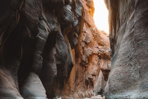
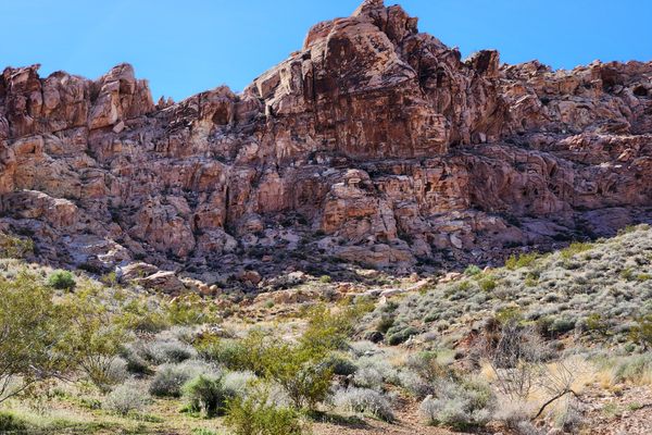
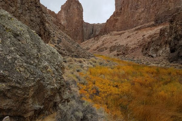
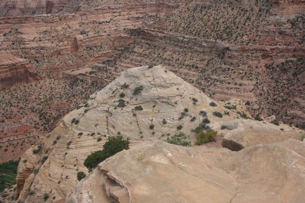
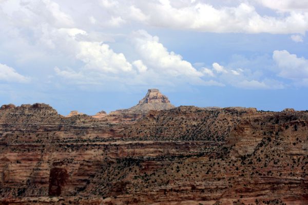
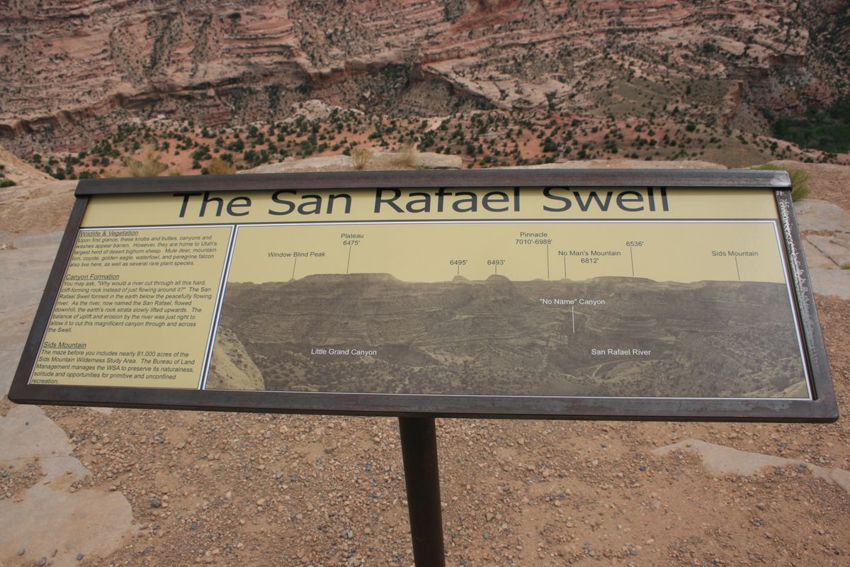
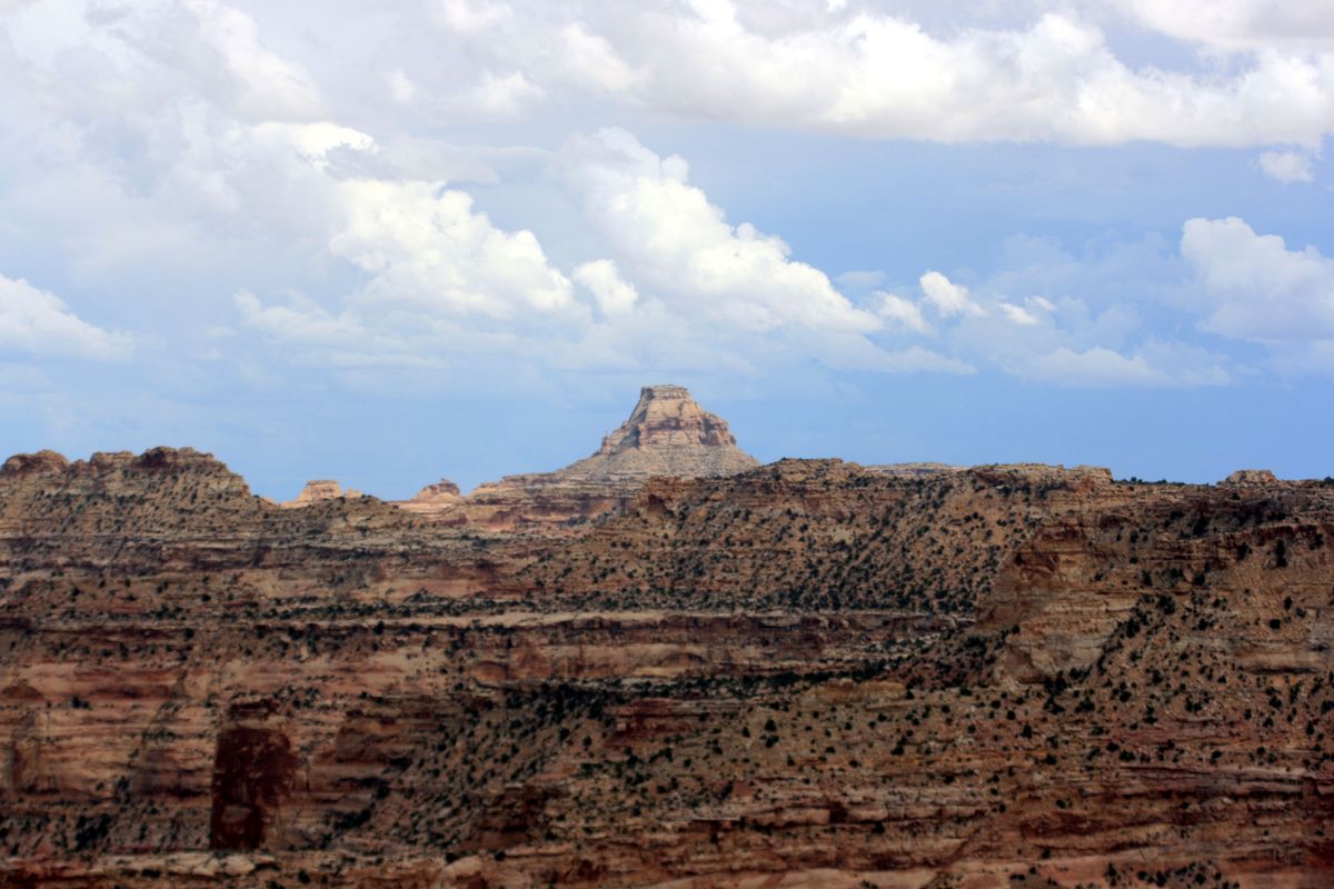
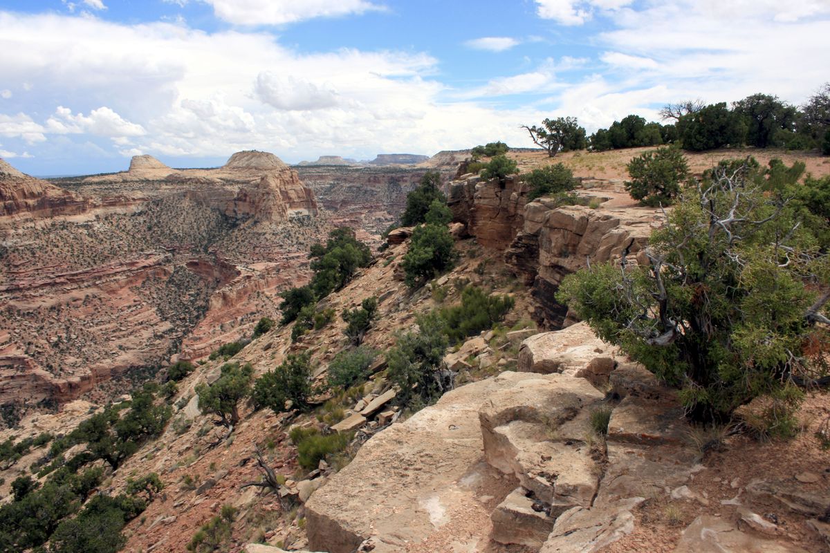
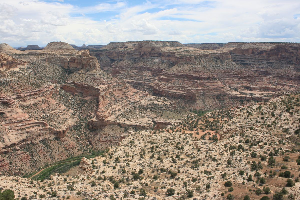
The San Rafael Swell is a broad geologic uplift in central Utah that hosts some of the scenic sandstone country for which Utah is famous. Although crossed by Interstate 70, the area is rugged and access to much of it remains difficult because of primitive or nonexistent roads.

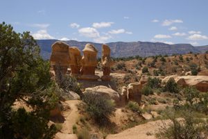
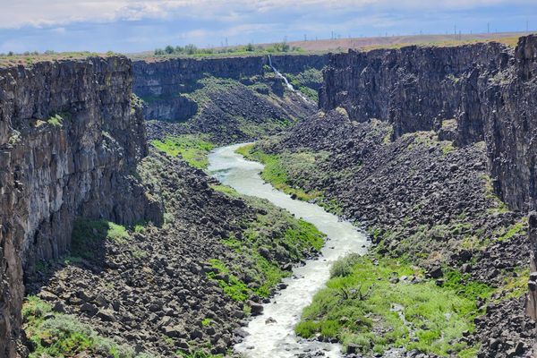
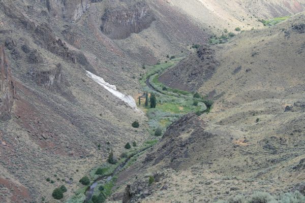
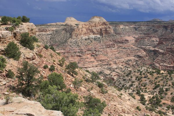
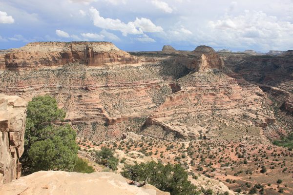
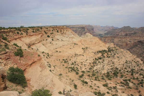
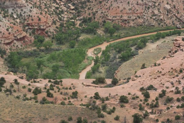
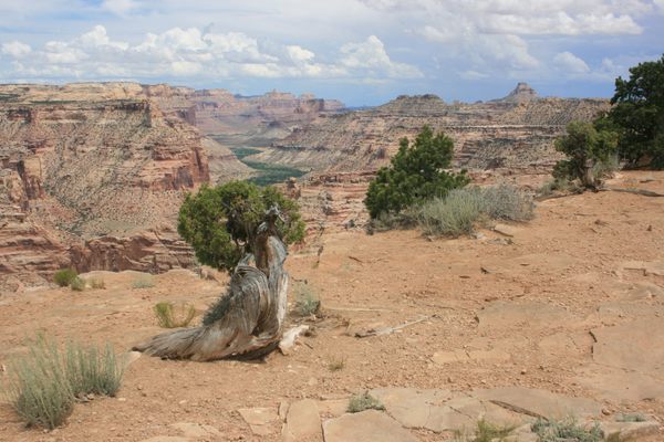
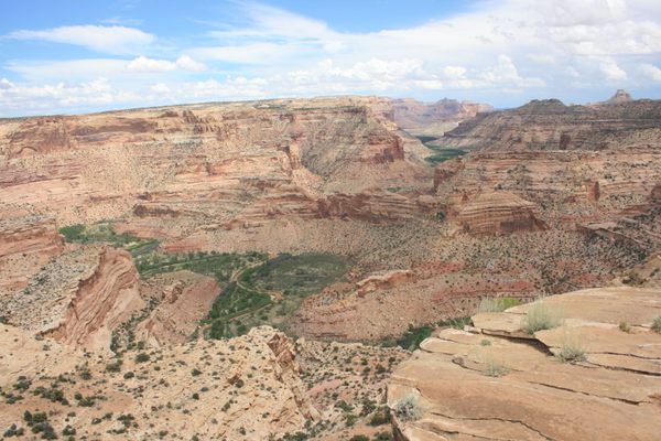
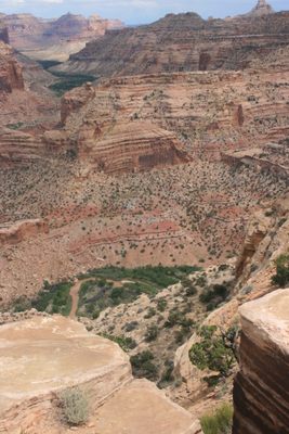
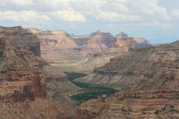
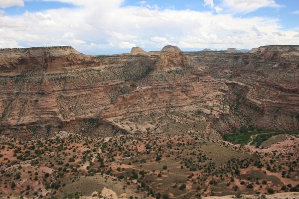
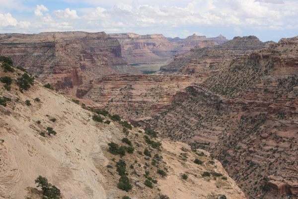
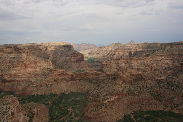
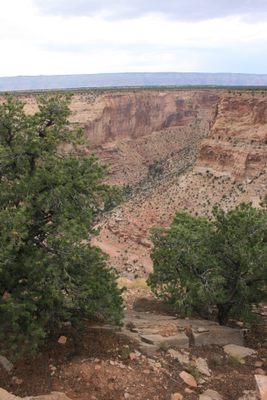
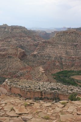
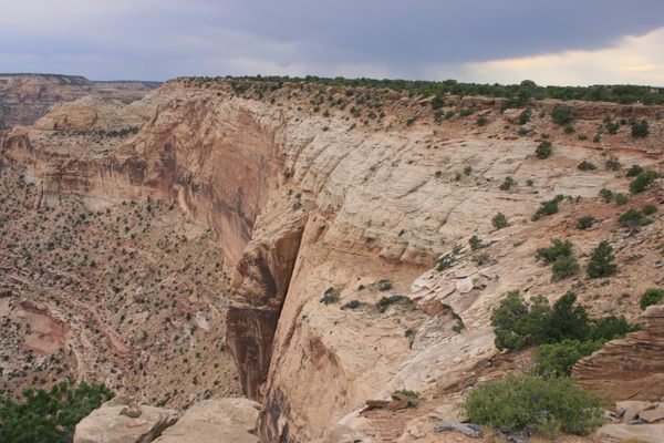
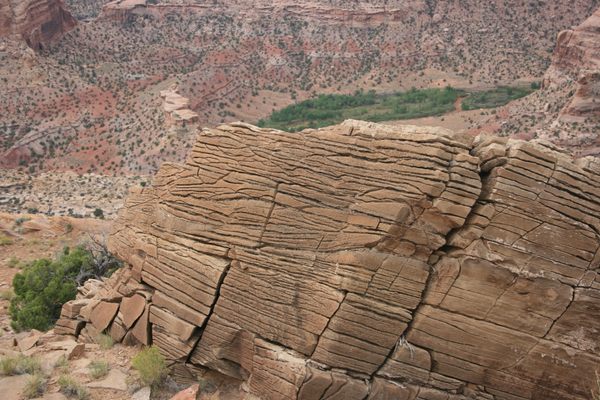
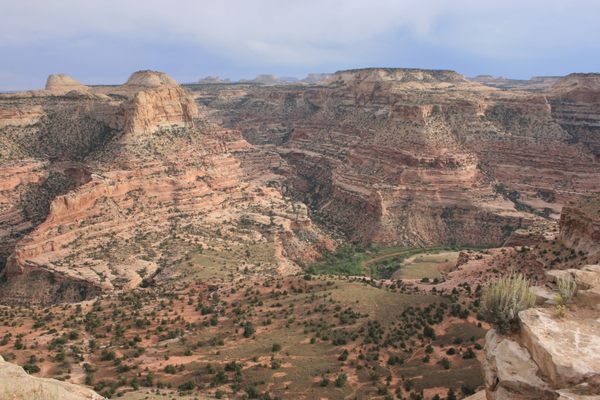
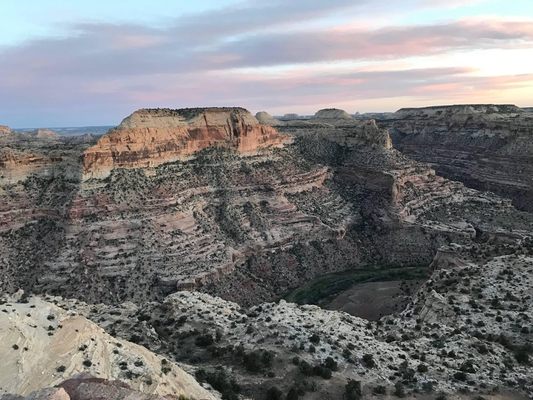
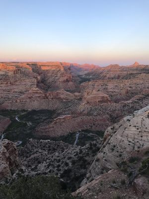
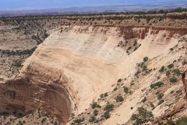
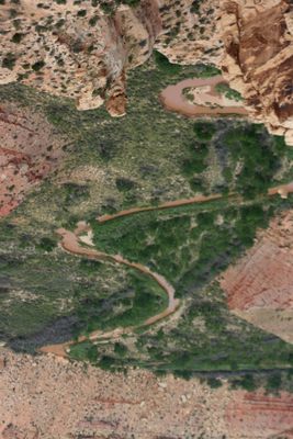
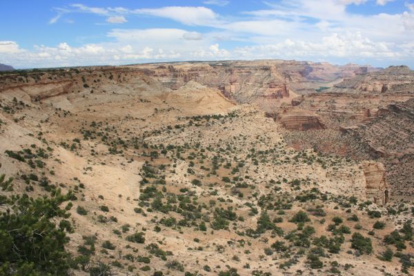
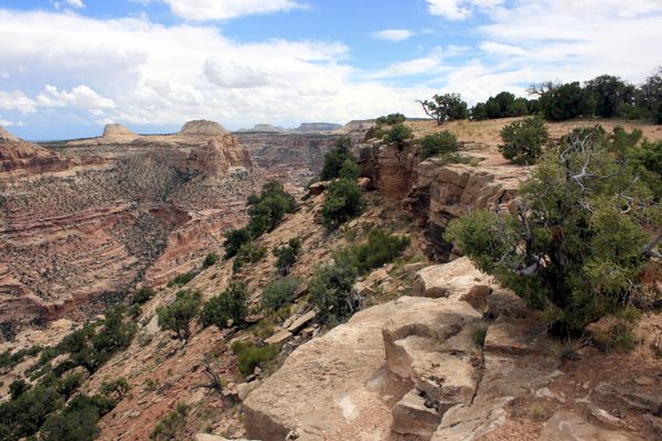
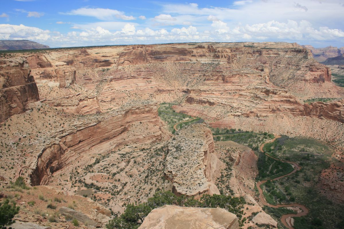
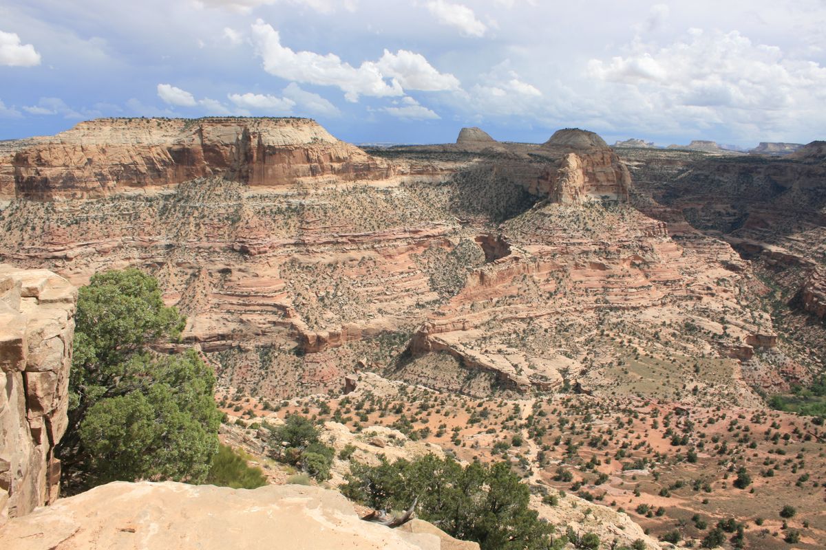
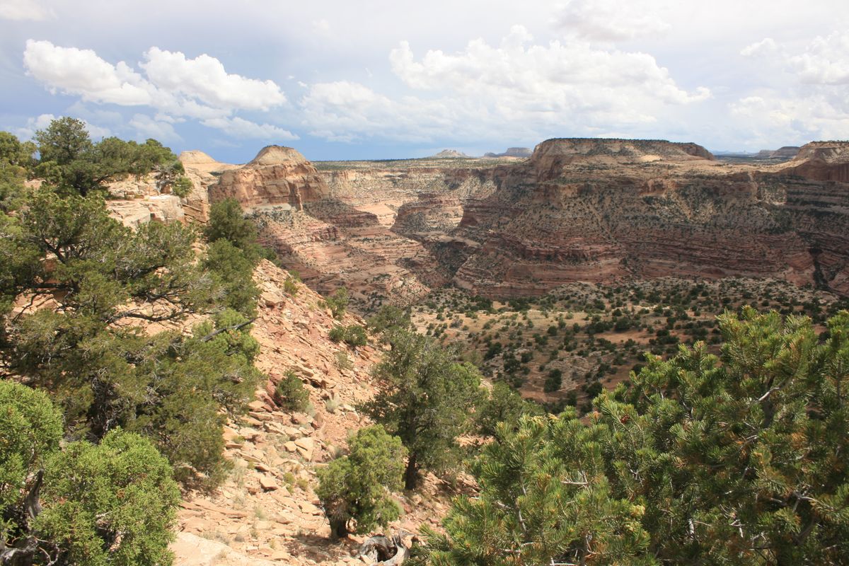
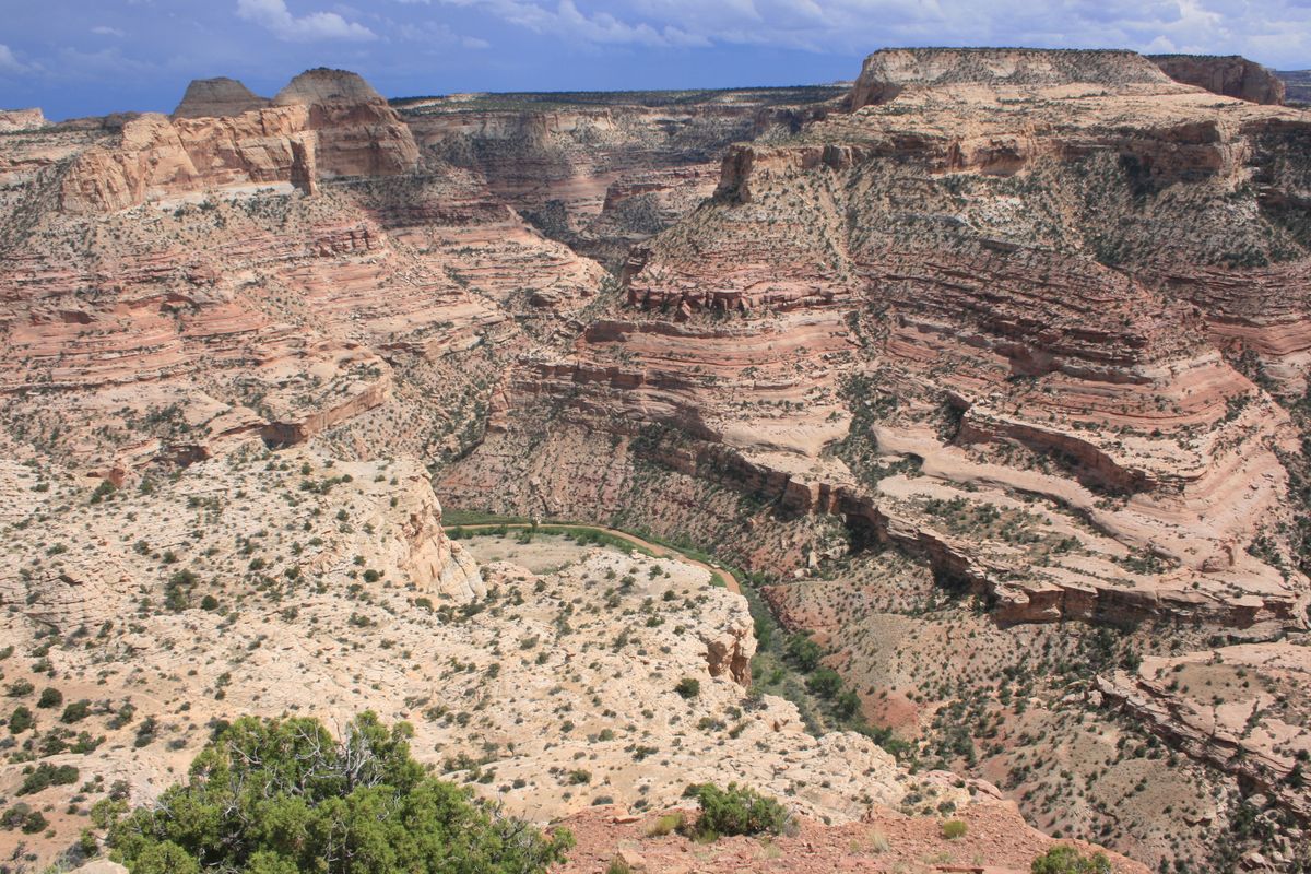
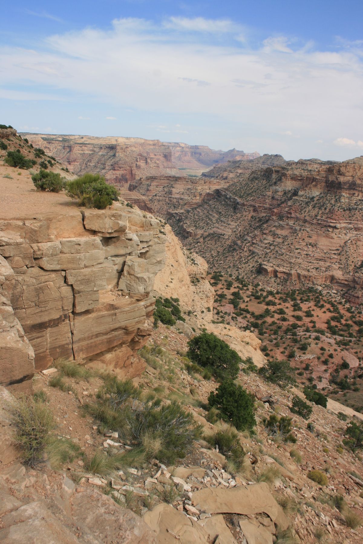
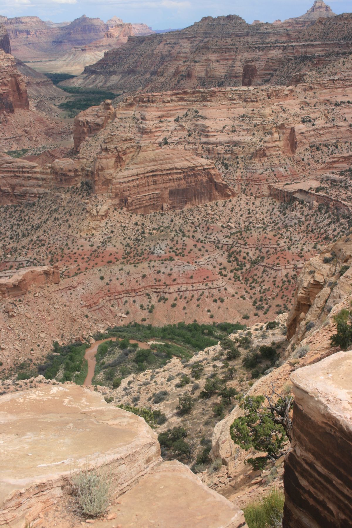
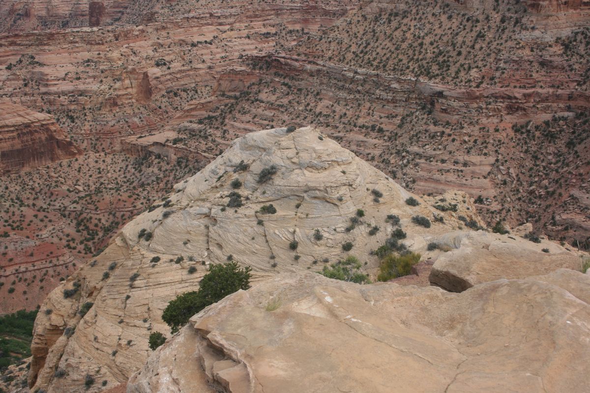
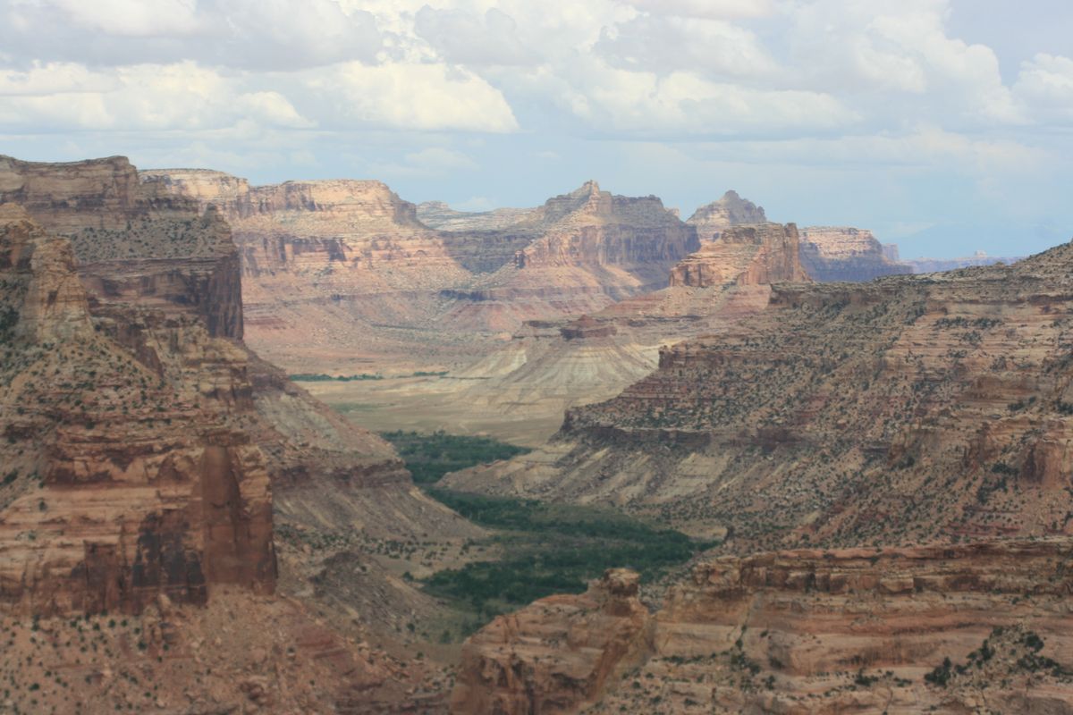
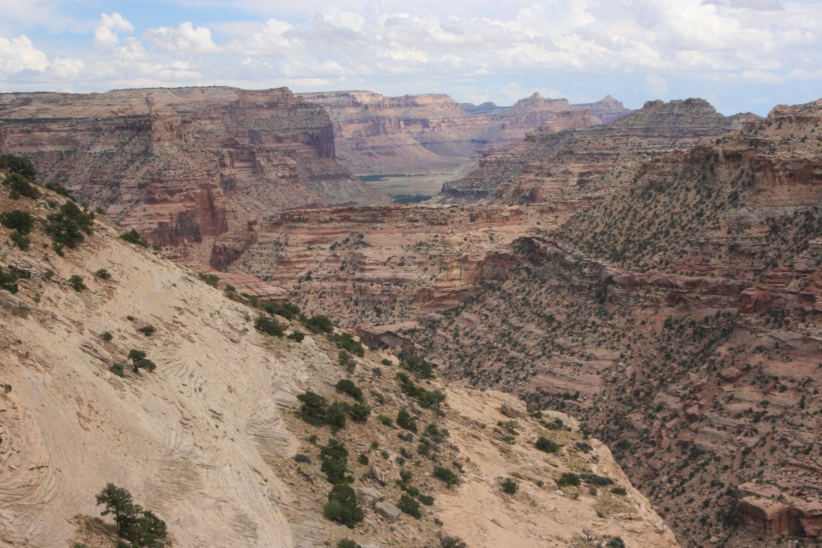
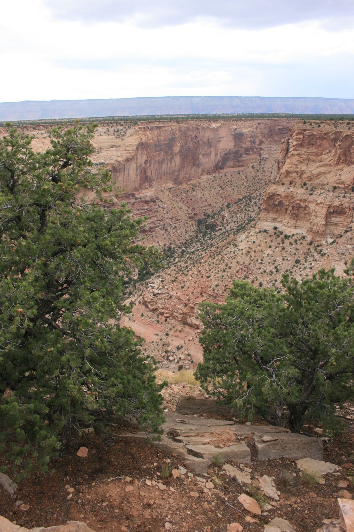
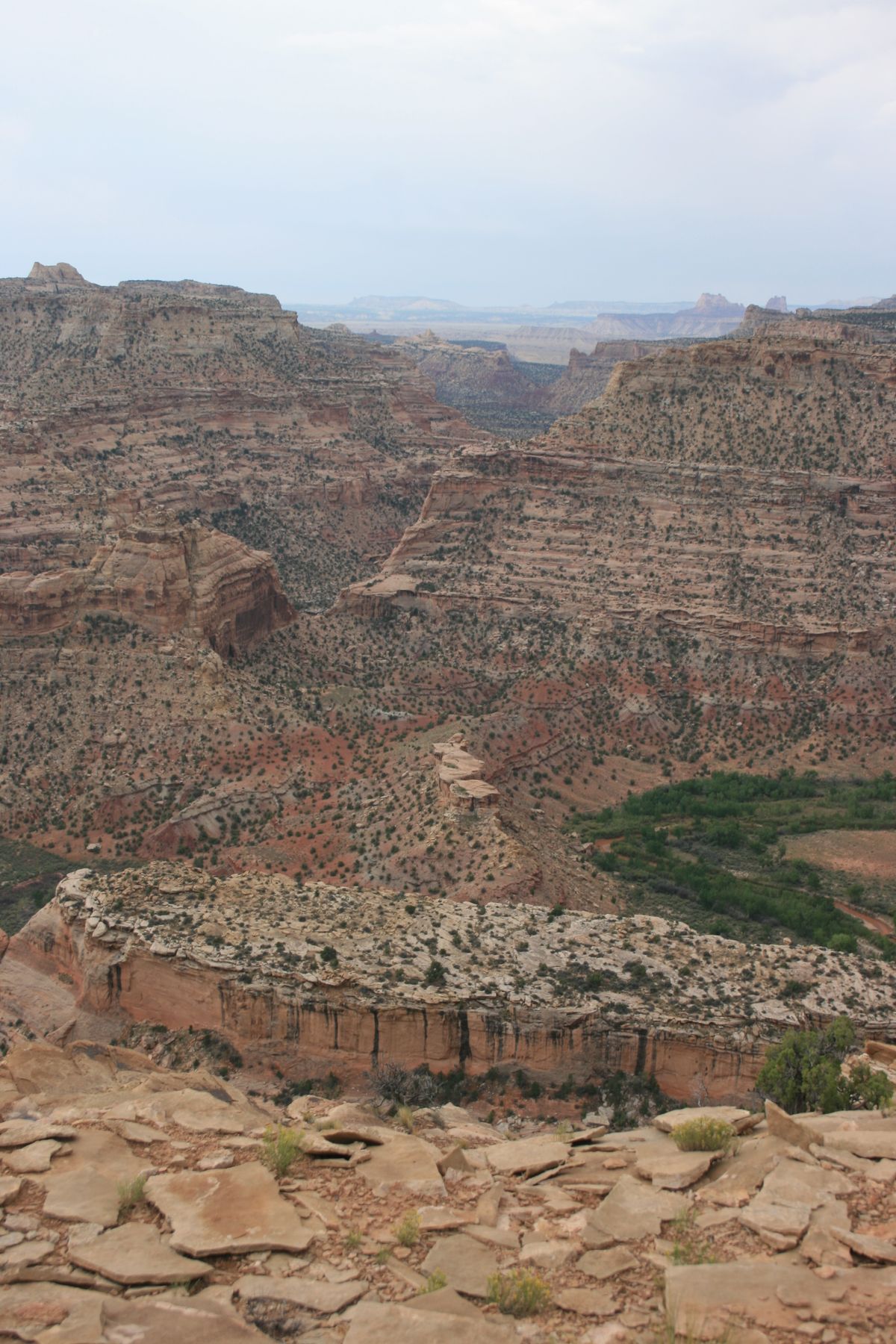
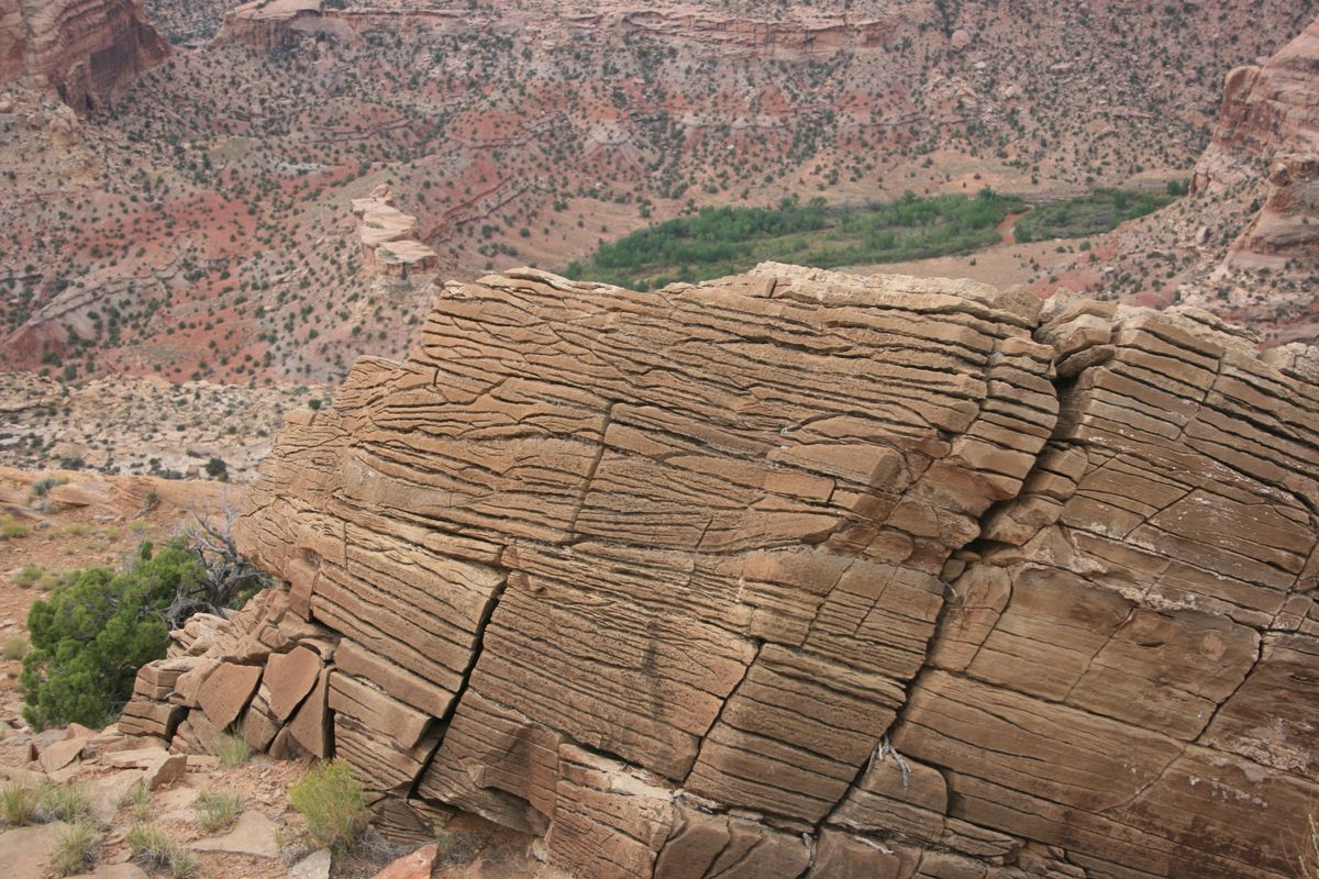
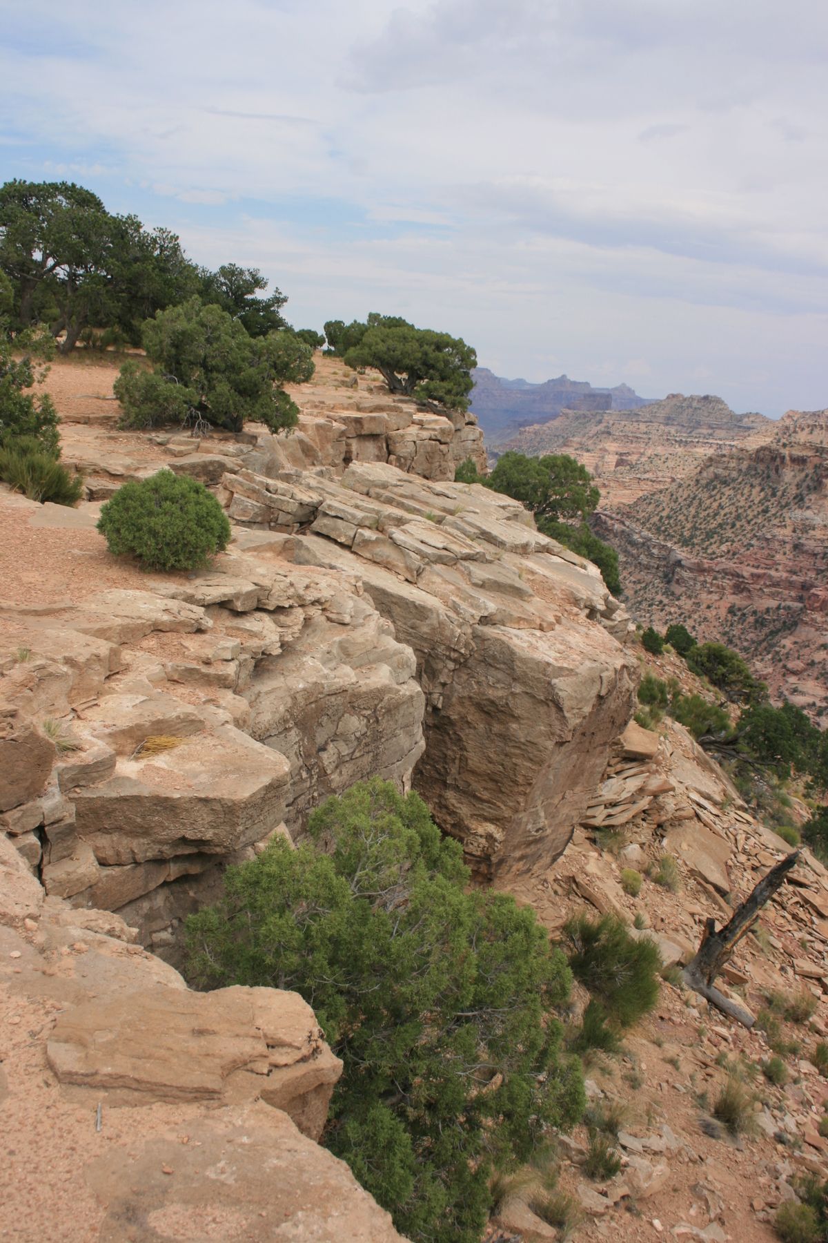
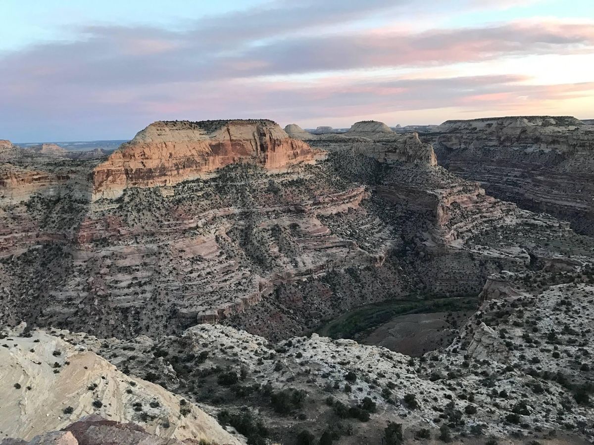
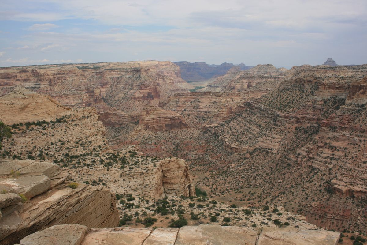
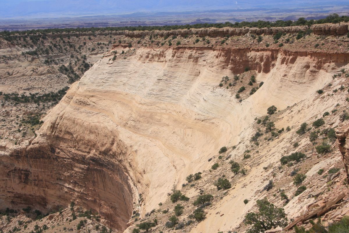
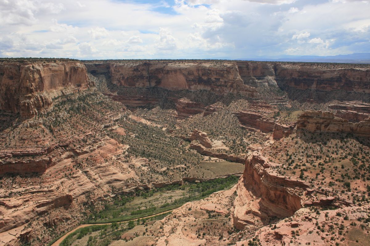
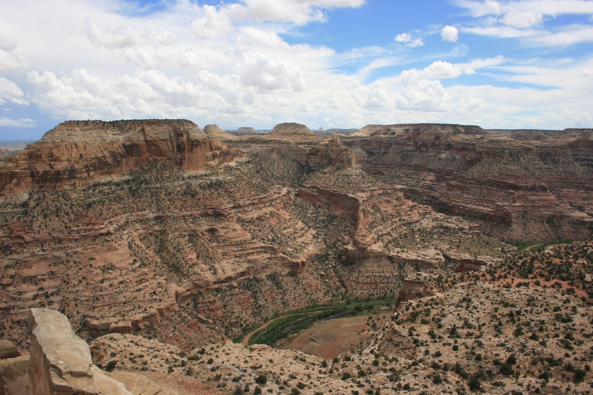
Of course, the limited access also cuts down on the crowds. In particular, the northern part of the Swell is dominated by the Little Grand Canyon of the San Rafael River and its tributaries. As its name suggests, the Little Grand Canyon is smaller than its counterpart in Arizona, but still a magnificent sight.   The Swell was uplifted around 40 to 60 million years ago, during the Laramide Orogeny, and the reddish rock walls of the canyon have since been carved out by the San Rafael.

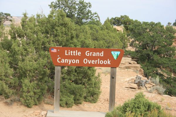
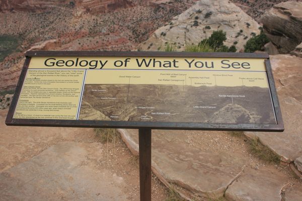
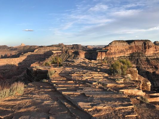
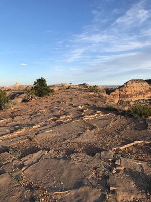
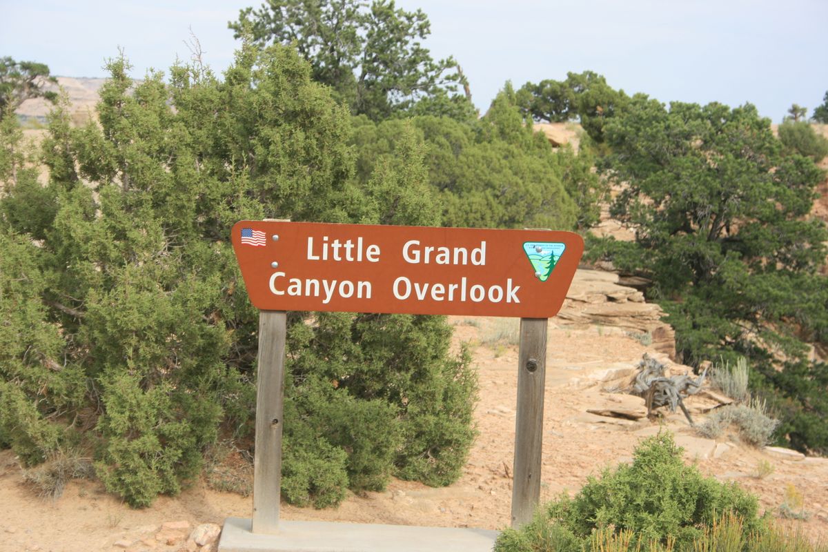
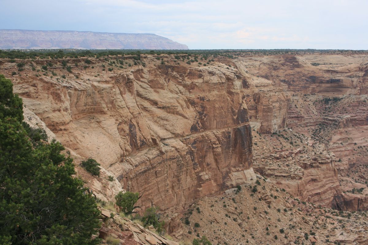
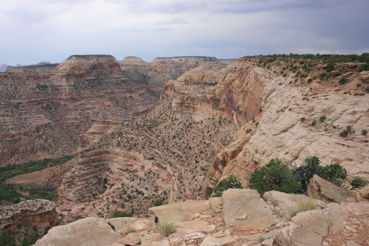
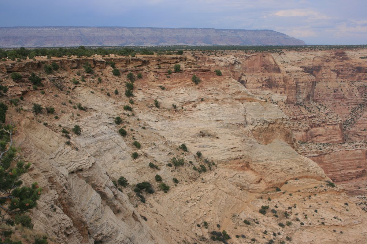
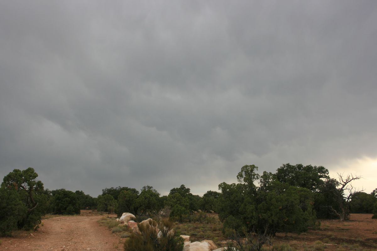
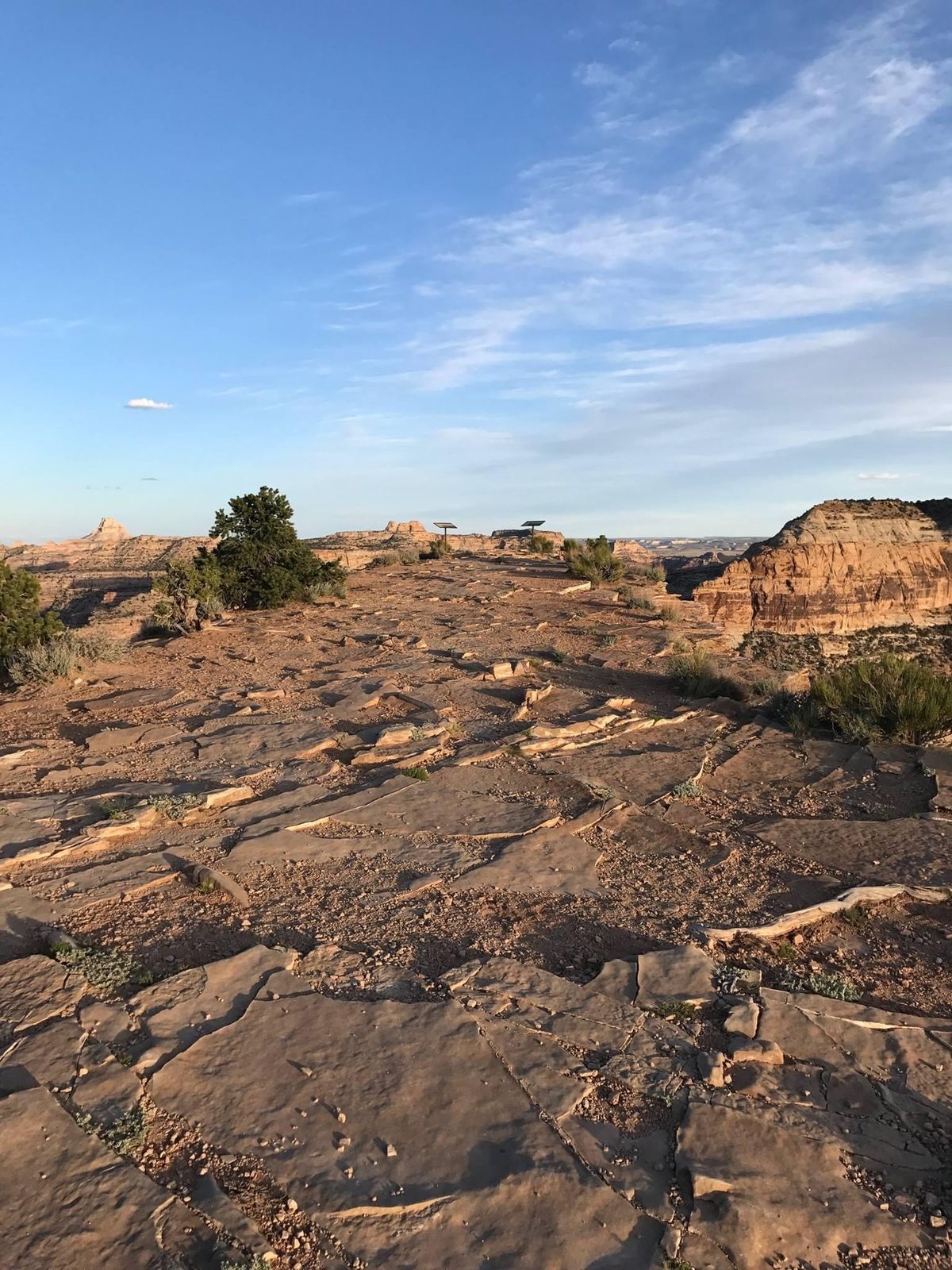
The only vehicle access to the canyon rim is a dirt road on the north side, in the so-called Wedge, where there are stunning views. There are a few interpretive signs along the rim road, and there may be a few other parties present, but overall it is an uncrowded experience. Some primitive camping is also available near the rim.

Related Tags

Rivers Canyons Rocks Geology

Know Before You Go

The most straightforward route is probably from Interstate 70. At Exit 131 take Buckhorn Draw Road (Co. Rd. 332) 29.1 miles north to a junction with County Rd. 401 (intersection at 39.170954 N, 10.751365 W). Go left on 401 2.4 miles to Co. Rd. 405. Buckhorn Wash Visitor Center is on the right at this intersection, at   39.175474 N, 110.790870 W. Turn left onto 405 (The Wedge Rd.) and proceed 6.7 miles to the Little Grand Canyon overlook. A small dirt road runs east and west for a few miles along the canyon rim, where there are lots of viewpoints. Parts of this overlook road may require high clearance, but overall the roads are graded and should be passable to ordinary passenger cars in dry weather. Washouts, however, are a risk particularly in the late summer monsoon season.

Community Contributors

Added By

slgwv

Edited By

zackofalltrades

  • zackofalltrades

Published

December 13, 2021

Edit this listing

Make an Edit
Add Photos
Sources
  • https://geology.utah.gov/map-pub/survey-notes/geosights/little-grand-canyon/
Wedge Overlook
Unnamed Road
Castle Dale, Utah, 84513
United States
39.098361, -110.749054
Visit Website
Get Directions

Nearby Places

Buckhorn Wash Pictograph Panel

Green River, Utah

miles away

John Wesley Powell River History Museum

Green River, Utah

miles away

Elgin Cemetery Sentimental Statues

Green River, Utah

miles away

Explore the Destination Guide

Photo of Utah

Utah

United States

Places 155
Stories 29

Related Stories and Lists

From Desert Waterfalls to Wind-Carved Hoodoos: Dive Into Utah’s Wild Dreamscapes

List

Sponsored by Visit Utah

Related Places

  • Lake Forest, California

    Red Rock Canyon

    A striking geological formation in Southern California.

  • Looking down the Gorge from the footbridge at its head.

    Tuttle, Idaho

    Malad Gorge

    Some 46,000 years ago, a volcanic eruption led to a flooding event that carved this short canyon with steep vertical walls.

  • Colorful sandstone cliff just west of the Colorock Quarry.

    Moapa Valley, Nevada

    Buffington Pockets

    The rocks exposed at Valley of Fire State Park also occur in a much less known but equally spectacular area a few miles to the southwest.

  • View of Frank Triguero homestead site from the canyon rim.

    Bruneau, Idaho

    Bruneau Canyon

    The "Grand Canyon of Southwestern Idaho" makes a spectacular gash across the flat Snake River plain.

  • The Sink

    Lander, Wyoming

    The Sinks

    This canyon is named for a unique geologic formation where the river vanishes underground near the mouth of the canyon and reappears farther down.

  • Lake Powell, Utah

    Cathedral in the Desert

    The damming of the Colorado River buried an iconic geologic formation before record-breaking drought brought it back.

  • Amidon Gorge

    Fredericktown, Missouri

    Castor River Shut-Ins

    These pink granite water slides are the result of millions of years of erosion.

  • Near eastern mouth of Thousand Creek Gorge.

    Winnemucca, Nevada

    Thousand Creek Gorge

    A spectacular but little-known slot canyon in extreme northern Nevada, with sheer walls nearly 500 feet high and a perennial stream.

Aerial image of Vietnam, displaying the picturesque rice terraces, characterized by their layered, verdant fields.
Atlas Obscura Membership

Become an Atlas Obscura Member


Join our community of curious explorers.

Become a Member

Get Our Email Newsletter

Follow Us

Facebook YouTube TikTok Instagram Pinterest RSS Feed

Get the app

Download the App
Download on the Apple App Store Get it on Google Play
  • All Places
  • Latest Places
  • Most Popular
  • Places to Eat
  • Random
  • Nearby
  • Add a Place
  • Stories
  • Food & Drink
  • Itineraries
  • Lists
  • Video
  • Podcast
  • Newsletters
  • All Trips
  • Family Trip
  • Food & Drink
  • History & Culture
  • Wildlife & Nature
  • FAQ
  • Membership
  • Feedback & Ideas
  • Community Guidelines
  • Product Blog
  • Unique Gifts
  • Work With Us
  • About
  • FAQ
  • Advertise With Us
  • Advertising Guidelines
  • Privacy Policy
  • Cookie Policy
  • Terms of Use
Atlas Obscura

© 2025 Atlas Obscura. All Rights Reserved.