Trips Places Foods Stories Newsletters

Take your next trip with Atlas Obscura!

Our small-group adventures are inspired by our Atlas of the world's most fascinating places, the stories behind them, and the people who bring them to life.

Visit Adventures
Trips Highlight
Slovenia mushroom foraging
Slovenia • 6 days, 5 nights
Forest to Table in Alpine Slovenia
from
Central Asia yurt night stars
Uzbekistan • 15 days, 14 nights
Central Asia Road Trip: Backroads & Bazaars
from
View all trips
Top Destinations
Latest Places
Most Popular Places Random Place Lists Itineraries
Add a Place
Download the App
Top Destinations
View All Destinations »

Countries

  • Australia
  • Canada
  • China
  • France
  • Germany
  • India
  • Italy
  • Japan

Cities

  • Amsterdam
  • Barcelona
  • Beijing
  • Berlin
  • Boston
  • Budapest
  • Chicago
  • London
  • Los Angeles
  • Mexico City
  • Montreal
  • Moscow
  • New Orleans
  • New York City
  • Paris
  • Philadelphia
  • Rome
  • San Francisco
  • Seattle
  • Stockholm
  • Tokyo
  • Toronto
  • Vienna
  • Washington, D.C.
Latest Places
View All Places »
Detail of the church’s right aisle
The Mosaic of Andreina
The older engine.
Dalat Railway Station
The exterior of STRAAT.
STRAAT
The front of the St. Charles’ Church
St. Charles’ Church
Latest Places to Eat & Drink
View All Places to Eat »
Cacio e pepe lasagna combines two classics.
C'è pasta... E pasta!
Spaghetto taratatà is named for the sound of rattling sabers.
Giano Restaurant
The gnocchi here get blanketed in a sugo with braised oxtail.
Cesare al Pellegrino
Romans insist you should feel the cracked peppercorns and cheese grains on your tongue.
Flavio al Velavevodetto
Tripe is fried to a crisp.
L’Osteria della Trippa
Recent Stories
All Stories Video Podcast
Most Recent Stories
View All Stories »
People paddling in their wooden canoes on one of the lakes near the Allagash Waterway in the north woods in Maine
The Allagash Abductions: This State Park’s Most Famous Visitors ... Are Aliens?
about 1 hour ago
The rocky Revere Beach coast in Revere, Massachusetts, just outside Boston.
Which Places With Bad Raps Are Actually Worth Visiting?
1 day ago
A dugong displays the telltale “smile.”
Saving the Sea Cows of Vanuatu
1 day ago
The first photo of the “woolly devil” made a stir among botanists when Deb Manley uploaded it to iNaturalist in March 2024.
How the Woolly Devil, Member of a New Plant Genus, Was Discovered on a Hike in Big Bend
2 days ago

No search results found for
“”

Make sure words are spelled correctly.

Try searching for a travel destination.

Places near me Random place

Popular Destinations

  • Paris
  • London
  • New York
  • Berlin
  • Rome
  • Los Angeles
Trips Places Foods Stories Newsletters
Sign In Join
Places near me Random place
All the United States Idaho Bruneau Bruneau Canyon
AO Edited

Bruneau Canyon

The "Grand Canyon of Southwestern Idaho" makes a spectacular gash across the flat Snake River plain.

Bruneau, Idaho

Added By
slgwv
Email
Been Here
Want to go
Added to list
View of Frank Triguero homestead site from the canyon rim.   slgwv / Atlas Obscura User
View southeasterly from canyon rim above Frank Triguero homestead. Jarbidge Mountains on the skyline right of center.   slgwv / Atlas Obscura User
Looking downstream (north) from above Frank Triguero homestead site.   slgwv / Atlas Obscura User
Looking upstream toward Bruneau Crossing.   slgwv / Atlas Obscura User
Old pickup used to power machinery at the jasper mine.   slgwv / Atlas Obscura User
Access road (“Cherrystem”) from the east to Bruneau Crossing, looking down.   slgwv / Atlas Obscura User
Access road (“Cherrystem”) from the east to Bruneau Crossing, looking up.   slgwv / Atlas Obscura User
Bruneau Canyon at the BLM overlook, looking upstream.   slgwv / Atlas Obscura User
Bruneau Canyon at the BLM overlook, looking downstream.   slgwv / Atlas Obscura User
East access road (“Cherrystem Road”) to Bruneau Crossing at the top. The gate is not locked but marks the beginning of the extreme 4wd section.   slgwv / Atlas Obscura User
Access road (“Cherrystem”) from the east to Bruneau Crossing, looking down.   slgwv / Atlas Obscura User
Interpretive sign about the jasper mine near Bruneau Crossing.   slgwv / Atlas Obscura User
Looking upstream toward Bruneau Crossing.   slgwv / Atlas Obscura User
Downstream from Bruneau Crossing.   slgwv / Atlas Obscura User
Bruneau Canyon at the BLM overlook, looking downstream.   slgwv / Atlas Obscura User
Bruneau Canyon at the BLM overlook, looking upstream.   slgwv / Atlas Obscura User
Bruneau Canyon at the BLM overlook, looking downstream.   slgwv / Atlas Obscura User
Bruneau Canyon at the BLM overlook, looking upstream.   slgwv / Atlas Obscura User
Bruneau Canyon near BLM overlook, looking downstream.   slgwv / Atlas Obscura User
East access road (“Cherrystem Road”) to Bruneau Crossing at the beginning of the wilderness area..   slgwv / Atlas Obscura User
Access road (“Cherrystem”) from the east to Bruneau Crossing, looking down.   slgwv / Atlas Obscura User
Looking upstream toward Bruneau Crossing.   slgwv / Atlas Obscura User
Rafting on the Bruneau River.   PxHere
View into Bruneau Crossing from downstream   Bob Wick, BLM
Raft on Bruneau River   BLMIdaho
Bruneau River   Bob Wick, BLM
Bruneau Canyon in Nevada just north of the old site of Rowland. Looking northeasterly.   slgwv / Atlas Obscura User
Been Here
Want to go
Added to list

About

The Bruneau River rises in the Jarbidge Mountains of extreme northern Nevada and flows north into Idaho, meeting the Snake River near the present site of the C. J. Strike Dam. Along the way, it is joined by the Jarbidge River as well as by several smaller tributaries.

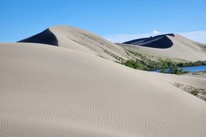
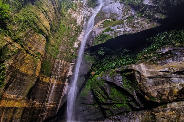
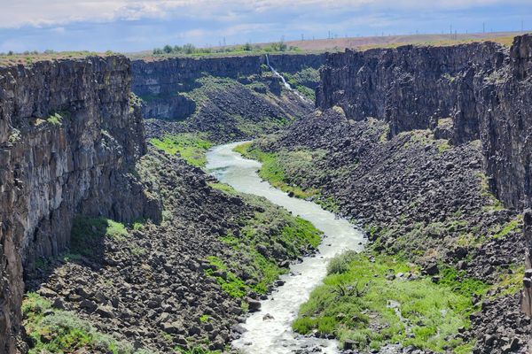
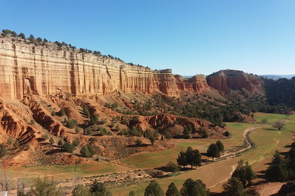
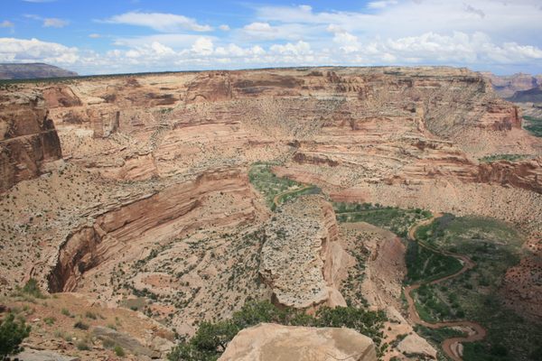
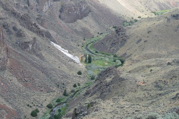
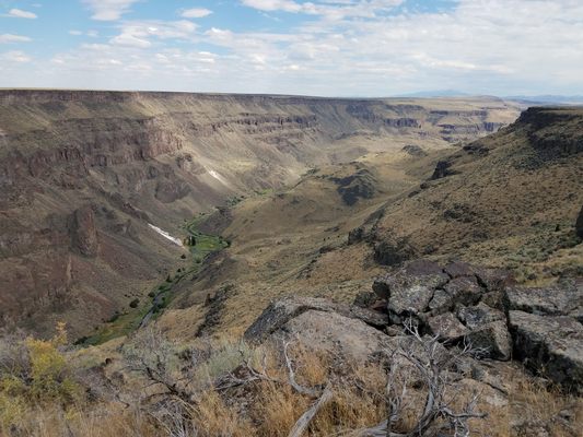
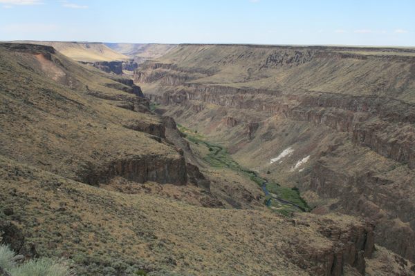
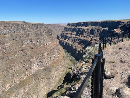
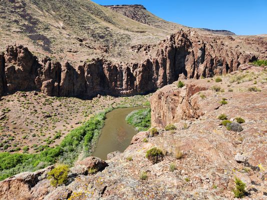
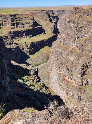
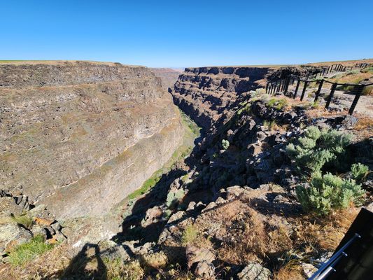
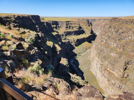
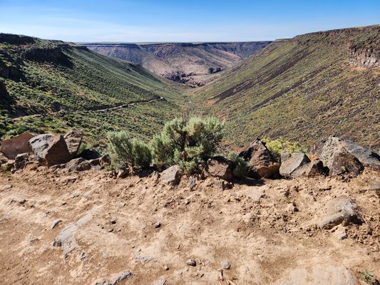
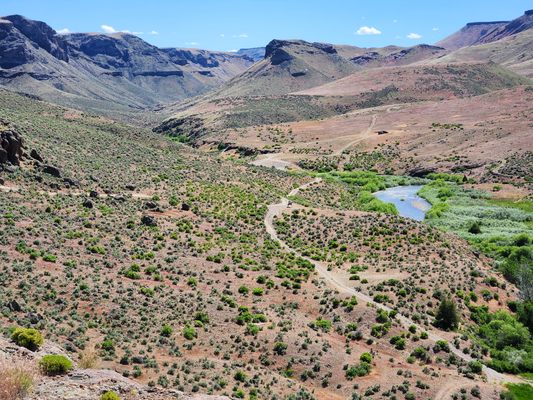
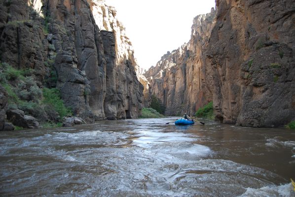
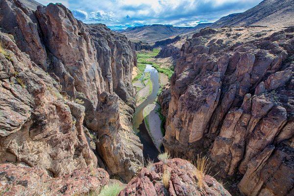
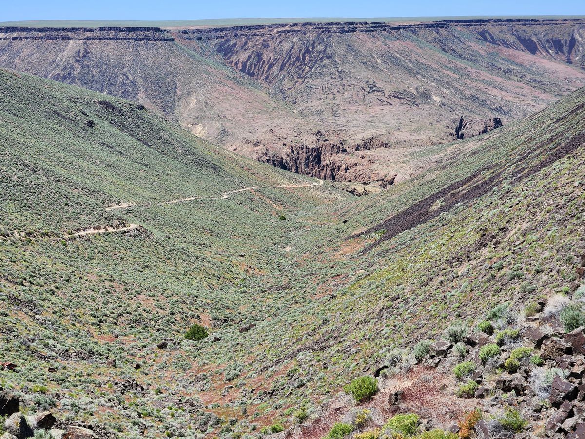
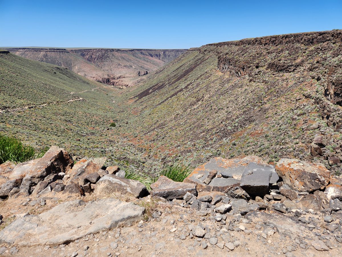
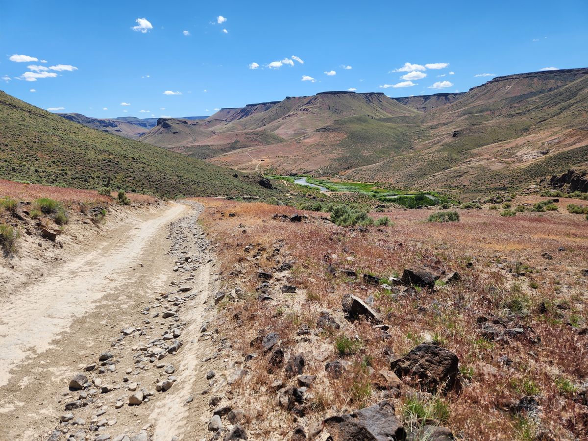
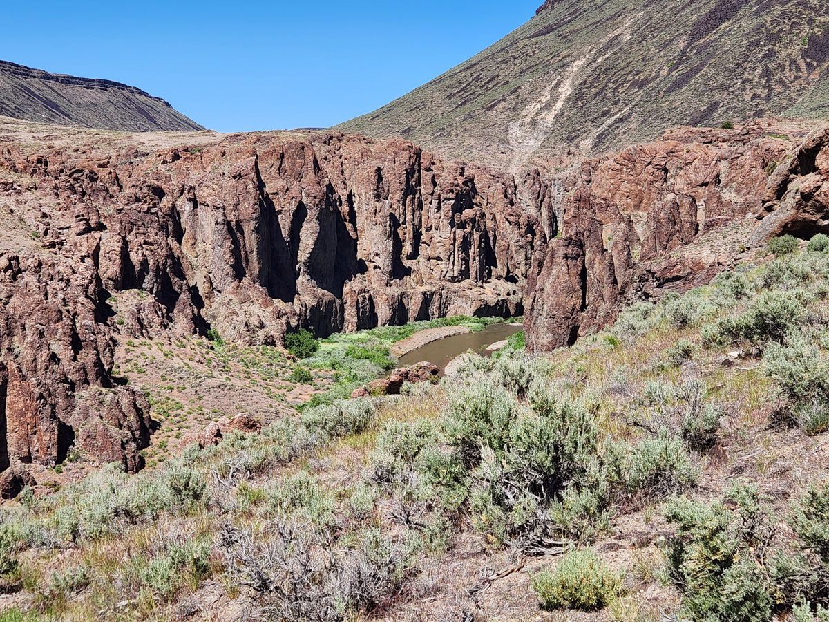
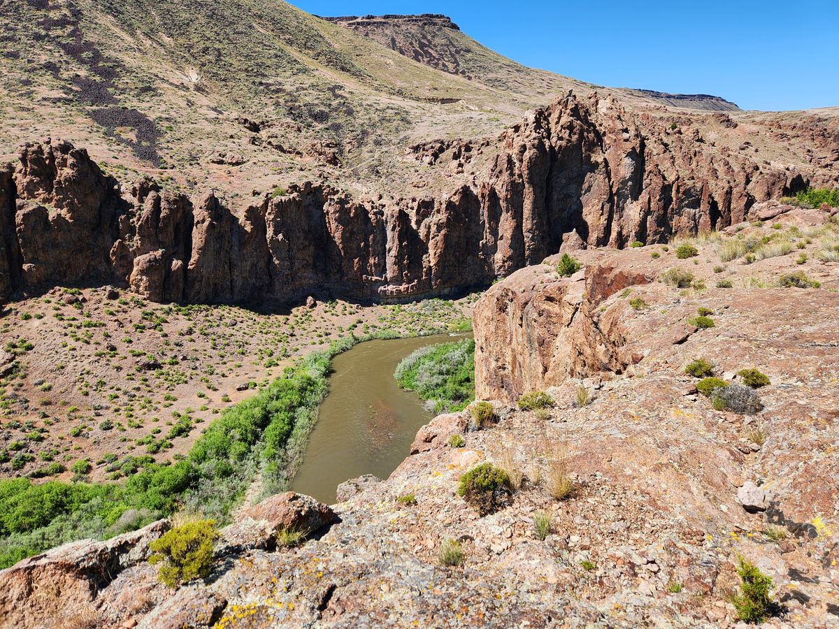
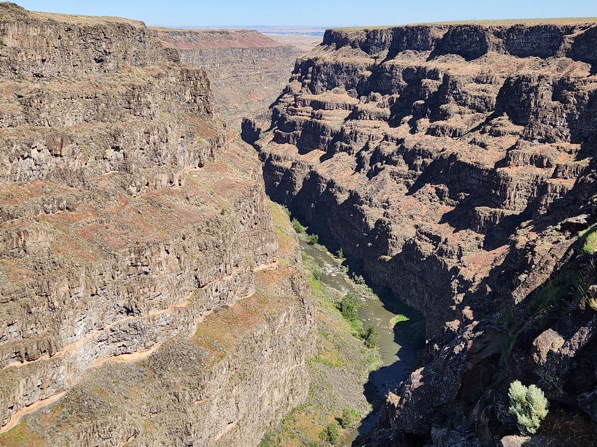
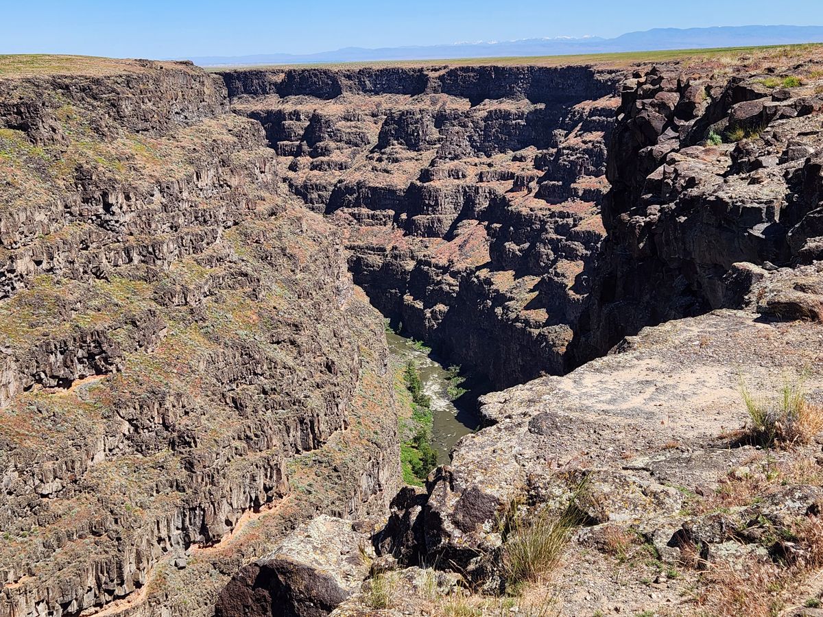
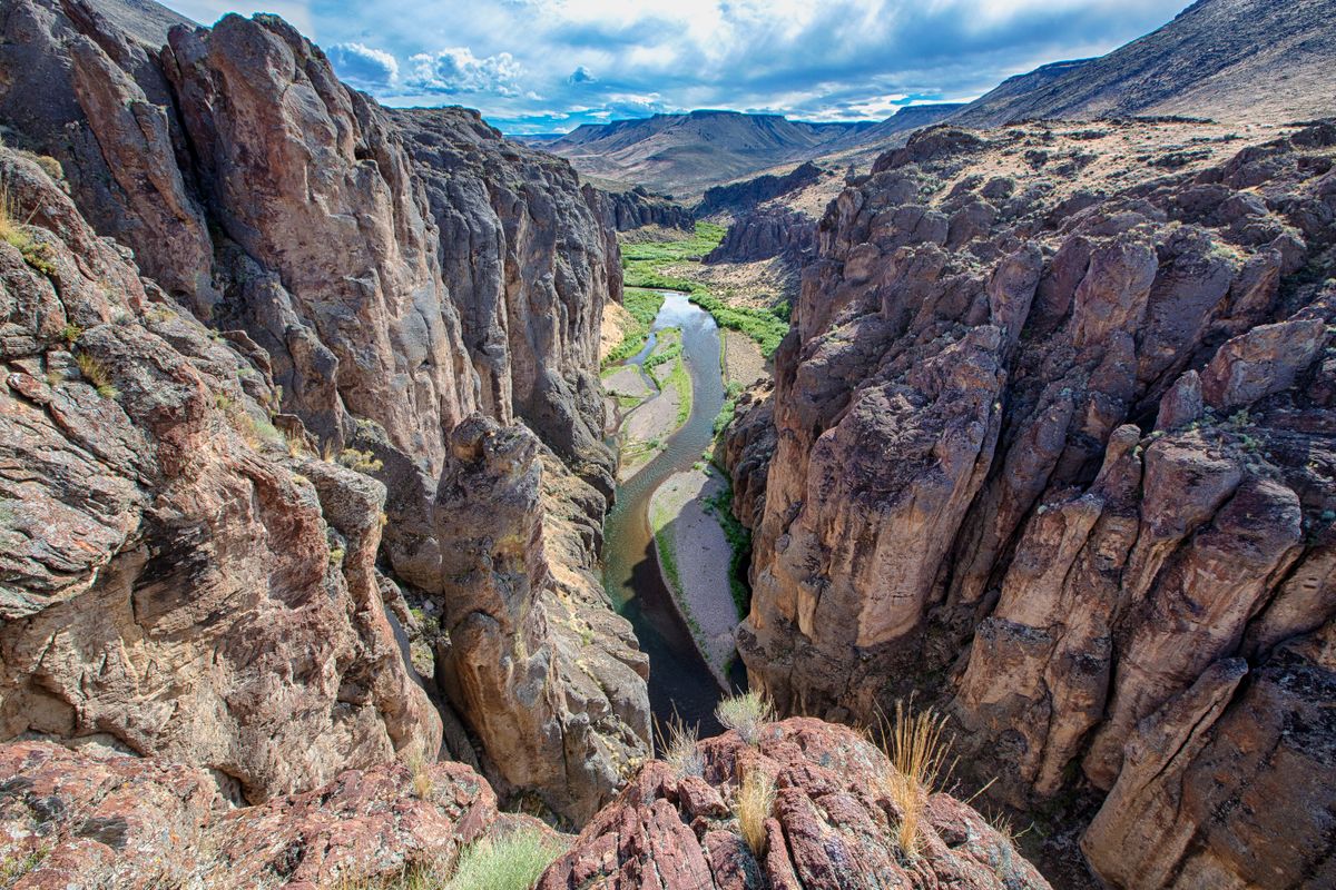
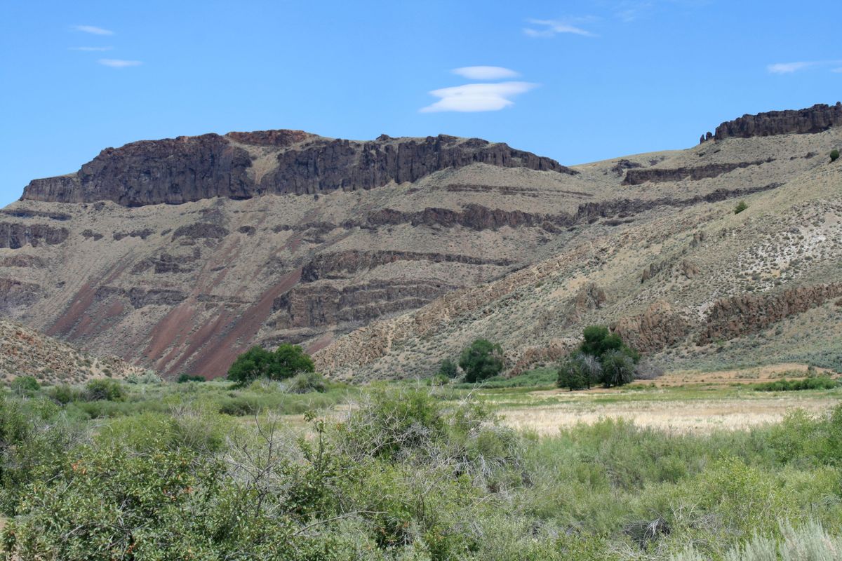
On its way to the Snake, the Bruneau crosses the gently rolling Snake River Plain. However, the Snake River itself has eroded into the plain, such that the river level is now well below the original surface. In response, the Bruneau and its tributaries have carved channels down to the present level of the Snake. This has resulted in spectacular canyons, nearly 1,000 feet deep in places and often hardly wider than their depth. The canyon system extends over 50 miles, and much of the canyons, including the tributaries, have been designated as the Bruneau-Jarbidge Wilderness Area. The wilderness area encompasses the confluence with the Jarbidge River and typically encloses the canyons with a buffer zone a half-mile or so wide. Even where such a buffer doesn't exist, the canyon below the rim is usually designated wilderness.

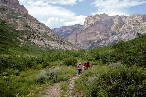
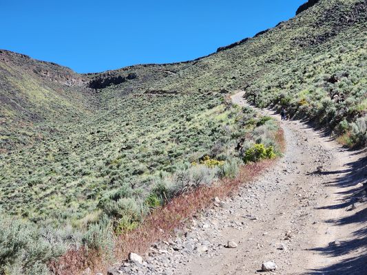
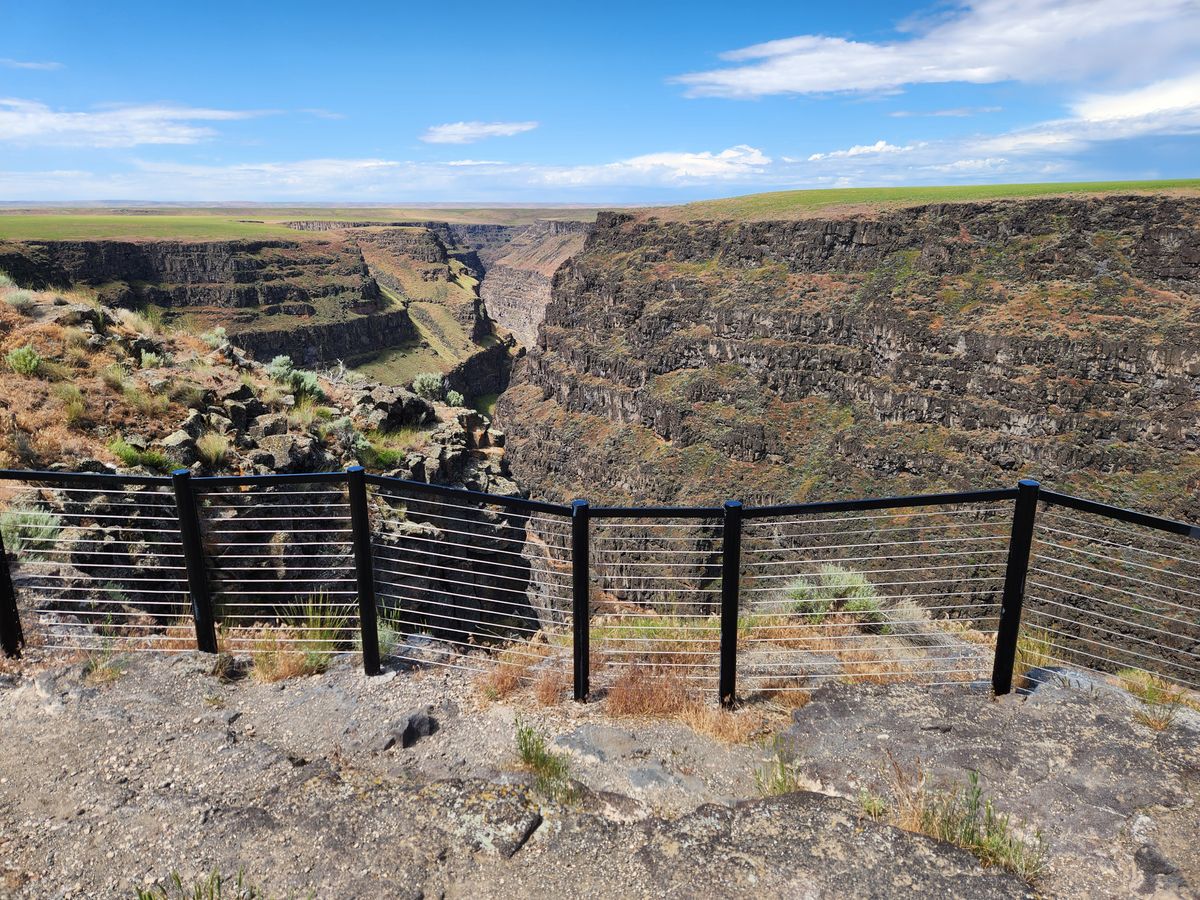
The country is so remote and access is so difficult, that the canyons remain little known outside the area. Even the most accessible canyon overlook, on the east side of the Bruneau River where the canyon is over 800 feet deep, is not reachable by a paved road, and other viewpoints require high clearance at a minimum and often 4-wheel-drive.

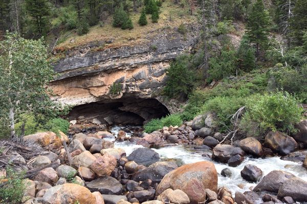
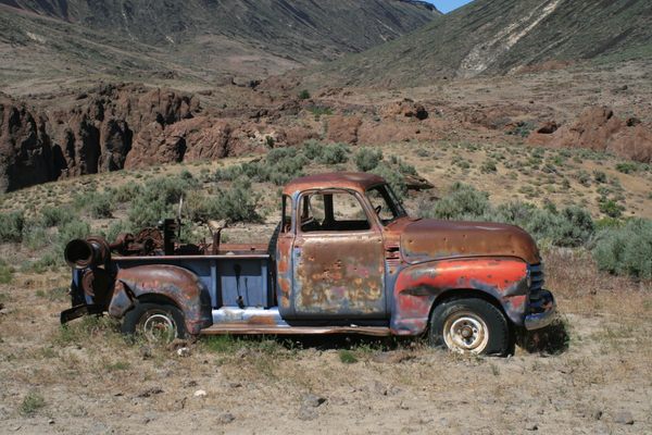
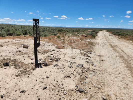
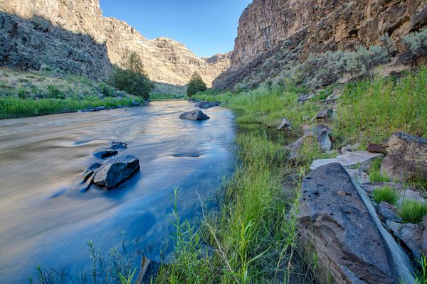
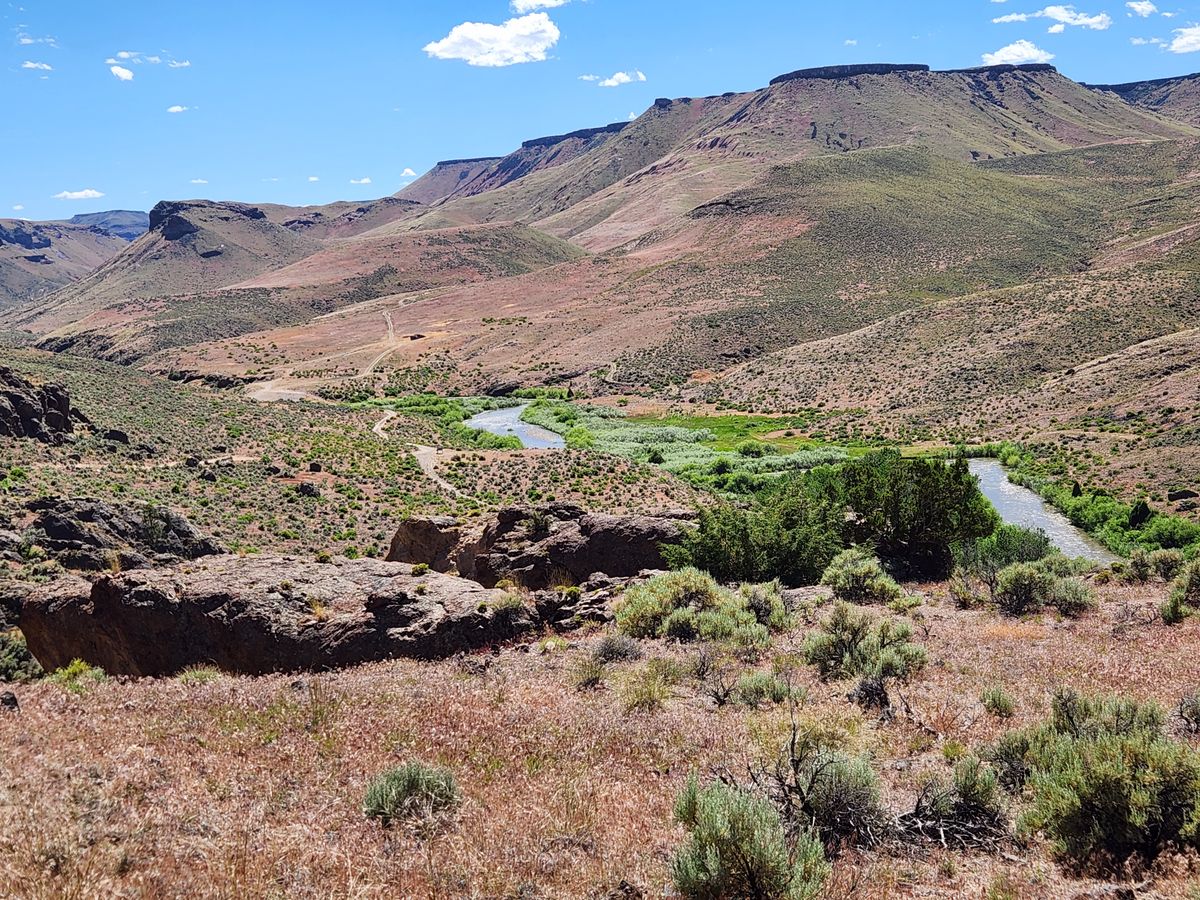
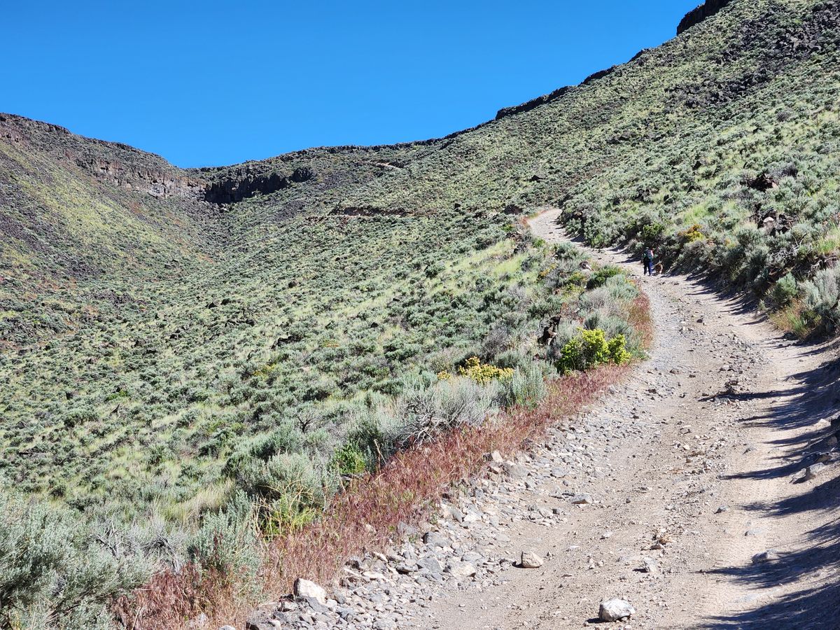
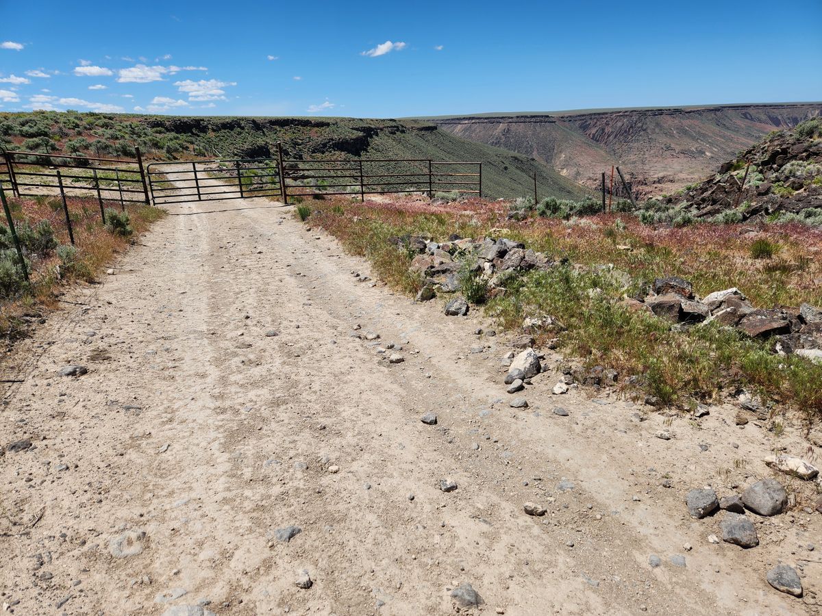
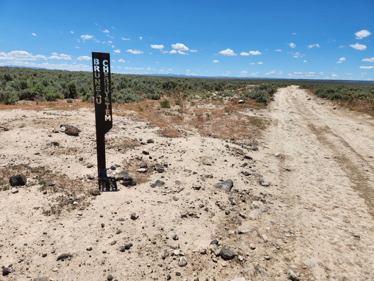
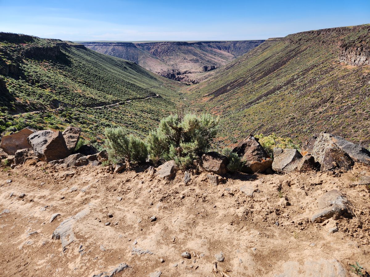
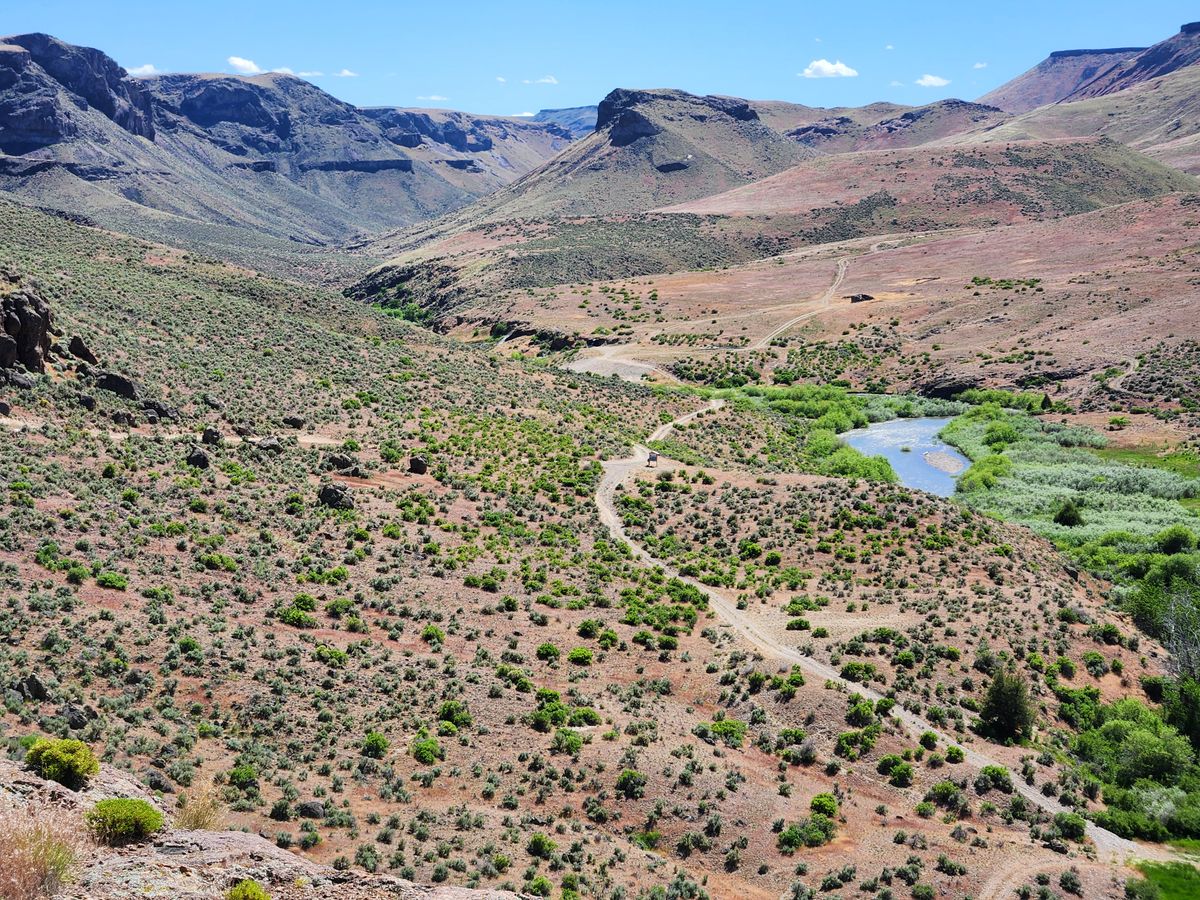
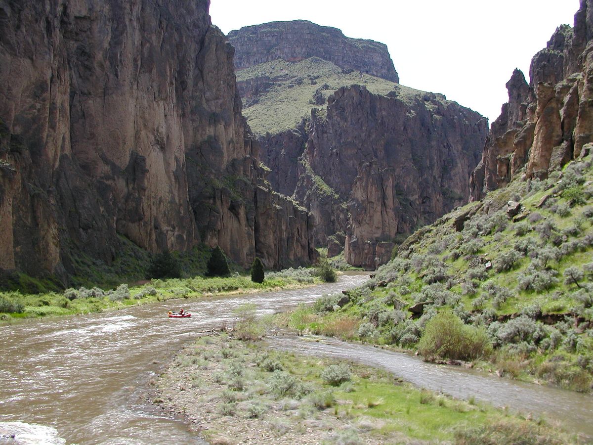
Bruneau Crossing (also called Indian Hot Spring Road) is an example. This is a Jeep road that lies in the middle of the wilderness area, crossing the Bruneau just north of the confluence of the Bruneau and Jarbidge Rivers. Indian Hot Spring, along with some ruins, are in the bottom of the canyon on the west side of the Bruneau. The road is a designated motorized access road through the wilderness (a so-called "cherrystem road"), but within the canyon itself much of it is an extreme shelf road that requires both experienced drivers and adequate vehicles. A new bridge was built across the Bruneau in the last few years, a cooperative project between the Bureau of Land Management and local ranchers, and it makes an incongruous contrast with the extreme Jeep trails it serves. This crossing is also a popular put-in point for river trips down the Bruneau, during the short running season around May at the height of the spring runoff.

Related Tags

Mountains Rivers Landscapes Geology Canyons

Know Before You Go

Other canyon viewpoints can be accessed with an adequate vehicle. Unusually, the Triguero homestead trailhead (at 42.186027 N, 115.695375 W), west of the Bruneau and south of the wilderness area, can be reached just by a high-clearance vehicle. Most viewpoints will require 4wd, however.

As noted, there is only one viewpoint on a graded road. This site even features guardrails and a vault toilet. To reach it, go to the village of Bruneau on Idaho State Route 51 and turn south on Hot Springs Road. This intersection is well marked. Follow the Hot Springs Road about 15.5 miles to a well-marked turnoff (at 42.70992 N, 115.62185 W) on the right for the "Bruneau Canyon Overlook." Turn here and follow the graded road another three miles.

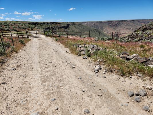
The road is paved for about 12 miles from Bruneau, while the rest is graded, including the spur road to the overlook. Passenger cars in dry weather should have no trouble.

The turnoff for Bruneau Crossing, at 42.43893 N, 115.38178 W, is 29 miles farther down this road (which has now become the Clover-Three Creek Road). The turnoff is marked for the Bruneau River. The first 4 miles are graded, but after that it becomes extremely rough, with high clearance mandatory. The point where you turn onto the rough road (at about 42.41860 N, 115.44266 W) is well marked. The road remains rough all the way to the wilderness boundary, marked as "Bruneau Cherrystem," at about 42.34239 N, 115.60412 W. You can proceed another mile or so on the cherrystem road to the beginning of the extreme shelf road into the canyon proper (at about 42.33167 N, 115.62216 W). Continuing down to the river, however, will require 4wd, an adequate vehicle (not too wide, preferably short-coupled, and with especially high clearance), as well as experience in negotiating extreme 4wd trails.

As mentioned, other overlooks and access points to Bruneau Canyon exist, but will be off primitive roads that will require high clearance and usually 4wd. As would be expected, the canyons themselves are major barriers to travel, with few crossings.

Consult maps to find potential access points; the USGS 7.5' topographic quadrangles will probably be the most useful. (Note that the USGS has put all its topographic maps online as PDF files, so they can be downloaded and put onto an e-reader or tablet. You do not need to buy paper maps.) A GPS will also be helpful. Remember that motorized travel into what is now the wilderness area is prohibited except along designated motorized corridors ("cherrystem roads"), and some of the quadrangles are too old to show the current wilderness boundaries. Of course, such old Jeep roads work fine as hiking trails, too.

When attempting these routes be sure your vehicle is fully fueled with a spare tire. Bringing adequate water is important particularly in the warm months. If you plan to use water from the Bruneau or tributary streams, be sure to treat it. Cattle are still actively run in the area and the water will be contaminated with cow excrement.

Community Contributors

Added By

slgwv

Published

July 23, 2024

Edit this listing

Make an Edit
Add Photos
Bruneau Canyon
Overlook Rd
Bruneau, Idaho, 83604
United States
42.692025, -115.670242
Visit Website
Get Directions

Nearby Places

Bruneau Dunes

Mountain Home, Idaho

miles away

Three Island Crossing State Park

Glenns Ferry, Idaho

miles away

Crater Rings

Cleft, Idaho

miles away

Explore the Destination Guide

Photo of Idaho

Idaho

United States

Places 67
Stories 12

Nearby Places

Bruneau Dunes

Mountain Home, Idaho

miles away

Three Island Crossing State Park

Glenns Ferry, Idaho

miles away

Crater Rings

Cleft, Idaho

miles away

Explore the Destination Guide

Photo of Idaho

Idaho

United States

Places 67
Stories 12

Related Places

  • Mesetas, Colombia

    Cañon del Guejar (Güejar River Canyon)

    River raft through rural Colombia’s ancient rock formations, pristine landscapes, and towering waterfalls.

  • Looking down the Gorge from the footbridge at its head.

    Tuttle, Idaho

    Malad Gorge

    Some 46,000 years ago, a volcanic eruption led to a flooding event that carved this short canyon with steep vertical walls.

  • Rambla de Barrachina

    Villaspesa, Spain

    Rambla de Barrachina

    The geomorphology of the Turia Valley could easily be mistaken for Utah or Arizona.

  • Top of Tahquitz Creek Falls.

    Palm Springs, California

    Tahquitz Creek Falls

    At the western edge of Palm Springs, a rugged desert canyon trail leads to a waterfall at the base of the San Jacinto Mountains.

  • The Sink

    Lander, Wyoming

    The Sinks

    This canyon is named for a unique geologic formation where the river vanishes underground near the mouth of the canyon and reappears farther down.

  • Hiking up Thomas Creek.  Looking back into Lamoille Canyon.

    Lamoille, Nevada

    Lamoille Canyon

    Drive up a paved road into "Nevada's Yosemite" for exquisite views and mountain hiking in an alpine setting.

  • View NNE.  Edge of Cedar Mountain at the left side of the photo.

    Castle Dale, Utah

    Wedge Overlook

    A spectacular overlook of the Little Grand Canyon of the San Rafael River, a deep sandstone gorge streaked with orange, red and white in a remote, uncrowded part of Utah.

  • Indian Canyons

    Palm Springs, California

    Indian Canyons

    Traversing these canyons, visitors can take in stunning views and glimpses of the region's history.

Aerial image of Vietnam, displaying the picturesque rice terraces, characterized by their layered, verdant fields.
Atlas Obscura Membership

Become an Atlas Obscura Member


Join our community of curious explorers.

Become a Member

Get Our Email Newsletter

Follow Us

Facebook YouTube TikTok Instagram Pinterest RSS Feed

Get the app

Download the App
Download on the Apple App Store Get it on Google Play
  • All Places
  • Latest Places
  • Most Popular
  • Places to Eat
  • Random
  • Nearby
  • Add a Place
  • Stories
  • Food & Drink
  • Itineraries
  • Lists
  • Video
  • Podcast
  • Newsletters
  • All Trips
  • Family Trip
  • Food & Drink
  • History & Culture
  • Wildlife & Nature
  • FAQ
  • Membership
  • Feedback & Ideas
  • Community Guidelines
  • Product Blog
  • Unique Gifts
  • Work With Us
  • About
  • FAQ
  • Advertise With Us
  • Advertising Guidelines
  • Privacy Policy
  • Cookie Policy
  • Terms of Use
Atlas Obscura

© 2025 Atlas Obscura. All Rights Reserved.