Trips Places Foods Stories Newsletters

Take your next trip with Atlas Obscura!

Our small-group adventures are inspired by our Atlas of the world's most fascinating places, the stories behind them, and the people who bring them to life.

Visit Adventures
Trips Highlight
Taktsang Lhakhang, also known as the “Tiger’s Nest”.
Bhutan • 11 days, 10 nights
Festivals & Temples of Bhutan
from
Macchu Picchu
Peru • 10 days, 9 nights
Peru: Machu Picchu & the Last Incan Bridges
from
View all trips
Top Destinations
Latest Places
Most Popular Places Random Place Lists Itineraries
Add a Place
Download the App
Top Destinations
View All Destinations »

Countries

  • Australia
  • Canada
  • China
  • France
  • Germany
  • India
  • Italy
  • Japan

Cities

  • Amsterdam
  • Barcelona
  • Beijing
  • Berlin
  • Boston
  • Budapest
  • Chicago
  • London
  • Los Angeles
  • Mexico City
  • Montreal
  • Moscow
  • New Orleans
  • New York City
  • Paris
  • Philadelphia
  • Rome
  • San Francisco
  • Seattle
  • Stockholm
  • Tokyo
  • Toronto
  • Vienna
  • Washington, D.C.
Latest Places
View All Places »
Headstone of Matilda Joslyn Gage.
Matilda Joslyn Gage Grave
Mammoth footprint replica
Ice Age Floods display at Tualatin Public Library
Karpeles Manuscript Library Mini Museum
Shakespeare’s Death Mask
Latest Places to Eat & Drink
View All Places to Eat »
The sign declares this the number-one gumbo shop in town.
Gumbo Hut Shioya
The pavlova comes crowned with jewel-like fruit.
Central Park Boathouse
The Village Tavern of Long Grove - exterior.
The Village Tavern
Hunter House Hamburgers
L’Escamoteur
Recent Stories
All Stories Video Podcast
Most Recent Stories
View All Stories »
Omni Parker House Hotel
The Omni Parker House: Inside the History of Boston’s Most Iconic Hotel
about 11 hours ago
The cute capybara.
Animal Takeover: Brace Yourself for Adorable Hordes
1 day ago
The Codex Gigas (the Devil’s Bible) open to the portrait of the devil.
Codex Gigas: Who Drew the Devil in This Massive Medieval Bible?
2 days ago
USDA and Washington State agriculture officials tagged this Asian giant hornet. Sept. 10, 2021.
What Ever Happened to the Murder Hornets?
3 days ago

No search results found for
“”

Make sure words are spelled correctly.

Try searching for a travel destination.

Places near me Random place

Popular Destinations

  • Paris
  • London
  • New York
  • Berlin
  • Rome
  • Los Angeles
Trips Places Foods Stories Newsletters
Sign In Join
Places near me Random place
All Canada British Columbia Alaska-Canada Highway Mile 0

Alaska-Canada Highway Mile 0

The arch marks the beginning of the road for northbound travelers.

Dawson Creek, British Columbia

Added By
amdehart
Email
Been Here
Want to go
Added to list
Alaska Highway Mile 0 sign   Will Elmore
  Eric Christensen / Atlas Obscura User
  Eric Christensen / Atlas Obscura User
Been Here
Want to go
Added to list

About

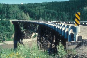
The Alaska-Canadian Highway, also known as the Alcan Highway or simply the Alaska Highway, was an ambitious engineering project constructed during World War II. It has been described as the largest and most difficult construction project since the Panama Canal. 

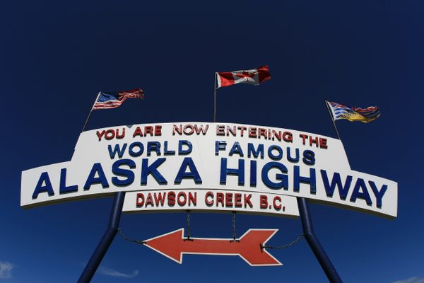
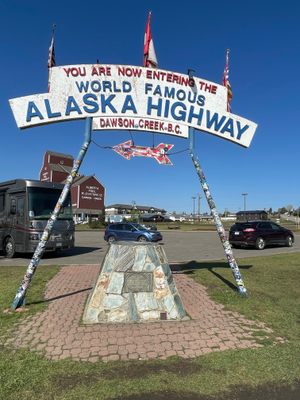
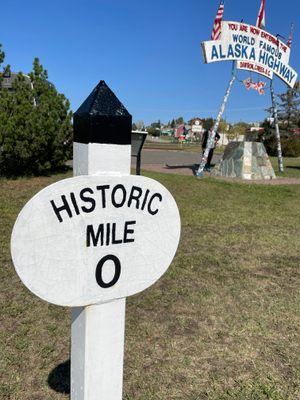
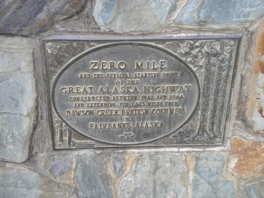
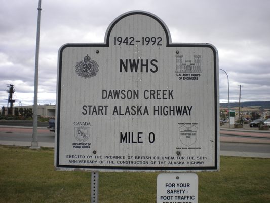
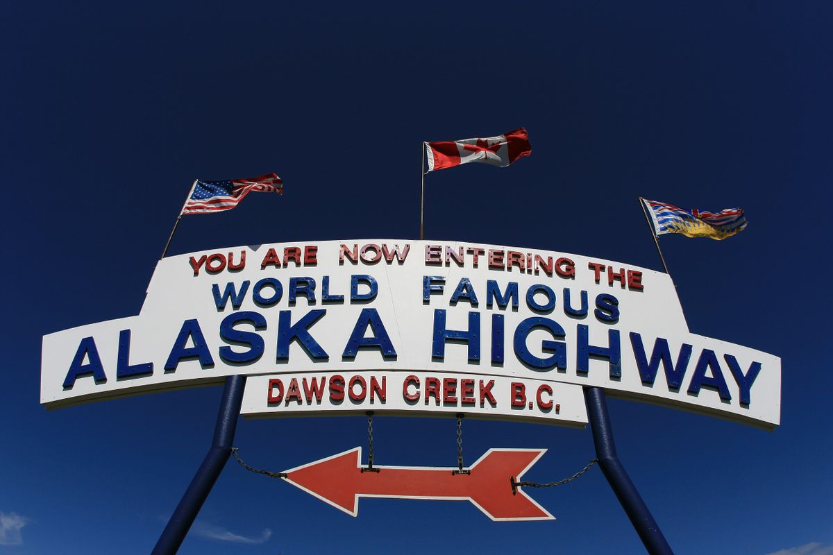
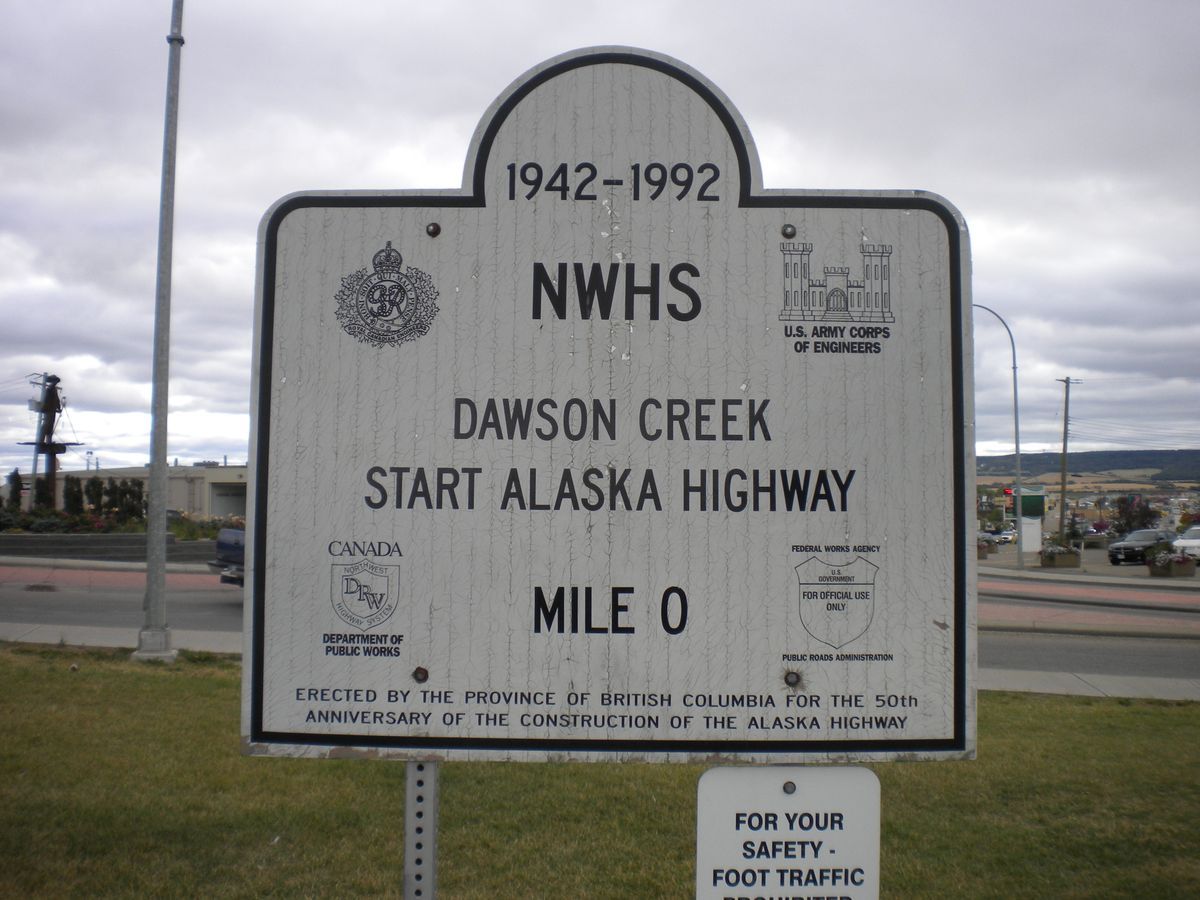
The highway begins at Dawson Creek in British Columbia, where this sign and a small cairn mark the start of the road. From there, the 1,400-mile-long highway snakes northwest through Canada to Alaska. The majority of the roadway is actually in Canada. When it was completed in 1942, the highway measured about 1,700 miles (2,700 kilometers) long, but because of rerouting and reconstruction, it is now some 300 miles shorter than that original length.

In Fairbanks, Alaska, another signpost marks the (unofficial) end of the historic route.

Related Tags

Signs Automotive History Roads Highways

Community Contributors

Added By

amdehart

Edited By

Eric Christensen, Michelle Cassidy

  • Eric Christensen
  • Michelle Cassidy

Published

November 7, 2023

Edit this listing

Make an Edit
Add Photos
Sources
  • https://themilepost.com/routes/alaska-highway/
  • https://vilda.alaska.edu/digital/collection/cdmg13/id/73/
  • https://www.explorenorth.com/library/roads/alcan-signs.html
Alaska-Canada Highway Mile 0
1317 Dawson Creek-Tupper Hwy
Dawson Creek, British Columbia
Canada
55.762295, -120.239169
Get Directions

Nearby Places

Kiskatinaw Bridge

Parkland, British Columbia

miles away

Philip J. Currie Dinosaur Museum

Wembley, Alberta

miles away

Explore the Destination Guide

Photo of British Columbia

British Columbia

Canada

Places 135
Stories 22

Nearby Places

Kiskatinaw Bridge

Parkland, British Columbia

miles away

Philip J. Currie Dinosaur Museum

Wembley, Alberta

miles away

Explore the Destination Guide

Photo of British Columbia

British Columbia

Canada

Places 135
Stories 22

Related Places

  • National Route 66 Museum

    Elk City, Oklahoma

    National Route 66 Museum

    An Oklahoma museum that celebrates the history of the "Mother Road."

  • The sign before it was covered in stickers.

    Chicago, Illinois

    Beginning (and End) of Historic Route 66

    A journey begins with a single step, and for many, the road-trip of a lifetime started at this Chicago intersection.

  • The final marker

    San Francisco, California

    Western Terminus of the Lincoln Highway

    The United States' first transcontinental automobile road came to its end at this spot in San Francisco's Lincoln Park.

  • Official start to the Dalton Highway

    Fairbanks, Alaska

    Haul Road (Dalton Highway)

    This gravelly, dangerous highway is the only road in the United States that leads to the Arctic Ocean.

  • Musical Road Ahead

    Palmdale, California

    R. Lee Ermey Musical Road

    The road plays 30 seconds of the Marine’s Hymn when driving over the grooved pavement.

  • Singapore Grand Prix at Old Upper Thomson Road - Racing in progress on the track

    Singapore

    Devil's Bend (Old Upper Thomson Road)

    This sharp turn was once the most dangerous part of the Singapore Grand Prix circuit.

  • Anchorage, Alaska

    Diamond Jim's Liquor Store Sign

    A quirky roadside sign was the subject of a years-long legal standoff over highway right-of-way clearances. 

  • US 6, looking east to a squall, just west of Warm Springs.

    Tonopah, Nevada

    U.S. 6 in Nevada

    A stretch of highway even lonelier than the so-called "Loneliest Road in America."

Aerial image of Vietnam, displaying the picturesque rice terraces, characterized by their layered, verdant fields.
Atlas Obscura Membership

Become an Atlas Obscura Member


Join our community of curious explorers.

Become a Member

Get Our Email Newsletter

Follow Us

Facebook YouTube TikTok Instagram Pinterest RSS Feed

Get the app

Download the App
Download on the Apple App Store Get it on Google Play
  • All Places
  • Latest Places
  • Most Popular
  • Places to Eat
  • Random
  • Nearby
  • Add a Place
  • Stories
  • Food & Drink
  • Itineraries
  • Lists
  • Video
  • Podcast
  • Newsletters
  • All Trips
  • Family Trip
  • Food & Drink
  • History & Culture
  • Wildlife & Nature
  • FAQ
  • Membership
  • Feedback & Ideas
  • Community Guidelines
  • Product Blog
  • Unique Gifts
  • Work With Us
  • About
  • FAQ
  • Advertise With Us
  • Advertising Guidelines
  • Privacy Policy
  • Cookie Policy
  • Terms of Use
Atlas Obscura

© 2025 Atlas Obscura. All Rights Reserved.