Trips Places Foods Stories Newsletters

Take your next trip with Atlas Obscura!

Our small-group adventures are inspired by our Atlas of the world's most fascinating places, the stories behind them, and the people who bring them to life.

Visit Adventures
Trips Highlight
Slovenia mushroom foraging
Slovenia • 6 days, 5 nights
Forest to Table in Alpine Slovenia
from
Central Asia yurt night stars
Uzbekistan • 15 days, 14 nights
Central Asia Road Trip: Backroads & Bazaars
from
View all trips
Top Destinations
Latest Places
Most Popular Places Random Place Lists Itineraries
Add a Place
Download the App
Top Destinations
View All Destinations »

Countries

  • Australia
  • Canada
  • China
  • France
  • Germany
  • India
  • Italy
  • Japan

Cities

  • Amsterdam
  • Barcelona
  • Beijing
  • Berlin
  • Boston
  • Budapest
  • Chicago
  • London
  • Los Angeles
  • Mexico City
  • Montreal
  • Moscow
  • New Orleans
  • New York City
  • Paris
  • Philadelphia
  • Rome
  • San Francisco
  • Seattle
  • Stockholm
  • Tokyo
  • Toronto
  • Vienna
  • Washington, D.C.
Latest Places
View All Places »
Hibiya Godzilla Square
Three Mile Island nuclear power plant.
Three Mile Island Historical Marker
Historical Marker.
Naval Air Station Richmond
Today, all that’s left of the mishap-plagued dam is its powerhouse.
Historic Hales Bar Dam Powerhouse
Latest Places to Eat & Drink
View All Places to Eat »
Cacio e pepe lasagna combines two classics.
C'è pasta... E pasta!
Spaghetto taratatà is named for the sound of rattling sabers.
Giano Restaurant
The gnocchi here get blanketed in a sugo with braised oxtail.
Cesare al Pellegrino
Romans insist you should feel the cracked peppercorns and cheese grains on your tongue.
Flavio al Velavevodetto
Tripe is fried to a crisp.
L’Osteria della Trippa
Recent Stories
All Stories Video Podcast
Most Recent Stories
View All Stories »
The first photo of the “woolly devil” made a stir among botanists when Deb Manley uploaded it to iNaturalist in March 2024.
How the Woolly Devil, Member of a New Plant Genus, Was Discovered on a Hike in Big Bend
about 23 hours ago
You don’t need to go to Turkey to see hundreds of hot air balloons rising.
Dear Atlas: Where Can I Find the Most Unusual Festivals in the U.S.?
2 days ago
Located in Indianola, Mississippi, Club Ebony hosted performances by blues legends like B.B. King.
How Club Ebony Helped Keep the Blues Alive in the Jim Crow South
2 days ago
Spot Gentoos and other species of penguins waddling, swimming, and diving from icebergs.
Adventure at Sea: An Explorer’s Guide to Antarctica
2 days ago

No search results found for
“”

Make sure words are spelled correctly.

Try searching for a travel destination.

Places near me Random place

Popular Destinations

  • Paris
  • London
  • New York
  • Berlin
  • Rome
  • Los Angeles
Trips Places Foods Stories Newsletters
Sign In Join
Places near me Random place
All the United States Alaska Fairbanks Haul Road (Dalton Highway)
AO Edited

Haul Road (Dalton Highway)

This gravelly, dangerous highway is the only road in the United States that leads to the Arctic Ocean.

Fairbanks, Alaska

Added By
Bryan Woerner
Email
Been Here
Want to go
Added to list
Official start to the Dalton Highway   bryanwoerner / Atlas Obscura User
Brooks Range   bryanwoerner / Atlas Obscura User
The North Slope   bryanwoerner / Atlas Obscura User
Mountain near Dietrich River   bryanwoerner / Atlas Obscura User
Information sign near Coldfoot   bryanwoerner / Atlas Obscura User
Yukon River Bridge   bryanwoerner / Atlas Obscura User
Pipeline along the bridge   bryanwoerner / Atlas Obscura User
Atigun Pass 2018   judyinalaska / Atlas Obscura User
Dall Sheep in Atigun Pass 2008   judyinalaska / Atlas Obscura User
Snowshoe Hare, Dalton Highway 2018   judyinalaska / Atlas Obscura User
Sukapak Mt with Pingo in front 2018   judyinalaska / Atlas Obscura User
Ground Squirrel, Galbraith Lake 2018   judyinalaska / Atlas Obscura User
pipeline at the Yukon River   devanney5 / Atlas Obscura User
Dalton Highway   devanney5 / Atlas Obscura User
sign along Dalton Hwy   devanney5 / Atlas Obscura User
heading to the Arctic Circle   devanney5 / Atlas Obscura User
The Oil Fields of Prudhoe Bay   bryanwoerner / Atlas Obscura User
This is what driving on compact gravel does to a car.   bryanwoerner / Atlas Obscura User
Brooks Range   bryanwoerner / Atlas Obscura User
Coldfoot Camp   bryanwoerner / Atlas Obscura User
Musk oxen   bryanwoerner / Atlas Obscura User
Porcupine, Dalton Highway 2018   judyinalaska / Atlas Obscura User
Brooks Range 2018   judyinalaska / Atlas Obscura User
Yukon River Bridge 2018   judyinalaska / Atlas Obscura User
Yukon River Bridge, Pipeline 2018   judyinalaska / Atlas Obscura User
Dall Sheep in Atigun Pass 2008   judyinalaska / Atlas Obscura User
Atigun Pass 2018   judyinalaska / Atlas Obscura User
the road the to the Arctic Circle.   devanney5 / Atlas Obscura User
Arctic Circle… (almost) the top of the world.   devanney5 / Atlas Obscura User
The late afternoon sky near the Arctic Circle. This photo was taken in October, 2020.   rbt45769 / Atlas Obscura User
The beautiful Kanuti River crosses the Dalton Highway. Fishing is good at this location.   rbt45769 / Atlas Obscura User
The Alaskan Pipeline runs parallel to the Dalton Highway in many places. I was able to access it with ease!   rbt45769 / Atlas Obscura User
This is part of the Finger Mountain rock formation just South of the Arctic Circle.   rbt45769 / Atlas Obscura User
Arctic Circle Sign   bryanwoerner / Atlas Obscura User
Road goes on and on   Curious Crow / Atlas Obscura User
Fellow traveler   Curious Crow / Atlas Obscura User
Proof   Curious Crow / Atlas Obscura User
Yep!   Curious Crow / Atlas Obscura User
Mud everywhere   Curious Crow / Atlas Obscura User
River crossing   Curious Crow / Atlas Obscura User
Yukon River 2018   judyinalaska / Atlas Obscura User
Muddy Mess but we made it   Curious Crow / Atlas Obscura User
Dalton Highway 2018   judyinalaska / Atlas Obscura User
Snow Barrier, Dalton Highway 2018   judyinalaska / Atlas Obscura User
Sukapak Mountain, Dalton Highway 2018   judyinalaska / Atlas Obscura User
Taken in 2002.   queso / Atlas Obscura User
Atigun Pass 2018   judyinalaska / Atlas Obscura User
Dalton Highway 2018   judyinalaska / Atlas Obscura User
Been Here
Want to go
Added to list

About

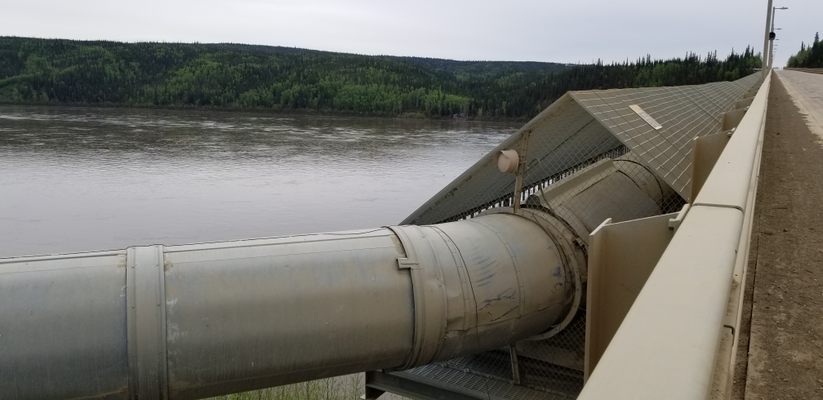
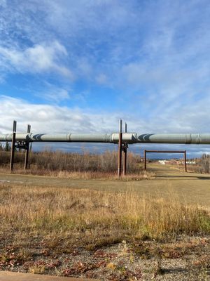
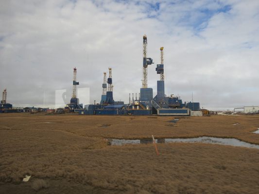
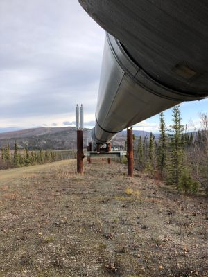
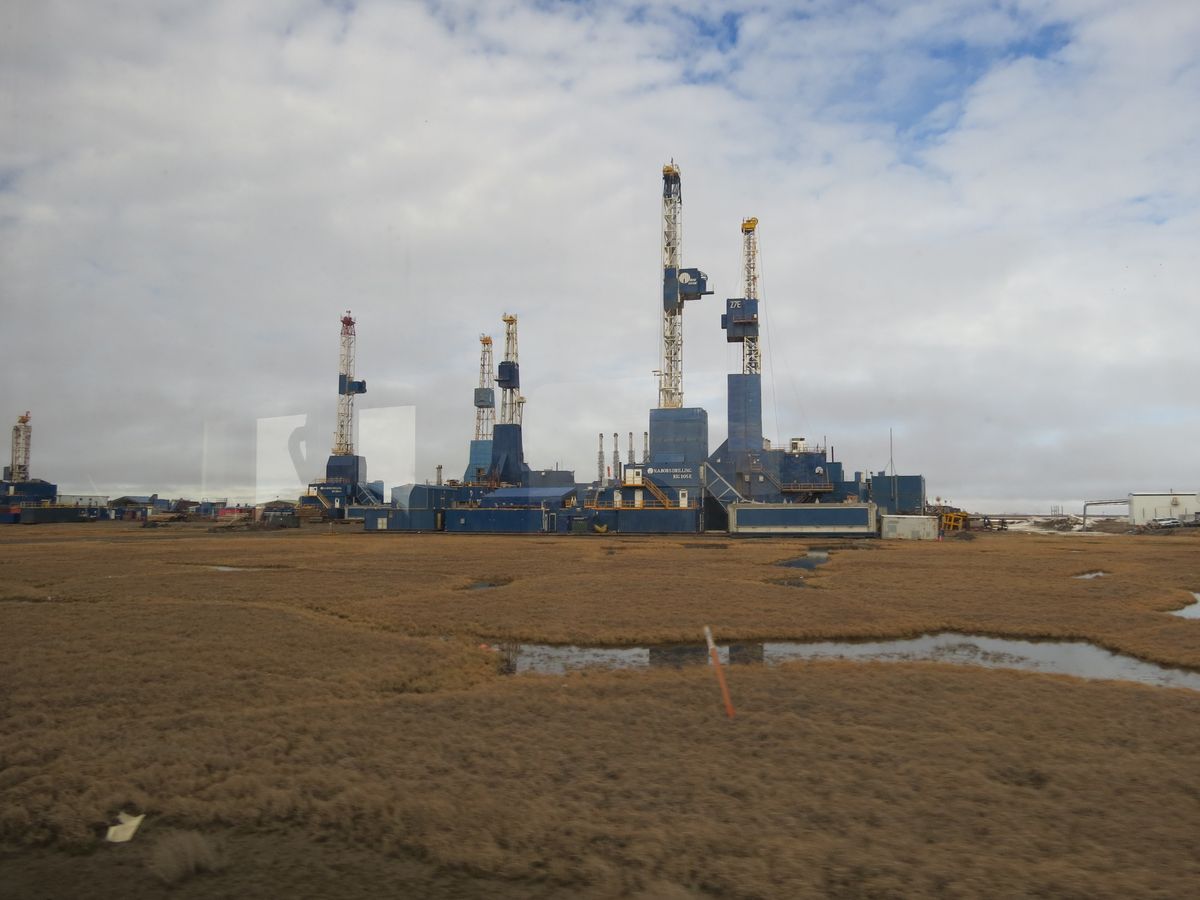
In 1968, oil was discovered on Alaska’s North Slope, which is near Prudhoe Bay on the Arctic Ocean. But those who wanted to extract that resource were faced with the challenge of getting the oil from the remote North Slope to the rest of the United States. The answer they found was a pipeline. And, in order to build the pipeline you need a road.

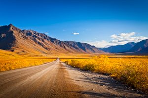
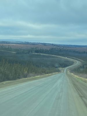
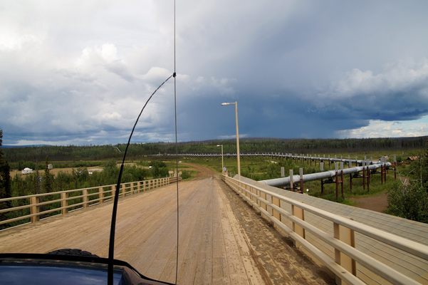
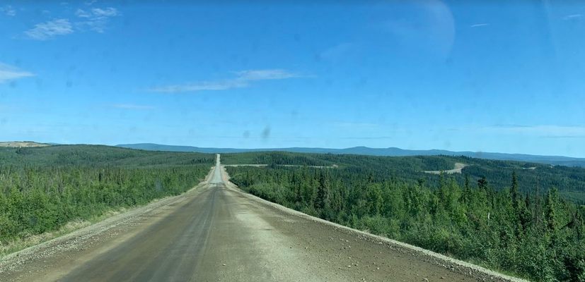
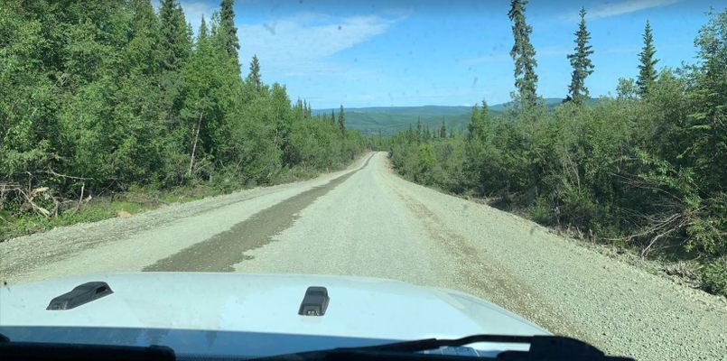
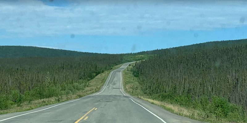
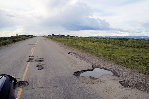
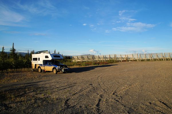
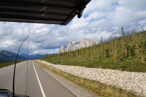
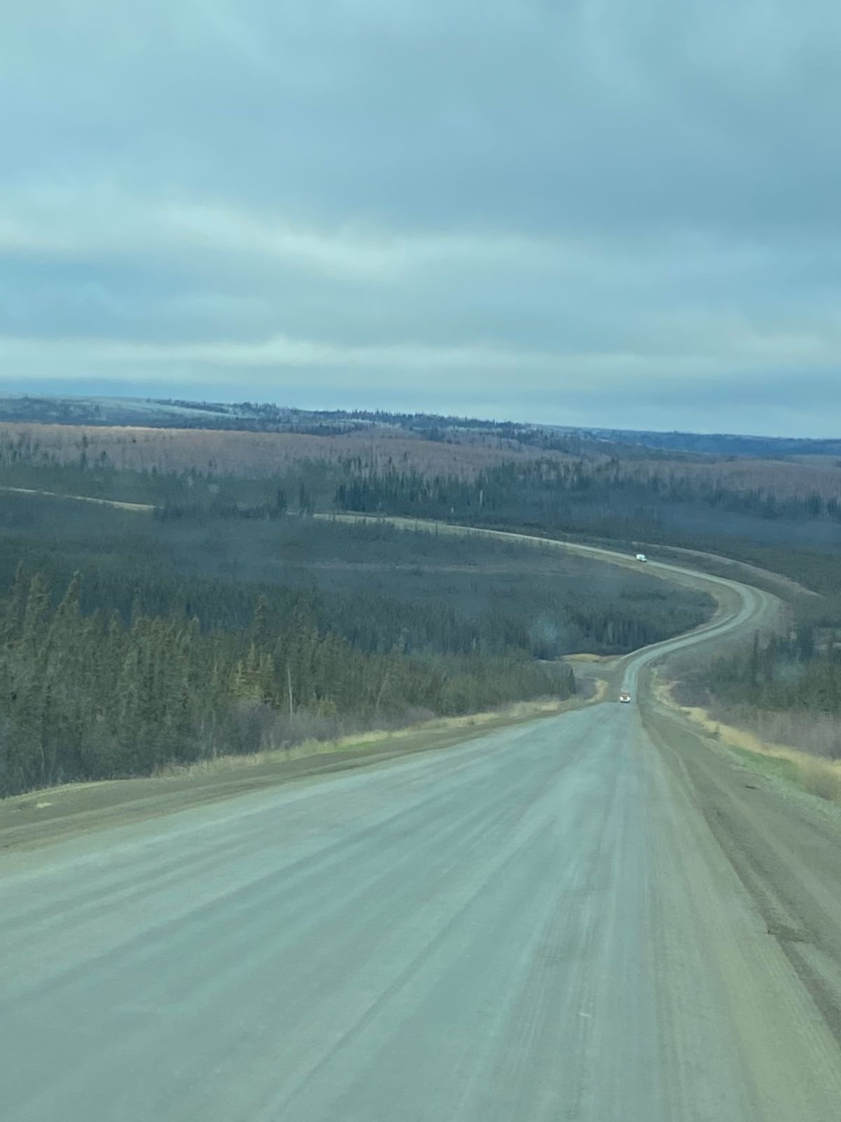
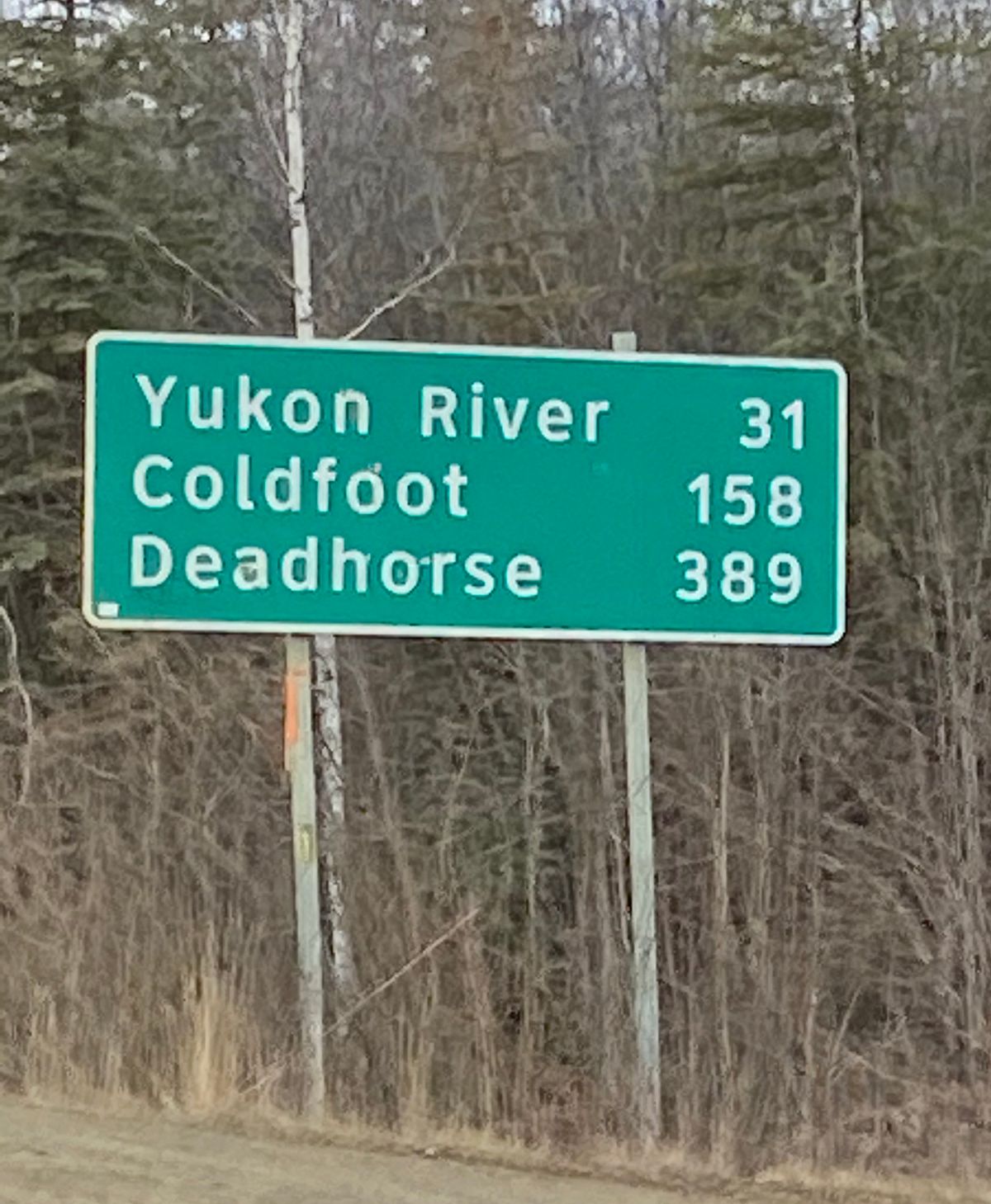
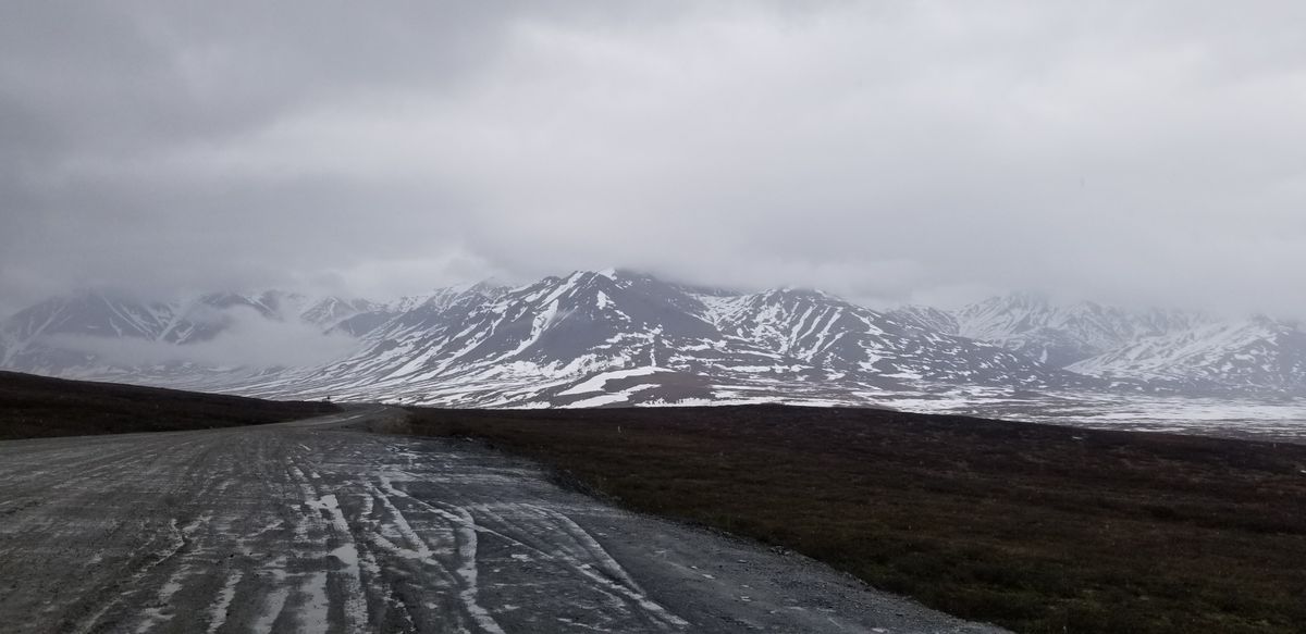
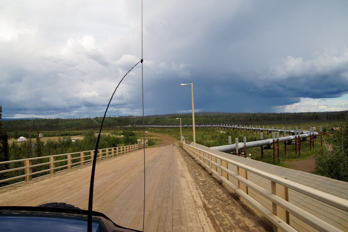
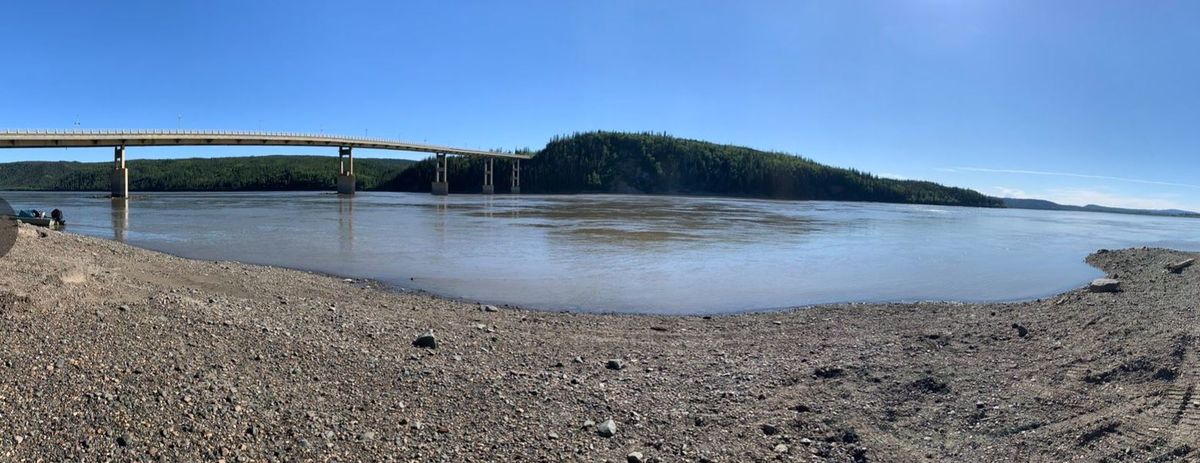
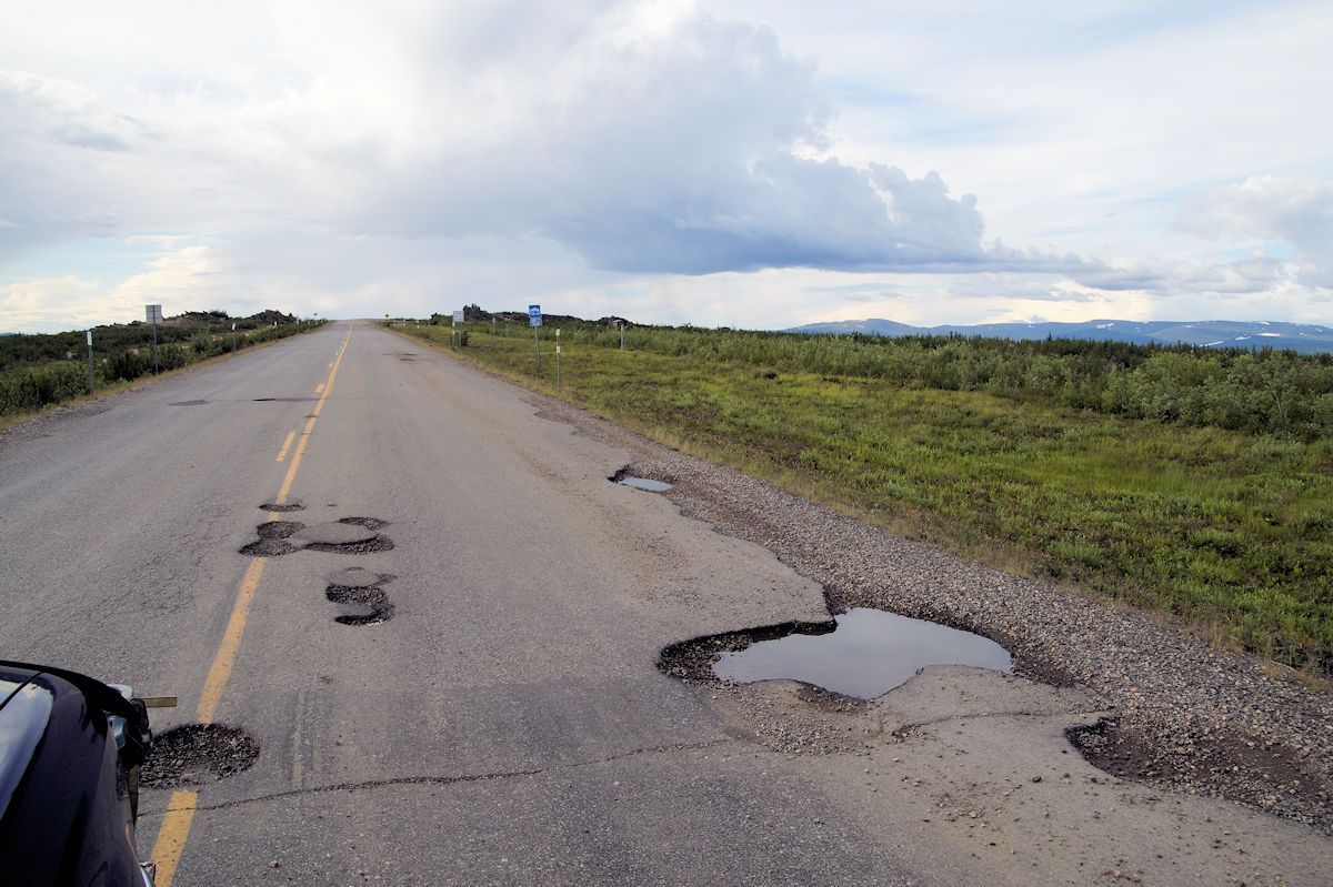
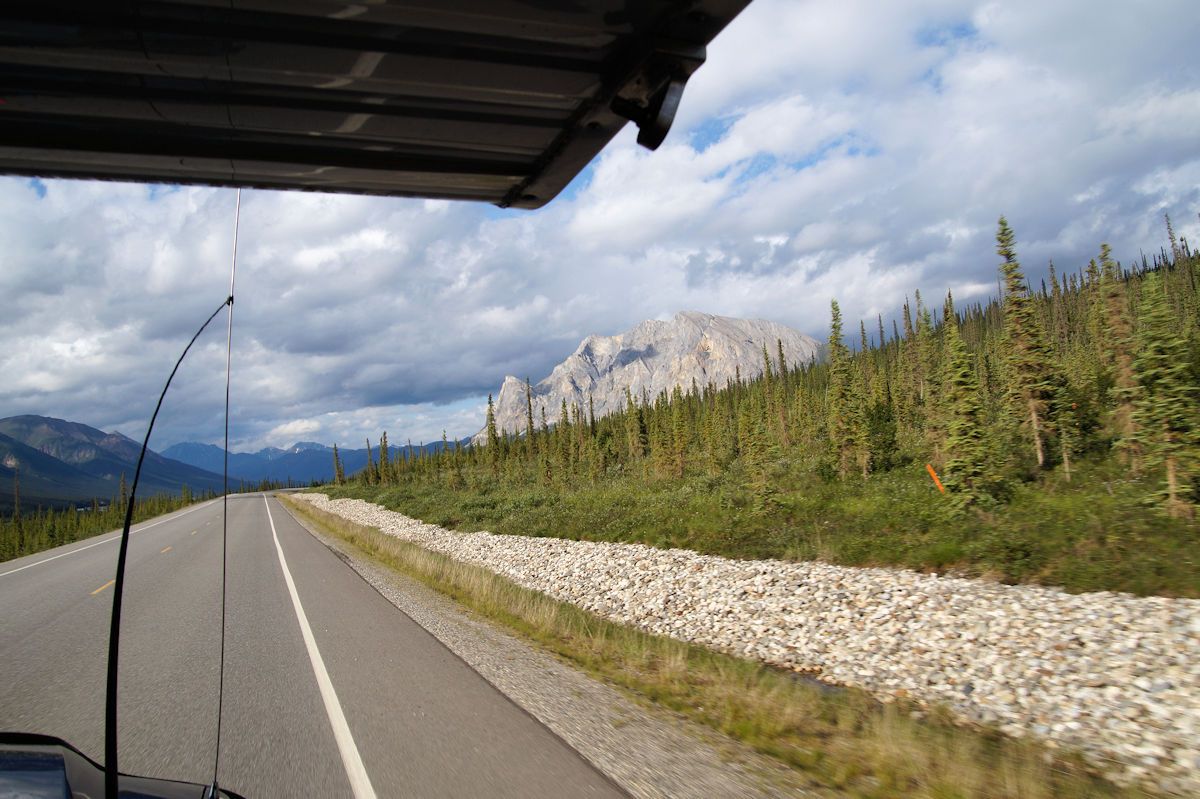
The North Slope Haul was built to aid construction of the Trans-Alaska Pipeline. Over the course of its 414 miles, the highway generally follows the pipeline from Livengood (north of Fairbanks) to the oil fields of Prudhoe Bay. It consists mainly of compact gravel and approximately 120 miles of paved sections. (The paved sections are rough as a result of the constant cycle of freezing and thawing.)

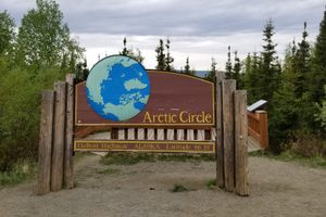
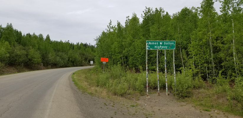
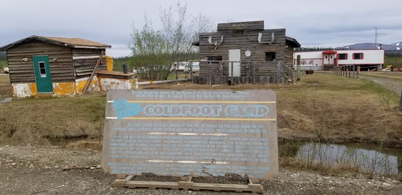
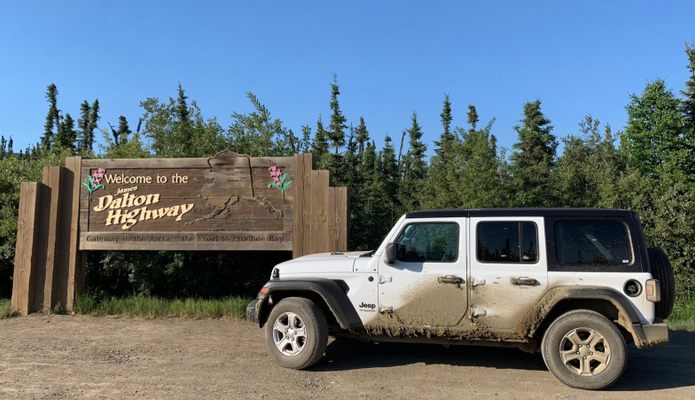
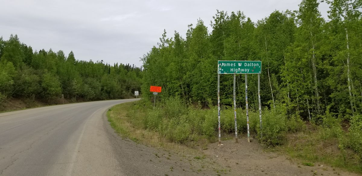
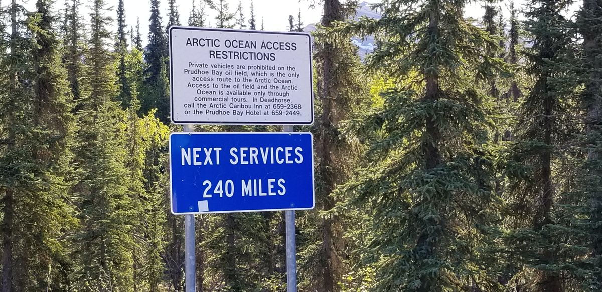
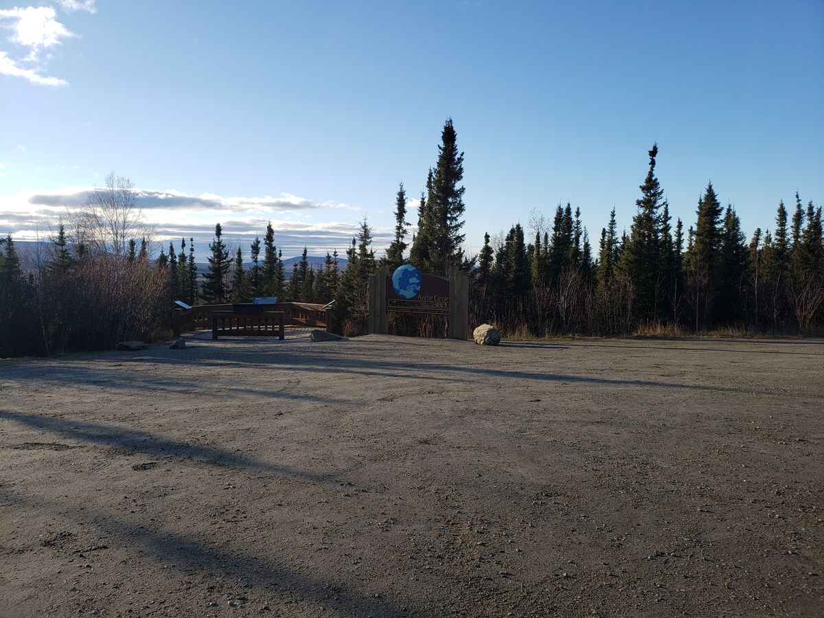
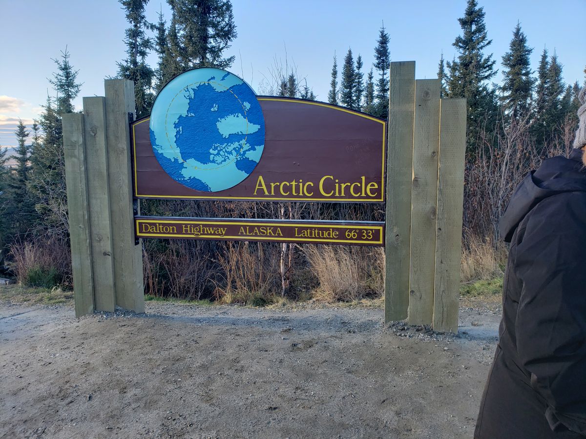
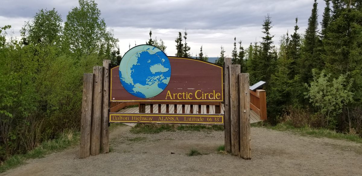
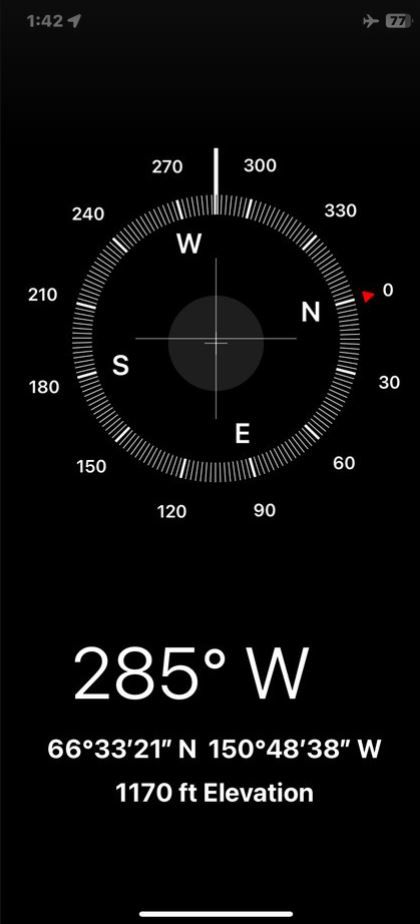
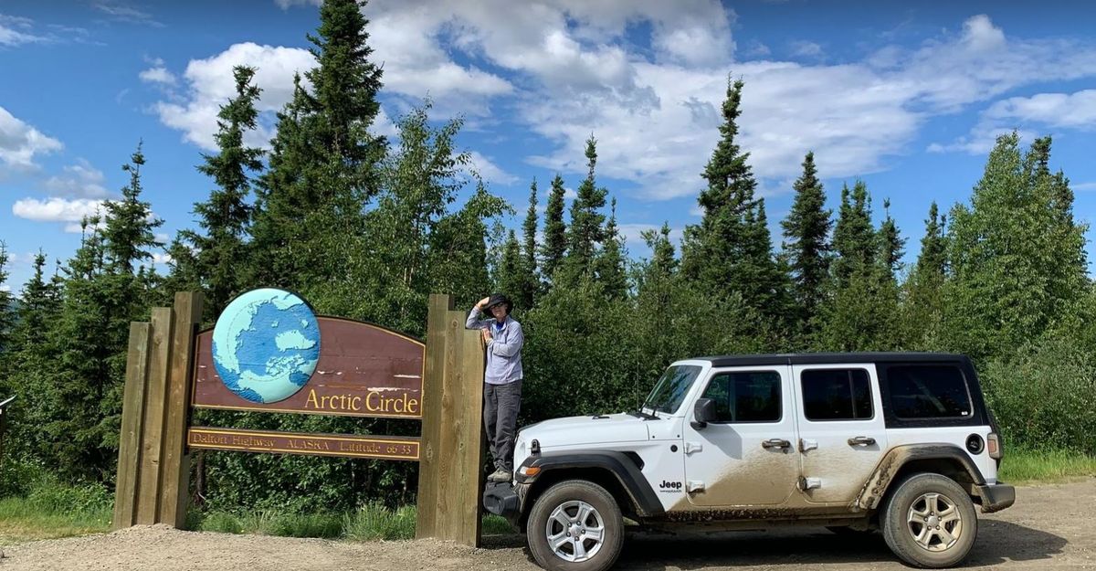
After construction was completed, operation of the road was turned over to the state of Alaska, which named it the James W. Dalton Highway, after the Arctic engineer and lifelong Alaskan. Up until 1994, the public could only use a portion of the road, up until Disaster Creek at mile 221. Beyond that, use of Dalton Highway was limited to supply trucks headed to the oil fields. After 1994, the whole road was open to the public and was made famous by such TV shows as the History Channel’s Ice Road Truckers.

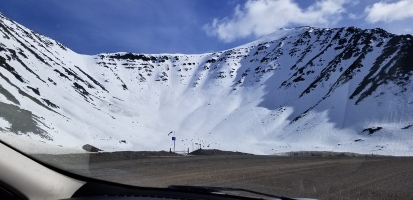
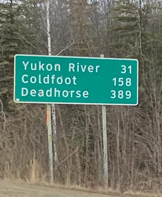
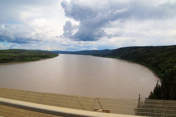
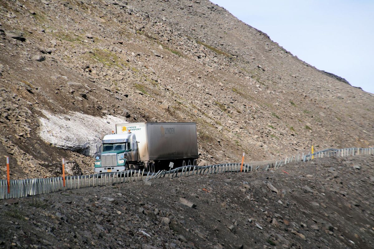
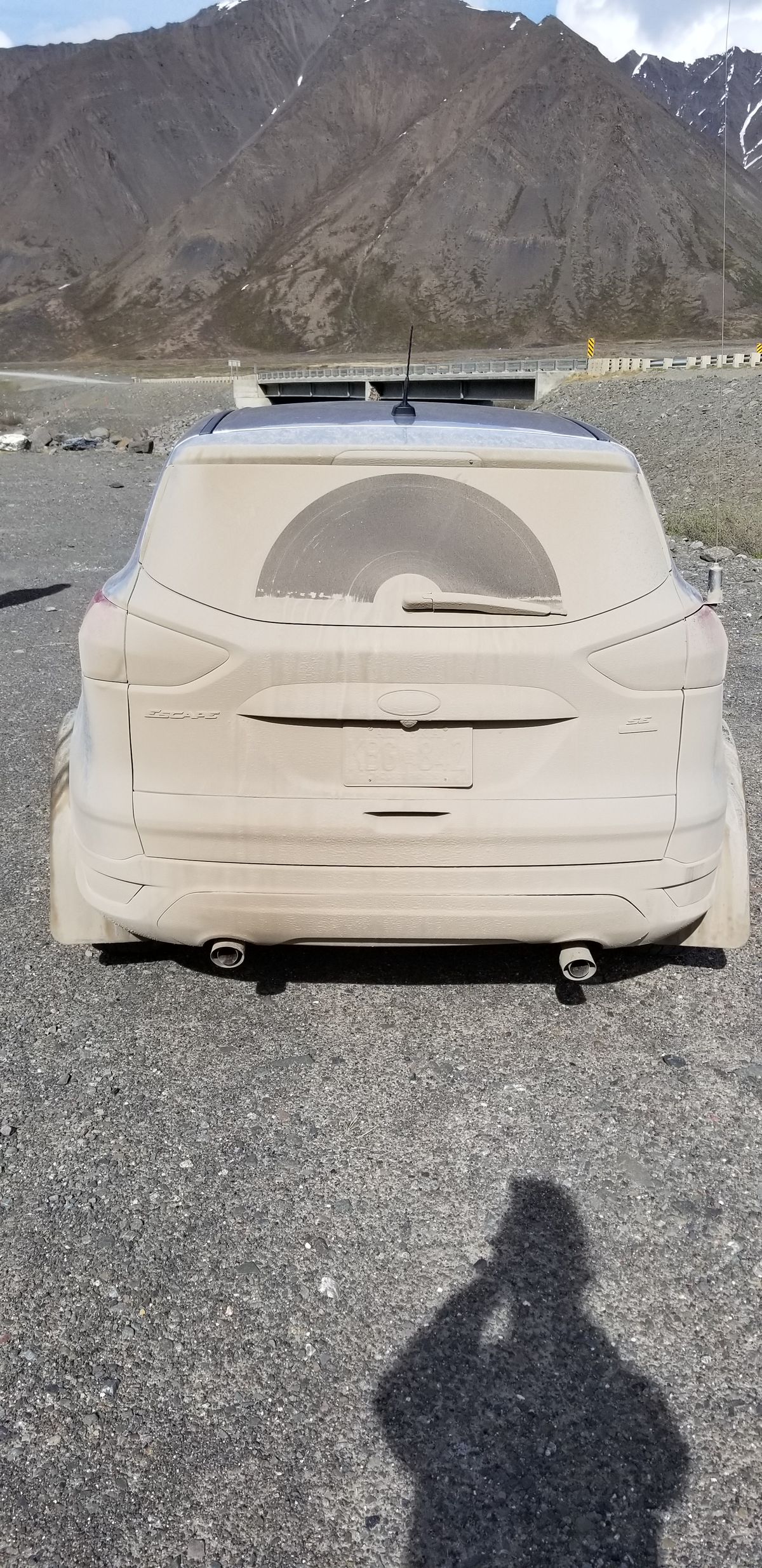
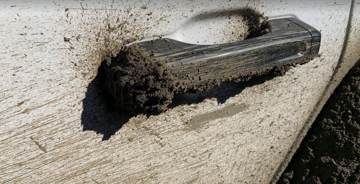
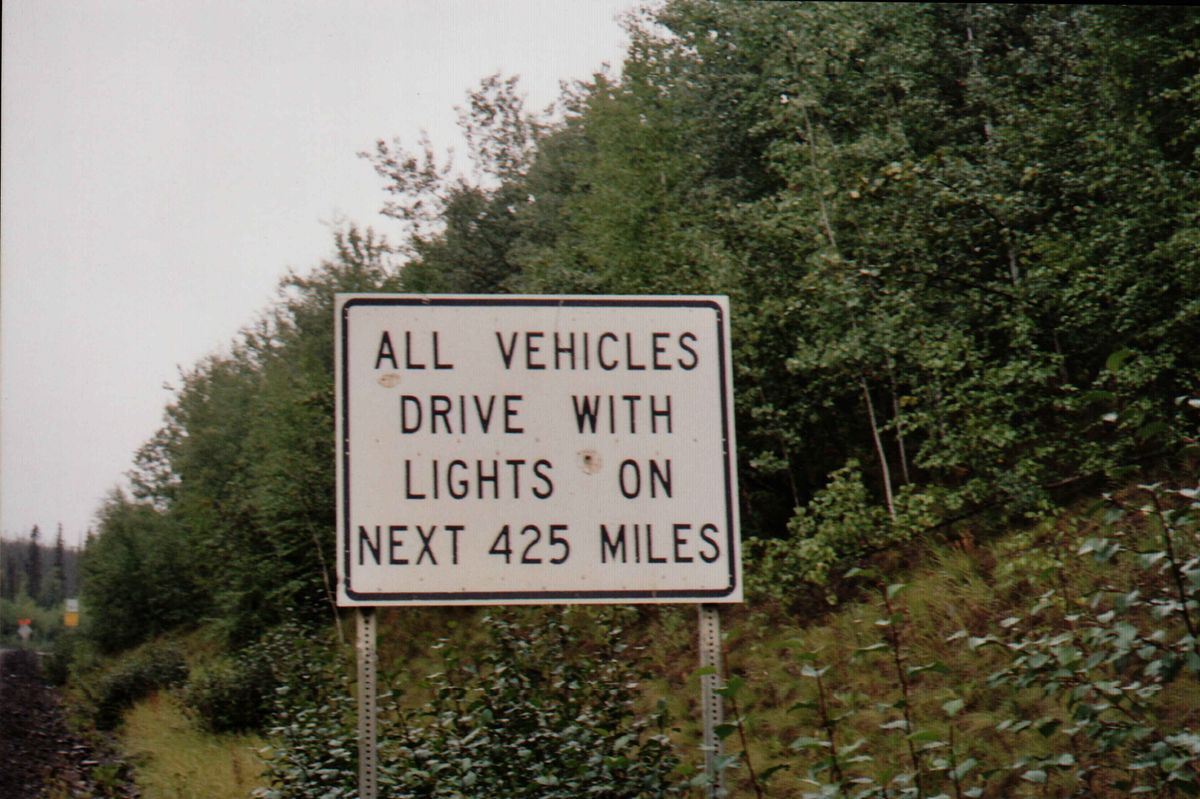
This road is not for the average driver. There is no cell phone service and only three places to get gas – E. L. Patton Yukon River Bridge, Coldfoot Camp (also includes repair services), and Deadhorse (also has repair services). Because of the compact gravel, trucks can and do kick up rocks that have enough force to smash windshields. The trucks (and the weather) can leave ruts in the gravel, making even staying on the road a challenge, especially in areas where it is barely wide enough for two vehicles to pass. While the road is mainly straight and flat, there are sharp turns—one playfully called "Oh Shit Corner"—and steep grades up to 16%. One of those sections is known as Ice Cut, which is cut through the ice shelf.

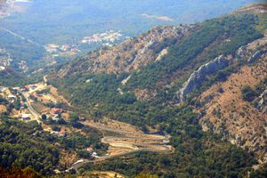
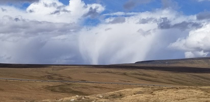
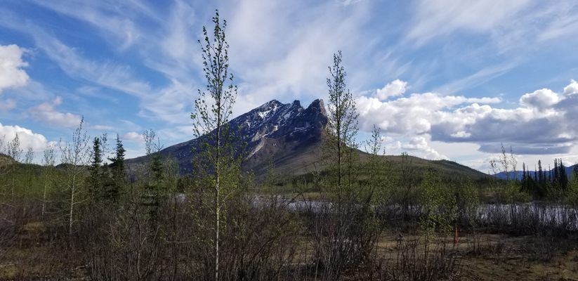
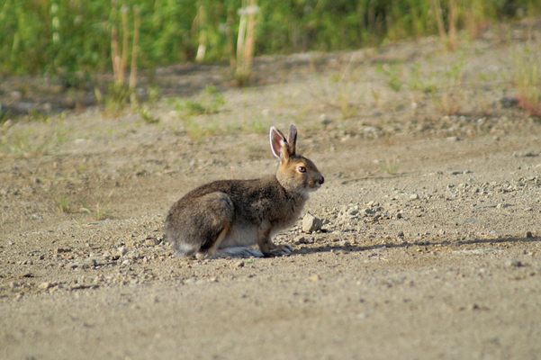
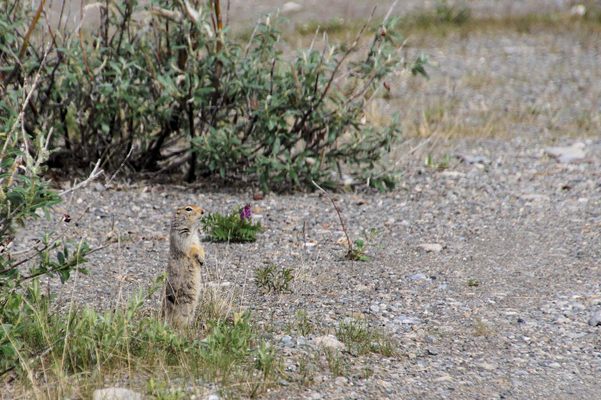
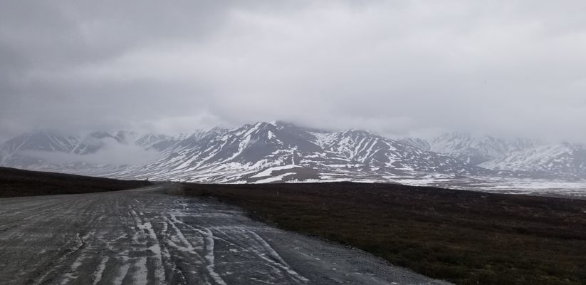
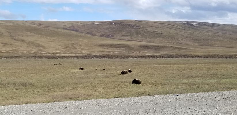
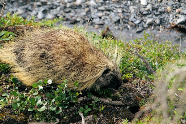
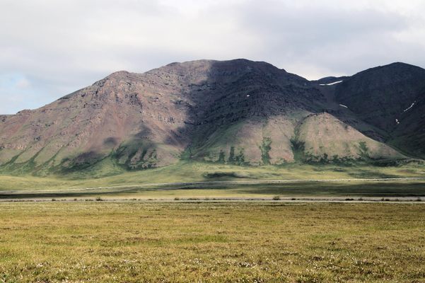
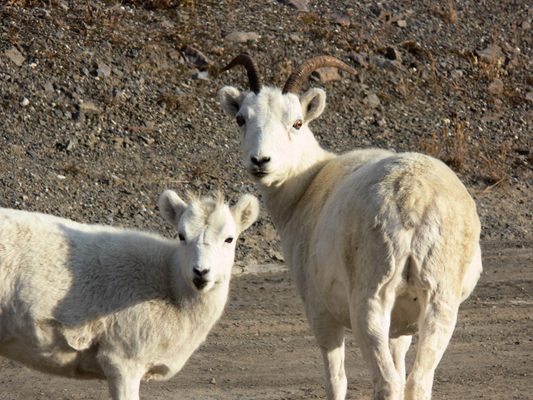
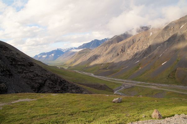
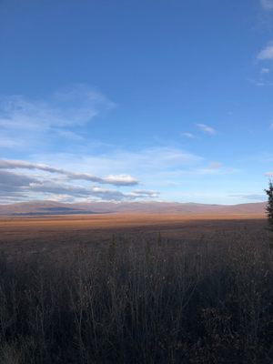
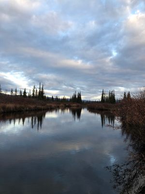
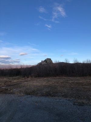
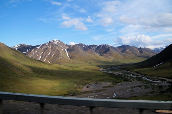
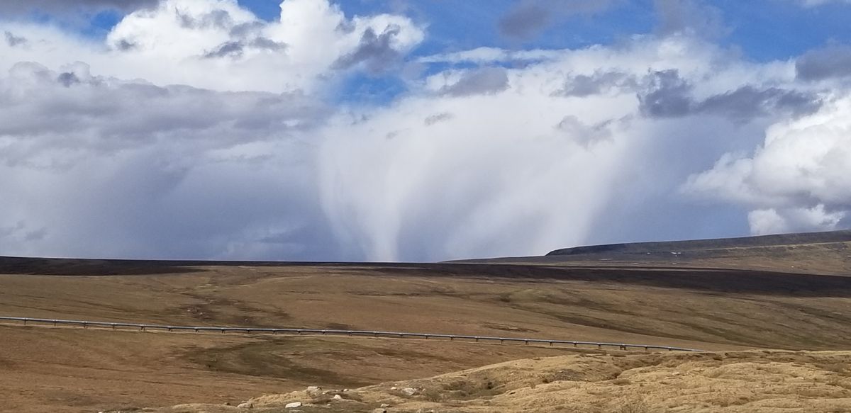
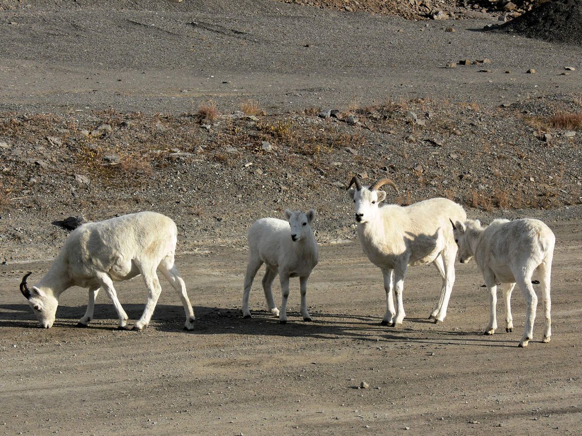
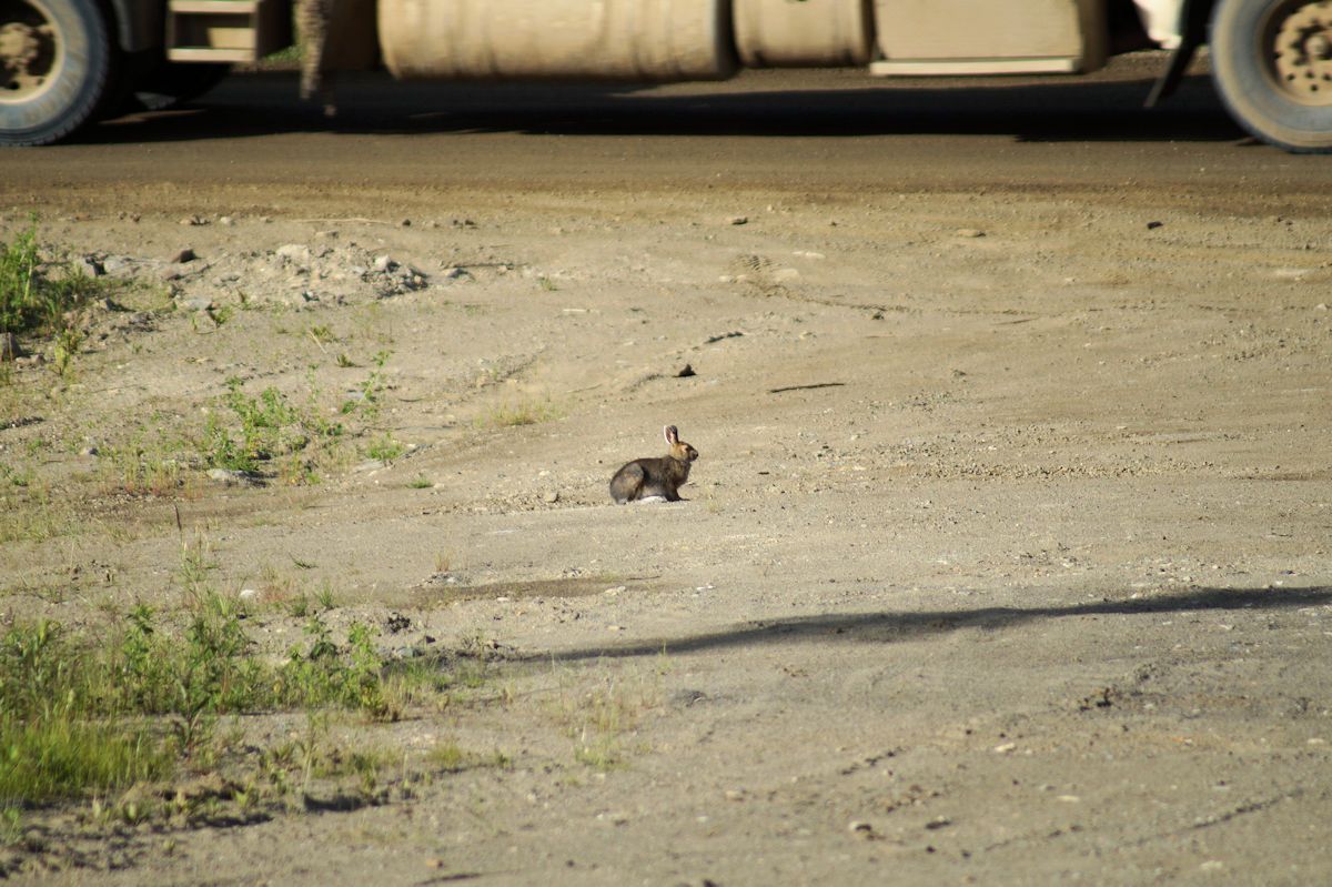
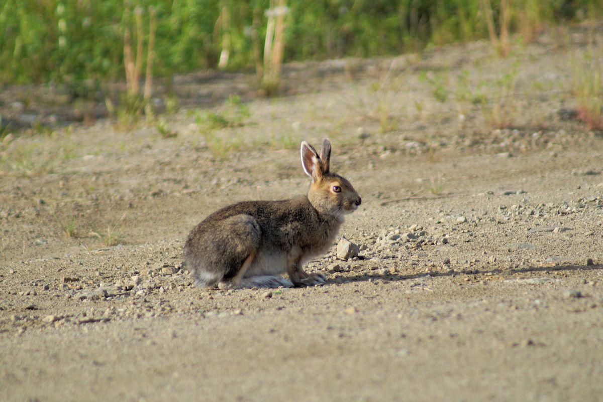
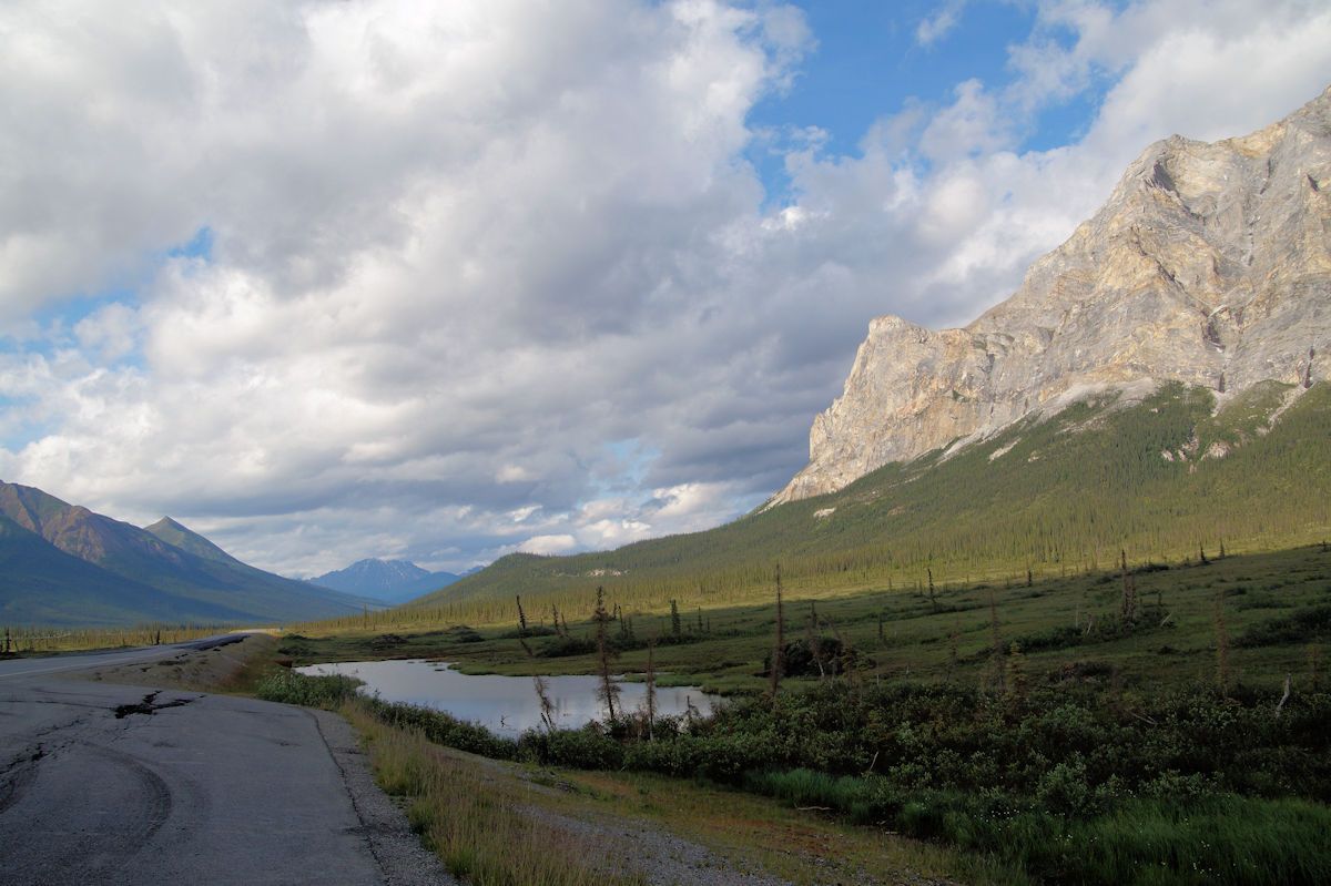
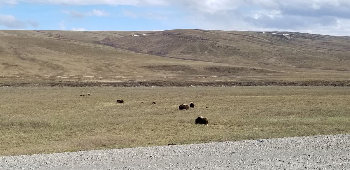
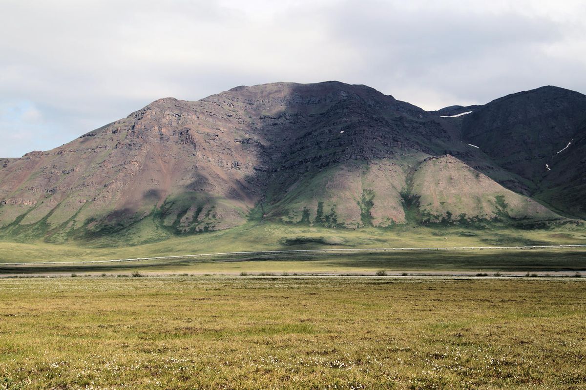
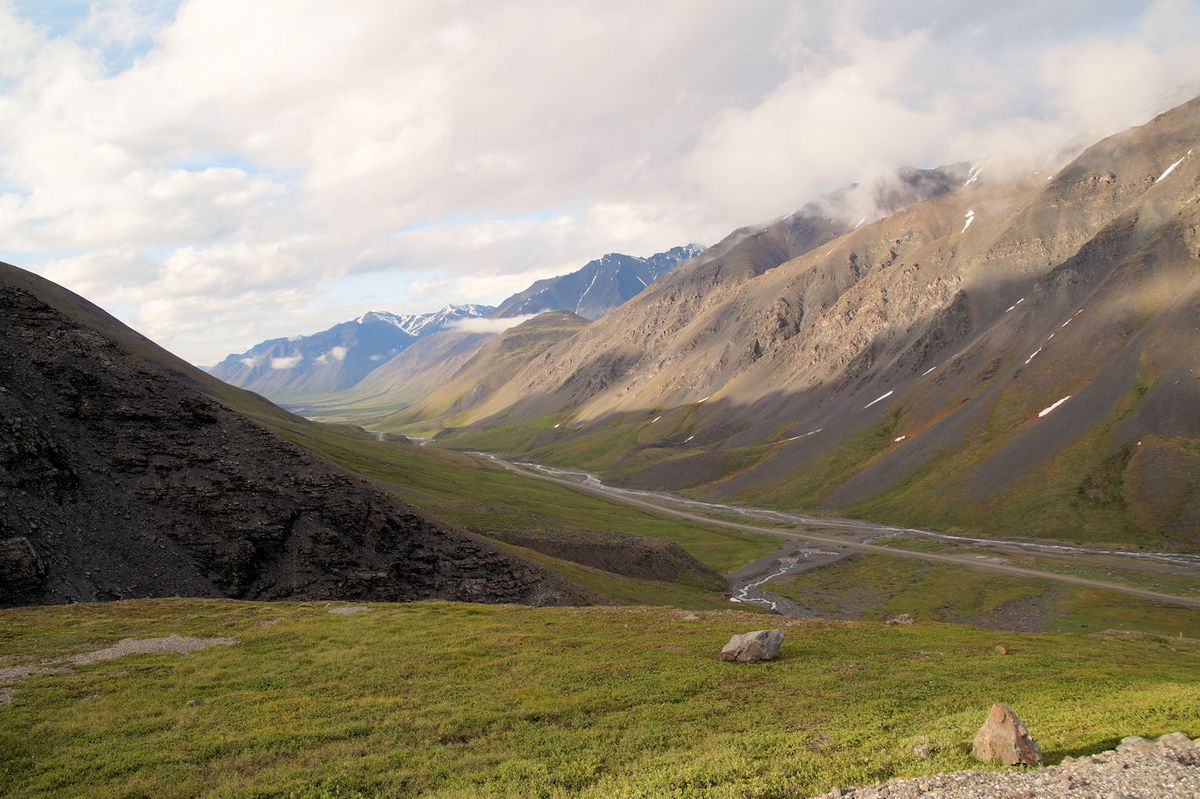
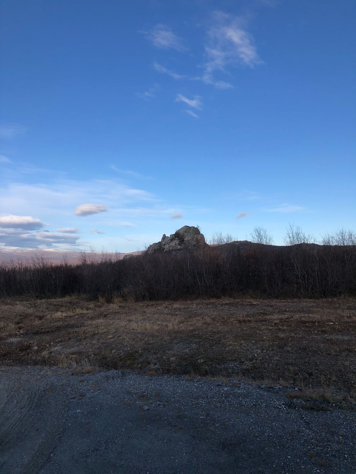
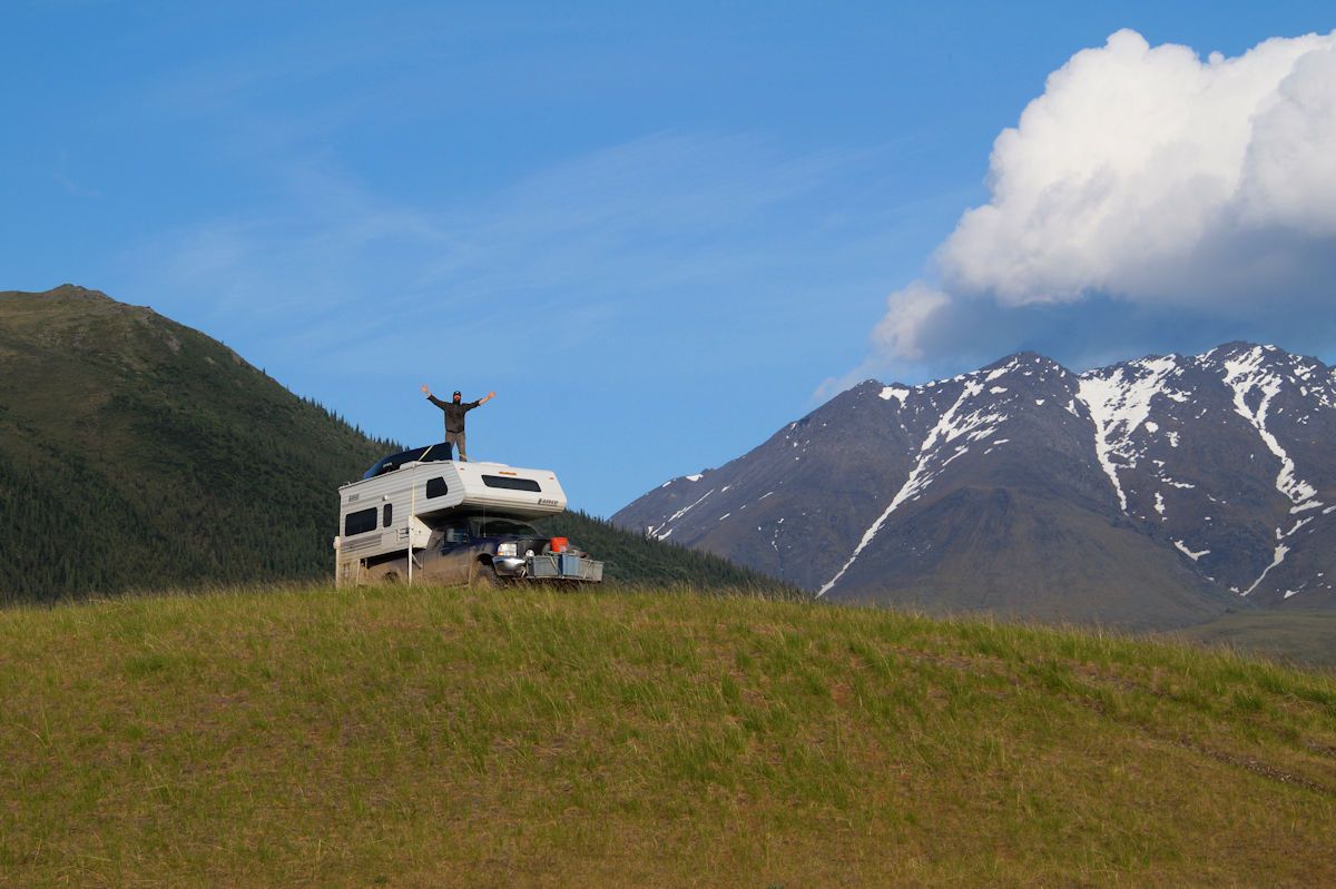
The road features a stunning view of the different environs of Alaska, from the Arctic forests, the Brooks Range mountains, and the vast tundra north of the Brooks to the oil fields. It is one of the few places where you can stop, and not hear any other sound of humanity.

Related Tags

Roads Highways Oil Trucks Automotive History

Know Before You Go

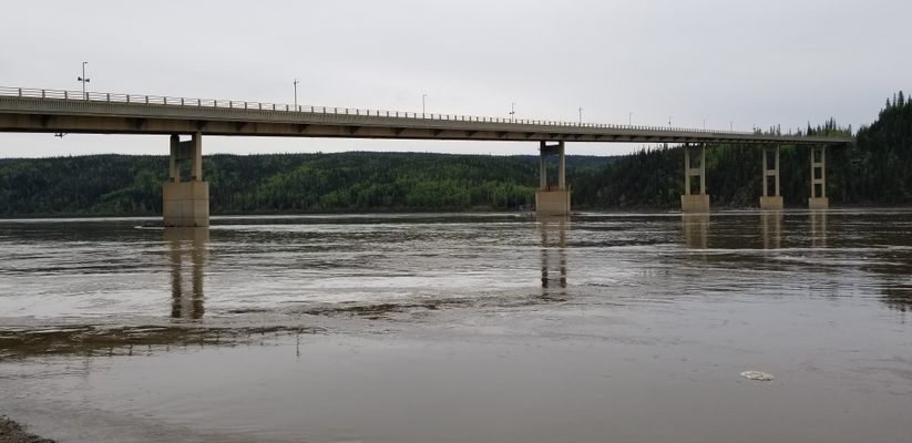
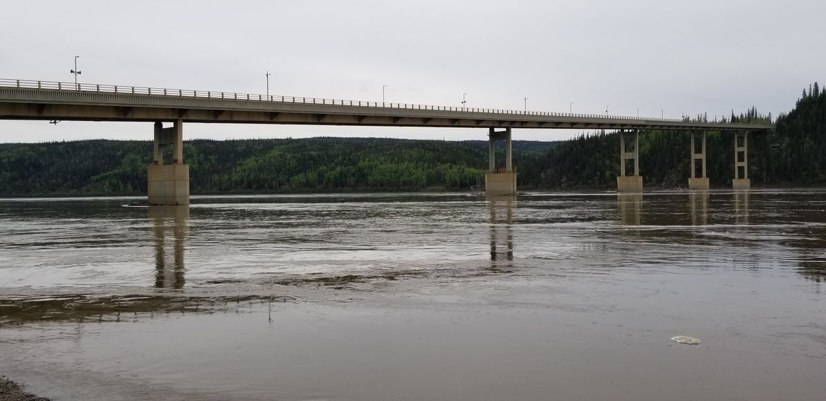
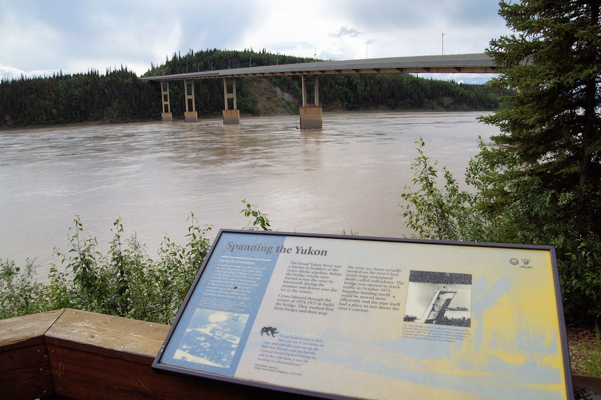
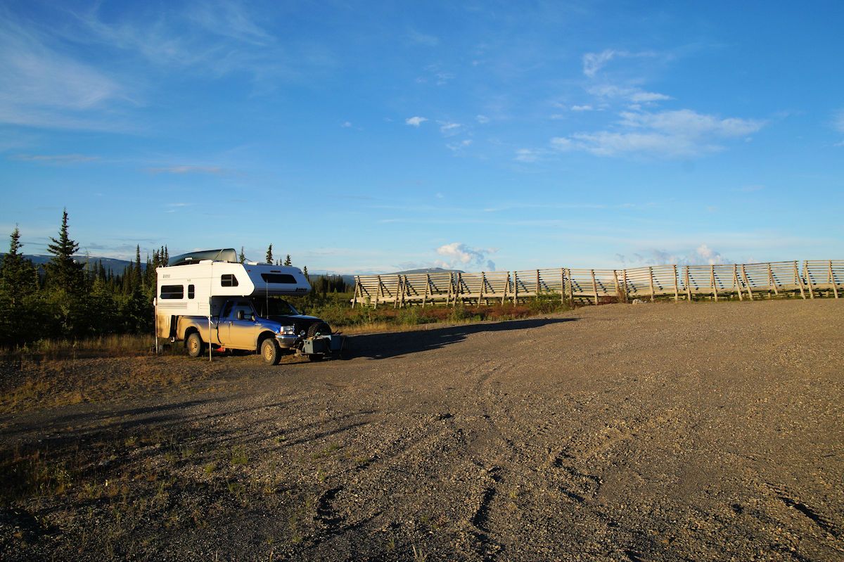
Most rental car companies in Alaska do not allow their vehicles on the Dalton Highway and private vehicles are strongly encouraged to have more than one full-sized spare tire, tools, and a CB, as there is no cellphone reception. The Dalton Highway is open year-round, though services at the Yukon River are closed mid-September to mid-May. Check local conditions before driving.

Community Contributors

Added By

bryanwoerner

Edited By

ljbrown, rbt45769, queso, devanney5...

  • ljbrown
  • rbt45769
  • queso
  • devanney5
  • judyinalaska
  • Curious Crow

Published

May 24, 2021

Edit this listing

Make an Edit
Add Photos
Sources
  • https://www.blm.gov/visit/dalton-highway
  • https://www.alaska.org/detail/the-last-tree-on-the-dalton
  • https://en.wikipedia.org/wiki/Dalton_Highway
  • http://dot.alaska.gov/highways/dalton/
  • https://www.dangerousroads.org/north-america/usa/50-james-dalton-highway-usa.html
Haul Road (Dalton Highway)
Fairbanks, Alaska, 99701
United States
67.844239, -149.816997
Visit Website

Nearby Places

Coldfoot Camp

Coldfoot, Alaska

miles away

Arctic Circle Monument Sign

Alaska

miles away

Explore the Destination Guide

Photo of Fairbanks

Fairbanks

Alaska

Places 14
Stories 2

Nearby Places

Coldfoot Camp

Coldfoot, Alaska

miles away

Arctic Circle Monument Sign

Alaska

miles away

Explore the Destination Guide

Photo of Fairbanks

Fairbanks

Alaska

Places 14
Stories 2

Related Stories and Lists

14 Precarious Roadways

List

By Jonathan Carey

The Loneliest Road in Every State in America

roads

By Frank Jacobs

Related Places

  • National Route 66 Museum

    Elk City, Oklahoma

    National Route 66 Museum

    An Oklahoma museum that celebrates the history of the "Mother Road."

  • Alaska Highway Mile 0 sign

    Dawson Creek, British Columbia

    Alaska-Canada Highway Mile 0

    The arch marks the beginning of the road for northbound travelers.

  • The final marker

    San Francisco, California

    Western Terminus of the Lincoln Highway

    The United States' first transcontinental automobile road came to its end at this spot in San Francisco's Lincoln Park.

  • Musical Road Ahead

    Palmdale, California

    R. Lee Ermey Musical Road

    The road plays 30 seconds of the Marine’s Hymn when driving over the grooved pavement.

  • Singapore Grand Prix at Old Upper Thomson Road - Racing in progress on the track

    Singapore

    Devil's Bend (Old Upper Thomson Road)

    This sharp turn was once the most dangerous part of the Singapore Grand Prix circuit.

  • The sign before it was covered in stickers.

    Chicago, Illinois

    Beginning (and End) of Historic Route 66

    A journey begins with a single step, and for many, the road-trip of a lifetime started at this Chicago intersection.

  • US 6, looking east to a squall, just west of Warm Springs.

    Tonopah, Nevada

    U.S. 6 in Nevada

    A stretch of highway even lonelier than the so-called "Loneliest Road in America."

  • Miyakojima Mamoru-kun

    Miyakojima, Japan

    Mamoru-kun Patrolman

    Made to improve road safety, these policemen-like figurines in Miyakojima island have earned an enthusiastic fanbase.

Aerial image of Vietnam, displaying the picturesque rice terraces, characterized by their layered, verdant fields.
Atlas Obscura Membership

Become an Atlas Obscura Member


Join our community of curious explorers.

Become a Member

Get Our Email Newsletter

Follow Us

Facebook YouTube TikTok Instagram Pinterest RSS Feed

Get the app

Download the App
Download on the Apple App Store Get it on Google Play
  • All Places
  • Latest Places
  • Most Popular
  • Places to Eat
  • Random
  • Nearby
  • Add a Place
  • Stories
  • Food & Drink
  • Itineraries
  • Lists
  • Video
  • Podcast
  • Newsletters
  • All Trips
  • Family Trip
  • Food & Drink
  • History & Culture
  • Wildlife & Nature
  • FAQ
  • Membership
  • Feedback & Ideas
  • Community Guidelines
  • Product Blog
  • Unique Gifts
  • Work With Us
  • About
  • FAQ
  • Advertise With Us
  • Advertising Guidelines
  • Privacy Policy
  • Cookie Policy
  • Terms of Use
Atlas Obscura

© 2025 Atlas Obscura. All Rights Reserved.