Trips Places Foods Stories Newsletters

Take your next trip with Atlas Obscura!

Our small-group adventures are inspired by our Atlas of the world's most fascinating places, the stories behind them, and the people who bring them to life.

Visit Adventures
Trips Highlight
Macchu Picchu
Peru • 10 days, 9 nights
Peru: Machu Picchu & the Last Incan Bridges
from
Central Asia yurt night stars
Uzbekistan • 15 days, 14 nights
Central Asia Road Trip: Backroads & Bazaars
from
View all trips
Top Destinations
Latest Places
Most Popular Places Random Place Lists Itineraries
Add a Place
Download the App
Top Destinations
View All Destinations »

Countries

  • Australia
  • Canada
  • China
  • France
  • Germany
  • India
  • Italy
  • Japan

Cities

  • Amsterdam
  • Barcelona
  • Beijing
  • Berlin
  • Boston
  • Budapest
  • Chicago
  • London
  • Los Angeles
  • Mexico City
  • Montreal
  • Moscow
  • New Orleans
  • New York City
  • Paris
  • Philadelphia
  • Rome
  • San Francisco
  • Seattle
  • Stockholm
  • Tokyo
  • Toronto
  • Vienna
  • Washington, D.C.
Latest Places
View All Places »
Though the dam crest is long gone, the tower still stands.
Den Hvide Jomfru (The White Maiden)
The front of the mosque.
Şakirin Mosque
Ornate decorations are part of some of the music boxes.
Terranova Music Box Museum
Take some of Michigan’s produce home with you.
American Spoon
Latest Places to Eat & Drink
View All Places to Eat »
Take some of Michigan’s produce home with you.
American Spoon
The local catch is delicious fried as well.
Terry's of Charlevoix
Carlson’s Fishery is a Great Lakes institution.
Carlson’s Fishery
Books are available inside for borrowing or purchase.
Cathedral Café
Exterior of the historic Dyffryn Arms pub.
Dyffryn Arms
Recent Stories
All Stories Video Podcast
Most Recent Stories
View All Stories »
Cely’s map is not only accurate, but captures the unique characteristics of Congaree’s trees and waterways.
How One Biologist Drew a Hyper-Accurate, Ranger-Approved Map of Congaree National Park
about 18 hours ago
Though they’re protected inside the park, wolves can be killed when they cross its borders.
Wolves Have a Bad Reputation. One Yellowstone Naturalist Is Trying to Fix It.
about 18 hours ago
Passersby stop to admire the punny offerings of Brooklyn’s only dinosaur bodega.
We Visited the Dino Bodega in (Jurassic) Park Slope
3 days ago
Native Americans have a longstanding, rich, and vibrant culture in Wyoming.
Wyoming’s Sacred Landscapes: A Journey Through Native American History
3 days ago

No search results found for
“”

Make sure words are spelled correctly.

Try searching for a travel destination.

Places near me Random place

Popular Destinations

  • Paris
  • London
  • New York
  • Berlin
  • Rome
  • Los Angeles
Trips Places Foods Stories Newsletters
Sign In Join
Places near me Random place
All the United States Nevada Tonopah U.S. 6 in Nevada
AO Edited

U.S. 6 in Nevada

A stretch of highway even lonelier than the so-called "Loneliest Road in America."

Tonopah, Nevada

Added By
slgwv
Email
Been Here
Want to go
Added to list
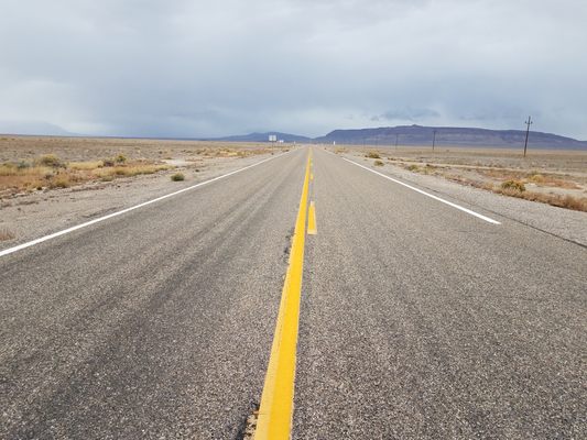
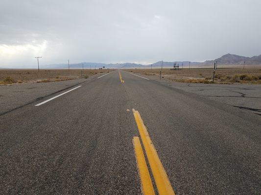
US 6, looking east to a squall, just west of Warm Springs.   slgwv / Atlas Obscura User
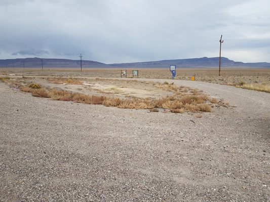
Looking east from Blue Jay rest stop.   slgwv / Atlas Obscura User
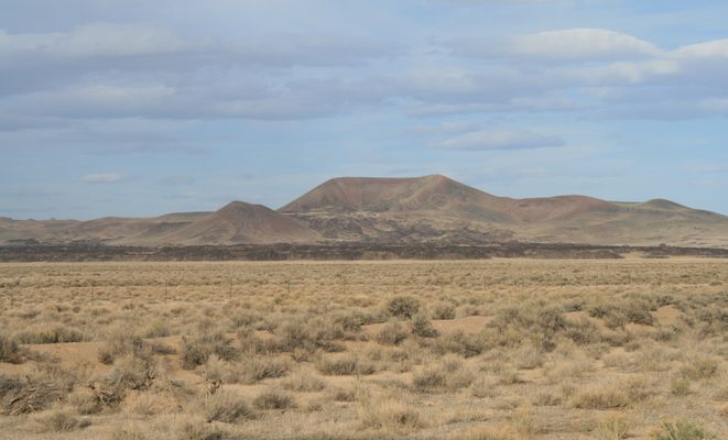
Basalt flow in Lunar Crater volcanic field.   slgwv / Atlas Obscura User
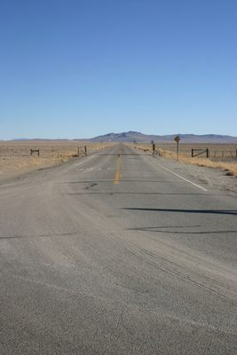
Road to Tonopah Test Range. Note: there is a high-security gate about 20 miles down this road!   slgwv / Atlas Obscura User
WW II hangar, Tonopah airport.   slgwv / Atlas Obscura User
Small oil refinery, Tonopah Industrial Park.   slgwv / Atlas Obscura User
Abandoned motel, Montgomery Pass.   slgwv / Atlas Obscura User
Site of ranch at McKinney Tanks   slgwv / Atlas Obscura User
Ruin at McKinney Tanks   slgwv / Atlas Obscura User
Turnoff to Tonopah Test Range. Figure gives scale.   slgwv / Atlas Obscura User
Abandoned building in Currant.   slgwv / Atlas Obscura User
Another view of the abandoned motel at Montgomery Pass.   slgwv / Atlas Obscura User
Ruin at McKinney Tanks   slgwv / Atlas Obscura User
Mustangs at McKinney Tanks.   slgwv / Atlas Obscura User
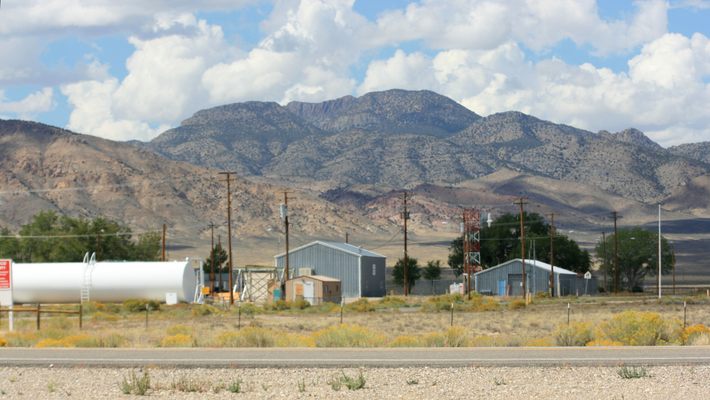
DOD installation just off the highway.   slgwv / Atlas Obscura User
Burned-out, abandoned casino, Montgomery Pass   slgwv / Atlas Obscura User
Looking west from Blue Jay rest stop, toward Warm Springs.   slgwv / Atlas Obscura User
US 6 looking east, in Hot Creek Valley.   slgwv / Atlas Obscura User
Looking west on US 6, toward Tonopah, at the Tonopah Test Range turnoff.   slgwv / Atlas Obscura User
Site of Loucks, in Railroad Valley.   slgwv / Atlas Obscura User
Looking east on US 6 at the Tonopah Test Range turnoff.   slgwv / Atlas Obscura User
Blue Jay rest stop, in Hot Creek Valley.   slgwv / Atlas Obscura User
Been Here
Want to go
Added to list

About

There's a stretch of U.S. Route 50 running straight through the middle of Nevada that has been dubbed the "Loneliest Road in America." But another Nevada highway might have a better claim to the title.

U.S. Highway 6, named the "Grand Army of the Republic" highway in honor of the Union Army during the Civil War, was one of the earliest coast-to-coast numbered routes. It was extended into Nevada in 1937, the stretch from Ely (pronounced "EE-lee") to Tonopah following the Midland Trail, an early “national auto trail” also called the Roosevelt Trail.

The route of U.S. 6 in Nevada has gone largely unchanged since 1937. It crosses Nevada mostly to the south of US 50, and in the nearly 300 miles between the Utah state line and the California state line, there are only two towns with populations of more than 100 people: Ely and Tonopah.

From Ely east to Delta, Utah U.S. 6 and U.S. 50 coincide, and from Tonopah west to Coaldale Junction, U.S. 6 and U.S. 95 coincide. About 24 miles southwest of Ely, U.S. 6 has a junction with Nevada State Route 318, a major north-south road that draws off much of the traffic.

Between this junction and Tonopah, a distance of some 141 miles, traffic is sparse indeed. According to Nevada Department of Transportation statistics, in 2021 fewer than 10 cars per hour, on average, traversed the highway at Warm Springs, where the junction of Nevada State Route 375 (the famed Extraterrestrial Highway) is located. By comparison, in the same year nearly 50 cars per hour, on average, traveled on U.S. 50 west of the junction of Nevada SR-278 near Eureka.

After the junction with SR-318, U.S.-6 follows a scenic stretch through piñon-juniper forest over Currant Summit, the last forested stretch until near the California line. From here the highway drops into the near-ghost town of Currant, a small farming community that lost its gas station in 1996. Currant sits toward the northern end of Railroad Valley, a long broad valley that contains no railroad (the origin of the name is uncertain).

Here and there you also pass defense installations, a reminder that this part of Nevada is just north of still-active military ranges, and that military activity has been ongoing in the area for decades. One of the most interesting installations is the Tonopah Test Range, a top-secret facility that is said to be involved with the maintenance of the nuclear stockpile. Its turnoff is about 11.7 miles east of the intersection with U.S. 95 in Tonopah, and is marked with a Cold War-era missile mounted on a stand.

McKinney Tanks, some 18.1 miles east of Tonopah, are a reminder that historical sites in the area long antedate the mid-20th-century military presence. This old ranch ruin consists of a roofless and largely collapsed adobe building, as well as some foundations. As is often the case with abandoned ranches, the site is marked by a large cottonwood tree.

Just a few miles east of Tonopah are three enormous wooden aircraft hangars. One is easily visible from the highway to the south. These are left over from World War II, when an air base was built here for training. The hangars also saw some use in the 1950s during the Cold War, but they are all now abandoned. In fact, they're now at the point of collapse and have been fenced off for safety. The airstrip now serves as the Tonopah Airport, and other infrastructure has been repurposed, with some success, as an industrial park.

Beyond Coaldale Junction, where U.S. 6 splits back off from U.S. 95, the traffic drops off again. It is about 22 miles to the junction with Nevada SR-360 coming in from the north. The traffic picks up somewhat after this point, because SR-360 is a shortcut between U.S. 95 and Southern California.

Some five miles past this intersection and only 8.5 miles from the California line is Montgomery Pass, where U.S. 6 brushes the edge of the scrub piñon-juniper biome for the first time since east of Currant. Here sits an abandoned motel/casino/gas station complex, which has now taken its place among the ghost towns dotting Nevada.

Related Tags

Ghost Towns Roads Highways

Know Before You Go

There are services only in Baker, Nevada (at the Utah border), Ely, and Tonopah, plus at a station about 7 miles down SR-318 outside Lund, Nevada. In particular, there is no gas on the 141-mile leg between the junction of SR-318 and Tonopah. Plan accordingly!

Community Contributors

Added By

slgwv

Published

August 30, 2023

Edit this listing

Make an Edit
Add Photos
U.S. 6 in Nevada
US-6
Tonopah, Nevada, 89049
United States
38.636618, -115.598488
Visit Website
Get Directions

Nearby Places

Meteorite Crater

Duckwater, Nevada

miles away

Easy Chair Crater

Nye County, Nevada

miles away

Lunar Crater

Tonopah, Nevada

miles away

Explore the Destination Guide

Photo of Tonopah

Tonopah

Nevada

Places 9
Stories 2

Nearby Places

Meteorite Crater

Duckwater, Nevada

miles away

Easy Chair Crater

Nye County, Nevada

miles away

Lunar Crater

Tonopah, Nevada

miles away

Explore the Destination Guide

Photo of Tonopah

Tonopah

Nevada

Places 9
Stories 2

Related Places

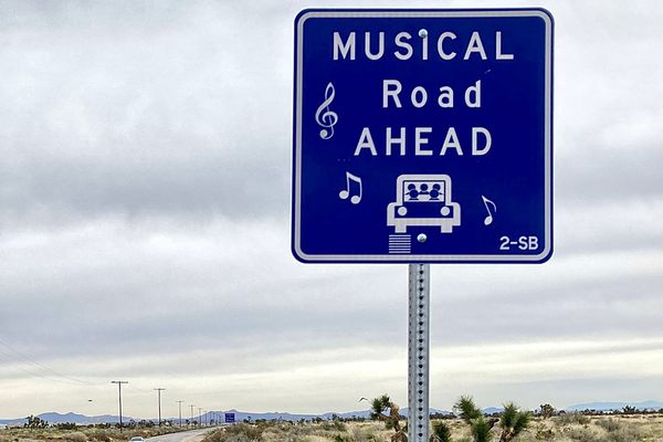
  • Musical Road Ahead

    Palmdale, California

    R. Lee Ermey Musical Road

    The road plays 30 seconds of the Marine’s Hymn when driving over the grooved pavement.

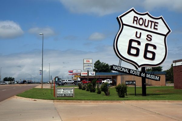
  • National Route 66 Museum

    Elk City, Oklahoma

    National Route 66 Museum

    An Oklahoma museum that celebrates the history of the "Mother Road."

  • Alaska Highway Mile 0 sign

    Dawson Creek, British Columbia

    Alaska-Canada Highway Mile 0

    The arch marks the beginning of the road for northbound travelers.

  • The sign before it was covered in stickers.

    Chicago, Illinois

    Beginning (and End) of Historic Route 66

    A journey begins with a single step, and for many, the road-trip of a lifetime started at this Chicago intersection.

  • Miyakojima Mamoru-kun

    Miyakojima, Japan

    Mamoru-kun Patrolman

    Made to improve road safety, these policemen-like figurines in Miyakojima island have earned an enthusiastic fanbase.

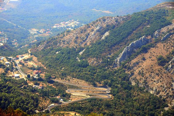
  • “M” shaped road section between Kotor and Trojica

    Trojica, Montenegro

    "M" Road

    The hairpin turns in this mountain road take the shape of a letter—is it a coincidence or a symbol of love?

  • The final marker

    San Francisco, California

    Western Terminus of the Lincoln Highway

    The United States' first transcontinental automobile road came to its end at this spot in San Francisco's Lincoln Park.

  • Milepost 1523 is near the Cushman Street Bridge.

    Fairbanks, Alaska

    Alaska Highway's Milepost 1523

    This mile marker stands at the unofficial end of a highway built to defend the United States from a Japanese invasion during World War II.

Aerial image of Vietnam, displaying the picturesque rice terraces, characterized by their layered, verdant fields.
Atlas Obscura Membership

Become an Atlas Obscura Member


Join our community of curious explorers.

Become a Member

Get Our Email Newsletter

Follow Us

Facebook YouTube TikTok Instagram Pinterest RSS Feed

Get the app

Download the App
Download on the Apple App Store Get it on Google Play
  • All Places
  • Latest Places
  • Most Popular
  • Places to Eat
  • Random
  • Nearby
  • Add a Place
  • Stories
  • Food & Drink
  • Itineraries
  • Lists
  • Video
  • Podcast
  • Newsletters
  • All Trips
  • Family Trip
  • Food & Drink
  • History & Culture
  • Wildlife & Nature
  • FAQ
  • Membership
  • Feedback & Ideas
  • Community Guidelines
  • Product Blog
  • Unique Gifts
  • Work With Us
  • About
  • FAQ
  • Advertise With Us
  • Advertising Guidelines
  • Privacy Policy
  • Cookie Policy
  • Terms of Use
Atlas Obscura

© 2025 Atlas Obscura. All Rights Reserved.