About
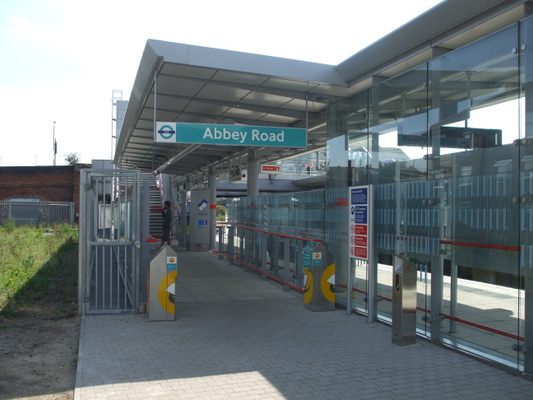
The Beatles' 1969 album Abbey Road has one of the most famous covers of all time. Generations of tourists have flocked to the location outside the Fab Four's former studio where the photo was shot to try and recreate the image. However, the iconic zebra crossing is only one of 11 Abbey Roads in all of London, and tourists who don't do their research often end up at one of these others—most likely at the rail station named Abbey Road, nine miles (14 kilometers) away from where they want to be.
The Abbey Road station is part of London Rail, located in West Ham in the east of London. It's part of the Docklands Light Railway (DLR) line, a light metro (medium-capacity) system serving the Docklands area, which was redeveloped in the late 20th and early 21st century. The section of the line that includes Abbey Road was built on the site of the Eastern Counties and Thames Junction Railway, originally opened in 1846. The DLR began operations in 1987, and the Stratford International extension opened in 2011, serving Canning Town, Star Lane, West Ham, Abbey Road, Stratford High Street, Stratford, and Stratford International.
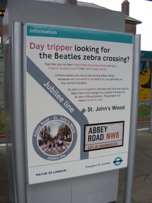
As the Abbey Road DLR station is the only Abbey Road in the entire London Underground or Overground systems, it didn't take long for tourists to start showing up in the Docklands looking for the famous crosswalk. The locals took it all in good stride, giving directions to the correct location. Eventually, Transport for London got in on the fun, printing maps at the Abbey Road station giving song-inspired directions to the Saint John's Wood station on the Jubilee Line, reminding tourists that they need a "ticket to ride."
Related Tags
Know Before You Go
Take the DLR service between Stratford International and Woolwich Arsenal or Beckton.
The DLR runs Monday-Saturday from 5:30 a.m. to 12:30 a.m., and on Sundays from from 7 a.m. to 11:30 p.m.
Published
January 11, 2022
