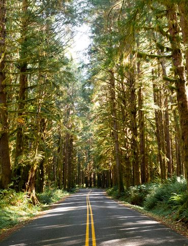
For vast vistas and surprising sights, check out these Maine marvels.
Discover the Endless Beauty of the Pine Tree State

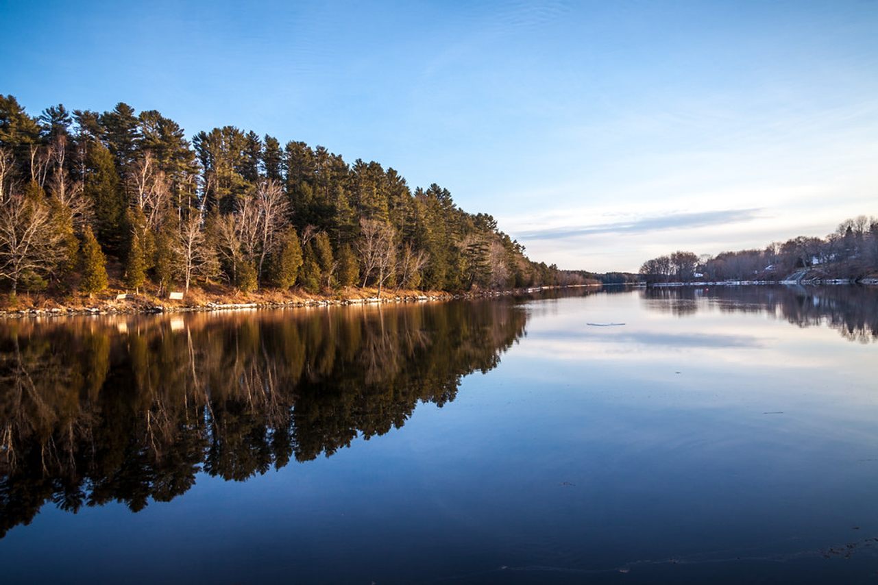
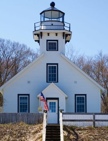
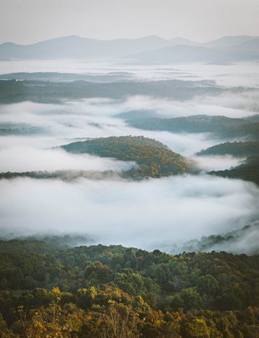
When people think of Maine, it’s often the rugged beauty of the coast that comes to mind: sunsets over craggy shorelines, lighthouses surrounded by towering pines, and lobster boats dotting the bay. But whether you’re angling for a hike, paddle, or simply a long drive through the backcountry, there’s no shortage of spectacular natural features throughout all of Maine’s 16 counties.
This itinerary will take you from secluded coves along Maine’s coastline to the highest peaks in the state, alongside thundering waterfalls, mystifying geology, and myriad wildlife. Welcome to Maine—act natural.
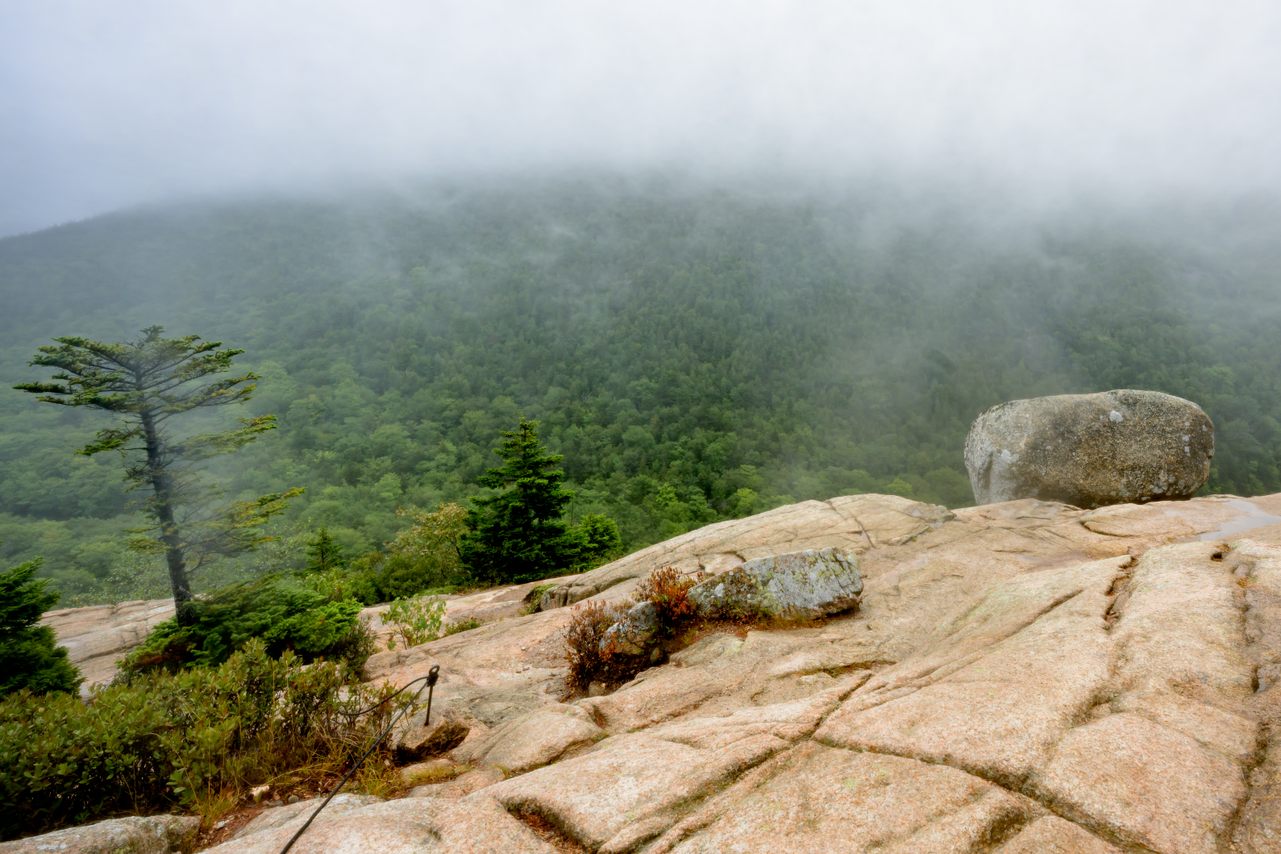
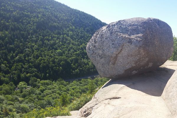
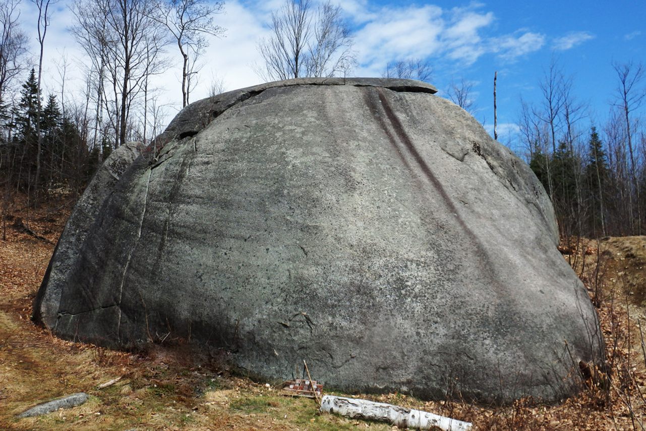
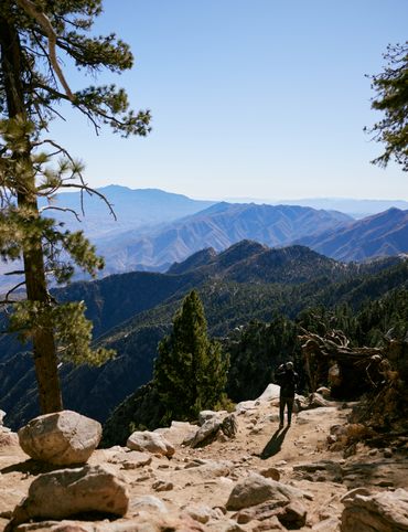
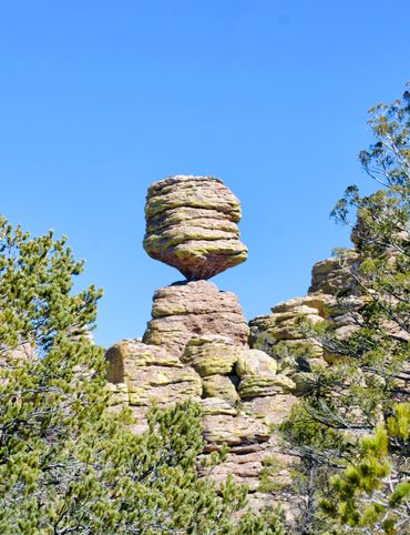
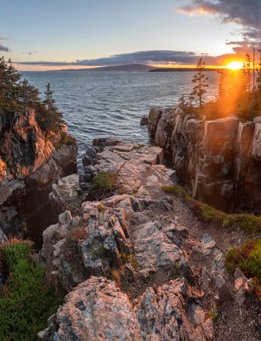
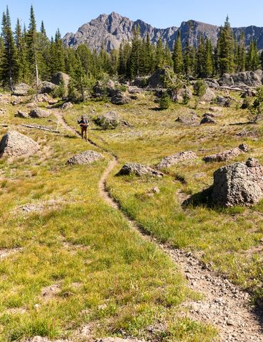
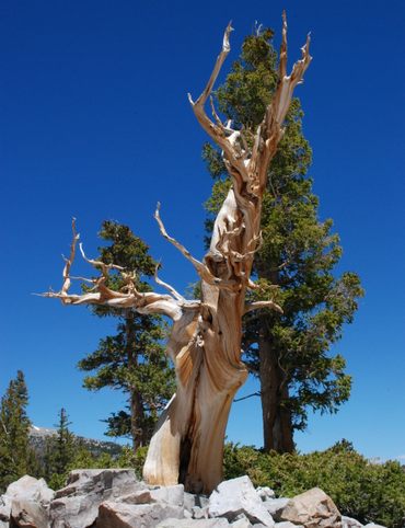
1. Bubble Rock
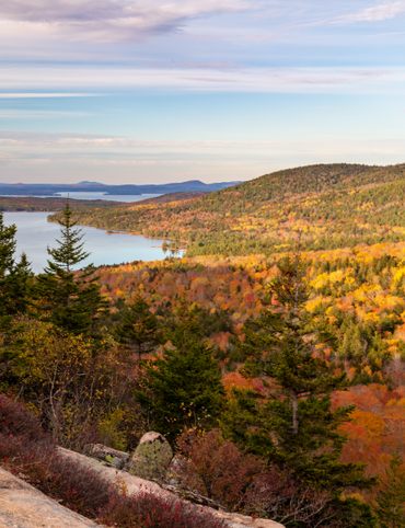
In the middle of Acadia National Park you’ll find Bubble Rock. The precariously balanced rock formation was created tens of thousands of years ago by glacial erosion, which slowly created the boulder now perched on the edge of a cliff overlooking the South Bubble summit.
Geologists have estimated that the rock originated 40 miles to the north, near Lucerne, Maine. The coarse-grain on its surface indicates a white granite composition, which differs from the surrounding rock of Mount Desert Island, typically a pink granite hue.
The trail to reach the rock is moderate—about 0.7 miles each way—and can be crossed through the Bubbles Divide Trail or Bubbles Trail. Once you reach the summit, South Bubble offers stunning views of Jordan Pond, Pemetic Mountain, Penobscot Mountain, and even the ocean beyond Seal Harbor.
Parking is available on the Park Loop Road, about a mile south of Bubble Pond and 1.5 miles north of Jordan Pond House. Parking can be crowded, especially in the summer. The trails are also open in the winter, but make sure that you have correct equipment to hike in colder conditions.
Park Loop Road, Mount Desert, Maine 04660
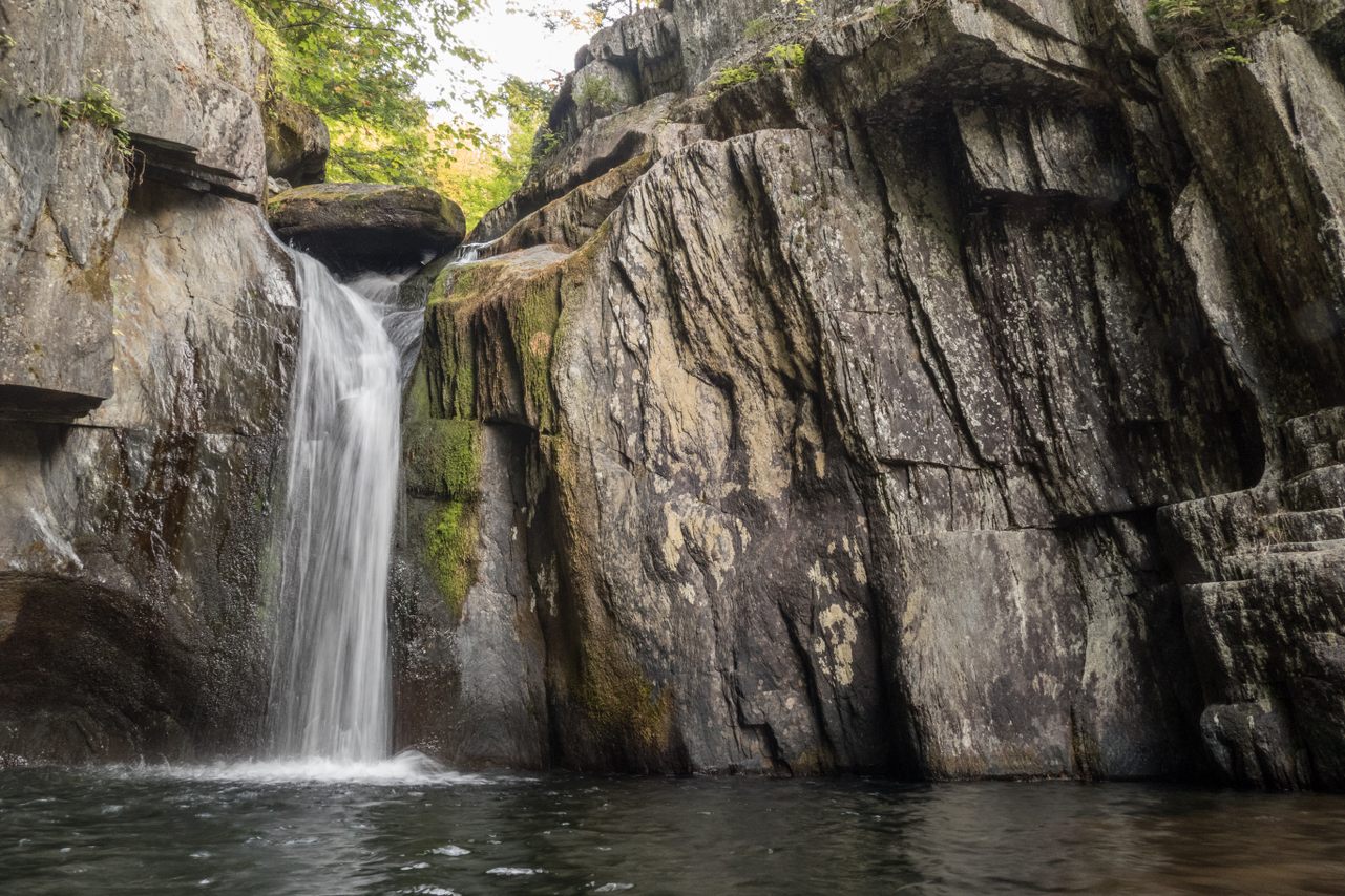
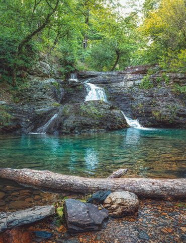
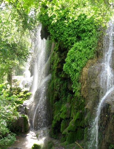
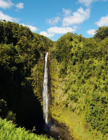
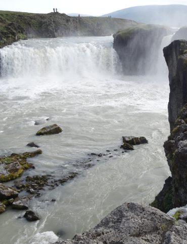
2. Gulf Hagas
While it may not boast the exact scale of Arizona’s Grand Canyon, Gulf Hagas has earned recognition as the “Grand Canyon of Maine,” at least, for being one of the deepest gorges in the state. What it may lack in relative grandeur is more than made up for in the range of old-growth forests, impressive waterfalls, and geologic features dotting this unique pocket of Maine’s highland region.
There are several trails that will get you to the Gulf, the most well-traveled being the Gulf Hagas Rim Trail which takes you through the Hermitage, a 35-acre swath of white pine trees—some 150 years old—overlooking the Pleasant River. You’ll also pass the thundering Screw Auger Falls, which plunge 26 feet onto canyon rocks below before reaching the gorge.
This is a remote hike without cell service or amenities so be sure to bring plenty of water, snacks, and reliable shoes. Depending on when you visit, there may be a cash-only entry fee, so plan accordingly.
Katahdin Iron Works Road, Monson, Maine, 04464 United States
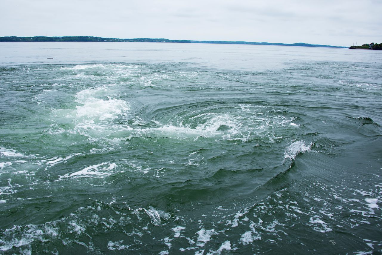
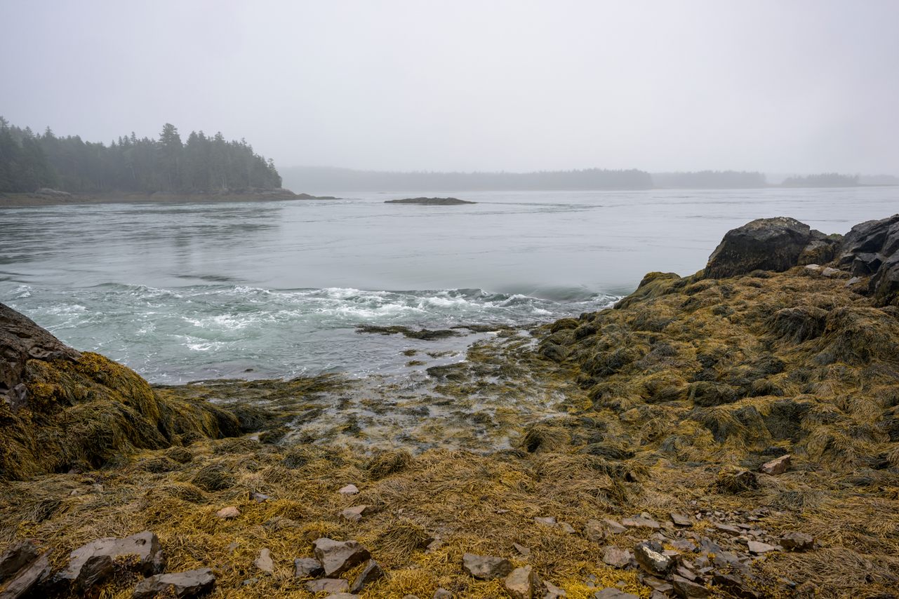
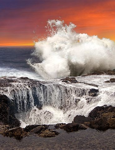
3. Old Sow
Located along the maritime U.S.-Canada border, the Old Sow whirlpool has long-hosted a curious oceanographic phenomenon. The whirlpool here is caused by the enormous tides and bathymetry of the ocean floor in the area, and while it may not be the fastest vortex around, it is one of the largest in the Western Hemisphere, with a diameter of around 250 feet.
While the name may derive from the whirlpool’s signature pig-like grunting sound, it’s more likely that it was called “olde sough” in earlier days, sough being a type of drain or a sucking sound. Pronounced suff, over the years the pronunciation of the Dutch word probably shifted to be pronounced like “sow.” Smaller nearby whirlpools are now known as “piglets.”
Old Sow is most active about three hours before high tide and continues for roughly two hours afterwards (check local tides here). The water turbulence—while rarely a danger to larger boats—can be dangerous to smaller watercraft, so it’s best to check it out from the safety of a licensed tour boat, many of which depart from Eastport.
Eastport, Maine United States
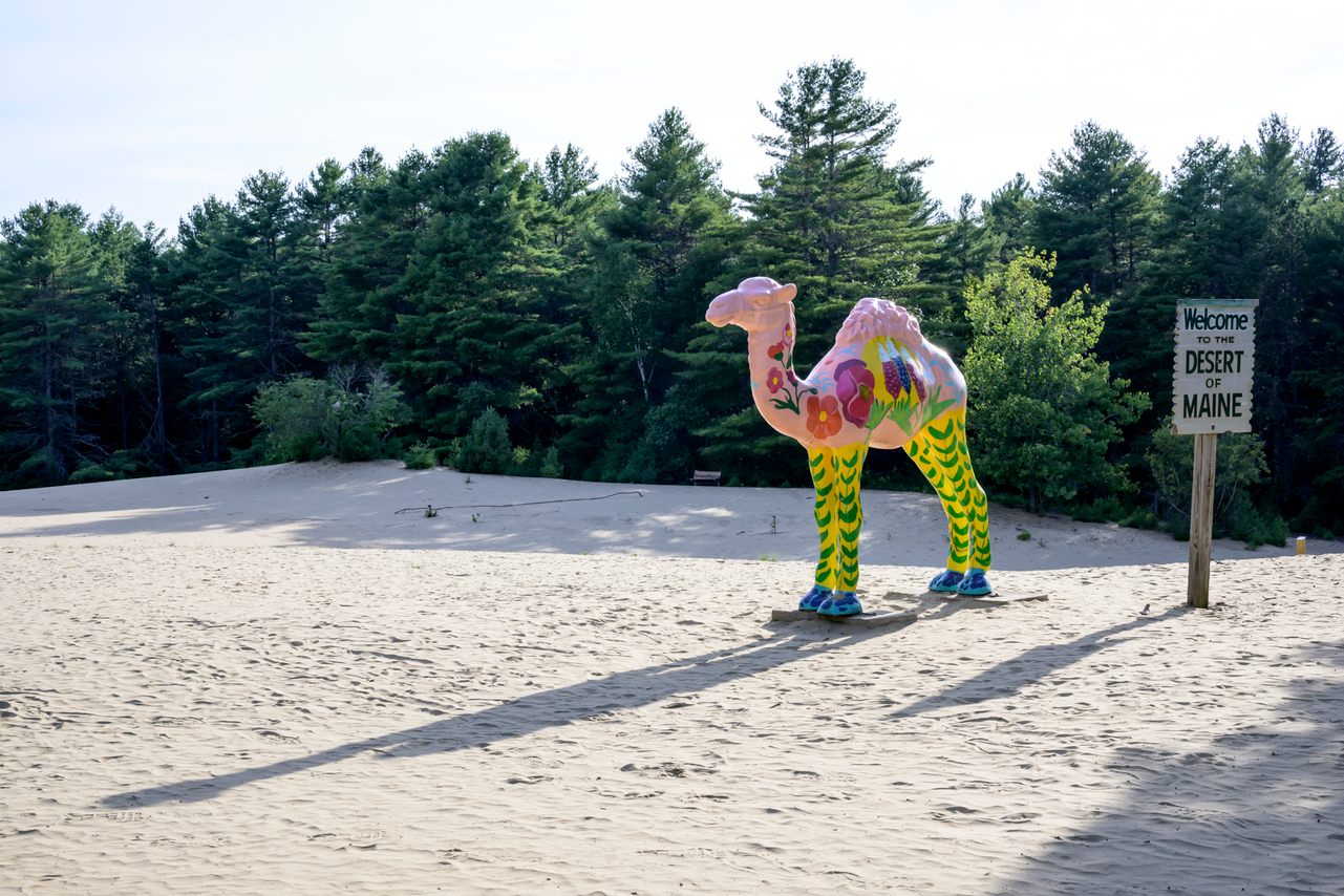
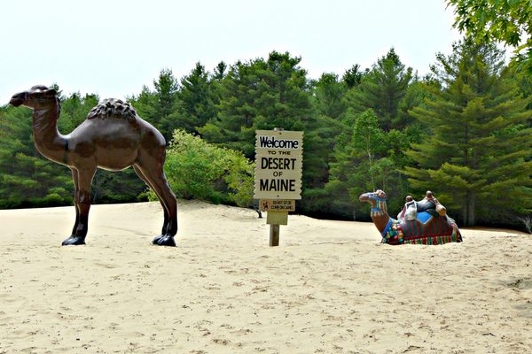
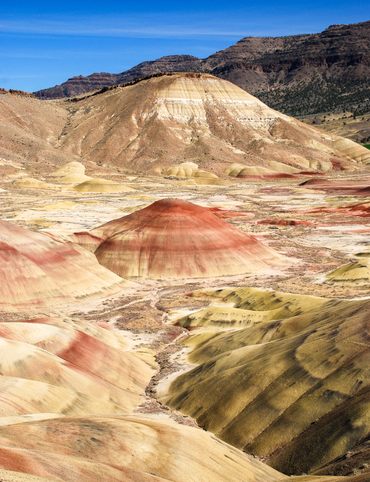
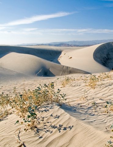
4. The Desert of Maine
While it's not an actual desert, the Desert of Maine is a curiosity of the natural world formed by only slight human interference. A large deposit of sand was formed here after Ice Age glaciers retreated, then a combination of overfarming and overgrazing eroded centuries of topsoil to once again expose 40 acres of sand.
Because of the land’s desert-like appearance, it was turned into a roadside tourist oddity in 1925 and has attracted curious visitors ever since. The “desert” now features a self-guided tour of sand-worn debris, gemstone hunts for children, a fiberglass camel, and a museum where you can take home some sand from one of the most unlikely deserts on earth. One hiking trail around the dunes leads to a building that was buried under 40 feet of sand for the last 80 years.
The Desert of Maine is open seasonally, from May to October, located just a few miles from I-295 in Freeport.
95 Desert Road, Freeport, Maine, 04032 United States
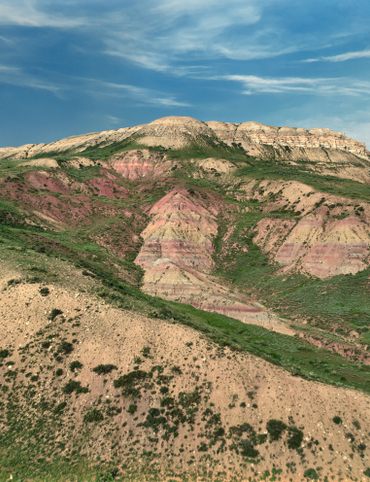
5. Daggett Rock
As the Laurentide Ice Sheet—an ancient, monstrous glacier that once covered most of North America—retreated across Maine, it dragged many large boulders far from their original bedrock. In other words, modern Maine is covered in giant rocks that look puzzlingly out-of-place, and Daggett Rock is the largest of them all.
Measuring 80 feet long, 25 feet high, and split into three pieces, Daggett Rock protrudes from a field of deciduous trees east of the Rangeley Lakes Region. Geologists believe the granite boulder may have been pulled from the side of Saddleback Mountain, about 12 miles away—quite a journey for an 8,000 ton rock.
As for the name, there’s an oft-told tale about a woodsman named Daggett who climbed up on the rock during a thunderstorm, arrogantly declaring that he would not be harmed. As if in response, he’s said to have been immediately struck by a lightning bolt, cracking the boulder into the three distinct fragments seen today.
Once you reach the trailhead in Phillips, it’s a short and sweet uphill hike to the boulder. Be on the lookout for geocaches hidden on the trail and abundant wildlife in any season.
138 Wheeler Hill Road, Phillips, Maine, 04966, United States
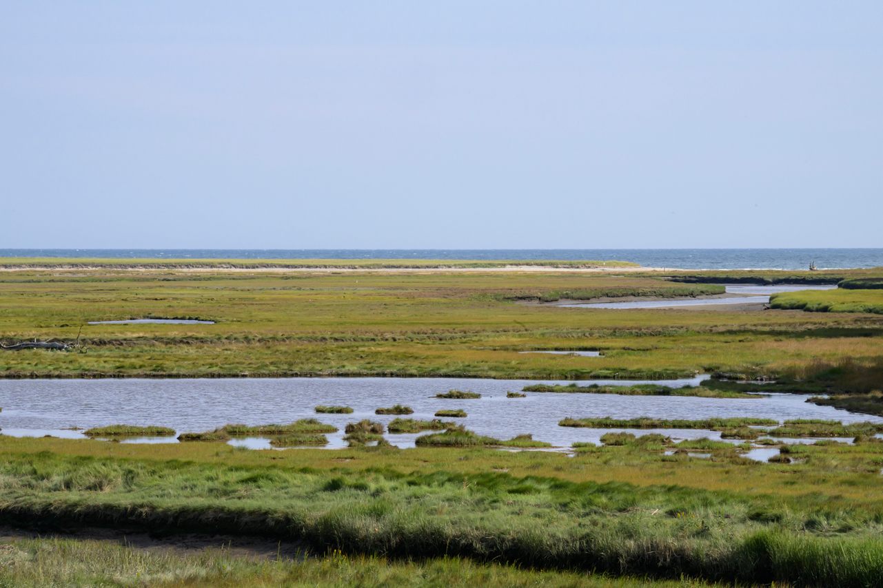
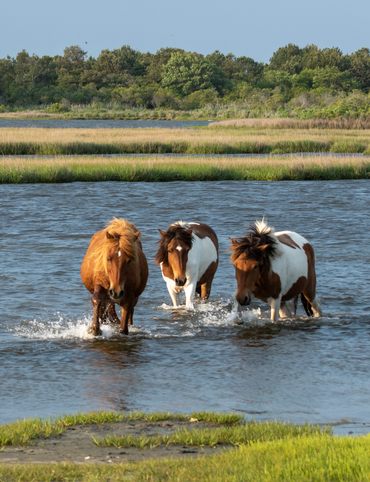
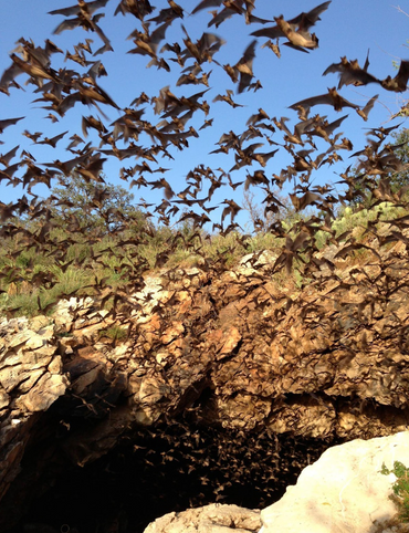
6. Rachel Carson National Wildlife Refuge
To say the tidal marshes and estuaries of southern Maine are hotspots for migratory birds is an ornithological understatement, which is why the establishment of this refuge in 1966 was so crucial. It offered many species—including rough-legged buzzards, common goldeneyes, and black skimmers—a safe place to touch down during their seasonal commutes along Maine’s coast.
It also created a pristine stretch of wilderness for human enjoyment. This 5,600-acre patch of protected coastline reaches inland to a boreal forest which is home to even more fauna found nowhere else in Maine, such as the at-risk piping plover, New England cottontail, and northern long-eared bat. A well-maintained walking trail along the gently flowing Merriland River features numerous lookout points, picnic tables, and of course, unparallelled birding.
There are several access points to the refuge throughout York and Cumberland counties which are open to the public year round, from 30 minutes before sunrise until 30 minutes after sunset.
321 Port Road, Wells, Maine, 04090, United States
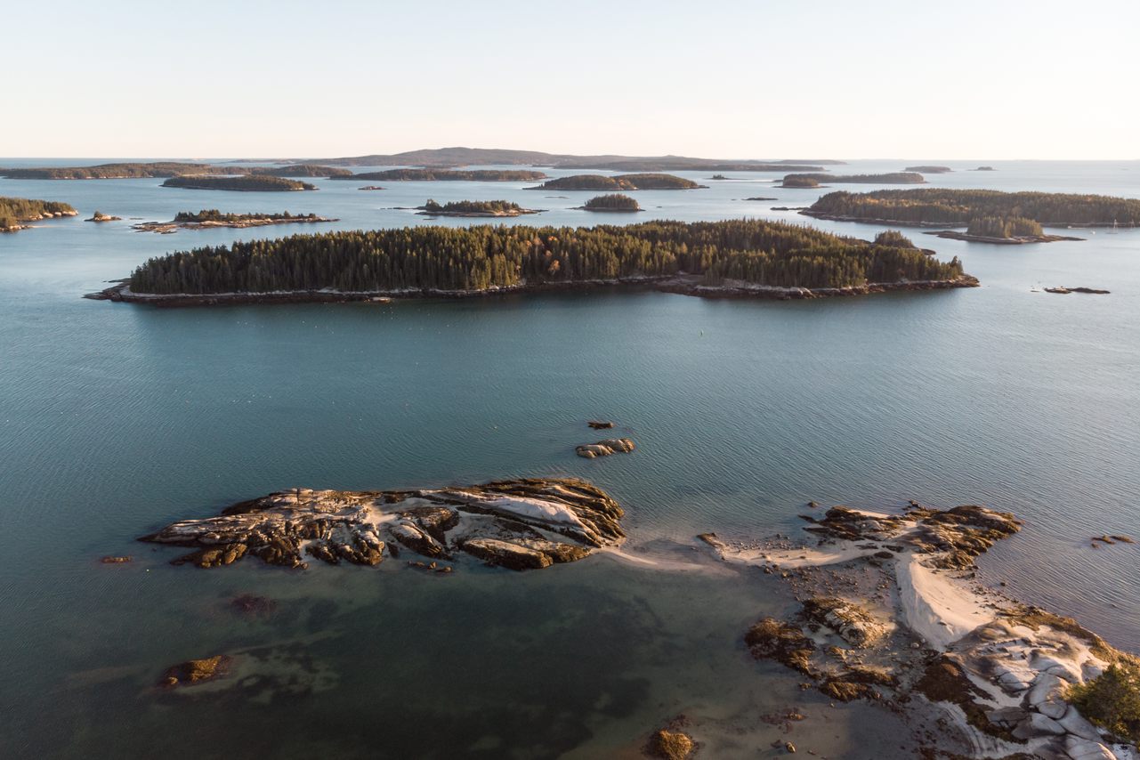
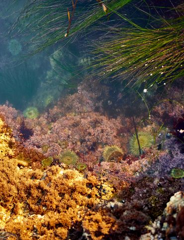
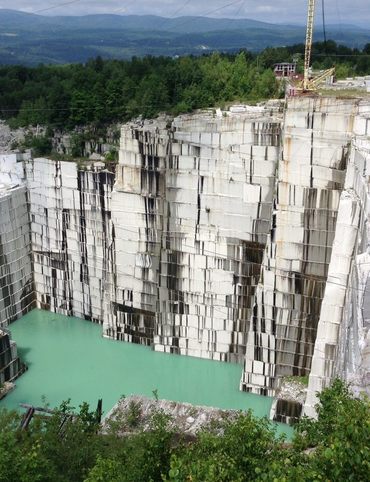
7. Green Island Quarry
Whether you prefer paddling, hiking, or swimming, it’s all on the menu at Green Island, one of more than 50 islands that make up the Merchant Row archipelago between Stonington and Isle au Haut.
Once you paddle across a short channel and land on Green Island’s southeastern wharf, a five-minute hike through a small meadow and a stand of pines will take you to the island’s titular swimming hole.
The quarry is a result of productive 19th-century granite mining operations carried out in the area. In fact, the granite from the islands in Merchant Row would go on to become pavers for many city streets and structural supports for the Museum of Fine Arts in Boston.
If you’re paddling, you can launch your canoe or kayak at Colwell Boat Ramp in Stonington, next to the Isle Haut Ferry Terminal. Otherwise, visitors can access Merchant Row by contacting Bert & I Charters in Stonington. If taking a dip is on your to-do list, the quarry water is warmest in August. Although there’s camping on other islands in Merchant Row, Green Island is for day-tripping only.
Stonington, Maine, 04681
8. Thorncrag Bird Sanctuary
Despite being the second largest city in Maine, Lewiston saved plenty of room for natural beauty. Perched atop the highest point in the city, the Thorncrag Bird Sanctuary—known locally as the “Crag”—is a much-beloved 450-acre wildlife preserve, a green jewel just a short drive from the city center.
It’s an ideal spot to hike and picnic in the warmer months, or otherwise snowshoe and ice skate in the winter. A well-maintained trail guides visitors through lush forests vibrant with avian activity, past old stone hearths and wide-open meadows in turn. In addition to providing protection for birds and other species, Thorncrag offers community outreach and conservation-focused educational programming.
Make sure to bring a good pair of walking shoes for the trails and your favorite binoculars for birdwatching—you’re going to see plenty.
Highland Spring Road, Lewiston, Maine, 04240
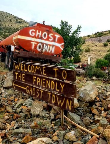
9. Swan Island
Islands in Maine don’t just belong to the ocean. While not nearly as copious as those along the coastline, there are many freshwater islands that sit in the middle of rivers, lakes, and ponds throughout the state.
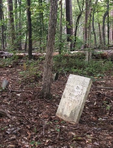
Once a small, thriving village of farmers and shipwrights, Swan Island, for one, is now a beautiful preserve teeming with wildlife, hiking trails, and campsites. It’s also one of the only ghost towns in Maine, with several Colonial homes, a cemetery, and water-wells still standing. It’s only a quick boat ride across the Kennebec River to the four-mile-long island where old dirt roads, fields, and forests are open to the public for hiking and mountain biking.
If you’re able to stay the night, there are wooden lean-tos perched right alongside the water that you can reserve for camping. It’s at this point, once the day trippers have returned to the mainland and any semblance of modernity has disappeared, that you’ll truly feel whisked back in time. Note that the island is only open from mid-May to late October.
7 Swan Island Landing, Richmond, Maine, 04357
10. Reversing Falls at Mahar Point
Along the Canadian border, in what’s considered the Downeast region of Maine, some rivers have a funny habit of changing direction. This fairly uncommon natural phenomenon, referred to as “tidal falls,” occurs in only eight places throughout Maine, and perhaps nowhere more dramatically than at Mahar Point.
When the tide is going out, the rivers of Downeast Maine flow into the Bay of Fundy as rivers anywhere else on earth might. However, this area is home to the greatest tidal range on earth, with changes of up to 28 feet in a single day. So when the tide comes in, the rivers nearest the ocean change direction, filling with saltwater for hours until high-tide is complete. The result, at certain points around Dennys Bay, looks something like a waterfall on the upstream side.
Abundant wildlife is the norm here, with seals playing in the falls and bald eagles and migratory birds circling overhead. Pack a picnic, find a soft patch of grass, and enjoy the show.
Because the currents can change quickly, it is unsafe to swim or wade at Reversing Falls at any time. Boating should only be done with an experienced local guide.
Reversing Falls Road, Pembroke, ME 04666
This post is sponsored by the Maine Office of Tourism. Click here to explore more.

Gastro Obscura’s 11 Essential Places to Eat and Drink in Bangkok

Gastro Obscura’s 10 Essential Places to Eat and Drink in Rome
The Explorer’s Guide to Road Tripping Around the Great Lakes
10 National Parks That Are Perfect for a Road Trip
10 Out-of-This-World Places You Can Reach in Your Car
The Explorer’s Guide to Road Tripping Around Appalachia

The Explorer’s Guide to Road Tripping Down Highway 61

Gastro Obscura’s 10 Essential Stops on an Alternative London Pub Crawl
The Explorer’s Guide to Joshua Tree National Park

The Explorer’s Guide to the Great Smoky Mountains National Park
Cosmic Colorado: A Stargazer’s Guide to the Centennial State
The Explorer’s Guide to Banff National Park
10 Wild Places That Define West Virginia’s Landscape
The Ultimate Guide to Hidden Red Rocks: 10 Secret Passageways, Artifacts, and Ghost Stories

The Explorer’s Guide to Williamsburg, Virginia
The Explorer’s Guide to the British Virgin Islands

Gastro Obscura’s 10 Essential Places to Eat, Drink, and Shop in Hong Kong

A Denver Guide for National Park Lovers

Gastro Obscura’s 10 Essential Places to Eat and Drink in Oaxaca

A Gastro Obscura Guide to Family-Friendly Dining in San Diego
The Explorer’s Guide to Outdoor Wonders In Maryland
The Secret Lives of Cities: Ljubljana

From Cigar Boom to Culinary Gem: 10 Essential Spots in Ybor City
The Explorer’s Guide to Wyoming’s Captivating History
A Nature Lover’s Guide to Sarasota: 9 Wild & Tranquil Spots
California’s Unbelievable Landscapes: A Guide to Nature’s Masterpieces
The Ultimate California Guide to Tide Pools and Coastal Marine Life
Explore California on Foot: Nature’s Year-Round Playground

Mardi Gras 9 Ways: Parades, Cajun Music, And Courirs Across Louisiana

The Explorer’s Guide to Winter in Germany
Ancient California: A Journey Through Time and Prehistoric Places
The Wildest West: Explore California’s Ghost Towns and Gold Fever Legacy

Sweet California: A Culinary Guide to Tasty Treats Across the State
Sea of Wonders: An Itinerary Through California’s Stunning Shoreline

10 Places to Taste Catalonia’s Gastronomic Treasures
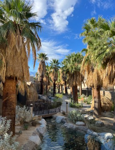
Atlas Obscura’s Guide to Palm Springs
Atlas Obscura’s Guide to the 10 Most Mystifying Places in Illinois
10 Fascinating Sites That Bring Idaho History to Life

North Carolina's Paranormal Places, Scary Stories, & Local Haunts
Exploring Missouri’s Legends: Unveiling the Stories Behind the State’s Iconic Figures

These Restaurants Are Dishing Out Alabama’s Most Distinctive Food

A Gastro Obscura Guide to Los Cabos
9 Watery Wonders on Florida’s Gulf Coast
Discover the Surprising and Hidden History of Monterey County

Gastro Obscura’s Guide to Eating Your Way Through Charlotte
Talimena Scenic Byway: 6 Essential Stops for Your Arkansas Road Trip
9 Amazing Arkansas Adventures Along the Scenic 7 Byway
The Explorer's Guide to Highway 36: The Way of American Genius

A Behind-the-Scenes Guide to DC’s Art and Music

9 Places Near Las Vegas For a Different Kind of Tailgate

10 Places to See Amazing Art on Florida's Gulf Coast
8 Reasons Why You Should Visit the Bradenton Area

A Music Lover’s Guide to New Orleans
Gastro Obscura’s Guide to Sipping Wine in Catalonia

9 Hidden Wonders in the Heart of Kansas City
10 Unexpected Delights of Vermont's Arts and Culture Scene

Gastro Obscura’s Guide to Eating Through Maine

The Gastro Obscura Guide to Asheville Area Eats

Gastro Obscura’s Guide to St. Pete/Clearwater
9 Hidden Wonders in Eastern Colorado
7 Places to Experience Big Wonder in Texas

8 Out-There Art Destinations in Texas
6 Ways To See Texas Below the Surface
9 Places to Dive Into Fresh Texas Waters

7 Ways to Explore Music (and History) in Texas
8 Ways to Discover Texas’ Rich History
The Explorer’s Guide to the Northern Territory, Australia

The Explorer's Guide to U Street Corridor

Gastro Obscura Guide to Southern Eats

Only In Delaware

The Secret History & Hidden Wonders of Charlotte, North Carolina
Exploring Colorado's Historic Hot Springs Loop
These 8 Arizona Ghost Towns Will Transport You to the Wild West
A Guide to Arizona’s Most Striking Natural Wonders
The Explorer's Guide to Hudson Valley, New York
Travel to New Heights Around the Pine Tree State
8 Historical Must-Sees in Granbury, Texas

7 Creative Ways to Take in San Antonio’s Culture
Eat Across the Blue Ridge Parkway

6 Ways to Absorb Addison, Texas’ Arts and Culture

6 Ways to Take in the History of Mesquite, Texas

6 Ways to Soak Up Plano’s Art and Culture
9 Dallas Spots for Unique Art and Culture
7 Sites of Small-Town History in Waxahachie, Texas
6 Natural Wonders to Discover in Austin, Texas
Discover the Secrets of Colorado’s Mountains and Valleys
A Road Trip Into Colorado’s Prehistoric Past

A Feminist Road Trip Across the U.S.
All Points South
Asheville: Off the Beaten Path

Restless Spirits of Louisiana

Eat Across Route 66

18 Mini Golf Courses You Should Go Out of Your Way to Play
4 Underwater Wonders of Florida
6 Spots Where the World Comes to Delaware

Study Guide: Road Trip from Knoxville to Nashville

6 Wondrous Places to Get Tipsy in Missouri
Rogue Routes: The Road to Pikes Peak

Rogue Routes: The Road to Carhenge

4 Pop-Culture Marvels in Iowa
7 Stone Spectacles in Georgia
6 Stone-Cold Stunners in Idaho
8 Historic Spots to Stop Along Mississippi's Most Famous River
5 Incredible Trees You Can Find Only in Indiana

5 Famous and Delightfully Obscure Folks Buried in Kentucky
4 Wacky Wooden Buildings in Wyoming
7 Spots to Explore New Jersey’s Horrors, Hauntings, and Hoaxes

4 Out-There Exhibits Found Only in Nebraska

6 Sweet and Savory Snacks Concocted in Utah
12 Places in Massachusetts Where Literature Comes to Life

8 Places to Get Musical in Minnesota

8 Buildings That Prove Oklahoma's an Eclectic Art Paradise

9 Stunning Scientific Sites in Illinois

5 Strange and Satanic Spots in New Hampshire
8 Historic Military Relics in Maryland

5 of Colorado's Least-Natural Wonders
Rogue Routes: The Road to Sky’s the Limit
6 Hallowed Grounds in South Carolina
9 Rocking Places in Vermont

Knoxville Study Guide
Nashville Study Guide
Rogue Routes: The Road to Camp Colton
Black Apples and 6 Other Southern Specialties Thriving in Arkansas
4 Monuments to Alabama’s Beloved Animals
The Dark History of West Virginia in 9 Sites
11 Zany Collections That Prove Wisconsin's Quirkiness
7 Inexplicably Huge Animals in South Dakota

6 Fascinating Medical Marvels in Pennsylvania

8 Places in Virginia That Aren’t What They Seem
7 Cool, Creepy, and Unusual Graves Found in North Carolina
7 of Montana's Spellbinding Stone Structures
9 of Oregon’s Most Fascinating Holes and Hollows

Take to the Skies With These 9 Gravity-Defying Sites in Ohio
9 Strange and Surreal Spots in Washington State
8 Watery Wonders in Hawaiʻi, Without Setting Foot in the Ocean

6 Unusual Eats Curiously Cooked Up in Connecticut
11 Close Encounters With Aliens and Explosions in New Mexico

10 Places to Trip Way Out in Kansas

The Resilience of New York in 10 Remarkable Sites
7 Very Tall Things in Very Flat North Dakota
8 Blissfully Shady Spots to Escape the Arizona Sun
On the Run: NYC
On the Run: Los Angeles
9 Surprisingly Ancient Marvels in Modern California

10 Art Installations That Prove Everything's Bigger in Texas

6 Huge Things in Tiny Rhode Island
7 Underground Thrills Only Found in Tennessee
Sink Into 7 of Louisiana's Swampiest Secrets

7 Mechanical Marvels in Michigan
11 Wholesome Spots in Nevada

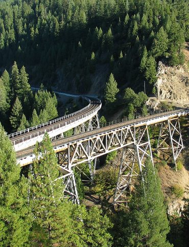
7 Places to Glimpse Maine's Rich Railroad History
11 Places Where Alaska Bursts Into Color

9 Places in D.C. That You're Probably Never Allowed to Go
2 Perfect Days in Pensacola
Rogue Routes: The Road to the Ice Castles

Taste of Tucson
North Iceland’s Untamed Coast

Hidden Edinburgh

Hidden Haight-Ashbury

The Many Flavors of NYC’s Five Boroughs

Hidden French Quarter

The Metropolitan Museum of Art
Motown to Music City Road Trip
Gulf Coast Road Trip
Hidden Coachella Valley

Highland Park

Venice

L.A.’s Downtown Arts District

Hidden Trafalgar Square

Secrets of NYC’s Five Boroughs

Mexico City's Centro Histórico

Hidden Hollywood

Hidden Times Square
Summer Radio Road-Trip
Amsterdam

Buenos Aires

Chicago
Detroit

Lisbon

Miami
Queens

San Diego